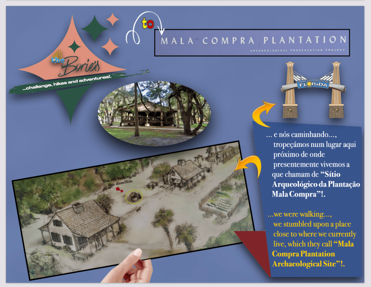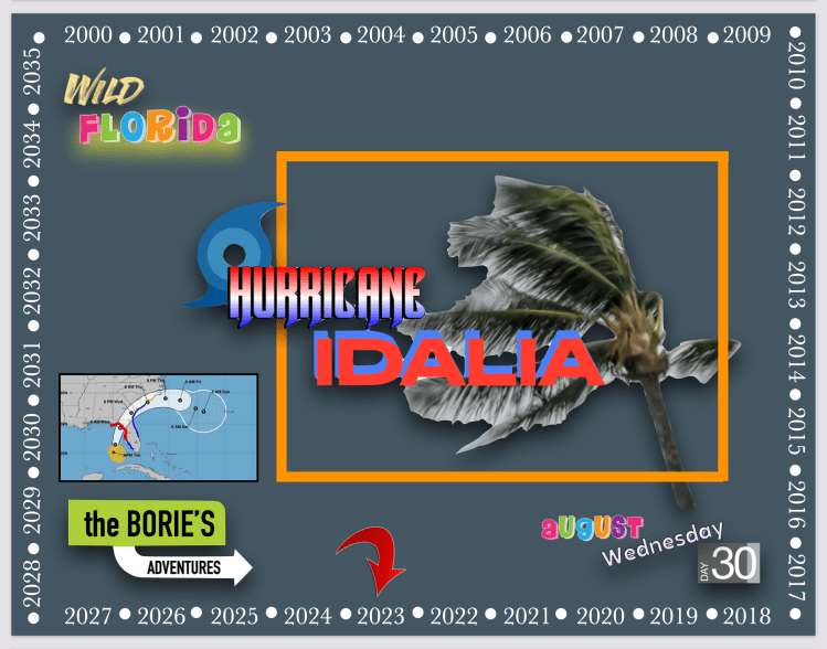
…hoje, quarta-feira dia 30 de Agosto de 2023, quando acordámos pela madrugada, as notícias eram um pouco assustadoras com a vinda do “Furacão Idalia”!. Sorrateiramente fomos lá fora ver e…, havia uma leve e fresca ventania vinda do oeste que até era agradável dada a alta temperatura que nesta época se faz sentir, e claro…, com os muitos anos vividos em situações parecidas, logo ficámos com a sensação que desta vez, com alguma sorte iríamos ficar a “leste do perigo”!.
…today, Wednesday, August 30, 2023, when we woke up at dawn, the news was a little scary with the coming of “Hurricane Idalia”!. We sneakily went outside to see and…, there was a light and fresh wind coming from the west that was even pleasant given the high temperature that is felt at this time, and of course…, with the many years lived in similar situations, we soon got the feeling which this time, with any luck we would stay “east of danger”!.
…regressando a casa, depois de tomar uma chávena de chá bem quente, sentámo-nos em frente à Televisão e…, a “5 o’clock news”, mostrava-nos imagens do furacão na costa oeste, dando-lhe a categoria 3, lá no Golfo do México, com ventos sustentados de 125 milhas por hora, dizendo que provavelmente aumentariam antes de atingir a costa da Flórida nesta quarta-feira!.
…returning home, after having a cup of hot tea, we sat in front of the television and…, “5 o’clock news”, showed us images of the hurricane on the west coast, giving it category 3, there in the Gulf of Mexico, with sustained winds of 125 miles per hour, saying they would probably increase before reaching the Florida coast this Wednesday!.

…sabíamos que este ano, El Niño, apresenta um novo padrão que nos chegou por aqui em Junho, mostrando-nos um fenómeno climático intermitente que pode ter efeitos abrangentes sobre o clima em todo o mundo aumentando a quantidade e direcção do vento ou a sua mudança, tanto no oceano como na superfície terrestre!.
…we knew that this year, El Niño, presents a new pattern that reached us here in June, showing us an intermittent weather phenomenon that can have far-reaching effects on the climate worldwide by increasing the amount and direction of the wind or its change, both in the ocean and on the land surface!.
…como tal e prevenindo uma possível catástrofe, o Governador Ron DeSantis disse que, 5.000 membros da Guarda Nacional foram activados, 580 equipes de busca e resgate foram mobilizadas, 1.100 geradores foram preparados para implantação e 200 ambulâncias estavam prontas para entrar na área!. Algumas pontes serão fechadas e 50 distritos escolares de condados também fecharam, tal como dezenas de sistemas de faculdades e universidades em toda a Flórida!. O Governador Ron DeSantis também emitiu uma declaração de emergência para 49 dos 67 condados da Florida!.
…as such and preventing a possible catastrophe, Governor Ron DeSantis said that 5,000 members of the National Guard were activated, 580 search and rescue teams were mobilized, 1,100 generators were prepared for deployment and 200 ambulances were ready to enter the area!. Some bridges will be closed, and 50 county school districts will also close, as will dozens of college and university systems across Florida!. Governor Ron DeSantis also issued an emergency declaration for 49 of Florida’s 67 counties!.
…porque na verdade, dos 10 furacões com ventos de 240 km/h ou mais que atingiram o continente dos EUA ao longo de 104 anos, todos, exceto um, testemunharam a explosão de força e poder conhecida como uma intensificação muito rápida, como por exemplo o “Furacão Ian”, que teve duas rajadas de vento em Setembro passado, que atingiram os 155 mph, antes de atingir a costa sudoeste da Flórida…, assim devemos acautelar e prevenir!.
…because in fact, of the 10 hurricanes with winds of 150 mph or more that hit the US mainland over the course of 104 years, all but one witnessed the explosion of force and power known as a very rapid intensification, as by for example, “Hurricane Ian”, which had two gusts of wind last September, which reached 155 mph, before hitting the southwest coast of Florida…, so we must be careful and prevent!..
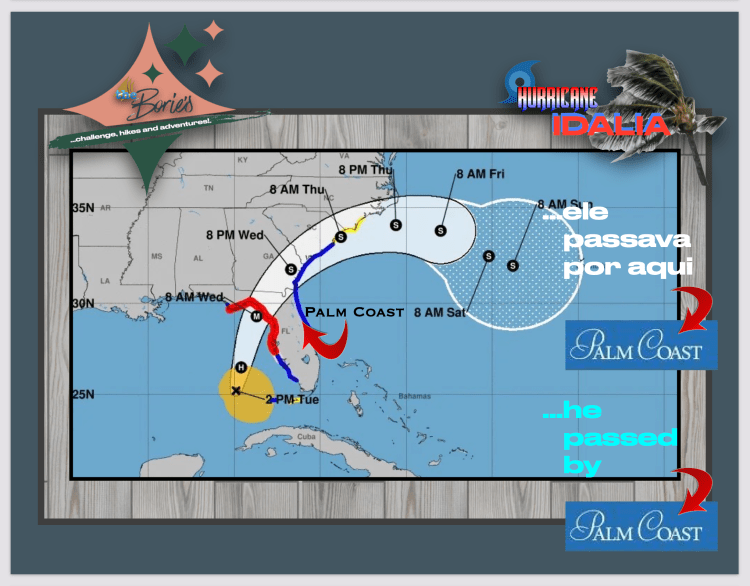
…também nos avisam para potenciais inundações com chuvas de 3 a 6 polegadas e ventos verdadeiramente destrutivos podem ocorrer, que provavelmente terão entre 30 e 50 milhas de largura quando chegarem a terra firme, e por aqui, na área onde presentemente vivemos, provavelmente ocorrerão ao meio-dia desta quarta-feira e serão principalmente de sul para norte, virando para o mar pela noite, mantendo inundações costeiras, com rajadas de vento na faixa de 50-60 mph!.
…also warn us of potential flooding with 3 to 6 inch rainfall and truly destructive winds could occur, which will likely be between 30 and 50 miles wide when they make landfall, and around here, in the area where we currently live, will likely occur around midday this Wednesday and will be mainly from south to north, turning to the sea at night, maintaining coastal flooding, with wind gusts in the range of 50-60 mph!.
…resumindo, às vezes é melhor reagir exageradamente do que reagir de forma insuficiente, porque o “Furacão Idalia” é agora um forte e perigoso furacão de categoria 3, com ventos monstruosos que podem atingir os 190 km/h enquanto transforma as ruas em rios e corta a energia ao longo da costa da Flórida, e claro, existe um grande potencial de morte e devastação catastrófica!. Como tal, já houve em pelo menos 28 condados evacuações e, em alguns emitiram ordens de evacuação obrigatórias!.
…in short, sometimes it’s better to overreact than underreact, because “Hurricane Idalia” is now a strong and dangerous Category 3 hurricane, with monster winds that can reach 190 km/h while turning streets into rivers and cuts power along the Florida coast, and of course, there is great potential for death and catastrophic devastation!. As such, there have already been evacuations in at least 28 counties, and in some they have issued mandatory evacuation orders!.
…e a terminar, parece que pela madrugada a sensação de que desta vez…, com alguma sorte iríamos ficar a “leste do perigo” foi certa, porquea Flórida não será o único estado a sentir os impactos do “Furacão Idalia”!. Depois que a tempestade atingir o continente, ventos prejudiciais e chuvas fortes vão espalhar-se pelo interior da Flórida, partes da Geórgia e até mesmo das Carolinas!.
…and finally, it seems that at dawn the feeling that this time…, with any luck we would be “east of danger” was right, because Florida will not be the only state to feel the impacts of “Hurricane Idalia”!. After the storm reaches the mainland, damaging winds and heavy rains will spread across the interior of Florida, parts of Georgia and even the Carolinas!.
Tony Borie, Século XXI. (Tony Borie, 21st Century).