…to North by Northwest!. (10)

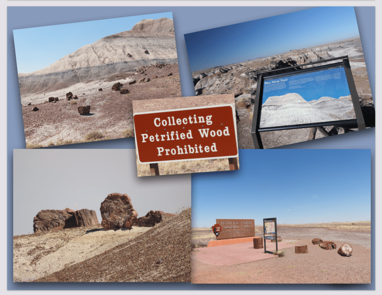
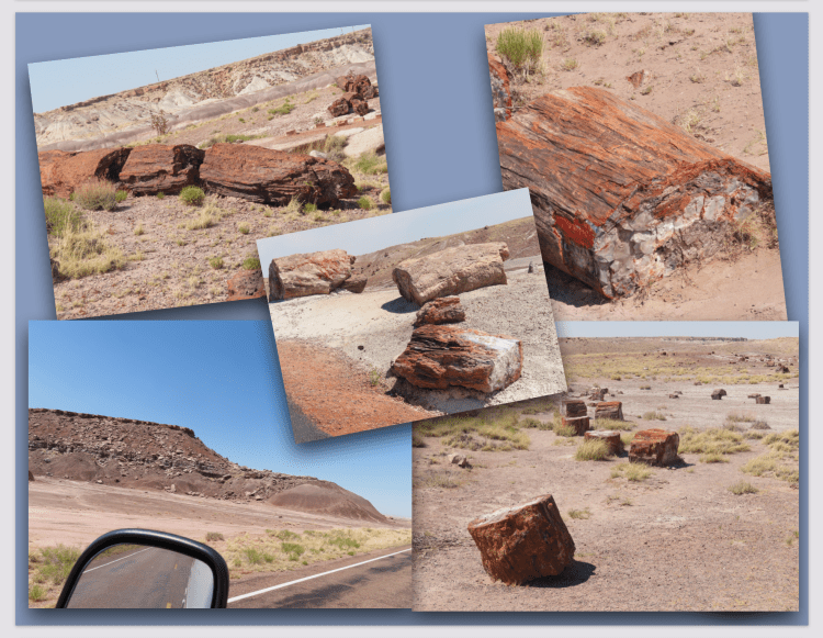
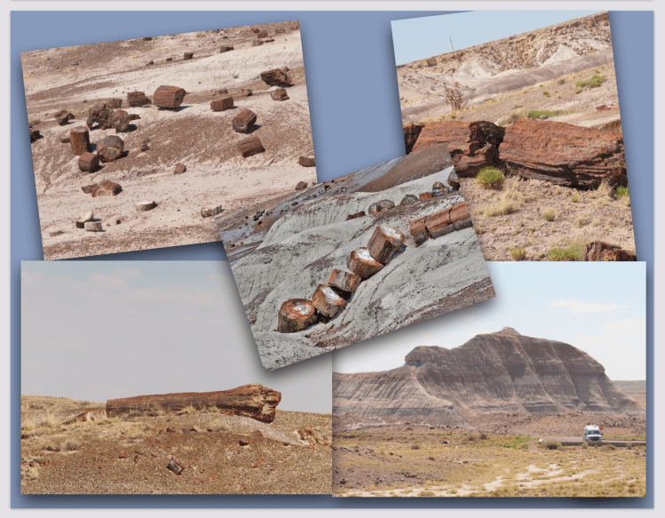
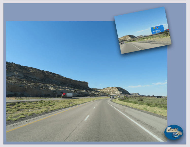
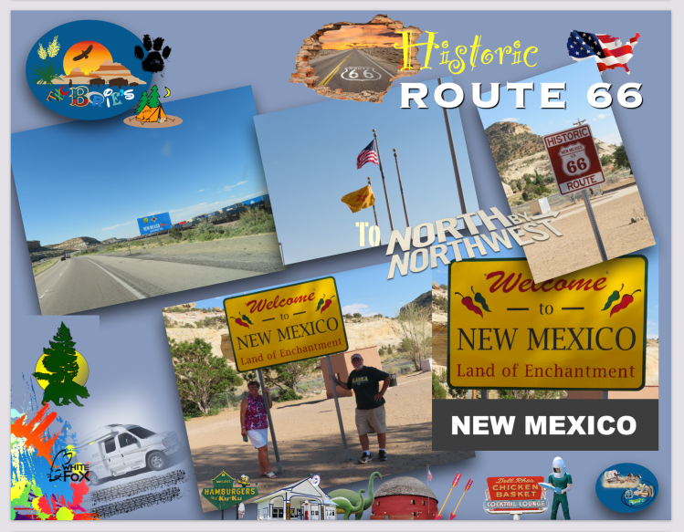
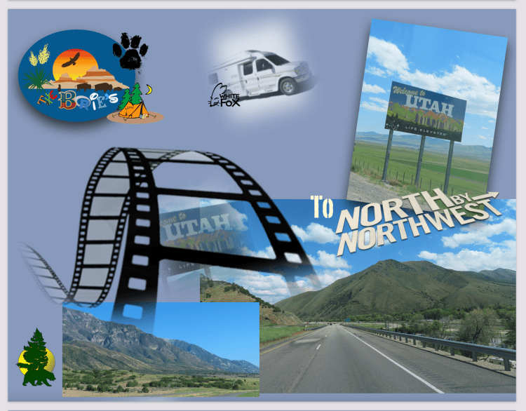
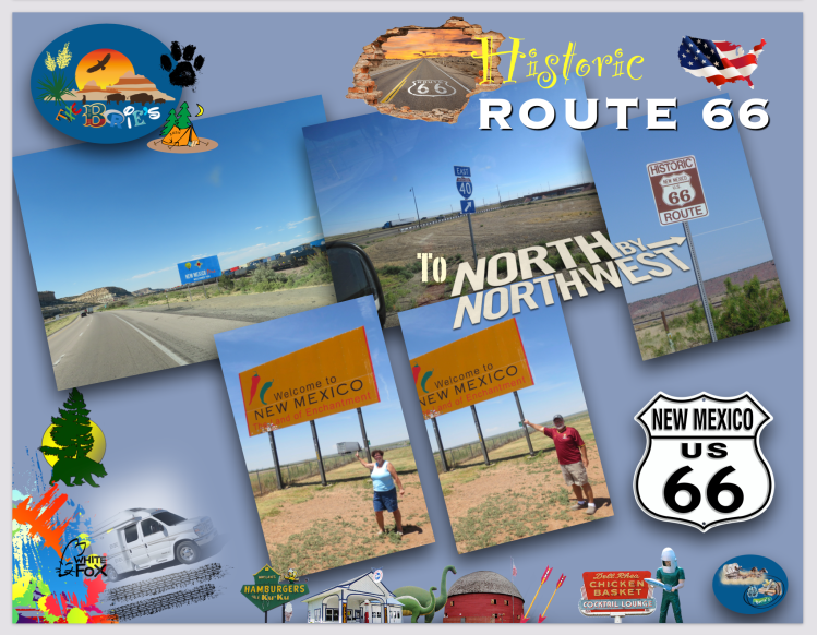
…estávamos no estado de Novo México continuando a viajar na estrada rápida I-40 na direcção leste, seguindo uma rota através da parte central do estado ao longo do caminho agora percorrido pela estrada rápida I-40, no entanto, até 1937, seguiu uma rota ainda mais longa através de Los Lunas, Albuquerque e Santa Fe!. Hoje, grandes porções desta histórica estrada, seguem paralelas à estrada rápida I-40 já referida, que seguiu o seu trajecto, com alguns letreiros de saídas para as “Vias dos Trilhos Antigos”, ou seja, para uma qualquer das vias cénicas da hoje histórica “Route 66”, que ao passar pelas pequenas vilas ou aldeias, não são mais do que estradas de fachada!.

(…we were in the state of New Mexico continuing to travel on the I-40 expressway heading east, following a route through the central part of the state along the path now taken by the I-40 highway, however, until 1937, it followed a even longer route through Los Lunas, Albuquerque and Santa Fe!. Today, large portions of this historic road run parallel to the aforementioned I-40 highway, which followed its route, with some exit signs for the “Vias dos Trilhos Antigos”, that is, for any of the scenic routes of today. Historical “Route 66”, which when passing through small towns or villages, are nothing more than facade roads)!.

…aqui e ali parávamos, apreciando pequenos trechos da cultura popular onde adoptaram as tais secções ignoradas e significativas da antiga “Route 66” nas suas redes de estradas estaduais, com o pomposo nome de “State Route 66” que para nós, incorporam a cultura da aventura, mostrando-nos o cenário dos espaços abertos oferecidos pelo oeste americano, numa rota que serpenteia através das partes mais românticas e célebres desse mesmo oeste, conectando as pequenas vilas e aldeias do centro/oeste com as da Costa do Oceano Pacífico!.

(…here and there we would stop, enjoying small snippets of popular culture where they adopted such ignored and significant sections of the old “Route 66” in their state road networks, with the pompous name of “State Route 66” that for us, embody the culture from the adventure, showing us the scenery of the open spaces offered by the American West, on a route that meanders through the most romantic and famous parts of that same West, connecting the small towns and villages of the Midwest with those of the Pacific Ocean Coast)!.

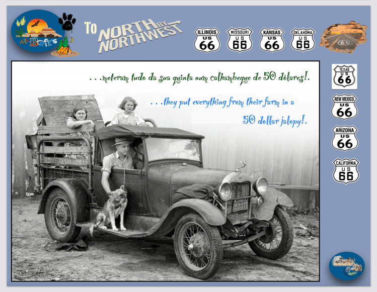
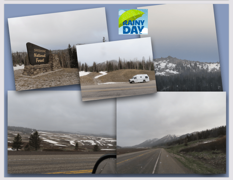
…e que em outra época deu esperança aos migrantes que iam a caminho do oeste, para encontrar uma nova vida, definindo uma geração em busca de aventura e liberdade, e nós por ali seguíamos, ouvindo música na rádio da nossa “White Fox” (caravana), bebendo café, comendo biscoitos ou fruta, lembrando aquela famíla que nos anos trinta do século passado, para se prepararem para a sua viagem até à Califórnia, meteram tudo da sua quinta num calhambeque de 50 dólares, matando os seus dois últimos porcos para fazer um barril de carne de porco salgada, para alimentar as 14 pessoas a bordo do seu calhambeque!.

(…and that at one time gave hope to migrants heading west, to find a new life, defining a generation in search of adventure and freedom, and we followed there, listening to music on the radio of our “White Fox” (caravan), drinking coffee, eating cookies or fruit, remembering that family that in the thirties of the last century, to prepare for their trip to California, put everything from their farm in a 50 dollar jalopy, killing their last two pigs to make a barrel of salted pork, to feed the 14 people aboard your jalopy)!.

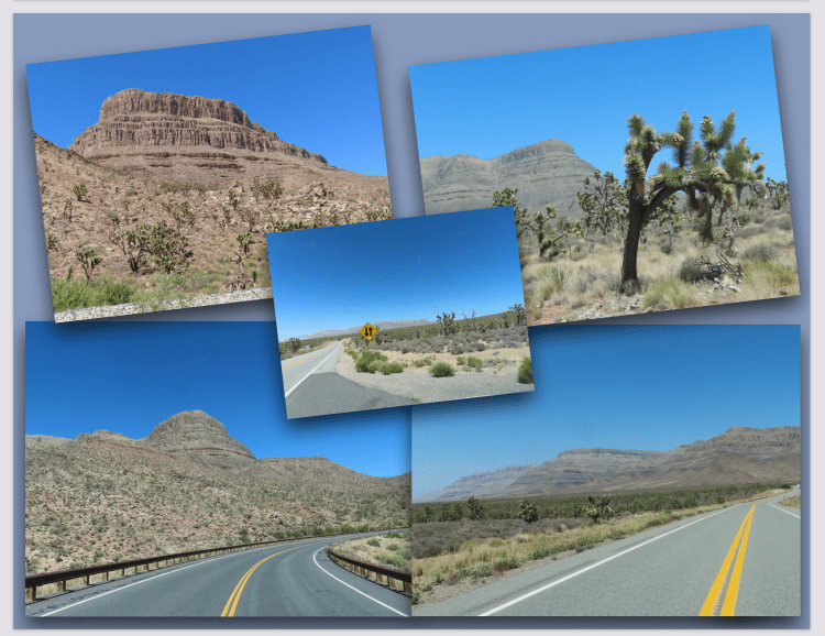
…a estrada rápida I-40, que segue numa extensão de estrada aberta de aproximadamente de 280 milhas de solidão e bastante desolada, entre Albuquerque, Novo México, e Amarillo, Texas, onde além de paragens para camiões onde ocasionalmente existe algumas lojas de conveniência para viajantes, não há muito para ver ou fazer, claro, tirando o maravilhoso cenário de algumas povoações onde tínhamos ascesso à já referida histórica “Route 66”, hoje um ícone da América, uma multiplicidade de ideias tais como, a liberdade, o velho oeste ou a solidão do interior americano!.

(…the fast road I-40, which follows an open road stretch of approximately 280 miles of solitude and quite desolate, between Albuquerque, New Mexico, and Amarillo, Texas, where in addition to truck stops where occasionally there are some shops convenience for travelers, there is not much to see or do, of course, apart from the wonderful scenery of some villages where we had access to the aforementioned historic “Route 66”, today an icon of America, a multiplicity of ideas such as freedom, the old west or the loneliness of the American countryside)!.

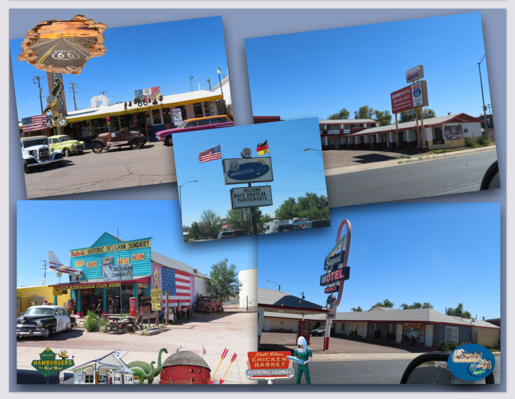
…e continuando passámos na cidade de Santa Rosa, que ainda hoje continua um ícone mundialmente famoso da “Route 66” daquela época, como por exemplo o rosto sorridente e satisfeito do Fat Man (homem gordo), que era quem atraía os visitantes do Club Café, conhecido pela sua comida caseira, biscoitos azedos e tortilhas mexicanas de milho azul, e claro, pelo seu Museu com uma grande colecção de carros antigos, camiões, brinquedos, bombas de gasolina e recordações, todos reunidos para celebrar e recordar os dias de glória daquela histórica estrada!.

(…and continuing on, we passed the city of Santa Rosa, which still today remains a world famous icon of “Route 66” of that time, such as the smiling and satisfied face of the Fat Man, who was the one who attracted visitors to the Club Café, known for its homemade food, sour cookies and Mexican blue corn tortillas, and of course, for its Museum with a great collection of vintage cars, trucks, toys, gas pumps and souvenirs, all gathered to celebrate and remember the days of glory of that historic road)!.

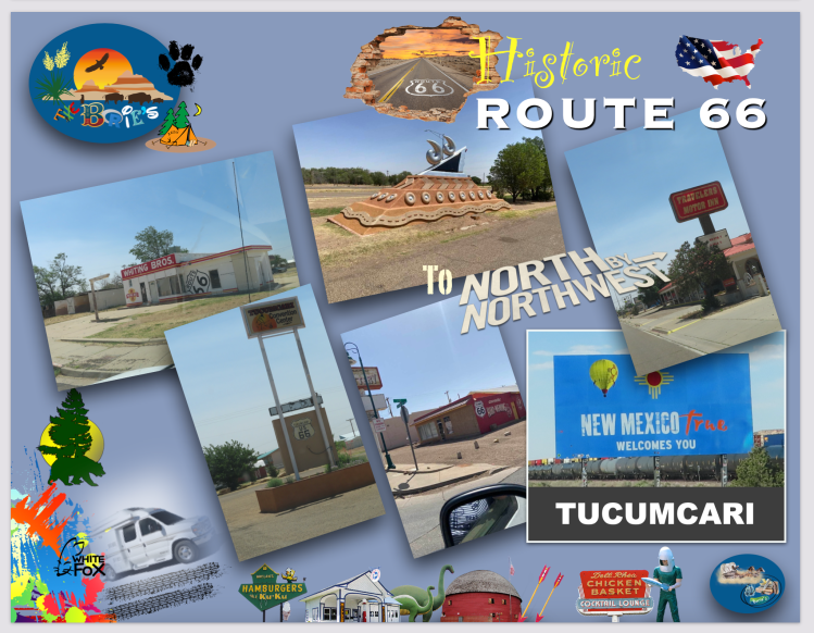
…também parámos na cidade de Tucumcari, onde o tempo quase parece que se esqueceu, crendo nós mesmo que é este um dos motivos que se destaca porque é o quão lindamente desolada é!. A maior parte da sua área circundante ainda hoje funciona como um centro dos fazendeiros rurais do Novo México, oferecendo um hospital, algumas lojas de conveniência, pequenos restaurantes e outras necessidades para a civilização!.

(…we also stopped in the city of Tucumcari, where time almost seems to have forgotten, we believe that this is one of the reasons that stands out because it is how beautifully desolate it is!. Most of its surrounding area still functions today as a center for rural New Mexico farmers, offering a hospital, a few convenience stores, small restaurants, and other necessities for civilization)!.

…muitos anos atrás, Tucumcari tem uma história única e fascinante, repleta de contos de índios Comanches e, mais tarde quando ali construiram um campo de construção para o Chicago, Rock Island e Pacifico Railroad, que logo foi apelidado de “Six Shooter Siding” (tapada dos seis atiradores), devido a inúmeros tiroteios, pois contam a existência de famosos ladrões de combóios e trabalhadores da construção do caminho de ferro que eram muito propensos em puxar por pistolas uns contra os outros!.

(…many years ago, Tucumcari has a unique and fascinating history, filled with tales of the Comanche Indians and, later, when they built a construction field there for the Chicago, Rock Island and Pacifico Railroad, which was soon dubbed the “Six Shooter”, due to numerous shootings, as they tell of the existence of famous train robbers and railway construction workers who were very prone to pulling pistols against each other)!.

…nós, atravessámos um trecho de estrada meio próspero e meio abandonado, que nos conta parte da história da cidade, os seus dias de negócios, os seus dias de declínio ou os seus dias de avivamento!.

(…we crossed a half-prosperous and half-abandoned stretch of road, which tells us part of the city’s history, its business days, its days of decline or its days of revival)!.

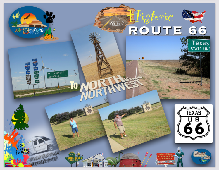
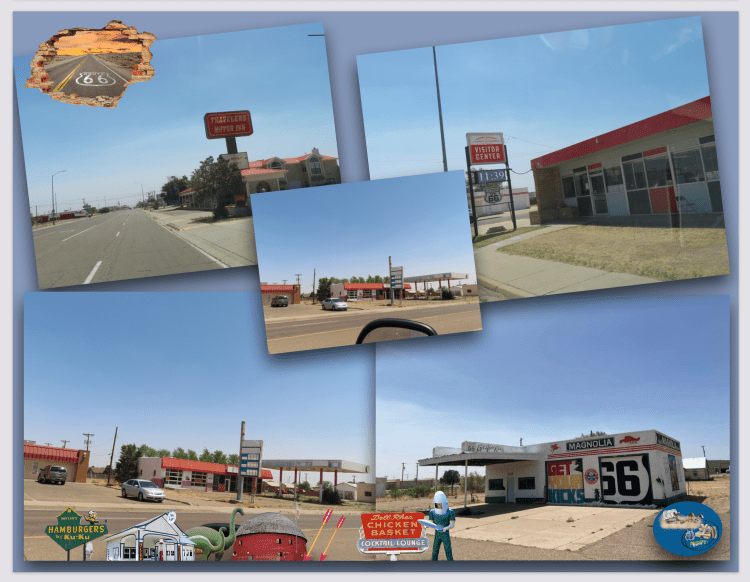
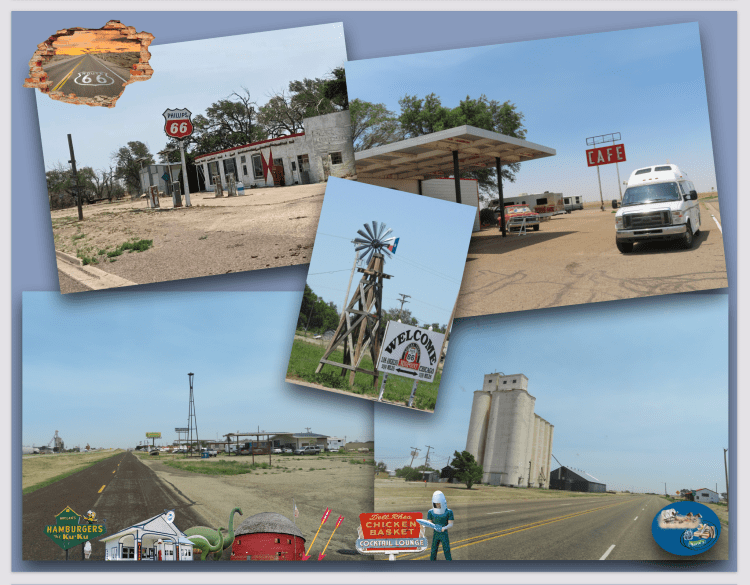
…até que chegámos ao estado do Texas, que ironicamente é o maior dos 48 estados mais baixos e acolheu o segundo alinhamento mais curto da Histórica Estrada 66!. A figura geralmente aceite é que havia 178 milhas desta famosa e histórica estrada velha, através do estreito do “Texas Panhandle”, e disto, cerca de 150 milhas permanecem, se quisermos contar a estrada de terra onde ainda se pode conduzir, porque muito da velha e histórica Route 66 é agora estrada de fachada, mas ainda recompensa conduzir por ela!.

(…until we arrived in the state of Texas, which ironically is the largest of the lower 48 states and hosted the second shortest alignment of Historic Highway 66!. The generally accepted figure is that there were 178 miles of this famous and historic old road, through the strait of the “Texas Panhandle”, and of this, about 150 miles remain, if you want to count the dirt road where you can still drive, because much of the Old and historic Route 66 is now a front road, but it is still rewarding to drive)!.

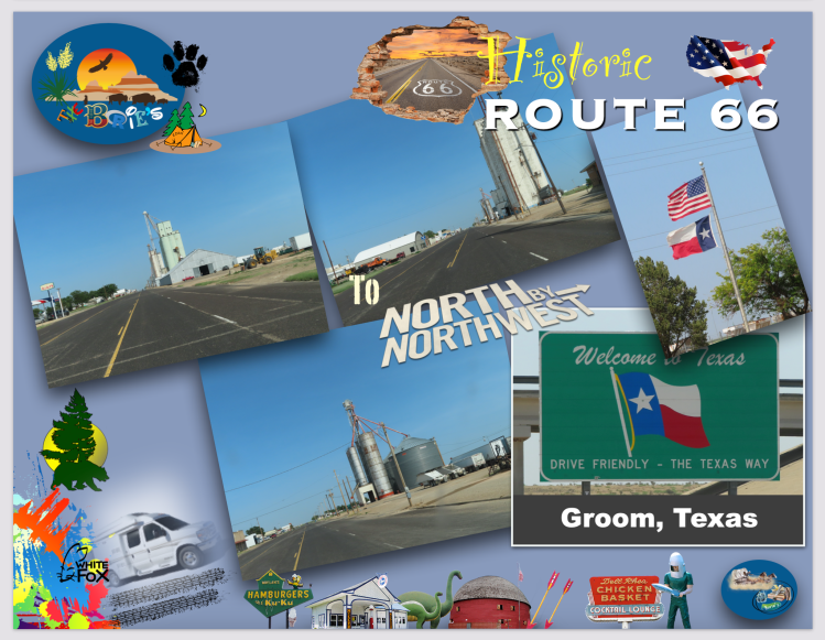
…e tal como em outros estados do sul, quando a estrada rápida I-40 foi construída, a maior parte desta histórica estrada foi aprimorada, reduzindo os custos de construção e mantendo as cidades existentes próximas à nova estrada rápida, para minimizar as perdas, principalmente do turismo!. Assim, algumas cidades foram ignoradas, onde se incluem Glenrio, Adrian, Vega, Conway, Noivo, Jericó, Alanreed, McLean e Shamrock, contudo, continuamos a ter ascesso as estas cidades, onde existem letreiros assinalando a sua localização!.

(…and as in other southern states, when the I-40 expressway was built, most of this historic highway was upgraded, reducing construction costs and keeping existing towns close to the new expressway, to minimize losses, mainly from tourism!. Thus, some cities were ignored, including Glenrio, Adrian, Vega, Conway, Noivo, Jericho, Alanreed, McLean and Shamrock, however, we continue to have access to these cities, where there are signs indicating their location)!.

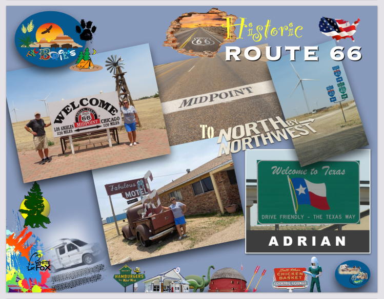
…continuando, chegámos à localidade de Adrian, já no estado do Texas, que entre outras curiosidades assinala geograficamente o ponto médio entre Chicago e Los Angeles, da Histórica Estrada 66!.

(…continuing, we arrived at the town of Adrian, in the state of Texas, which, among other curiosities, geographically marks the midpoint between Chicago and Los Angeles, of Historic Route 66)!.

…a sinalização na localidade de Adrian, orgulhosamente declara uma distância de 1139 milhas para cada lado, ostentando um slogan de que  “quando você está aqui, você está no meio do caminho”!. Aqui existe um Café, construído por volta do ano de 1928, que operava 24 horas por dia durante o auge da Histórica Estrada 66, sendo considerado hoje, o mais antigo café, operando continuamente entre Amarillo, no estado do Texas e Tucumcari, já no estado de Novo México!.

(…the signage in the town of Adrian, proudly declares a distance 1139 miles each way, sporting a slogan that “when you’re here, you’re halfway there!”. There is a Café here, built around 1928, which operated 24 hours a day during the heyday of Historic Highway 66, being considered today, the oldest café, operating continuously between Amarillo, in the state of Texas and Tucumcari, already in the state of New Mexico)!.

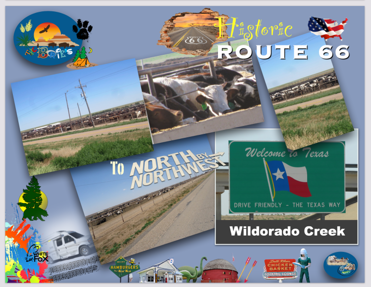
…continuámos a nossa viajem e, próximo de Wildorado Creek, talvez a umas tantas milhas de distância já se notava o cheiro no ar que já nos era conhecido de outras ocasiões que por aqui passámos!. Tivemos que fechar as janelas da nossa “White Fox” (Caravana)!. Era um cheiro mau, muito mau que vinha da maior manada de vacas da nossa vida, que deviam de ser milhares, nunca tínhamos visto tantas vacas juntas!.

(…we continued our journey and, near Wildorado Creek, perhaps a few miles away, the smell was already noticeable in the air that was already known to us from other occasions that we passed through!. We had to close the windows of our “White Fox” (Caravan)!. It was a bad, very bad smell that came from the largest herd of cows in our lives, which must have been thousands, we had never seen so many cows together)!.

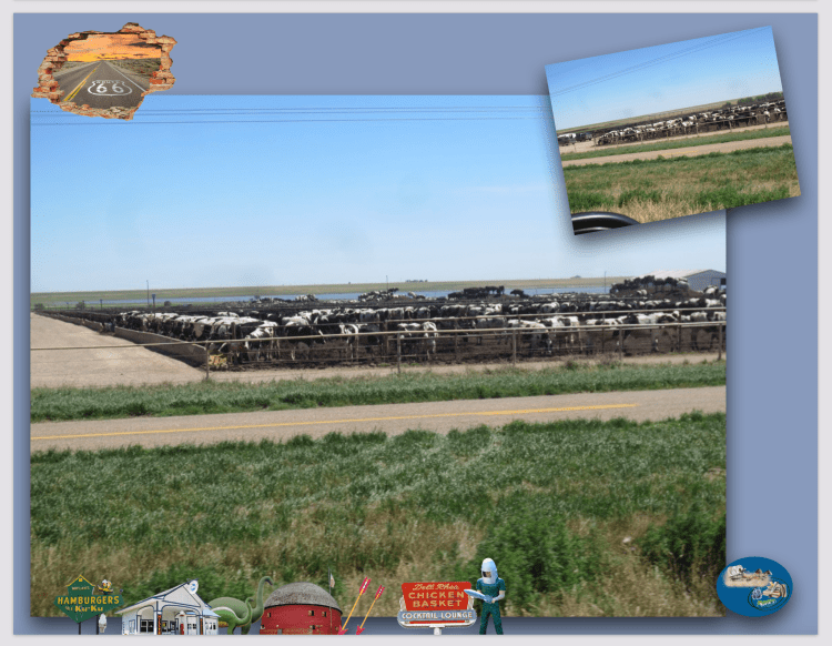
…afrouxámos a velocidade, encostando ao lado da estrada, a nossa dedicada esposa Isaura foi fotografando talvez milhares e milhares de manadas de gado bobino, em currais, talvez esperando o transporte no caminho de ferro ou esperando um possível abate, não sabemos, mas o cenário era incomum para quem vive longe do campo e de extensas áreas de pastagem!.

(…we slowed down, pulling over to the side of the road, our devoted wife Isaura was photographing perhaps thousands and thousands of herds of cattle, in corrals, perhaps waiting for transport on the railroad or waiting for a possible slaughter, we don’t know, but the scenario was unusual for those who live far from the countryside and extensive pasture areas)!.

…Wildorado Creek, é uma comunidade que foi fundada por volta do ano de 1900 como uma localidade ferroviária ao longo da Chicago, Rock Island e Gulf Railroad e, no final dos anos vinte e trinta, Wildorado Creek foi torturado por tempestades de areia e secas mas, o elemento turbulento de algumas localidades em expansão no “Texas Panhandle”, viu o Wildorado Creek como um alvo fácil e, bancos e lojas eram roubados frequentemente!.

(…Wildorado Creek, is a community that was founded around the year 1900 as a railroad town along the Chicago, Rock Island and Gulf Railroad, and in the late twenties and thirties, Wildorado Creek was tortured by sandstorms and droughts, but the turbulent element of some expanding localities in the “Texas Panhandle”, saw Wildorado Creek as an easy target, and banks and stores were often robbed)!.

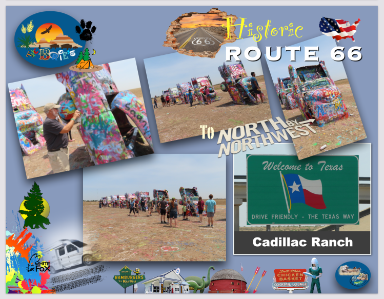
…continuando, já próximo da cidade de Amarillo, parámos de novo na  atracção da “Route 66”, que consiste em dez Cadillacs já usados ​​ou velhos (1949-1963) enterrados de nariz no chão, e que hoje dá pelo nome de “Cadillac Ranch”, considerado de arte pública e escultura, situado ao longo da “Route 66” a oeste de Amarillo, Texas, que foi inventado e construído por um grupo de hippies artísticos importados de São Francisco!.

(…continuing, already close to the city of Amarillo, we stopped again at the attraction of “Route 66”, which consists of ten used or old Cadillacs (1949-1963) buried with their noses in the ground, and which today goes by the name of “Cadillac Ranch”, considered public art and sculpture, located along “Route 66” west of Amarillo, Texas, which was invented and built by a group of artistic hippies imported from San Francisco!.

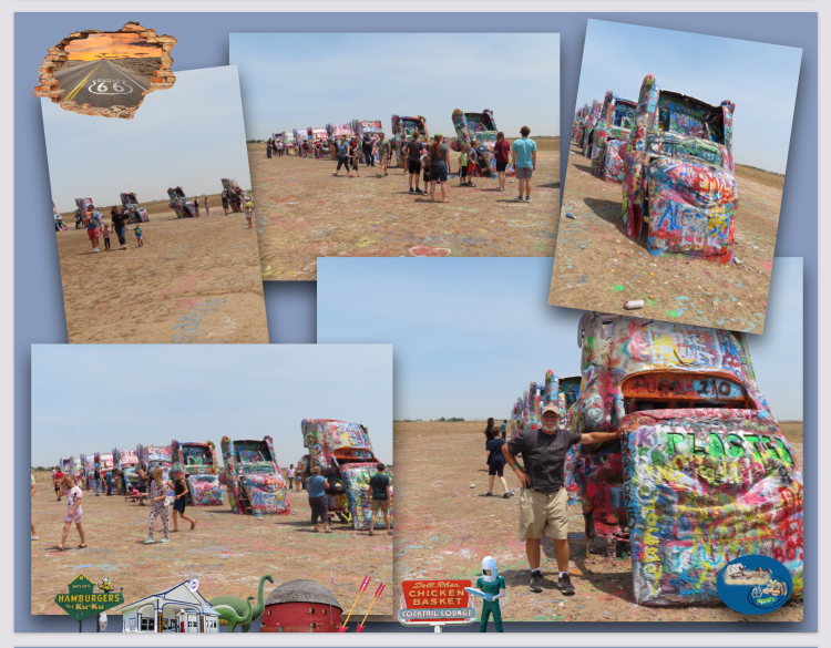
…os Cadillacs estão no chão como arte há mais tempo do que na estrada como carros, que continuam a ser despojados das suas molduras, algumas danificadas e com muitas manchas de tinta de visitantes como nós que continuam a pintá-los com tinta spray, ficando cada vez mais irreconhecíveis como automóveis!. No entanto, o Cadillac Ranch está mais popular do que nunca, tornando-se num local de ritual para aqueles que viajam pela Estrada Mãe!.

(…Cadillacs have been on the ground as art longer than they have been on the road as cars, which continue to be stripped of their frames, some damaged and heavily smeared with paint from visitors like us who continue to spray paint them, leaving increasingly unrecognizable as automobiles!. However, Cadillac Ranch is more popular than ever, becoming a ritual site for those traveling the Mother Road)!.

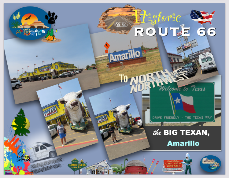
…parámos para comer na cidade de Amarillo, Texas, num restaurante que cujo lema é “home of the free 72 onças steak”, que quer mais ou menos dizer que, se alguém conseguir comer um bife de 72 onças, não paga, é de graça!. Já é costume parar-mos por aqui, e durante a nossa presença no restaurante, houve dois candidatos a comer o enorme bife e, tudo foi acompanhado de um personagem parecido com um mestre de cerimónias, que faz um relato quase minucioso de todo este acontecimento, ou seja, do progresso do candidato e como vai comendo o emorme bife, e falando numa voz muito rápida, parecida com a voz de um relator típico do Texas, de um qualquer leilão de vacas ou cavalos, que nós, pessoas visitantes quase não compreendemos nada, mas que foi divertido, lá isso foi!.

(…we stopped to eat in the city of Amarillo, Texas, at a restaurant whose motto is “home of the free 72 oz steak”, which more or less means that if anyone can eat a 72 oz steak, they don’t pay, it’s grace!. It is already customary to stop here, and during our presence in the restaurant, there were two candidates to eat the huge steak and, everything was accompanied by a character similar to a master of ceremonies, who gives an almost detailed account of this whole event, that is, of the candidate’s progress and how he is eating the huge steak, and speaking in a very fast voice, similar to the voice of a typical Texas rapporteur, of some cow or horse auction, which we visiting people hardly ever we understand nothing, but that was fun, there it was)!.

…continuando a viajar na direcção leste, parámos na cidade de Groom, para ver e fotografar a Torre Inclinada de Britten, que é uma torre de água inclinada que serve como atracção na histórica “Route 66” como um item decorativo ao longo desta histórica estrada, em Groom, Texas!. Às vezes é chamada de Torre Inclinada do Texas!. Esta torre era originalmente uma torre de água em funcionamento que foi programada para demolição até que Ralph Britten a comprou e a mudou para servir como um anúncio para a sua parada de camiões e centro de informações turísticas!.

(…continuing to travel eastwards, we stopped in the town of Groom, to see and photograph the Leaning Tower of Britten, which is a leaning water tower that serves as an attraction on historic “Route 66” as a decorative item along this historic road, in Groom, Texas!. It is sometimes called the Leaning Tower of Texas!. This tower was originally a working water tower that was slated for demolition until Ralph Britten bought it and moved it to serve as an advertisement for his truck stop and tourist information center)!.

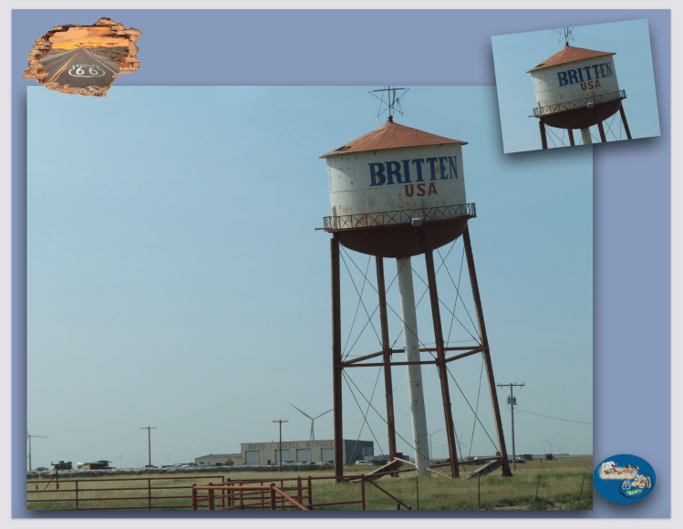
…como curiosidade, é deliberadamente inclinada num ângulo de aproximadamente 10 graus, tornando-se num destino turístico popular, havendo uma pequena estrada de cascalho no local para estacionar e tirar fotos!. Durante a época de Natal, a cidade de Groom coloca uma grande estrela multicolorida no topo da torre!. Imagens da caixa d’água são comuns nos livros de fotografia da histórica “Route 66”!.

(…as a curiosity, it is deliberately tilted at an angle of approximately 10 degrees, making it a popular tourist destination, with a small gravel road in place to park and take pictures!. During the Christmas season, Groom City places a large multicolored star on top of the tower!. Images of the water tank are common in the photography books of the historic “Route 66”)!.

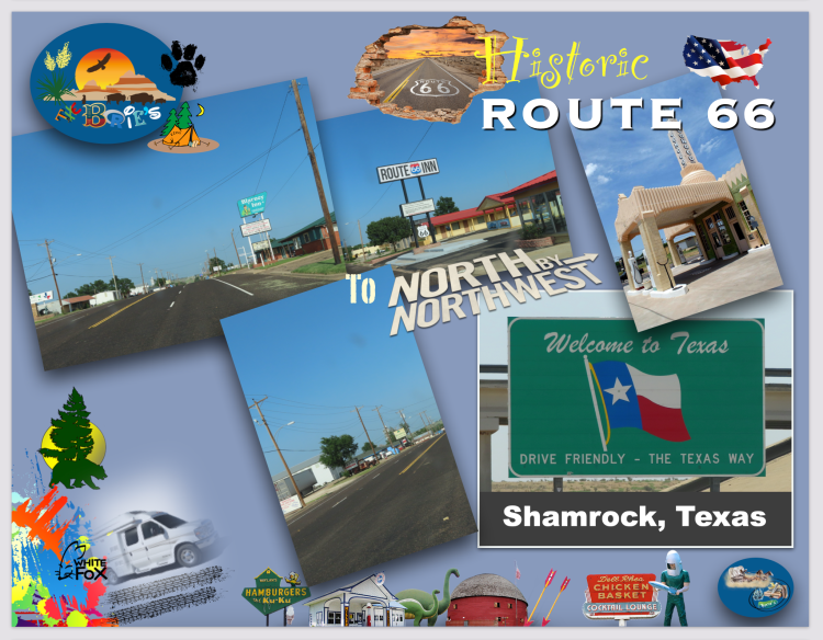
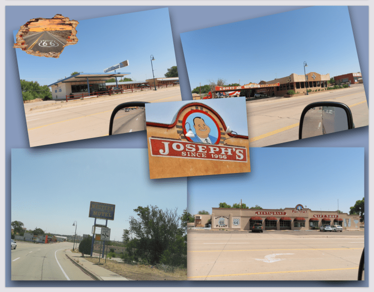
…e ainda no estado do Texas, já quase na fronteira com o estado de Oklahoma, passámos pela cidade de Samrock, onde a hoje histórica “Route 66” fez a avenida principal de Shamrock crescer com garagens, postos de gasolina, restaurantes e praças turísticas e, entre as principais atrações estão o Pioneer West Museum, a Zeigler House, o Magnolia Gas Station, tal com o U-Drop Inn!.

(…and still in the state of Texas, almost on the border with the state of Oklahoma, we passed through the city of Samrock, where the now historic “Route 66” made the main avenue of Shamrock grow with garages, gas stations, restaurants and tourist squares. and, among the main attractions are the Pioneer West Museum, the Zeigler House, the Magnolia Gas Station, as well as the U-Drop Inn)!.

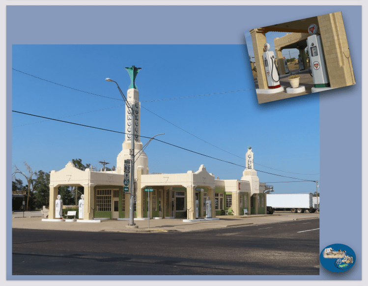
…como curiosidade, um pequeno fragmento da genuína Pedra de Blarney do Castelo de Blarney no Condado de Cork, na Irlanda, está  montado num pilar no Elmore Park e o Centro de Informações ao Visitante de Shamrock e a Câmara de Comércio estão localizados no U-Drop Inn, o qual mostramos na foto!.

(…as a curiosity, a small fragment of genuine Blarney Stone from Blarney Castle in County Cork, Ireland, is mounted on a pillar in Elmore Park and the Shamrock Visitor Information Center and Chamber of Commerce are located at the U- Drop Inn, which we show in the photo)!.

…e, nós sentimo-nos uns previlegiados, porque tivémos a felicidade de ver todo este cenário sendo viajantes da hoje “Histórica Route 66”, porque viajar por esta famosa estrada, é como dar um passo atrás para um tempo mais simples e, nós vimos, presenciámos que milhares e milhares de pessoas nos dias de hoje continuam a percorrer o que resta desta histórica estrada e deste grande corredor de néon, embora já um pouco desbotado, que vai desde a cidade de Chicago, no estado de Illinois, à cidade de Los Angeles, no estado da Califórnia!.

(…and we feel privileged, because we were lucky enough to see all this scenery as travelers on today’s “Historical Route 66”, because traveling along this famous road is like taking a step back to a simpler time and, we we saw, we witnessed that thousands and thousands of people today continue to walk what remains of this historic road and this great neon corridor, although already a little faded, which ranges from the city of Chicago, in the state of Illinois, to the city of Los Angeles, in the state of California)!.

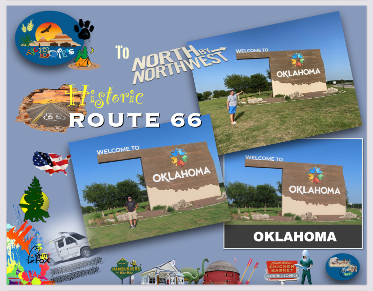
…e finalmente entrámos no estado de Oklahoma, onde dormimos num parque de RV, dando assim algum descanso à nossa “White Fox”, (caravana)!.

(…and finally we entered the state of Oklahoma, where we slept in an RV park, thus giving some rest to our “White Fox”, (caravan)!.

Tony Borie, Século XXI.  (Tony Borie, 21st Century).  

…to North by Northwest, 2022 (9)

…viajando sentimos alguma tranquilidade!. Sim, tranquilidade ao apreciar um trecho de estrada deserta ou um qualquer pássaro ou animal selvagem rodeado de folhas verdes ou secas, duma qualquer árvore que nasceu ao lado dessa estrada deserta ou de um rio com água revoltosa e enlameada, limpa ou brilhante, que corre suave num verdejante vale ou revoltoso entre pedras de uma qualquer montanha, em direção ao mar!.

(…travelling, we feel some tranquility!. Yes, tranquility when enjoying a stretch of deserted road or any bird or wild animal surrounded by green or dry leaves, any tree that grew up next to that desert road or a river with turbulent and muddy water, clean or shiny, that flows smooth in a green valley or revolting between rocks of any mountain, towards the sea)!.

…tal como fizémos nestes últimos dias da nossa viajem pelo norte e oeste, porque agora sim, viajamos em direcção ao mar Atlântico, ou seja à nossa Flórida, no entanto continuamos a parar aqui e ali, nem que seja para apreciar um qualquer conjunto de cores violeta, azul, verde, amarelo, laranja ou vermelho, em qualquer lugar ou em qualquer pôr do sol!.

(…just as we did in these last days of our journey through the north and west, because now we are traveling towards the Atlantic sea, that is to say our Florida, however we continue to stop here and there, even if it is to appreciate any set of violet, blue, green, yellow, orange or red colors, anywhere or at any sunset)!.

…continuando com o relato da nossa viajem, pela manhã, depois de comprar alguns géneros alimentícios para sobrevivência na estrada, deixámos a cidade lendária da “Route 66” que dá pelo nome de Kingman, ainda no estado do Arizona que é uma cidade no Condado do Mohave com muito movimento, hoteis, restaurantes, praças comerciais, mas sempre preservando a imagem de tudo o que respeita à famosa estrada 66!.

(…continuing with the story of our trip, in the morning, after buying some groceries for survival on the road, we left the legendary city of “Route 66” that goes by the name of Kingman, still in the state of Arizona which is a city in the County Mohave with a lot of movement, hotels, restaurants, commercial squares, but always preserving the image of everything that concerns the famous “Route 66”)!.

…entrando nós na estrada rápida I-40 no sentido leste, estrada esta que segue paralela em quase toda a sua extenção à lendária “Route 66” neste estado do Arizona, que seguiu o seu trajecto, com alguns letreiros de saídas para as “vias dos trilhos antigos”, ou seja, para uma qualquer das vias cénicas da histórica “Route 66”, que ao passar pelas pequenas vilas ou aldeias, não são mais do que estradas de fachada!. 

(…entering the fast road I-40 towards the east, a road that runs parallel for almost all of its length to the legendary “Route 66” in this state of Arizona, which followed its route, with some exit signs for the “lanes from the old trails”, that is, to any of the scenic routes of the historic “Route 66”, which, when passing through small towns or villages, are nothing more than facade roads)!.

…já algumas vezes fizémos o percurso da “Route 66”, em algumas partes até nos dois sentidos, assim somos um pouco “veteranos” que, partindo da Adams Street, na cidade de Chicago, estado de Illinois, através dos estados de Missouri, Kansas, Oklahoma, Texas, Novo México e Arizona, seguimos todo o seu trajecto, antes de terminar na Santa Monica Pier, no Condado de Los Angeles, Califórnia, cobrindo o seu um total de 2.448 milhas (3.940 km)!.

(…we have already traveled the “Route 66”, in some parts even in both directions, so we are a bit “old-timers” who, starting from Adams Street, in the city of Chicago, Illinois, through the states of Missouri, Kansas, Oklahoma, Texas, New Mexico and Arizona, we followed its entire route, before ending up at Santa Monica Pier, in Los Angeles County, California, covering a total of 2,448 miles (3,940 km)!.

…mas, existe sempre algo que ainda não foi apreciado ao pormenor e foi o que tentámos fazer!. Porquê?. Porque, a “Route 66” serviu como rota principal para aqueles que migraram para o oeste, especialmente durante o ‘“Dust Bowl dos anos 30” e a estrada sustentava as economias das comunidades pelas quais passava, onde as pessoas que faziam negócios ao longo da rota tornaram-se prósperas devido à crescente popularidade da estrada e essas mesmas pessoas mais tarde lutaram para manter a estrada viva, diante da crescente ameaça de serem ignoradas pelo novo sistema de Estradas Rápidas interestaduais!. 

(…but, there is always something that has not yet been appreciated in detail and that is what we tried to do!. Because?. Because, “Route 66” served as the main route for those who migrated westward, especially during the “Dust Bowl of the 1930s” and the road supported the economies of the communities it passed through, where people doing business along the route became thriving due to the road’s growing popularity and these same people later struggled to keep the road alive, in the face of the growing threat of being ignored by the new system of Interstate Fast Roads)!.

…continuando e desviando-nos aqui e ali da estrada rápida I-40, parámos por algum tempo na cidade de Seligman, que em certa época ficou conhecida como o “Berço da Histórica Route 66”, no entanto hoje, Seligman abriga inúmeras lojas de presentes, restaurantes e vários pequenos motéis, sendo realmente um passo para trás no tempo!. Existem por aqui muitas lembranças históricas interessantes que se podem comprar em lojas pitorescas e bem abastecidas, onde ao mesmo tempo se pode mergulhar na “histórica Route 66”, e claro, numa aconchegante e pequenina cidade!.

(…continuing and detouring here and there from the fast road I-40, we stopped for a while in the town of Seligman, which at one time became known as the “Birthplace of Historic Route 66”, however today, Seligman is home to numerous boutique shops. gifts, restaurants and several small motels, really being a step back in time!. There are many interesting historical souvenirs here that you can buy in picturesque and well-stocked stores, where at the same time you can dive into the “historic Route 66”, and of course, in a cozy and small town)!.

…Seligman experimentou o seu verdadeiro apogeu após a Segunda Guerra Mundial quando do movimento, principalmente de ex-IGs e suas famílias, para ingressar no crescente mercado de trabalho da Califórnia e, não só de ex-IGs como também para as famílias de agricultores que escapavam do “Dust Bowl dos anos 30”, tornando a “histórica Route 66” no “Caminho de Voo” e alguém a baptizou como a “Mother Road”, carregando esse apelido desde então, registando esse êxodo monumental que foi um movimento de massas dos humanos na história desta nação!.

(…Seligman experienced his true heyday after World War II when the movement, primarily by ex-IGs and their families, to enter California’s growing job market, and not just ex-IGs but the farming families who escaped the “Dust Bowl of the 30s”, turning the “historic Route 66” into the “Flight Path” and someone christened it the “Mother Road”, carrying that nickname ever since, recording that monumental exodus that was a mass movement of humans in the history of this nation)!.

…voltámos à estrada rápida I-40 por algum tempo desviando-nos de novo em na cidade de Ash Fork, que orgulhosamente se proclamou “A Capital da Laje do Mundo”, devido ao grande número de pedreiras, onde algumas ainda estão em actividade!. Passando pela avenida principal designada como “Route 66”, verificámos que algumas casas de negócio, talvez do início dos anos 1900 já se foram, mas alguns dos edifícios da década de 1940 sobreviveram e estão lá!. 

(…we returned to the fast road I-40 for a while, detouring back into the town of Ash Fork, which has proudly proclaimed itself “The Slab Capital of the World”, due to the large number of quarries, some of which are still in operation!. Passing through the main avenue designated as “Route 66”, we found that some business houses, perhaps from the early 1900s, are gone, but some of the buildings from the 1940s have survived and are there)!.

…a história diz-nos que Ash Fork é um excelente exemplo de uma pequena cidade que sofreu muitos contratempos ao longo dos anos, mas foi sempre sobrevivendo e exemplo disto é que, começou como uma cidade ferroviária na década de 1880, um incêndio queimou a pequena cidade em meados da década de 1890, mas o seu processo de reconstrução começou e mais tarde, sendo atravessada durante o início da era das viagens de automóvel, beneficiou de uma prosperidade económica renovada, tornando-se uma paragem muito importante da hoje “histórica Route 66”!. 

(…history tells us that Ash Fork is an excellent example of a small town that has suffered many setbacks over the years, but has always survived and an example of this is that, starting as a railroad town in the 1880s, a fire burned down the small town in the mid-1890s, but its rebuilding process began and later, being traversed during the early age of car travel, it benefited from renewed economic prosperity, making it a very important stop in today’s “historic Route 66”)!.

…e continuando, parámos de novo e por algum tempo, na cidade Winslow, Arizona, que é o local do famoso parque “Standin’ on the Corner”, popularizado pela música “Take It Easy” cantada pelos Eagles!. Esta escultura, tal como o mural são uma atração imperdível e histórica, e claro, uma oportunidade para fotos!.

(…and continuing, we stopped again and for a while, in the city of Winslow, Arizona, which is the site of the famous park “Standin’ on the Corner”, popularized by the song “Take It Easy” sung by the Eagles!. This sculpture, like the mural, are a must-see and historic attraction, and of course, a photo opportunity!.

…Winslow também é o local do Memorial 9-11, construído com duas vigas recuperadas das torres do World Trade Center em Nova York!. Esta área foi dedicada em 11 de setembro de 1999, como uma homenagem à canção memorável da década de 1970, que fez de Winslow, Arizona, uma cidade para cantar na hoje famosa e histórica “Route 66”.

(…Winslow is also the site of the 9-11 Memorial, built with two beams salvaged from the towers of the World Trade Center in New York!. This area was dedicated on September 11, 1999, as a tribute to the memorable song of the 1970s that made Winslow, Arizona, a city to sing on the now famous and historic “Route 66”).

…não nos querendo alongar, a música “Take It Easy” foi escrita por Jackson Browne e Glenn Frey e gravada pelos Eagles!.  O “Standin’ on the Corner Park” apresenta um mural de dois andares e uma estátua de bronze, estimando-se que mais de 100.000 visitantes venham a esta esquina a cada ano!.

(…not wanting to stretch us out, the song “Take It Easy” was written by Jackson Browne and Glenn Frey and recorded by the Eagles!. The “Standin’ on the Corner Park” features a two-story mural and a bronze statue, it is estimated that more than 100,000 visitors come to this corner each year)!.

…voltámos à estrada rápida I-40, voltando a sair na cidade de José, que simplesmente é o assentamento Mórmon mais antigo do Arizona e, um dos pontos mais turísticos da hoje histórica “Route 66” nesta pequena cidade é o “Ella’s Frontier Trading Post” na Main Street, onde também se pode ainda ver o Old Fort Marker, o antigo Pacific Motel e o Mural at Old Garage!.

(…we returned to the fast road I-40, exiting again in the city of José, which is simply the oldest Mormon settlement in Arizona and, one of the most touristic points of the now historic “Route 66” in this small town is “Ella’s Frontier Trading” Post” on Main Street, where you can also see the Old Fort Marker, the old Pacific Motel and the Mural at Old Garage)!.

…e, viajando um pouco para o sul podemos visitar a Ponte Histórica!, tal como um pouco antes de entrar nesta cidade vimos o grande painel publicitário e o “Jack Rabbit Trading Post”, que nos dizem para parar e visitar, o que desta vez não fizémos!. 

(…and, traveling a little to the south, we can visit the Historic Bridge!, just as just before entering this city we saw the big advertising board and the “Jack Rabbit Trading Post”, which tell us to stop and visit, what about this time we didn’t)!.

…o dia já ia longo, já passava do meio dia, no entanto estava no nosso roteiro visitar o Parque Nacional da Floresta Petrificada, assim abandonámos de novo a estrada rápida I-40, saindo na cidade de Holbrook, Arizona, parando na relíquia histórica da “Route 66”, que é o “Wigwam Motel”!.

(…the day was already long, it was past noon, however it was on our itinerary to visit the Petrified Forest National Park, so we left the I-40 fast road again, leaving in the city of Holbrook, Arizona, stopping at the historic relic from “Route 66”, which is the “Wigwam Motel”!).

…que é um motel com 15 barracas de concreto e aço, onde originalmente havia um posto de gasolina!. Estas unidades individuais são chamadas de “wigwams”, não “quartos” ou “tendas” ou “cabanas” e em cada unidade há um pequeno banheiro com pia, vaso sanitário e chuveiro, sendo os móveis de nogueira restaurados originais, duas camas de casal, TV via satélite e ar condicionado montado na janela e para manter a autenticidade da restauração, não há telefones ou máquina de gelo!.

(…which is a motel with 15 concrete and steel tents, where there was originally a gas station!. These individual units are called “wigwams”, not “rooms” or “tents” or “cabins” and in each unit there is a small bathroom with sink, toilet and shower, with the original restored walnut furniture, two double beds , satellite TV and window mounted air conditioning and to maintain the authenticity of the restoration, there are no phones or ice machine)!.

…também existem por aqui automóveis antigos restaurados da década de 1960 e anteriores, pequenos bancos de metal verde gravados com as palavras “Wigwam Village #6”, também estão espalhados por todo este complexo e, perto do balcão de registro há uma pequena sala que contém muitas  recordações, incluindo uma coleção de madeira petrificada!.

(…there are also restored vintage automobiles from the 1960s and earlier, small green metal benches engraved with the words “Wigwam Village #6” are also scattered throughout this complex, and near the registration desk is a small room that contains many memorabilia, including a petrified wood collection)!.

…continuando, querendo visitar o Parque Nacional da Floresta Petrificada, entrámos numa estrada com uma ainda linha de postes telefónicos que marca o leito da hoje histórica “Route 66” dentro deste parque!. Estes vestígios de um velho leito de estrada com estes postes telefónicos já desgastados, marcam o caminho da famosa “Rua Principal da América” e, o Parque Nacional da Floresta Petrificada é o único parque do Sistema de Parques Nacionais que contém uma secção da “Route 66”!.

(…continuing, wanting to visit the Petrified Forest National Park, we entered a road with a line of telephone poles that marks the bed of the now historic “Route 66” within this park!. These vestiges of an old roadbed with these telephone poles already worn, mark the path of the famous “Main Street of America” ​​and the Petrified Forest National Park is the only park in the National Park System that contains a section of the “Route 66”)!.

…tudo isto é impressionante porque o Parque Nacional da Floresta Petrificada fica na fronteira entre o condado de Apache e o condado de Navajo, no nordeste do Arizona e, é conhecido pelos seus fósseis, especialmente de árvores caídas que viveram no Triássico Superior da era Mesozóica, cerca de 225 a 207 milhões de anos atrás!. Durante esse período, a região que hoje é o parque ficava perto do equador na borda sudoeste do supercontinente Pangeia, e o seu clima era úmido e subtropical!.

(…this is all impressive because the Petrified Forest National Park straddles the border between Apache County and Navajo County in northeastern Arizona and is known for its fossils, especially of fallen trees that lived in the Upper Triassic of the Mesozoic era , about 225 to 207 million years ago!. During that period, the region that is now the park was close to the equator on the southwest edge of the supercontinent Pangea, and its climate was humid and subtropical)!.

…o que mais tarde se tornou o nordeste do Arizona, que era uma planície baixa ladeada por montanhas ao sul e sudeste e um mar a oeste!. Os riachos que fluem pela planície a partir das terras altas depositaram sedimentos inorgânicos e matéria orgânica, incluindo árvores, bem como outras plantas e animais que entraram ou caíram na água!. No entanto, embora a maior parte da matéria orgânica se decomponha rapidamente ou seja comida por outros organismos, algumas são enterradas tão rapidamente que permanecem intactas e podem se tornar fossilizadas!.

(…what later became northeast Arizona, which was a low plain flanked by mountains to the south and southeast and a sea to the west!. The streams flowing across the plain from the highlands deposited inorganic sediments and organic matter, including trees, as well as other plants and animals that entered or fell into the water!. However, while most organic matter decomposes quickly or is eaten by other organisms, some are buried so quickly that they remain intact and can become fossilized)!.

…mais palavras para quê?. Nós, que por diversas vezes mencionamos que “perante diversos cenários nos tornamos em contadores de histórias”, aqui, depois de caminhar, observar, tocar, e claro, fotografar todo este maravilhoso cenário, só nos resta mencionar o que dizem os diversos letreiros que frequentemente nos aparecem, que mencionam “Collecting Petrified Wood is prohibited”, (É proibido colectar madeira petrificada)!. E para quê?. Carregar connosco tantos milhões de anos!.

(…more words for what?. We, who have mentioned several times that “in the face of different scenarios we become storytellers”, here, after walking, observing, touching, and of course, photographing all this wonderful scenery, we only have to mention what the various signs that “Collecting Petrified Wood is prohibited”!. And for what?. Carry with us so many millions of years)!.

…o dia já ia longo quando atravessámos a fronteira para o estado de Novo México, acampando num Parque de RV, lembrando a hoje histórica “Route 66”, também conhecida como Will Rogers Highway, a Main Street of America ou a Mother Road, que foi uma das estradas originais no sistema de estradas dos EUA, que ajudou a transformar o oeste americano de uma fronteira isolada em uma região economicamente vital, tornando-a acessível a qualquer pessoa que viajasse de carro!. 

(…the day was already long when we crossed the border into the state of New Mexico, camping in an RV Park, remembering the now historic “Route 66”, also known as Will Rogers Highway, the Main Street of America or the Mother Road, which It was one of the original roads in the US road system, which helped transform the American West from an isolated frontier into an economically vital region, making it accessible to anyone traveling by car)!.

Tony Borie, Século XXI. (Tony Borie, 21st Century). 

…to North by Northwest, 2022!. (8)

…pela manhã, ainda no estado do Utah, seguindo na estrada rápida I-15 no sentido sul e passando na área da cidade de St. George, que se localiza a sudoeste, quase na fronteira com o estado do Arizona, mais propriamente a parte nordeste do Deserto de Mojave, adjacente às Montanhas do Vale do Pinheiro e perto da convergência de três áreas geológicas e ecorregiões distintas que são o Deserto de Mojave, o Planalto do Colorado e a sua Grande Bacia!.

(…in the morning, still in the state of Utah, following the I-15 highway heading south and passing through the St. George, which is located to the southwest, almost on the border with the state of Arizona, more precisely the northeast part of the Mojave Desert, adjacent to the Pine Valley Mountains and close to the convergence of three distinct geological areas and ecoregions that are the Desert of Mojave, the Colorado Plateau and its Great Basin)!.

…seguindo a rota do sul e na mesma estrada rápida, entrámos por pouco tempo no estado de Arizona, passando pela área do Deserto de Mohave, como acima já explicámos, que apesar de estar isolado do resto do Arizona, na remota Faixa do Arizona, continua a ser notável pela sua passagem cénica pelo Virgin River Gorge, sempre na direção sul até quase à fronteira com o Nevada!.

(…following the southern route and on the same fast road, we entered the state of Arizona for a short time, passing through the Mohave Desert area, as we have already explained, which despite being isolated from the rest of Arizona, in the remote Arizona Strip, continues to be notable for its scenic passage through the Virgin River Gorge, always in a southerly direction almost to the border with Nevada)!.

…e continuando, entrámos no estado de Nevada!. Estávamos a centena e pouco de milhas ao norte da cidade de Las Vegas que era o nosso destino mas, já com reserva no parque de RV tivémos que cancelar, porque o parque de RV fica um pouco distante da área do centro da cidade e já não existe o tal transporte gratuito para o tal cenário por onde quase todos os visitantes querem andar, ou seja, os tais casinos, espectáculos ou diversões e, os transportes públicos são raros e os táxis custam uma “fortuna” aos bolsos de pessoas como nós que, nesta bonita idade, “todos os centavos contam”!.  

(…and continuing, we entered the state of Nevada!. We were about a hundred miles north of the city of Las Vegas, which was our destination, but, with a reservation at the RV park, we had to cancel, because the RV park is a little far from the downtown area and there is such a free transport to such scenery where almost all visitors want to walk, that is, the casinos, shows or amusements, and public transport is rare and taxis cost a “fortune” to the pockets of people like us who , at this beautiful age, “every cent counts”)!.

…assim, ainda no estado de Nevada, viajando agora com destino ao leste, parámos na área de Recreação Nacional do Lago Mead, onde se localiza a célebre Barragem Hoover e, depois de rigorosa inspecção à nossa “White Fox” (caravana), que inclui um pequeno interrogatório, ficámos autorizados a caminhar por lá!. 

(…so, still in the state of Nevada, now heading east, we stopped at the Lake Mead National Recreation Area, where the famous Hoover Dam is located and, after a rigorous inspection of our “White Fox” (caravan), which includes a small interrogation, we were allowed to walk there)!.

…primeiro, caminhando atravessámos a nova ponte nos dois sentidos, cujo nome é, Ponte Memorial Mike O’Callaghan-Pat Tillman, sobre o Rio Colorado em frente à Barragem Hoover, entre os estados do Nevada e o Arizona, um projeto com um enorme arco em concreto e aço com um comprimento total de1.900 pés (579 m) a uma altura de 890 pés (270 m) que demorou cerca de 5 anos a construir!. 

(…first, walking we crossed the new two-way bridge, named Mike O’Callaghan-Pat Tillman Memorial Bridge, over the Colorado River in front of the Hoover Dam, between the states of Nevada and Arizona, a project with a huge concrete and steel arch with a total length of 1,900 feet (579 m) at a height of 890 feet (270 m) that took about 5 years to build)!.

… esta nova ponte é um desvio da Barragem Hoover por onde o tráfico se fazia antes, transportando agora a Interstate 11 e a U.S. Route 93 sobre o Rio Colorado que redirecionou a US 93 da sua rota anterior ao longo do topo da Barragem Hoover e removeu várias curvas fechadas e curvas cegas daquela rota, tornando esta ponte em arco de concreto e aço na mais alta do mundo, onde lá de cima podemos admirar um cenário espectacular porque o Black Canyon abaixo da barragem é um formidável desfiladeiro de 890 pés de profundidade com penhascos rochosos bastante dramáticos naquelas paredes íngremes do desfiladeiro, situadas numa área de água profunda e revoltosa!.

(…this new bridge is a bypass of the Hoover Dam where traffic used to be, now carrying Interstate 11 and the U.S. Route 93 over the Colorado River which redirected US 93 from its previous route along the top of Hoover Dam and removed several sharp turns and blind turns from that route, making this concrete and steel arch bridge the tallest in the world where there from above we can admire a spectacular scenery because the Black Canyon below the dam is a formidable canyon 890 feet deep with very dramatic rocky cliffs on those steep canyon walls, located in an area of ​​deep and turbulent water)!.

…depois, andámos pela Barragem Hoover, que é uma barragem de concreto com gravidade na forma de arco no Black Canyon do rio Colorado e como acima já explicámos, se situa na fronteira entre os estados de Nevada e do Arizona!. Foi construído entre 1931 e 1936 durante a Grande Depressão!.

(…then, we walked through the Hoover Dam, which is a concrete dam with gravity in the form of an arc in the Black Canyon of the Colorado River and as we explained above, it is located on the border between the states of Nevada and Arizona!. It was built between 1931 and 1936 during the Great Depression!.

…dizem-nos também que a sua construção foi o resultado de um esforço maciço que envolveu milhares de trabalhadores e custou mais de cem vidas, porque já desde a longínquo ano de 1900, o Black Canyon e o Boulder Canyon nas proximidades eram investigados pelo seu potencial para sustentar uma barragem que controlaria as inundações, forneceria água para irrigação e produziria energia hidrelétrica!.

(…we are also told that its construction was the result of a massive effort that involved thousands of workers and cost more than a hundred lives, because since the distant 1900s, the Black Canyon and the nearby Boulder Canyon were investigated for their potential to sustain a dam that would control floods, provide water for irrigation and produce hydroelectric power)!.

…a sua estrutura de concreto é tão grande que nunca havia sido construída antes e algumas das técnicas nunca tinham sido comprovadas num local onde o clima tórrido do verão e a falta de instalações próximas ao local também apresentaram muitas dificuldades, tornando esta barragem no maior reservatório dos USA em volume de água quando está cheia, com os seus geradores a fornecerem energia para serviços públicos e privados em Nevada, Arizona e Califórnia, sendo também uma grande atração turística, com 7 milhões de turistas por ano!.

(…its concrete structure is so large that it had never been built before and some of the techniques had never been proven in a place where the torrid summer weather and lack of facilities close to the site also presented many difficulties, making this dam the largest reservoir USA in volume of water when it is full, with its generators providing energy for public and private services in Nevada, Arizona and California, being also a major tourist attraction, with 7 million tourists per year)!.

…continuando a nossa rota rumo ao leste, entrando numa área quase deserta, na estrada US 93, parámos num pequeno “oásis” para comprar água, biscoitos e gasolina ao módico preço de quase $6.20 o galão!.

(…continuing our route towards the east, entering an almost deserted area, on the US 93 road, we stopped at a small “oasis” to buy water, cookies and gasoline at the modest price of almost $6.20 a gallon)!.

…desviando-nos um pouco para norte e depois de viajar aproximadamente 70 milhas pelo deserto do Arizona em direcção norte/leste numa estrada quase rural, chegámos finalmente a uma área onde nós, amantes da natureza pura, é benéfica e espectacular porque o cenário procura abraçar tanto a cultura do local quanto a grandeza natural, que se encontra situado na borda oeste deste maravilhoso Canyon histórico!. É o Grand Canyon West, que nos oferece inúmeras experiências memoráveis, tal como vistas extravagantes com uma história muito rica, e claro, aventura ao ar livre!.

(…detouring a little to the north and after traveling approximately 70 miles through the Arizona desert in a north/east direction on an almost rural road, we finally arrived at an area where we, lovers of pure nature, are beneficial and spectacular because the scenery looks embrace both the local culture and the natural grandeur, which is situated on the west rim of this wonderful historic Canyon!. It is the Grand Canyon West, which offers us countless memorable experiences, such as extravagant views with a very rich history, and of course, outdoor adventure)!.

….estávamos numa área que fazia parte do Parque Nacional do Grand Canyon, que é como se fosse uma “zona montanhosa”, mas ao contrário, cá em cima é plano, mesmo plano, depois são os “moldes” das montanhas, metidos nas aberturas da terra, desfiladeiros, que vão até às profundezas do rio Colorado!. Enfim, cerca de 2 bilhões de anos da história geológica da terra foram expostos pelo rio, à medida que este e os seus afluentes vão expondo camada após camada de sedimentos!.

(…we were in an area that used to be part of the Grand Canyon National Park, which is like a “mountainous area”, but on the contrary, up here it is flat, even flat, then there are the “molds” of the mountains, placed in the earth openings, canyons, which go to the depths of the Colorado River!. Finally, about 2 billion years of the earth’s geological history were exposed by the river, as it and its tributaries expose layer after layer of sediment)!.

…adoramos o cenário do Rio Colorado, e sempre que viajamos para o oeste e nos é possível, vamos junto dele, porque nos oferece uma sensação inegável do pré-histórico ao estar entre as imponentes sentinelas de rocha e as águas agitadas do Grand Canyon West, que sem qualquer dúvida que é uma maravilha moldada pela lenta agitação do tempo que, até aos dias de hoje permanece sagrada, pelo menos para o povo da Nação Hualapai!.

(…we love the scenery of the Colorado River, and whenever we travel west and we can, we go along with it, because it gives us an undeniable prehistoric feeling being among the imposing rock sentries and the rough waters of the Grand Canyon West, which without any doubt is a wonder shaped by the slow agitation of time that, to this day, remains sacred, at least for the people of the Hualapai Nation)!.

…o cenário da Nação Hualapai é evidente imediatamente após a chegada a Eagle Point, o lar da Skywalk em forma de ferradura e, despertou-nos a atenção um empregado, que nos pareceu um nativo dos Hualapai, que barafustava pelo barulho dos helicópteros que sobrevoavam por ali, dizendo entre outras, que os pássaros e os insectos desapareceram e que à noite, aí sim, se torna um paraíso, pois os helicópteros param e todos os pássaros e insetos começam a cantar ao mesmo tempo!. 

(…the scenery of the Hualapai Nation is evident immediately upon arrival at Eagle Point, the home of the horseshoe-shaped Skywalk, and an employee, who seemed to us a native of the Hualapai, caught our attention, who was confused by the noise of the helicopters flying overhead around there, saying, among others, that the birds and insects have disappeared and that at night, then, it becomes a paradise, as the helicopters stop and all the birds and insects begin to sing at the same time)!.

…nós, habituados ao ambiente do resto do mundo, nunca nos tínhamos apercebido deste fenómeno mas devia de ser verdade à noite haver esta sinfonia maciça de som, um levante incrível da vida que não sabíamos que existia!. Continuando a conversa com este nativo da Nação Hualapai, convidou-nos a tirar o bilhete e passear na ponte do Skywalk, que é uma ponte de vidro em forma de ferradura de 10 pés de largura que se estende por 70 pés sobre a borda, até 4.000 pés acima do piso do Grand Canyon!.

(…we, used to the environment of the rest of the world, had never noticed this phenomenon but it must be true at night there is this massive symphony of sound, an incredible uprising of life that we did not know existed!. Continuing the conversation with this native of the Hualapai Nation, he invited us to take the ticket and walk on the Skywalk Bridge, which is a 10-foot-wide horseshoe-shaped glass bridge that spans 70 feet over the edge, to 4,000 feet above the floor of the Grand Canyon)!.

…foi o que fizémos!. No entanto, antes de nos aventurar na plataforma, tomámos conhecimento da história deste território, em fotos e desenhos que adornam as paredes deste complexo, com artefatos Hualapai envoltos em vidro, ouvindo a música tradicional e a narrativa que enchia a sala, com contos que narravam a força de um povo cuja perseverança é tão impressionante quanto aquele cenário de rochas e desfiladeiros a que eles chamam de lar!.

(…that’s what we did!. However, before venturing into the platform, we learned about the history of this territory, in photos and drawings that adorn the walls of this complex, with Hualapai artifacts wrapped in glass, listening to traditional music and the narrative that filled the room, with tales that they narrated the strength of a people whose perseverance is as impressive as that scenery of rocks and canyons they call home)!.

…entretanto ao nosso lado ouvimos uma voz que dizia, “vamos lá pessoal”!. E insistia, “vamos encontrar a águia”!. Essa personagem estava-se a referir a uma formação rochosa que lembra o perfil de uma águia e, criando alguma coragem entrámos finalmente na plataforma do Skywalk, com o chão aparentemente desaparecendo debaixo de nós, o estômago caiu um pouco mas, depois de algum tempo de embaraço na borda e um pouco de fé na magia, as nossas costas endireitaram-se e os nossos passos foram mais decididos, entrando e caminhando sobre esta ponte de vidro, e era verdade, olhando para as formações espectaculares e para uma rocha em forma de águia que se destacava um pouco a norte, que deu nome a este lugar, que é muito inerente à história de origem dos Hualapai!. 

(…however, next to us we heard a voice that said, “let’s go guys”!. And he insisted, “let’s find the eagle”!. This character was referring to a rock formation that resembles the profile of an eagle and, building up some courage we finally entered the Skywalk platform, with the ground apparently disappearing under us, the stomach dropped a little but after a while from embarrassment on the edge and a little faith in the magic, our backs straightened and our steps were more purposeful, entering and walking over this glass bridge, and it was true, looking at the spectacular formations and a rock shaped “eagle” that stood out a little to the north, which gave its name to this place, which is very inherent in the history of origin of the Hualapai)!.

…na verdade até ficámos gratos por estar a olhar ao nosso redor, em vez de olhar para abaixo, para aquele desfiladeiro que nos parecia um precipício, enquanto outro helicóptero ocasionalmente voava sobre nós e, de volta ao terreno sólido, sem balanços, fizémos o nosso caminho através de uma aldeia nativa americana com moradias, abrigos e outras estruturas tradicionais, como modelos de arquitetura que estavam por ali muito antes de qualquer estranho andar por aqui!. 

(…in fact, we were even grateful that we were looking around us, instead of looking down at that canyon that looked like a precipice to us, while another helicopter occasionally flew over us and, back on solid ground, without rocking, we made our way through a Native American village with dwellings, shelters and other traditional structures, such as architectural models that were around long before any stranger walked here)!.

…fomos andando, apreciando a parte oeste do Grand Canyon, que é um cenário selvagem e implacável, onde a água é perigosamente escassa, repleto de desfiladeiros desconhecidos, cactos selvagens, pequenos caminhos perigosos mas, com vistas amplas e para nós maravilhosas, que como já referimos anteriormente é o lar da tribo indígena Hualapai, onde em tempos caçavam e cultivavam uma grande faixa de planalto no norte do Arizona, bem como nas margens sul e oeste do Grand Canyon!.

(…we walked, enjoying the west part of the Grand Canyon, which is a wild and unforgiving landscape, where water is dangerously scarce, full of unknown canyons, wild cacti, small dangerous paths but, with wide and wonderful views, for us, which, as we mentioned earlier, is home to the Hualapai Indian tribe, where they once hunted and farmed a large swath of plateaus in northern Arizona, as well as on the southern and western shores of the Grand Canyon)!.

…aqui, verificámos aquilo que foi resistindo aos ciclos de tempo, onde à cerca de 200 milhões de anos atrás, a areia que fazia parte do maior sistema de areia e dunas do continente norte-americano, que talvez fossem “mares de areia” que eventualmente se foram endurecendo pela água e minerais no Navajo Sandstone, numa uniforme e incrível camada lisa de arenito, que se estendia do Arizona para Wyoming, e ainda hoje pode ter mais de dois mil pés de expessura em alguns lugares!.

(…here, we verified what was resisting the cycles of time, where, about 200 million years ago, the sand that was part of the largest sand and dune system on the North American continent, which perhaps were “seas of sand” that eventually they were hardened by water and minerals in the Navajo Sandstone, into a uniform and amazingly smooth layer of sandstone, which stretched from Arizona to Wyoming, and even today can be over two thousand feet thick in places)!.

…e, depois de Arenito Navajo endurecido, outras camadas diferentes de sedimentares se foram empilhando, e claro, ao longo de alguns milhões de anos, a paciente água sob a forma de chuva, gelo, inundações e córregos, foi trabalhando, corroendo essas diferentes camadas de Arenito Navajo, onde a areia foi lentamente desaparecendo, surgindo um cenário a que hoje chamam o leito do rio Colorado!.

(…and after the hardened Navajo Sandstone, other different sedimentary layers were piled up, and of course, over a few million years, the patient water in the form of rain, ice, floods and streams, was working, corroding these different layers of Navajo Sandstone, where the sand was slowly disappearing, creating a scenario that is now called the bed of the Colorado River)!.

…já era quase ao final do dia quando regressámos, viajando pela mesma estrada que usámos quando da ida, tomando depois a direcção do leste, dormindo na cidade lendária da “Route 66” que dá pelo nome de Kingman, ainda no estado do Arizona, num parque de RV para o qual já havíamos feito reserva!.

(…it was almost at the end of the day when we returned, traveling along the same road that we had used on the way out, then heading east, sleeping in the legendary city of “Route 66” that goes by the name of Kingman, still in the state of Arizona, in an RV park for which we had already made a reservation)!.

Tony Borie, Século XXI. (Tony Borie, 21st Century).

…to north by northwest!. (7)

…continuando, e como explicámos no último texto, aqui e ali cruzávamo-nos com os tais 732.489,24… pés, de neve branca e gelada, que nos causavam algumas dificuldades, no entanto, não existe nada melhor do que o silêncio e o cenário de uma montanha coberta de neve, de um lago natural cujo fundo é uma montanha ao contrário, onde os minerais que o compõem dão tonalidades diferentes à sua água consoante a luz natural do sol que nele se reflete, ou mesmo de um longo trecho de estrada deserta, que para nós viajantes do mundo, nos ensina mais do que uma centena de anos de tranquilidade!.

(…continuing, and as we explained in the last text, here and there we came across those 732,489.24 feet, of white and icy snow, which caused us some difficulties, however, there is nothing better than silence and the scenery of a snow-covered mountain, of a natural lake whose bottom is an upside-down mountain, where the minerals that compose it give different shades to its water depending on the natural light of the sun that reflects on it, or even a long stretch of deserted road, which for us world travelers, teaches us more than a hundred years of tranquility)!.

…e, ouvindo as notícias na rádio da nossa “White Fox” (caravana), diziam-nos que devido à precipitação dos últimos dias e ao derretimento rápido da neve de final da temporada, tomaram a decisão de fechar o Parque Nacional de Yellowstone para todas as visitas de entrada e, que a primeira prioridade foi evacuar a secção norte do parque, onde tinham várias falhas em estradas e pontes, onde algumas comunidades ficaram isoladas, estando a trabalhar para fornecer o suporte necessário aos moradores, que actualmente estavam em dificuldades em algumas áreas!.

(…and, listening to the news on the radio from our “White Fox” (caravan), we were told that due to the precipitation of the last few days and the rapid melting of the end of the season snow, they made the decision to close Yellowstone National Park to all inbound visits and that the first priority was to evacuate the northern section of the park, where there were several faults in roads and bridges, where some communities were isolated, working to provide the necessary support to the residents, who were currently in difficulties in some areas)!.

…e nós, atentos a todos estes avisos seguíamos em direcção ao sul do Parque, onde as previsões de níveis mais altos de inundação poderiam chegar a áreas do circuito sul, todavia o nosso destino agora era mais própriamente chegar a área do Grand Teton National Park, no estado de Wyoming, que esse sim, estava no nosso roteiro inicial e onde os guardas florestais com que nos cruzávamos nos indicavam para seguirmos sempre na direcção sul, que era rota com a indicação de evacuação e que tudo poderia ficar muito feio se a água continuar a chegar, que causaria possíveis deslizamentos de rochas e lama!.

(…and we, attentive to all these warnings, were heading towards the south of the Park, where the predictions of higher levels of flooding could reach areas of the southern circuit, however our destination now was more properly to reach the area of ​​the Grand Teton National Park , in the state of Wyoming, that this was on our initial route and where the rangers that we came across told us to always go south, which was the route with the indication of evacuation and that everything could get very ugly if the water continue to arrive, which would cause possible rockslides and mud)!.

…com cuidado e alguma sorte chegámos à sua entrada onde o simpático guarda florestal, ouvindo o nosso sotaque de voz e nos perguntando de onde éramos oriundos, nos explicou num sorriso aberto que conhecia Portugal, principalmente Lisboa, Fátima e Nazaré, entrando em pormenores, onde entrávam as pessoas acolhedoras, o mar quase sempre azul ou o pão e o peixe, que eram sempre frescos!.

(…with care and some luck we arrived at its entrance where the friendly forester, listening to our accent of voice and asking us where we came from, explained to us with an open smile that he knew Portugal, mainly Lisbon, Fátima and Nazaré, going into details, where the welcoming people came in, the almost always blue sea or the bread and fish, which were always fresh)!.

…continuando e entrando no Grand Teton National Park, que ocupa um vale, alimentado pelo rio Snake, que com muita frequência forma pequenos lagos, ou de um dos seus afluentes, o rio Gros Ventre, que também por aqui passa antes de entrar no Parque Nacional de Yellowstone!. Esta área é tão rica em cenário selvagem, que Hollywood a frequenta por diversas vezes, tal como nas filmagens do filme “Rocky 4”, onde o personagem fitício Rock supostamente se treinava na Sibéria!. 

(…continuing and entering the Grand Teton National Park, which occupies a valley, fed by the Snake River, which very often forms small lakes, or one of its tributaries, the Gros Ventre River, which also passes through here before entering the Park Yellowstone National!. This area is so rich in wild scenery, that Hollywood frequents it several times, such as in the filming of the movie “Rocky 4”, where the fictional character Rock supposedly trained in Siberia)!.

…a vida selvagem é constante mesmo vista da estrada ou nas nossas frequentes paragens, apreciando entre outras, o pico mais alto das montanhas de Teton, o “Grand Teton”, que foi baptizado por um caçador francês, que devia de ser uma pessoa romântica, pois ao observá-lo, do lado do estado de Idaho, logo lhe chamou “tétons”, que dizem que é um calão francês que designa “mamilos”!.

(…wildlife is constant even from the road or at our frequent stops, enjoying, among others, the highest peak of the Teton Mountains, the “Grand Teton”, which was named by a French hunter, who must have been a romantic person, because when observing him, from the state of Idaho, he soon called him “tetons”, which they say is a French slang that designates “nipples”)!.

…em algumas áreas e em alguns momentos estava nevando, o que para nós tornava o cenário ainda mais lindo!. Este destino é privilegiado e muito popular para todos aqueles que gostam da natureza, andar a cavalo, caminhadas, caçar, pescar ou qualquer outra forma de passar o tempo ao ar livre, pois existem algumas centenas de  milhas em trilhos, que nos levam ao lado das montanhas, cuja elevação média do vale é de mais de 6.500 pés acima do nível do mar, com grandes montanhas da cordilheira Teton, que podem atingir mais de outros 6.500 pés de altura!.

(…in some areas and at times it was snowing, which for us made the scenery even more beautiful!. This destination is privileged and very popular for all those who enjoy nature, horseback riding, hiking, hunting, fishing or any other way of spending time outdoors, as there are hundreds of miles of trails that take us alongside Mountains, whose average valley elevation is more than 6,500 feet above sea level, with large mountains of the Teton range, which can reach more than another 6,500 feet in height)!.

…no percurso que íamos fazendo era impossível não parar em alguns locais onde o cenário era deslumbrante, sendo quase obrigados a parar e fotografar ou quando algum animal selvagem cruzava ou simplesmente estava parado ou alimentando-se ao lado da estrada rural!.

(…on the route we were making it was impossible not to stop in some places where the scenery was stunning, being almost forced to stop and photograph or when some wild animal crossed or was simply stopped or feeding on the side of the rural road)!.

…ou ainda para fotografar as ruinas do que é o celeiro considerado mais fotografado dos USA, a oeste da estrada conhecida como Mormon Row, próximo da cadeia de montanhas que está quase sobre ele, formando uma composição visual impressionante!. No entanto, o local não é apenas famoso porque é fotogênico, porque o celeiro é tudo o que resta da propriedade construída por Thomas Alma Moulton e seus filhos entre 1912 e 1945!. Pena foi que nessa ocasião o tempo estava de frio e de chuva!.

(…or even to photograph the ruins of what is considered the most photographed barn in the USA, west of the road known as Mormon Row, close to the mountain range that is almost over it, forming an impressive visual composition!. However, the site is not just famous because it is photogenic, because the barn is all that remains of the property built by Thomas Alma Moulton and his sons between 1912 and 1945!. It was a pity that on that occasion the weather was cold and rainy)!.

…continuando e sempre na direcção do sul, o nosso pensamento vai para a história do povoamento dos USA, lembrando a apreciação que devemos ter por essas pessoas a quem chamavam “pioneiros” e, nesta situação, pelos membros da Expedição Lewis & Clark, que depois de regressar das Montanhas Rochosas no estado do Colorado, chegaram a esta região por volta do ano de 1807, passando nas imediações do “Togwotee Pass”, tornando-se assim nos primeiros americanos brancos a ver este vale!.

(…continuing and always in the direction of the south, our thoughts go to the history of the settlement of the USA, remembering the appreciation we must have for those people whom they called “pioneers” and, in this situation, for the members of the Lewis & Clark Expedition, who after returning from the Rocky Mountains in the state of Colorado, they arrived in this region around the year 1807, passing in the vicinity of the “Togwotee Pass”, thus becoming the first white Americans to see this valley)!.

…onde na sua encosta se encontra o Museu Nacional de Arte da Vida Selvagem que visitámos, fazendo parte das quase 100.000 pessoas que anualmente visitam este Museu, que além de 14 galerias, possui uma trilha de esculturas, loja do museu, restaurante, galeria de descoberta infantil e biblioteca e, que preserva e exibe arte da vida selvagem, ficando localizado como dissémos, na sua encosta, quase um penhasco chamado East Gros Ventre Butte, no meio de um habitat de vida selvagem real, com uma vista deslumbrante para o National Elk Refuge!.

(…where on its slope is the National Museum of Art of Wildlife that we visited, being part of the almost 100,000 people who annually visit this Museum, which in addition to 14 galleries, has a sculpture trail, museum shop, restaurant, gallery of children’s discovery and library and, which preserves and displays wildlife art, being located as we said, on its slope, almost a cliff called East Gros Ventre Butte, in the middle of a real wildlife habitat, with a breathtaking view of the National Elk Refuge)!.

…passando e não parando, (porque o tráfico no actual momento com a evacuação do Parque Nacional de Yellowstone era excessivo), por uma das mais populares cidades onde ainda se cultiva a lenda dos “Índios & Cowboys”, onde existe a “Main Street”, o “Xerife”, os “Sallons”, talvez os “Duelos” de há muitos anos atrás, que eram frequentes na hoje cidade de Jackson Hole, no estado de Wyoming!.

(…passing and not stopping, (because the traffic at the moment with the evacuation of Yellowstone National Park was excessive), through one of the most popular cities where the legend of “Indians & Cowboys” is still cultivated, where there is “Main Street” “, the “Sheriff”, the “Sallons”, perhaps the “Duels” of many years ago, which were frequent in the present-day city of Jackson Hole, in the state of Wyoming)!.

…e, onde no final da década de 1820, um tal David Edward “Davey” Jackson, andando por esta região, aprisionou um Castor, pensando que era uma boa zona de caça, por aqui ficou, sendo um dos primeiros homens brancos a passar o inverno inteiro no Vale das Montanhas deTeton, talvez na companhia de Nativos Americanos que usavam o vale para fins de caça e cerimónias!. 

(…and, where in the late 1820s, a David Edward “Davey” Jackson, walking through this region, trapped a Beaver, thinking it was a good hunting ground, here he stayed, being one of the first white men to pass through the entire winter in the Teton Valley, perhaps in the company of Native Americans who used the valley for hunting and ceremonial purposes)!.

…e entrámos, vindos do leste no estado de Idaho que há muitos anos atrás, fazia parte do “Oregon Country”, um território disputado entre os USA e o Reino Unido, mas através de um tratado assinado em 1846, os USA assumiram posse da região, que inicialmente fez parte do Território de Oregon, mas que por volta do ano de 1853, tornou-se parte do Território de Washington, no entanto, dez anos mais tarde o Território de Idaho foi formado e elevado à categoria de Estado em Julho de 1890, altura em que se  tornou o 43º Estado americano a entrar na União!. 

(…and we entered from the east into the state of Idaho that many years ago was part of the “Oregon Country”, a disputed territory between the USA and the United Kingdom, but through a treaty signed in 1846, the USA took possession of the region, which was initially part of the Oregon Territory, but which around the year 1853, became part of the Washington Territory, however, ten years later the Territory of Idaho was formed and elevated to the status of state in July 1890, when it became the 43rd American state to enter the Union)!.

…viajando pela região leste, entre vales e pequenas montanhas, onde se viam plantações de batatas, beterraba, ervilhas ou grão de bico, que muitos anos atrás por aqui se foram estabelecendo pessoas que criavam vacas e ovelhas, onde o Union Pacific Railroad, construiu uma ponte em madeira, sobre o Snack River, para escoar o produto das minas de cobre que existiam na cidadde de Bute, no estado de Montana e, com a construção da ponte e da linha do caminho de ferro, toda esta região  depressa se tornou em pequenos campos, aldeias de tendas, com “sallons”, dançarinas, casas de jogo e hoteis!.

(…traveling through the eastern region, between valleys and small mountains, where there were plantations of potatoes, beets, peas or chickpeas, which many years ago people who raised cows and sheep settled here, where the Union Pacific Railroad, built a wooden bridge, over the Snack River, to drain the product of the copper mines that existed in the city of Bute, in the state of Montana and, with the construction of the bridge and the railroad line, this whole region quickly became in small fields, tent villages, with “sallons”, dancers, gambling houses and hotels)!.

…continuámos em direcção ao sul, usando a estrada rápida I-15 onde entretando entrámos, com longas rectas quase sempre plana, que em outros tempos, serviu para os pioneiros, que a caminho do oeste usavam a “Oregon Trail”, “California Trail” ou a “Mormon Trail”, pelos que buscavam terras a oeste das planícies interiores e das montanhas rochosas que ligavam o rio Missouri aos vales do hoje estado de Oregon!. 

(…we continued towards the south, using the fast road I-15 where we entered, however, with long straights almost always flat, which in other times, served for the pioneers, who on the way to the west used the “Oregon Trail”, “California Trail ” or the “Mormon Trail”, by those seeking land west of the interior plains and rocky mountains that connected the Missouri River to the valleys of what is now the state of Oregon)!.

…continuando a viajar por longas rectas, com placas de sinalização avisando que podia haver fortes ventos, entrámos no estado de Utah, onde há muitos anos viviam duas tribos nativo americanas, que eram os “Utes” e os “Navajos” e onde por volta do ano de 1850, o Congresso Americano, criou o Território de Utah, tendo nomeado este território numa homenagem à tribo nativa americana “Ute” que vivia na região, e anos mais tarde, o Utah tornou-se o 45º Estado americano, onde agora, se pode viajar a 80 milhas por hora!.

(…continuing to travel along long straights, with signs warning that there could be strong winds, we entered the state of Utah, where for many years two Native American tribes lived, who were the “Utes” and the “Navajos” and where around In 1850, the US Congress created the Territory of Utah, naming this territory in honor of the Native American “Ute” tribe that lived in the region, and years later, Utah became the 45th American state, where now , you can travel at 80 miles per hour)!.

…entretanto o teremómetro da nossa “White Fox” (caravana) marcava 115 graus e, em contraste com a que havia mais a norte a temperatura era alta, mas continuámos viajando sem problemas no sentido sul e, quanto mais nos dirigiamos para sul mais frequentes eram os cruzamentos com outras estradas, que se cruzam por longas milhas porque nos estávamos a aproximar da cidade foi apelidada de “Crossroads of the West” “Cruzamento de Estradas do Ocidente”, que é Salt Lake City, cujo crescimento da indústria de mineração e a construção da primeira ferrovia transcontinental, lhe trouxeram um enorme crescimento económico!.

…however, the thermometer of our “White Fox” (caravan) read 115 degrees and, in contrast to the one further north, the temperature was high, but we continued traveling southwards without any problems and, the further we went south, the more frequent we were. were the intersections with other roads, which intersect for long miles because we were approaching the city it was nicknamed the “Crossroads of the West”, which is Salt Lake City, whose growth of the mining and the construction of the first transcontinental railroad, brought him enormous economic growth)!.

Salt Lake City, é a capital e a cidade mais populosa do estado do Utah,  situando-se nas margens do Grande Lago Salgado de onde provém o seu nome, sendo atravessada pela estrada de Lincoln, a primeira Estrada Transcontinental  em 1913, e actualmente duas grandes auto-estradas, I-15 e I-80, cruzam-se na cidade!. A cidade foi fundada em 1847, no Great Salt Lake City por um grupo de pioneiros mórmons liderados por seu profeta Brigham Young, que dizem que fugiu da hostilidade e violência do meio-oeste dos Estados Unidos!. Dizem ainda, que actualmente 78% da população da cidade é adepta da religião mórmon!.

(…Salt Lake City, is the capital and the most populous city in the state of Utah, located on the shores of the Great Salt Lake from which it takes its name, being crossed by the Lincoln road, the first Transcontinental Highway in 1913, and currently Two major highways, I-15 and I-80, intersect in the city!. The city was founded in 1847 in Great Salt Lake City by a group of Mormon pioneers led by their prophet Brigham Young, who are said to have fled the hostility and violence of the midwestern United States!. They also say that currently 78% of the population of the city is adept of the Mormon religion)!.

…continuando pela mesma estrada rápida e sempre rumo ao sul, um tempo depois parámos para cozinhar, comer e dormir rum parque de RV, dando descanso, sobretudo à nossa “White Fox” (caravana), onde já tínhamos reserva!.

(…continuing along the same fast road and always heading south, a while later we stopped to cook, eat and sleep in an RV park, giving rest, especially to our “White Fox” (caravan), where we already had a reservation)!.

Tony Borie, Século XXI. (Tony Borie, Century XXI).