

…pela manhã, o tempo era de chuva miudinha com algumas abertas e…, o frio ia desaparecendo de acordo como nos íamos aproximando do paralelo 48º, ou seja, do sul!. Como tal, viajando mais uma vez na hoje famosa e “Histórica Alaska Highway”, agora no sentido leste, ou seja, em direção à cidade de Dawson Creek, na província de British Columbia!. Íamos também contando as milhas no contador da nossa “White Fox” (caravana)!.
…in the morning, the weather was light rain with some rain and…, the cold disappeared as we approached the 48th parallel, that is, from the south!. As such, traveling once again on the now famous and “Historic Alaska Highway”, now in an easterly direction, that is, towards the city of Dawson Creek, in the province of British Columbia!. We were also counting the miles on the meter of our “White Fox” (caravan)!.

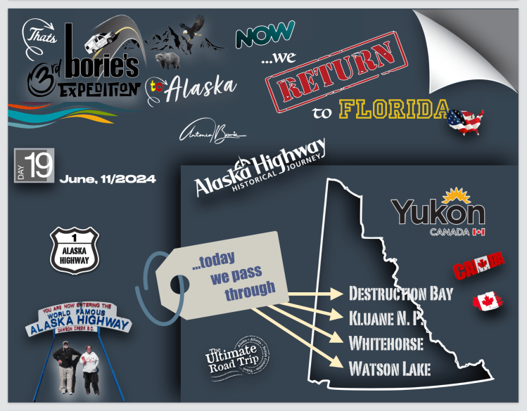
…assim, passámos pela povoação de Burwash Landing, onde simplesmente afrouxámos para tirar a foto, não parando, porque um pouco à frente já se notava o princípio de uma zona de construção na estrada, e aí sim, era uma paragem forçada!. Era normal, porque é nesta época de verão que existe oportunidade para reparação dos estragos das avalanches e intempéries de inverno!.
…so, we passed through the town of Burwash Landing, where we simply slowed down to take the photo, not stopping, because a little ahead we could already see the beginning of a construction zone on the road, and then yes, it was a forced stop!. It was normal, because it is during this summer time that there is an opportunity to repair the damage caused by avalanches and winter weather!
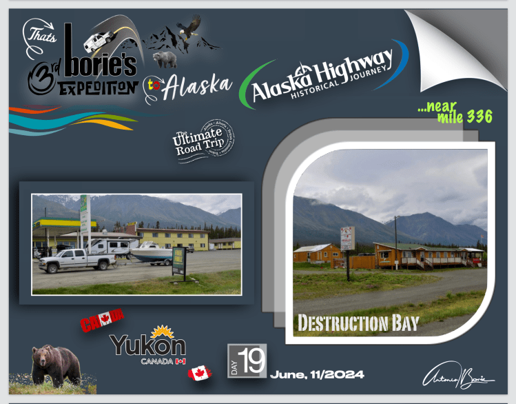
…a povoação de Destruction Bay era já ali!. Parámos, e a chuva miudinha voltou!. Comprámos café, biscoitos e gasolina!. Ao passar por estas povoações, dissemos, “adeus até qualquer dia”, mas com alguma alegria, bendizendo a sorte, porque consideramo-nos uns privilegiados por contemplar um cenário quase deserto, onde sempre aparece um “oásis”!.
…the town of Destruction Bay was already there! We stopped, and the light rain returned! We bought coffee, cookies and gasoline! As we passed through these villages, we said, “goodbye until any day”, but with some joy, blessing our luck, because we consider ourselves privileged to contemplate an almost deserted scenario, where an “oasis” always appears!.
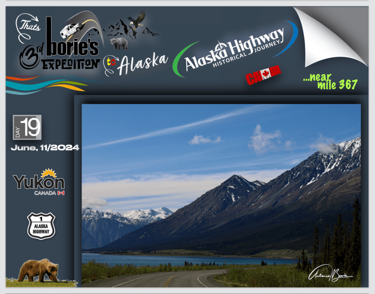
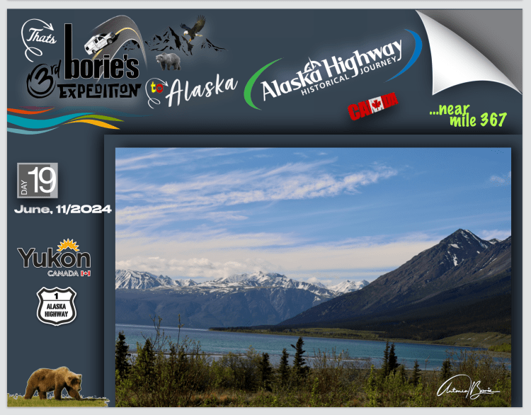
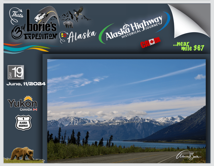
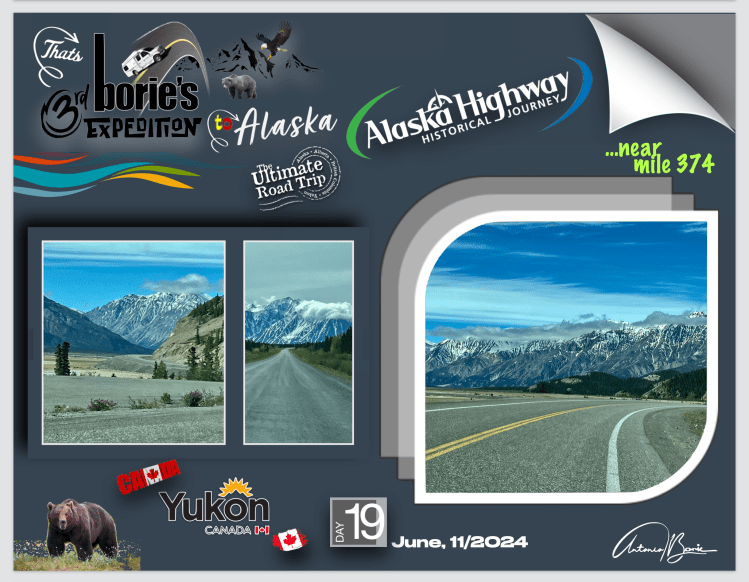
…as milhas e milhas ia passando e…, o tempo ia melhorando!. Já havia algum sol e algumas nuvens brancas, mesmo raras, que tentavam encobrir um adorável céu azul!. Continuávamos a bendizer a sorte, porque o cenário era magnífico para fotos!. Como tal fomos fotografando as montanhas junto do Lago Kluane!.
…the miles and miles went by and…, the weather got better!. There was already some sun and some white clouds, even rare, that tried to cover up a lovely blue sky!. We continued to bless our luck, because the scenery was magnificent for photos! As such, we photographed the mountains next to Lake Kluane!.

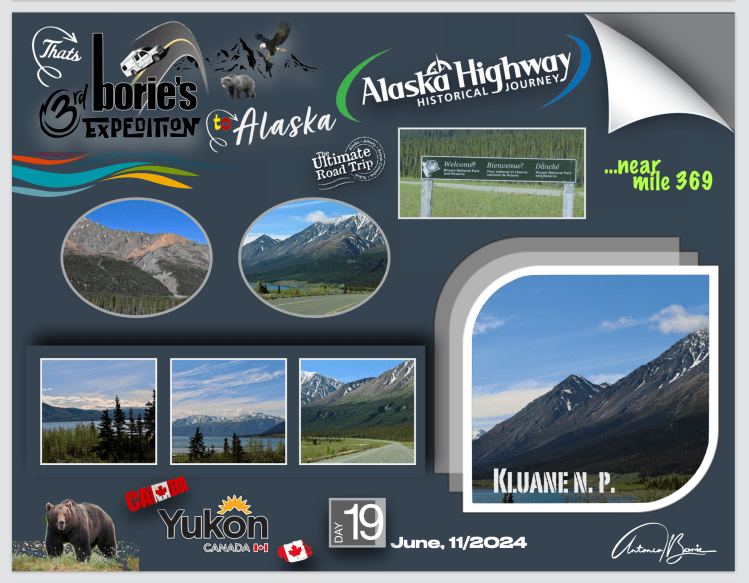
…este é o maior lago localizado inteiramente na província do Yukon, e tem aproximadamente 160 milhas quadradas e 50 milhas de comprimento, sendo até agora alimentado pelo A’ay Chu (rio Slims), que era composto de água do derretimento da montanha de gelo de Kaskawulsh, localizada no Parque Nacional de Kluane, desaguando para o Rio Kluane, cujas águas fluem para o rio Donjek, rio Branco, rio Yukon e eventualmente o mar de Bering!.
…this is the largest lake located entirely in the province of Yukon, and is approximately 160 square miles and 50 miles long, being hitherto fed by the A’ay Chu (Slims River), which was composed of meltwater from the ice mountain of Kaskawulsh, located in Kluane National Park, flowing into the Kluane River, whose waters flow into the Donjek River, White River, Yukon River and eventually the Bering Sea!.
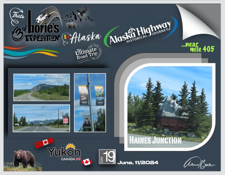
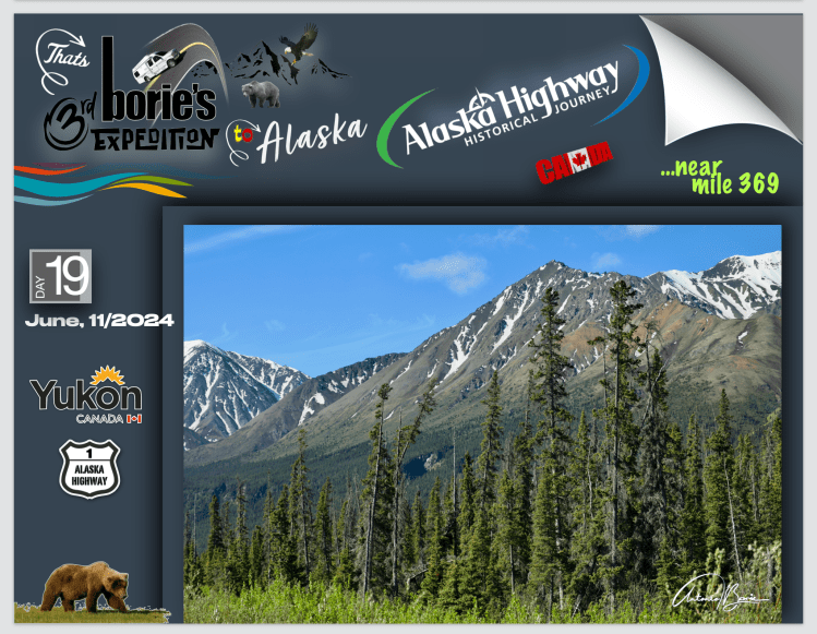
…depois de longas retas e algumas curvas suaves com montanhas aparecendo de ambos os lados, chegámos à hoje cidade de Haines Junction, que no ano de 1942era um campo de construção e um centro de abastecimento e serviço para o Corpo de Engenheiros do Exército dos USA, que estavam construindo a hoje famosa e“Histórica Alaska Highway”, e no ano seguinte iniciaram a construção de uma segunda estrada, a Estrada Haines, para conectar a acima já mencionada e hoje famosa estrada, com a cidade costeira de Haines, no Alaska, através da passagem de Chilkat!.
…after long straights and a few gentle curves with mountains looming on both sides, we reached what is now the town of Haines Junction, which in 1942 was a construction camp and supply and service center for the US Army Corps of Engineers. USA, who were building the now famous “Historic Alaska Highway”, and the following year began construction of a second road, the Haines Road, to connect the aforementioned and now famous road, with the coastal city of Haines, in Alaska, through the Chilkat Passage!.

…continuando e sempre rumo ao leste, com todas as coisas boas e más, que um viajante aventureiro depara por estas estradas remotas do norte, uma vez mais chegámos à cidade de Whitehorse!. Que alívio, aqui os nossos olhos vêem alguma civilização!. Visitámos o centro de visitas, procurando informação, que nos foi dada com muita simpatia e fomos entre outras a um restaurante de estrada que serve pratos leves, sanduíches e café, que é popular no Canada e que dá pelo nome de “Tim Hortons”!.
…continuing and always heading east, with all the good and bad things that an adventurous traveler encounters on these remote northern roads, once again we arrived in the city of Whitehorse!. What a relief, here our eyes see some civilization! We visited the visitor center, looking for information, which was given to us very kindly and we went, among others, to a roadside restaurant that serves light dishes, sandwiches and coffee, which is popular in Canada and is called “Tim Hortons”! .

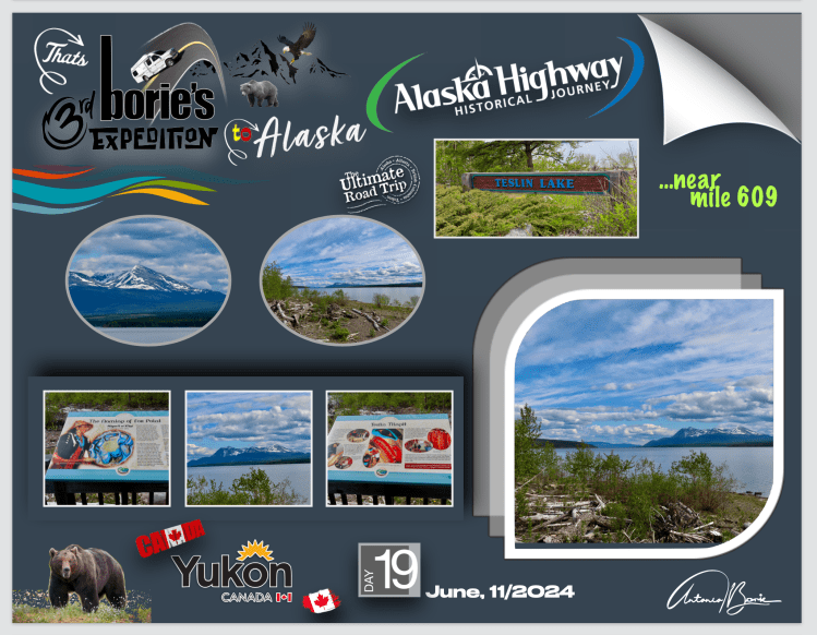
…deixando a cidade de Whitehorse para trás e continuando rumo ao leste, o cenário era de longas retas e alguma montanha, até que parámos no Lago Teslin, que é um grande lago que atravessa a fronteira entre a Colúmbia Britânica e o Yukon, da qual nos íamos aproximando!. Este lago, faz parte de um grupo de grandes lagos na região do extremo noroeste de BC, a leste do alto Panhandle do Alaska, que são a extremidade sul da bacia do rio Yukon, e que são conhecidos em Yukon como “os Lagos do Sul”!.
…leaving the city of Whitehorse behind and continuing eastwards, the scenery was of long straights and some mountains, until we stopped at Teslin Lake, which is a large lake that crosses the border between British Columbia and the Yukon, of which We were getting closer! This lake is one of a group of large lakes in the extreme northwest region of BC, east of the upper Alaska Panhandle, which are the southern end of the Yukon River basin, and which are known in Yukon as “the Lakes of the South”!.

…a povoação de Teslin era a poucas milhas!. É um bom local para se abastecer de alimentos e gasolina, todavia não parámos porque não necessitávamos!. Está a ser construída uma nova ponte sobre o lago!. Passámos na original que faz ressonância ao passar no seu tapete, mas tudo bem!.
…the town of Teslin was just a few miles away! It’s a good place to stock up on food and gasoline, but we didn’t stop because we didn’t need to! A new bridge is being built over the lake! We passed on the original one that resonates when passed on your carpet, but that’s ok!.

…continuando, parámos no lugar que assiná-la o “Continental Divide” e, quando aqui nos encontramos de pé, sabemos que é a linha do cume, que separa as duas das maiores drenagens dos rios na América do Norte!. A “Histórica Alaska Highway”, atravessa a divisão num dos pontos mais baixos!. Apenas pequenos montes de areia e cascalho, separam o rio Swift, que flui para o oeste, do rio Rancheria que flui para o leste!.
…continuing, we stopped at the place that marks the “Continental Divide” and, when we find ourselves standing here, we know that it is the ridge line, which separates the two of the largest river drainages in North America!. The “Historic Alaska Highway” crosses the divide at one of the lowest points!. Only small mounds of sand and gravel separate the west-flowing Swift River from the east-flowing Rancheria River!
…e, um pouco antes de chegar aqui, ao longo do caminho…, o céu ao norte estava a começar a desintegrar-se e nós estávamos indo em direcção ao sul e havia chuva miudinha com algumas abertas!. E, quando misturamos sol e chuva…, normalmente aparece no horizonte um lindo arco-íris!. Foi o que nos aconteceu e logo fotografámos!.
…and, just before getting here, along the way…, the sky to the north was starting to disintegrate and we were heading south and there was light rain with some light rain!. And, when we mix sun and rain…, a beautiful rainbow usually appears on the horizon! That’s what happened to us and we immediately took photos!

…continuando rumo ao leste, afrouxámos na estrada quase deserta para fotografar uma pequena montanha que quase se atravessa na estrada e que os viajantes tal como nós, chamam de “Lion’s Head” (cabeça de Leão)!. Um pouco à frente existe um aglomerado de casas, mas não existe qualquer placa assinalando nome!.
…continuing towards the east, we eased onto the almost deserted road to photograph a small mountain that almost crosses the road and which travelers like us call “Lion’s Head”!. A little ahead there is a cluster of houses, but there is no sign indicating their name!.
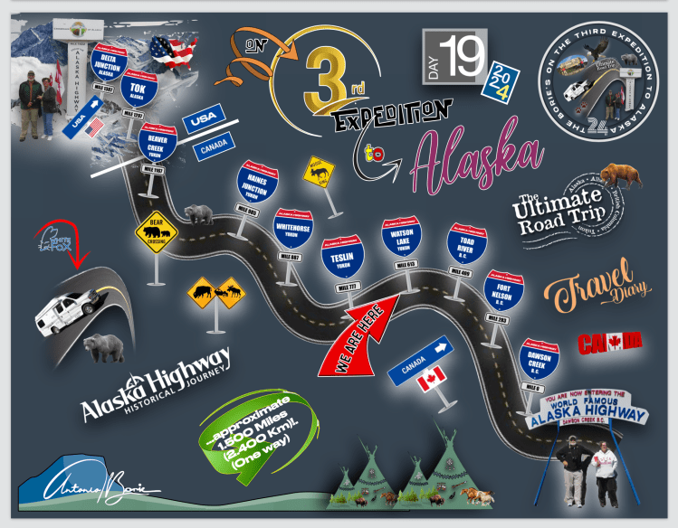
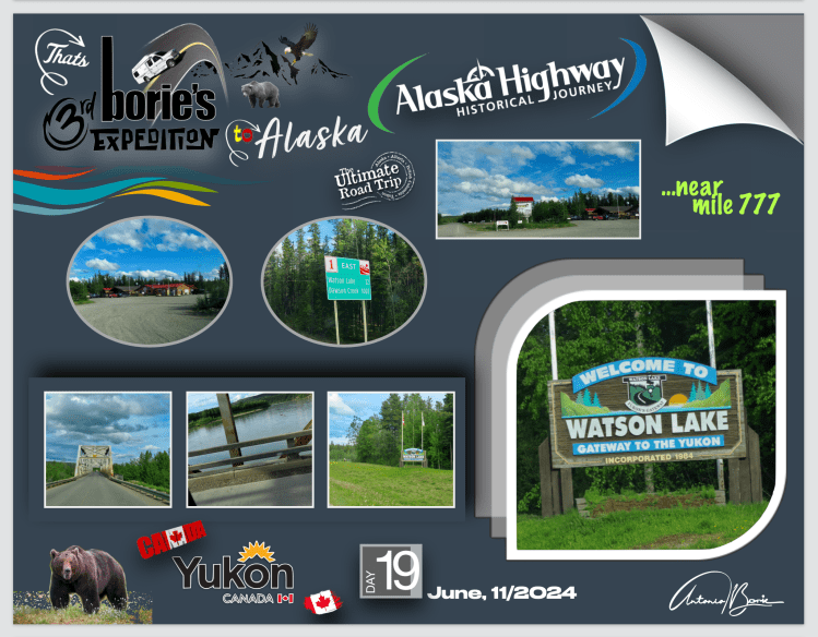
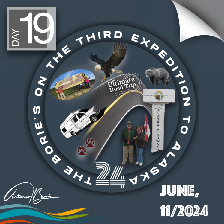
…até que finalmente chegámos à pequena cidade de Watson Lake, onde pernoitámos num parque de RV e…, o contador da nossa “White Fox” (caravana), marcava 777 milhas percorridas desde a entrada no hoje famoso e “Histórico Alaska Highway”!.
…until we finally arrived at the small town of Watson Lake, where we spent the night in an RV park and…, the meter of our “White Fox” (caravan), showed 777 miles traveled since entering the now famous and “Historic Alaska Highway”! .
Tony Borie.
