…Expedição ao Alaska24 (Dia 12) …Alaskan Expedition24 (Day 12)

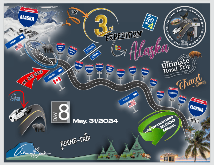
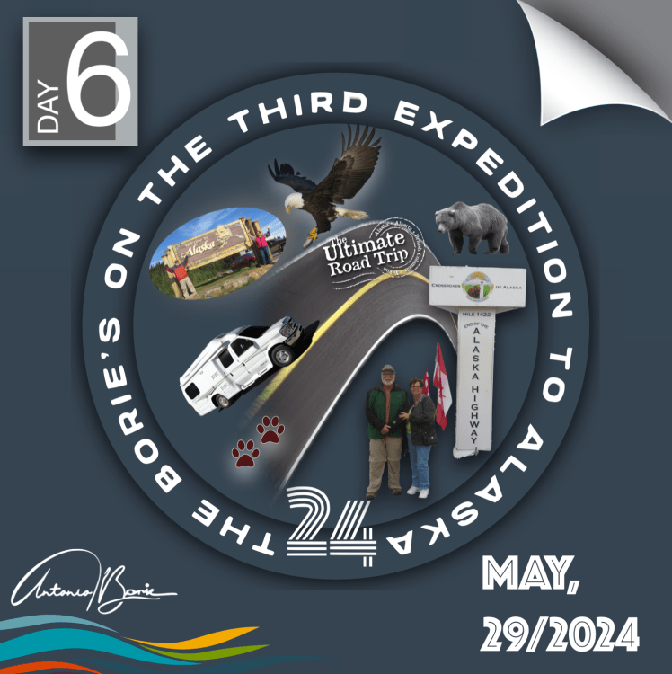
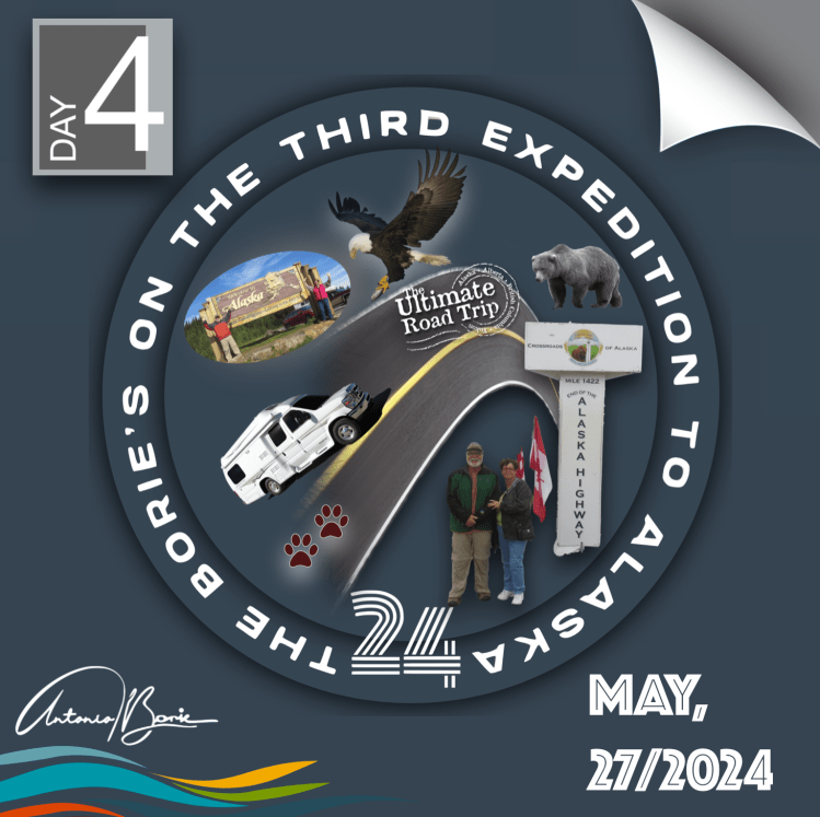
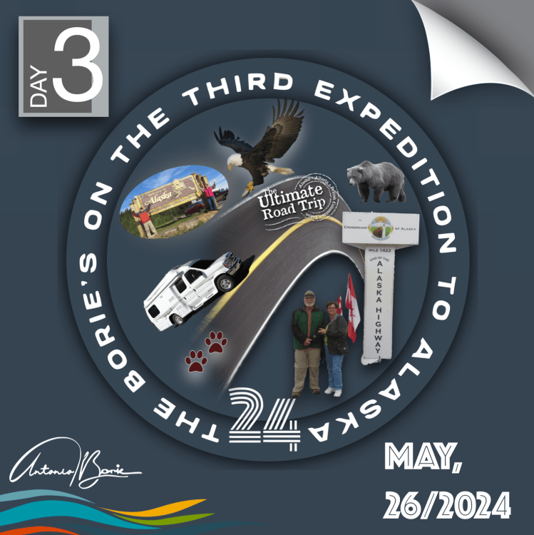
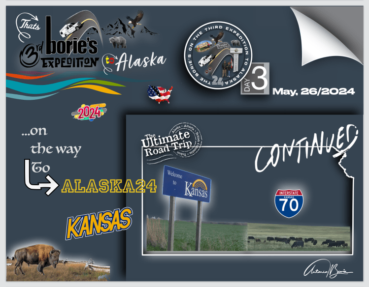
…era o nosso primeiro dia nesta Terceira Expedição ao Alaska, e de repente, percebemos que estávamos aqui, realmente aqui, e poderíamos ir fazer o que quiséssemos!. Isto deixou-nos um tanto atordoados, porque havia tanto para ver e fazer…, e o que seria primeiro?. Decidimos então estabelecer uma meta facilmente alcançável, talvez uma semana mais uns dias, o máximo duas semanas, e para começar viajámos para sul!.

…it was our first day on this Third Alaska Expedition, and suddenly, we realized that we were here, really here, and we could go do whatever we wanted!. This left us somewhat stunned, because there was so much to see and do…, and what would be first?. So we decided to set an easily achievable goal, maybe a week plus a few days, maximum two weeks, and to start we traveled south!.

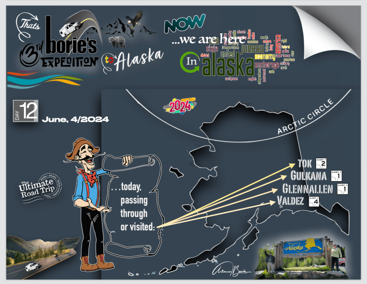
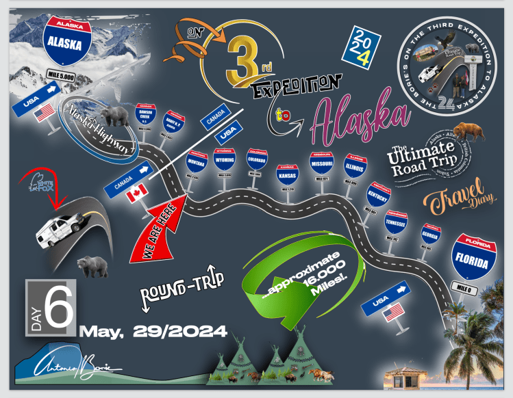
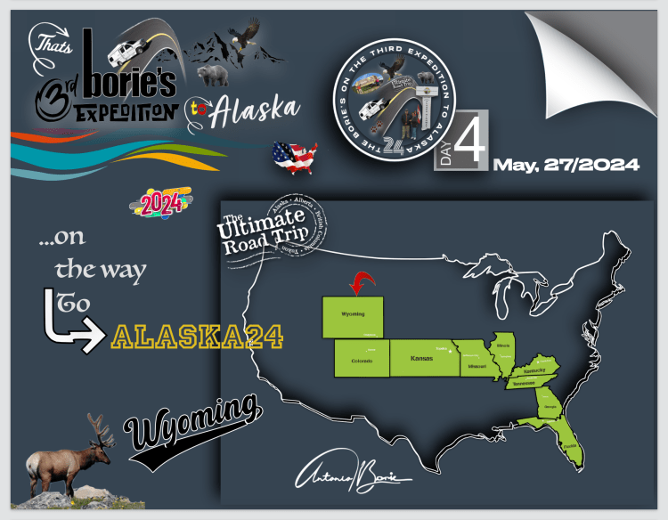
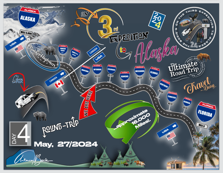
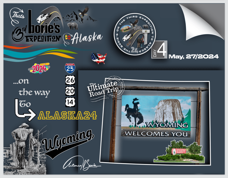
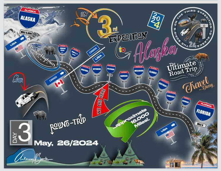
…seguimos pela estrada #2, antes de entrar na #1!. Foi um bom plano para começar a nossa aventura no Alaska!. Íamos também viajar pela estrada  #4 que tem longas retas e curvas suaves através de algumas paisagens montanhosas impressionantes!. Sabíamos que a nossa visita ao Alaska no início de Junho seria um pouco complicada!. Porquê?. Porque tão perto da chegada do Verão, os dias são incrivelmente longos e na verdade, perdemos a ideia de quando são horas para ir dormir…, e às vezes a tão desejada “hora de ouro” tarda sempre em aparecer, porque a luz do dia é constante por quase 22 horas!. 

…we followed road #2, before entering #1!. It was a good plan to start our Alaskan adventure!. We were also going to travel along road #4 which has long straights and gentle curves through some stunning mountain scenery!. We knew our visit to Alaska in early June would be a bit complicated!. Why?. Because so close to the arrival of Summer, the days are incredibly long and in fact, we lose the idea of ​​when it is time to go to sleep…, and sometimes the much-desired “golden hour” always takes a while to appear, because daylight It is constant for almost 22 hours!.

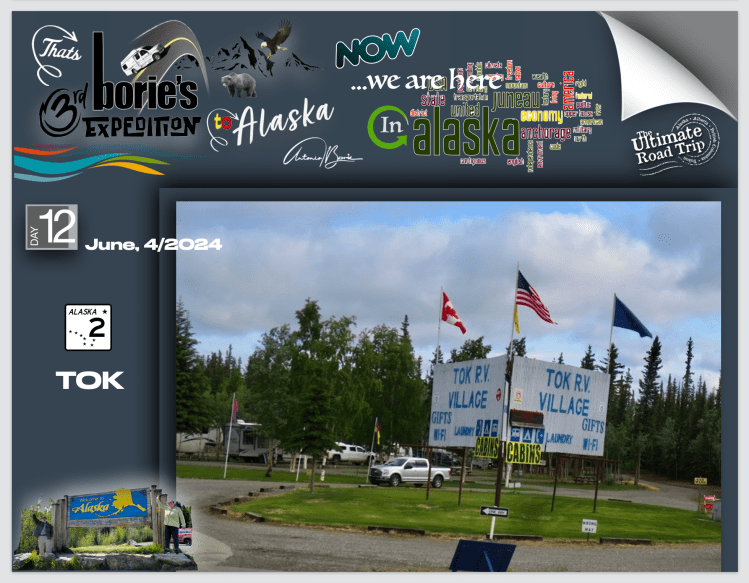
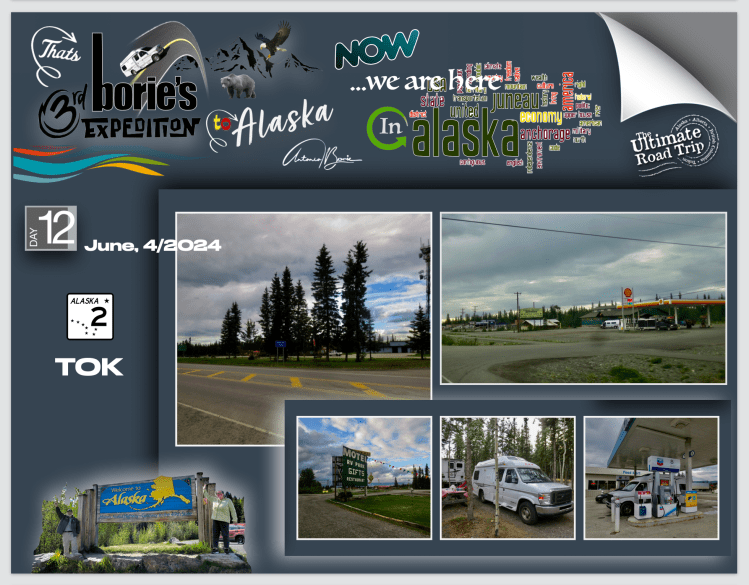
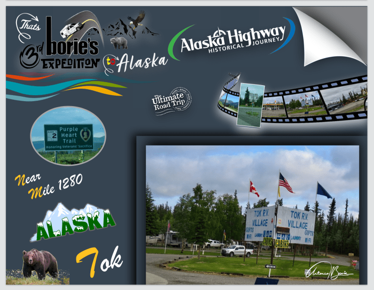
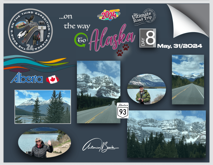
…a manhã estava fresca quando saímos da cidade de Tok, que é a comunidade com mais facilidades, pelo menos para viajantes, que se situa mais perto da fronteira, e que se encontra numa planície aluvial muito grande e plana, do Vale Tanana, entre o Rio Tanana e o Alaska Range, que é uma cordilheira de montanhas que se avista ao norte!.

…the morning was cool when we left the town of Tok, which is the community with the most facilities, at least for travelers, which is located closest to the border, and which is on a very large and flat alluvial plain, of the Tanana Valley, between the Tanana River and the Alaska Range, which is a mountain range that can be seen to the north!.

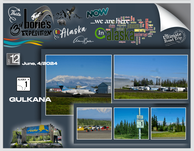
…e, depois de abastecer com gasolina a nossa “White Fox” (caravana) e comprar café e biscoitos, iniciámos viajem!. Passado umas dezenas de milhas já na Estrada Richardson, (estrada #4), e com alguma curiosidade própria de viajantes, parámos para ver os pequenos aviões no aeroporto de Gulkana, que é uma aldeia que começou com a “Gulkana Roadhouse”, que foi construída no início de 1900 por um negociante de peles que administrou esta estalagem até 1916!.   

…and, after filling up our “White Fox” (caravan) with gasoline and buying coffee and cookies, we started our journey!. After a few dozen miles on Richardson Road, (road #4), and with some curiosity typical of travelers, we stopped to see the small planes at Gulkana airport, which is a village that began with the “Gulkana Roadhouse”, which It was built in the early 1900s by a fur trader who ran this inn until 1916!.

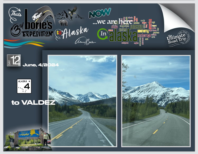
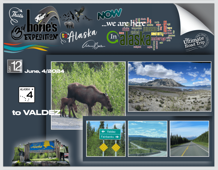
…sempre rumo ao sul, parámos em Glennallen, que é um pequeno “oasis”, num cruzamento de estradas!. Aqui, quem segue para sul, vai para Valdez que era o nosso destino!. A povoação, tem um Centro de Visitas e encontra-se ao longo da Estrada Glenn na sua junção com a Estrada de Richardson, e apenas um pouco fora do limite ocidental do Parque de Wrangell-St. Elias!.

…always heading south, we stopped at Glennallen, which is a small “oasis”, at a crossroads!. Here, whoever heads south goes to Valdez, which was our destination! The village, has a Visitor Center, and lies along Glenn Road at its junction with Richardson Road, and just outside the western boundary of Wrangell-St. Elijah!

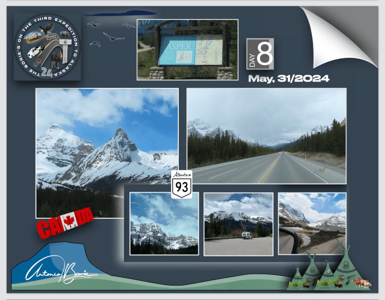
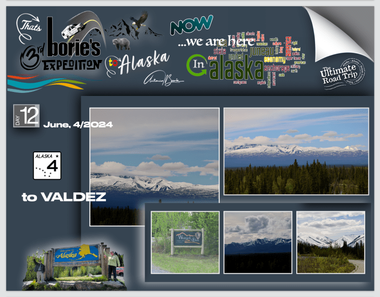
…no já referido Centro de Visitas, a uma pergunta nossa, o amável funcionário explicou que não era lá muito recomendável viajar pelo desvio de estrada, com um piso onde frequentemente aparece terra e cascalho e, também era um pouco difícil caminhar nas magníficas trilhas do Wrangell-St. O Elias National Park & Preserve que é, sem qualquer dúvida, o maior e mais magnífico dos vastos parques nacionais do Alaska, com nove dos 16 picos mais altos dos USA!. 

… at the aforementioned Visitor Center, when asked by us, the kind employee explained that it was not very advisable to travel along the road detour, with a surface where dirt and gravel often appear, and that it was also a little difficult to walk on the magnificent trails of the Wrangell-St. Elias National Park & ​​Preserve is, without a doubt, the largest and most magnificent of Alaska’s vast national parks, with nine of the 16 highest peaks in the USA!.

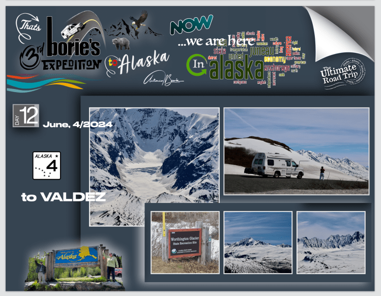
…no entanto, a caminho da cidade de Valdez, saímos aproximadamente   na milha 106, em Copper Center e lá fomos caminhando por algum tempo nesta grandiosa região montanhosa na fronteira com o Canadá que contém inúmeros glaciers, lagos e córregos da montanha e…, é o lar de uma rica variedade de vida selvagem!. Fomos apreciando ao longe até onde nos foi possível mas, vêem-se picos sobre picos e glaciers após glaciers, acreditando que, se flutuar-mos por qualquer rio ou ribeiro seguindo até a sua fonte, com toda a certeza que iríamos encontrar um qualquer glacier derretendo-se lentamente!.

…however, on the way to the city of Valdez, we exited at approximately mile 106, in Copper Center and there we walked for some time in this great mountainous region on the border with Canada that contains countless glaciers, lakes and mountain streams and…, yeah home to a rich variety of wildlife!. We appreciated as far as we could, but we saw peaks upon peaks and glaciers after glaciers, believing that if we floated down any river or stream following its source, we would certainly find some glacier. slowly melting!.

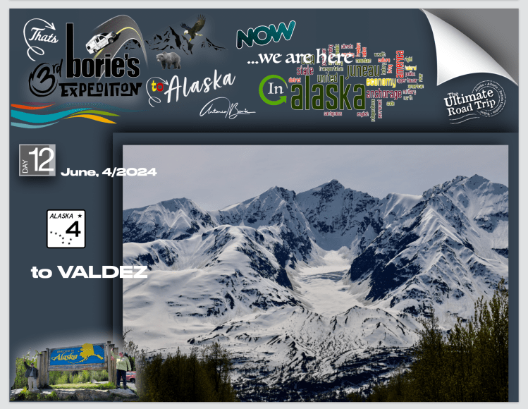
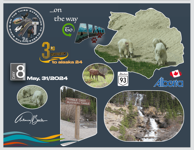
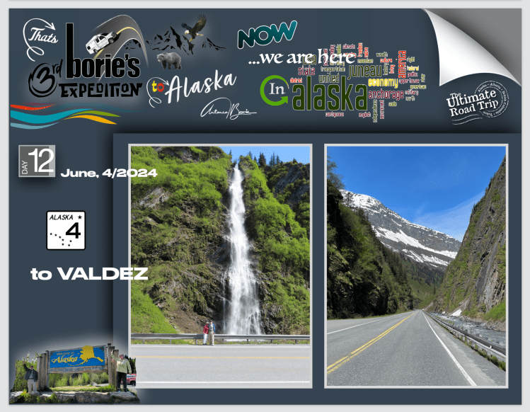
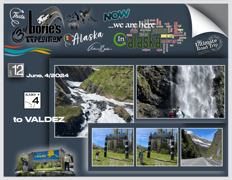
…voltando à Estrada de Richardson, e já próximo da milha 16, derivado à área da cidade de Valdez, que se situa na “milha 0” da já referida estrada, ser aquela que recebe níveis épicos de neve no inverno, eser considerada o “lugar onde cai mais neve nos USA”, podemos apreciar grandes cascatas de água e…, quando toda a neve se derrete, ela escapa-se, derramando pelas encostas das montanhas em algumas das mais belas cascatas do mundo!. 

…returning to Richardson Road, and already close to mile 16, derived from the area of ​​the city of Valdez, which is located at “mile 0” of the aforementioned road, being the one that receives epic levels of snow in winter, and being considered the “the place where the most snow falls in the USA”, we can enjoy large waterfalls of water and…, when all the snow melts, it escapes, spilling down the mountainsides in some of the most beautiful waterfalls in the world!.

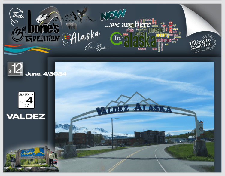
…entretanto chegámos ao nosso destino que era a cidade de Valdez na “milha 0” da Estrada Richardson!. Esta hoje pequena cidade, tal como muitas outras no Alaska, tem uma história da “Corrida ao Ouro”, fundada no ano de 1790, pelo explorador espanhol Salvador Fidalgo, em homenagem ao ministro da Marinha espanhol Antonio Valdés e, está localizada na cabeça de um fiorde, no lado leste do Prince William Sound!.

…in the meantime we arrived at our destination, which was the city of Valdez at “mile 0” on the Richardson Road!. This small town, like many others in Alaska, has a history of the “Gold Rush”, founded in 1790, by Spanish explorer Salvador Fidalgo, named after Spanish Minister of the Navy Antonio Valdés, is located at the head of a fjord on the east side of Prince William Sound!.

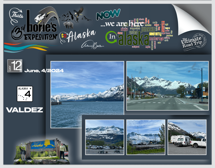
…caminhámos e pernoitámos lá num parque de RV, e tem uma pitoresca história onde, como sempre…, entra a “corrida ao ouro” e, tudo começou com uma “mentira”, para atrair garimpeiros da trilha Klondike Gold Rush, que levou esta hoje cidade a ser desenvolvida lá pelo ano de 1898!. Algumas empresas de navios a vapor promoveram a “Valdez Glacier Trail” como sendo uma rota melhor para os mineiros alcançarem os campos de ouro de Klondike, e assim, descobrir novos campos na região do rio Copper do interior do Alaska!.

…we walked and spent the night there in an RV park, and it has a picturesque story where, as always…, the “gold rush” enters and, it all started with a “lie”, to attract prospectors from the Klondike Gold Rush trail, which led This is now a city being developed around 1898! Some steamship companies promoted the “Valdez Glacier Trail” as a better route for miners to reach the Klondike gold fields and thus discover new fields in the Copper River region of interior Alaska!

…os garimpeiros que acreditavam na promoção, descobriram que haviam sido enganados!. A trilha, caminhando pelos icebergs, era duas vezes mais longa e íngreme do que a relatada, e muitos homens morreram tentando a travessia, ou em parte contraindo escorbuto durante o longo inverno frio sem suprimentos adequados!. 

…the miners who believed in the promotion discovered that they had been deceived!. The trail, walking through the icebergs, was twice as long and steep as reported, and many men died attempting the crossing, or in part from contracting scurvy during the long cold winter without adequate supplies!.

..assim, esta pequena cidade não floresceu até depois da construção de uma estrada rudimentar, por volta do ano de 1899, só aberta apenas no verão até ao ano de 1950, quando finalmente se construiu a actual Estrada Richardson operada como uma rota durante todo o ano, que liga Valdez a Fairbanks!. 

…thus this small town did not flourish until after the construction of a rudimentary road, around the year 1899, open only in the summer until the year 1950, when finally the present Richardson Road operated as a year-round route, which connects Valdez to Fairbanks!.

…só e para terminar, aqui em Valdez, usam helicópteros, tal como lá em baixo no sul, depois do paralelo 48, usam aquelas camionetas descobertas e com dois pisos, com desenhos floridos de turismo, para dar a volta e apreciar as cidades, em qualquer lugar de qualquer estado dos USA!.

…just to finish, here in Valdez, they use helicopters, just like down in the south, after the 48th parallel, they use those open, double-decker vans, with flowery tourism designs, to go around and enjoy the cities, anywhere in any state in the USA!.

Tony Borie

…Expedição ao Alaska24 (Dia 11) …Alaskan Expedition24 (Day 11)

…no pequeno e único parque de RV onde pernoitámos na milha 804, na localidade de Teslin, onde os seus habitantes têm orgulho em dizer que é o lar da primeira nação “Teslin Inland Tlingit First”, uma senhora oriunda do estado de Illinois, que estacionou ao nosso lado não se cansava de nos dizer “vou para o Alaska onde trabalho todos os anos nos meses de Junho, Julho, Agosto e Setembro, depois regresso a Illinois, à minha terra natal”!.

…in the small and unique RV park where we spent the night at mile 804, in the town of Teslin, where its inhabitants are proud to say that it is home to the “Teslin Inland Tlingit First” nation, a lady from the state of Illinois, who He parked next to us and never tired of telling us “I’m going to Alaska where I work every year in the months of June, July, August and September, then I’m going back to Illinois, to my homeland”!.

…e continuava, “não é só pelo trabalho que ajuda a minha sobrevivência, que para aqui venho, é também pela aventura de viajar pelo “Histórico Alaska Highway” pois é um “zoológico gratuito”, ou mais precisamente…, um safari não guiado, porque os animais estão sempre lá!. São os ursos pretos ou pardos, os alces, os bisontes, as raposas, as ovelhas da montanha, os búfalos, as águias, os veados, os lobos da floresta, as pegas, os castores, os linces, e a lista podia continuar…, que constantemente atravessavam a estrada ou se alimentavam ao redor”!.

…and continued, “it is not only for the work that helps my survival, that I come here, it is also for the adventure of traveling the “Historic Alaska Highway” as it is a “free zoo”, or more precisely…, an unguided safari , because the animals are always there! They constantly crossed the road or fed around it”!.

…era verdade!. Vamos então continuar!.

…Milha 918 – cidade de Whitehorse!. O viajante do “Histórico Alaska Highway”, quando chega à cidade de Whitehorse, pára o seu veículo, abre os braços e diz que, “finalmente chegou à civilização”!. A cidade tem o que normalmente se necessita para a sobrevivência, além de um Centro de Visitas muito funcional, prestando informação com eficiência e, tem sinal de internet!. Nós deambulámos pela cidade e visitámos um barco que nos faz lembrar os primeiros pesquisadores de ouro que apareceram na região nas suas aventuras pelo Rio Yukon!.

…it was true! So let’s continue!

…Mile 918 – city of Whitehorse!. The traveler on the “Historic Alaska Highway”, when he arrives in the city of Whitehorse, in his vehicle, opens his arms and says that, “he has finally arrived at civilization”!. The city has what is normally needed for survival, in addition to a very functional Visitor Center, providing information efficiently and has an internet signal! We wandered around town and visited a boat that reminds us of the first gold searchers who appeared in the region on their adventures along the Yukon River!.

…milha 918 – é uma paisagem antiga a poucos minutos do centro da cidade, que criou um dos locais mais bonitos de Whitehorse!. Quase nove milhões de anos atrás, uma torrente de lava basáltica espalhou-se por uma paisagem pré-glacial criando uma faixa de água azul-turquesa que corre entre as falésias que ainda restam!. As Primeiras Nações usavam este local como acampamento de pesca referindo-se à área como Kwanlin, que significa “água corrente pelo desfiladeiro” e que hoje dá pelo nome de “Canyon City”!. Os garimpeiros da Corrida do Ouro, chamavam de “Grand Canyon” e o usavam como via principal quando viajavam para o norte durante a Corrida do Ouro!. Naquela época, o tráfego pelos rios era tão intenso que a Polícia Montada do Noroeste estabeleceu aqui um posto avançado para verificar os barcos e garantir a segurança de sua viagem!.

…mile 918 – is an ancient landscape just minutes from the city center, which has created one of the most beautiful spots in Whitehorse!. Almost nine million years ago, a torrent of basaltic lava spread across a pre-glacial landscape creating a ribbon of turquoise water that runs between the remaining cliffs!. The First Nations used this location as a fishing camp, referring to the area as Kwanlin, which means “flowing water through the canyon” and which today goes by the name “Canyon City”!. Gold Rush miners called it “Grand Canyon” and used it as a main thoroughfare when traveling north during the Gold Rush!. their trip!. At that time, traffic on the rivers was so intense that the North West Mounted Police established an outpost here to check boats and ensure the safety of their journey!.

…milha 966 – “Historic Canyon Creek Bridge”!. É uma área de descanso onde estão painéis interpretativos sobre a história desta ponte, que também é um local excelente para tirar fotos!. A história diz que, uma corrida ao ouro no Rio Alsek, trouxe uma debandada de mineiros para esta área, onde imediatamente foi construída uma estrada para carroças a partir da cidade de Whitehorse!. De seguida, construíram uma ponte com a madeira das árvores que por ali havia, sobre um riacho que passava naquele desfiladeiro!.    

…mile 966 – “Historic Canyon Creek Bridge”!. It is a rest area where there are interpretive panels about the history of this bridge, which is also an excellent place to take photos! The story goes that a gold rush on the Alsek River brought a stampede of miners to this area, where a wagon road was immediately built from the city of Whitehorse! Then, they built a bridge with wood from the trees that were there, over a stream that passed through that gorge!.

…milha 976 -Cordilheiras de gelo de Kluane!. Viajando na estrada, podemos observar uma vista  impressionante das cordilheiras de gelo nas montanhas e em algumas povoações que vistas de perto nos pareciam abandonadas, assim como algumas aberturas na floresta que nos pareciam pequenos aeroportos, aparecendo aqui e ali ursos, tanto pretos como castanhos, que teimavam em ocupar a estrada!.  

…mile 976 -Kluane Ice Ranges!. Traveling on the road, we can observe an impressive view of the ice ridges in the mountains and some villages that seemed abandoned up close, as well as some openings in the forest that looked like small airports, with bears appearing here and there, both black and brown, who insisted on occupying the road!.

…milha 985 – Haines Junction!. É uma povoação de cruzamento de estradas!. Tem quase todas as facilidades que um viajante de estrada necessita, incluindo sinalização, indicando diversas rotas a seguir!. Indo em direcção ao norte do estado do Alaska mudamos de direção!. Um pouco para norte, as montanhas em redor ainda têm neve, a sua história diz que, por cerca de dois mil anos, as pessoas do sul da Tutchone tiveram campos de caça e, caça sazonais na área da actual Haines Junction!. 

…mile 985 – Haines Junction!. It’s a crossroads village! It has almost all the facilities a road traveler needs, including signage, indicating different routes to follow!. Heading towards the north of the state of Alaska, we changed direction! A little to the north, the surrounding mountains still have snow, their story says that, for about two thousand years, the people of southern Tutchone had hunting grounds and seasonal hunts in the area of ​​present-day Haines Junction!.

…milha 990  (aproximadamente) – “Kluane Ranges”!. Vista maravilhosa a sudoeste da Cordilheira Kluane, coberta de neve com a “Histórica Estrada do Alaska” a seguir paralela à Cordilheira desde a povoação de Haines Junction, apresentando uma corrente quase ininterrupta de montanhas com 8.000 pés de altura, interrompida por apenas alguns grandes vales, cortados pelos “glaciers”!. 

…mile 990 (approximately) – “Kluane Ranges”!. Wonderful view southwest of the snow-capped Kluane Range with the “Historic Alaska Highway” running parallel to the Haines Junction Settlement Range, featuring an almost unbroken chain of 8,000-foot high mountains, interrupted by only a few large valleys, cut by “glaciers”!.

…milha 992 (aproximadamente) – “Parque Nacional de Kluane”!. É uma reserva, no Território de Yukon para os amantes do ar livre, que podem apreciar as maravilhas deste parque!. A sua beleza selvagem é  impressionante fazendo com que o Parque Nacional e Reserva de Kluane, fosse  declarado Património da Humanidade pela UNESCO, no ano de 1979!.  Abriga 17 dos 20 picos mais altos de todo o Canadá, sendo o maior campo de gelo alpino não polar do mundo!. 

…mile 992 (approximately) – “Kluane National Park”!. It is a reserve in the Yukon Territory for outdoor lovers, who can enjoy the wonders of this park!. Its wild beauty is impressive, causing the Kluane National Park and Reserve to be declared a World Heritage Site by UNESCO in 1979!. It is home to 17 of the 20 highest peaks in all of Canada, making it the largest non-polar alpine ice field in the world!.

…milha 1024 (aproximadamente) – Lago Kluane!. A estrada segue a maior parte da fronteira sul do Lago Kluane, oferecendo lindas vistas do lago!. É o maior lago contido inteiramente dentro do Território do Yukon, com aproximadamente 50 milhas de comprimento!. Até ao ano de 2016, foi alimentado pelo A’ay Chu (rio Slims) que era composto por água do degelo do Glaciar Kaskawulsh, localizado dentro do Parque Nacional de Kluane!. Drena para o rio Kluane, cujas águas correm para o rio Donjek, o rio White, o rio Yukon e, por fim, o mar de Bering!. 

…mile 1024 (approximately) – Kluane Lake!. The road follows most of the southern border of Lake Kluane, offering beautiful views of the lake!. It is the largest lake contained entirely within the Yukon Territory, approximately 50 miles long!. Until 2016, it was fed by the A’ay Chu (Slims River) which was composed of meltwater from the Kaskawulsh Glacier, located within Kluane National Park!. It drains into the Kluane River, whose waters flow into the Donjek River, the White River, the Yukon River and finally the Bering Sea!.

…milha 1050 – continuando a nossa jornada rumo ao norte/oeste, fomos cruzando algumas povoações, umas com pequenas lojas com gasolina ou outros artigos de sobrevivência para viajantes, outras única e simplesmente abandonadas!. Entretanto chegámos à povoacão de Destruction Bay!. É uma povoação que por certo nasceu e cresceu ao lado da hoje famosa e “Histórica Alaska Highway” e do Lago Kluane!. É muito popular nos viajantes desta famosa estrada, pois tem onde dormir, fazer refeições e reparação de veículos!.  

…mile 1050 – continuing our journey towards the north/west, we crossed some villages, some with little shops with gasoline or other survival items for travelers, others simply abandoned!. Meanwhile we arrived at the town of Destruction Bay!. It is a town that was certainly born and raised next to the now famous “Historic Alaska Highway” and Kluane Lake!. It is very popular with travelers on this famous road, as it has places to sleep, eat meals and have vehicle repairs!

…milha 1061 – povoação de Burwash Landing!. O local actual de Burwash Landing, foi usado pela primeira vez como um acampamento de verão pelos Southern Tutchone Athabascans, até que um posto de comércio foi construído no início dos anos 1900, pelos irmãos Jacquot. É o lar do Museu Kluane de História Natural e da primeira Nação Kluane e também o lar do maior prato de pesquizar ouro do mundo!.  

…mile 1061Burwash Landing settlement!. The current site of Burwash Landing, was first used as a summer camp by the Southern Tutchone Athabascans, until a trading post was built in the early 1900s by the Jacquot brothers. It is home to the Kluane Museum of Natural History and the first Kluane Nation and also home to the largest gold pan in the world!.

…milha 1167 – povoação de Beaver Creek!. É uma povoação fronteiriça, que se situa próximo da passagem fronteiriça de Alcan-Beaver Creek!. É a comunidade mais ocidental do Canadá e os principais empregadores são a Agência dos Serviços da Fronteira do Canadá!. Uma curiosidade, a Estação da Agência de Serviços da Fronteira do Canadá, é a mais distante do cruzamento de fronteira de qualquer estação aduaneira canadense, a uma distância de 17,8 milhas e, pelo menos até a década de 1990, alguns indivíduos viviam na “terra de ninguém” entre a fronteira e a estação de alfândega!. 

…mile 1167 – Beaver Creek settlement!. It is a frontier village, which is located near the Alcan-Beaver Creek border crossing!. It is the westernmost community in Canada and the main employers are the Canadian Border Services Agency!. Interestingly, the Canada Border Services Agency Station is the furthest from the border crossing of any Canadian customs station, at a distance of 17.8 miles, and at least until the 1990s, some individuals lived at the border crossing. “no man’s land” between the border and the customs station!.

…milha 1186 – Bem-vindo ao Alaska, Canada/USA Internacional Fronteira!. É uma paragem que, não sendo obrigatória, nos merece uma visita, onde se pode admirar os marcos de fronteira, placas indicando a entrada no estado do Alaska, assim como alguma informação e história de ambos os países amigos, e claro, para tirar fotografias!. A Estação de Alfândega e Proteção de Fronteiras dos EUA será encontrada umas milhas mais à frente, mais propriamente na milha 1222 e, marca oficialmente sua entrada em solo americano!.   

…mile 1186 – Welcome to Alaska, Canada / US International Border!. It is a stop that, although not mandatory, is worth a visit, where you can admire the border markers, signs indicating entry into the state of Alaska, as well as some information and history of both friendly countries, and of course, to take photographs !. The US Customs and Border Protection Station will be found a few miles further on, more precisely at mile 1222 and officially marks your entry into American soil!.

…até à milha 1280 – A estrada em algumas áreas está em melhor estado de conservação ou em reparação, a velocidade é controlada em milhas, existem algumas localidades onde se vende entre outras coisas gasolina medida em galões a um preço mais em conta!. Também podemos parar no Refúgio Nacional da Vida Selvagem da localidade Tetlin, onde os apreciadores de aves se deliciam com a paisagem dinâmica deste já mencionado Refúgio!. 

…up to mile 1280 – The road in some areas is in better condition or undergoing repairs, speed is controlled in miles, there are some locations where gasoline measured in gallons is sold, among other things, at a more affordable price! . We can also stop at the Tetlin National Wildlife Refuge, where bird lovers will delight in the dynamic landscape of this aforementioned refuge!.

…milha 1280 – Cidade de Tok, já no Alaska!. Tok é o lar das boas-vindas não oficial do Alaska!, apelidada de “Capital do Cão de Trenó do Alaska”, ficando perto da fronteira com o Canadá!. Há muito tempo é considerada um paraíso para os viajantes desde a sua fundação em 1942, claro, graças à construção da hoje “Histórica Estrada do Alaska!. O centro de visitantes, assim como restaurantes e parques de RV, são fáceis de encontrar!. Aqui, podemos dizer que, “já chegámos ao Alaska”!. Portanto, vamos andar por aí, e que mais vamos ver?.

…mile 1280 – Town of Tok, now in Alaska!. Tok is home to the unofficial Alaskan Welcome!, nicknamed the “Sled Dog Capital of Alaska”, being close to the Canadian border!. It has long been considered a paradise for travelers since its founding in 1942, thanks of course to the construction of today’s “Historic Alaska Highway!” The visitor center, as well as restaurants and RV parks, are easy to find! Here, we can say that, “we have already arrived in Alaska”! So let’s walk around, and what else will we see?

Tony Borie

…Expedição ao Alaska24 (Dia 10) …Alaskan Expedition24 (Day 10)

…já chegámos ao Território do Yukon!. Hoje foi um dia de estrada!. Era sempre aos zig-zags subidas e descidas com vistas de rios, ribeiros, lagos e montanhas, muitos animais selvagens, principalmente ursos negros!. Contámos mais de duas dezenas!. É o “Histórico Alaska Highway” que adoramos!. Gasolina?. Sim, havia em muitos lugares, não como no passado em que levávamos depósitos extras!.

 …we’ve already reached Yukon Territory!.Today was a day on the road!. It was always zig-zagging ups and downs with views of rivers, streams, lakes and mountains, lots of wild animals, especially black bears!. We counted more than two dozen! It’s the “Historic Alaska Highway” that we love! Gasoline?. Yes, there were in many places, not like in the past when we took extra deposits!.

…viajar pelo hoje lendário e “Histórico Alaska Highway” não é muito complicado, pelo menos para nós, veteranos!. Porquê?. Porque é só uma estrada, e para tornar ainda menos complicado, fomos contando as milhas no contador da nossa “White Fox’ (caravana)!. Assim, sabemos onde estamos quantas milhas já fizemos e quantas nos faltam para chegar ao nosso destino…, que é o Alaska!.

…traveling the legendary and “Historic Alaska Highway” is not very complicated, at least for us veterans!. Why?. Because it’s just a road, and to make it even less complicated, we counted the miles on the meter of our “White Fox” (caravan)!. This way, we know where we are, how many miles we have already covered and how many miles we have left to reach our destination…, which is Alaska!.

..como tal, nas fotos que publicamos para as identificar…, mencionamos apenas o número de milhas percorridas a partir do início, que é a cidade de Dawson Creek!. Então cá vai a lista das povoações e lugares históricos por onde passámos, saindo de Fort Nelson, na província de British Columbia onde pernoitámos num parque de RV, que é aproximadamente na milha 300!.

…as such, in the photos we posted to identity them…, we only mention the number of miles traveled since the beginning, which is the city of Dawson Creek!. So here is the list of towns and historic places that we passed through, leaving Fort Nelson, in the province of British Columbia, where we spent the night in an RV park, which is approximately at mile 300!.

 …milha 375– parámos aqui porque era a primeira civilização que encontrávamos depois de Fort Nelson!. Existem algumas casas e uma placa anunciando um motel com cabines e um campo de campismo, convidando os viajantes a parar e ir caminhar até ao rio que é próximo!. O local é convidativo e tem um poste anunciando a sua localização, dando-nos a ideia de que durante a construção desta hoje histórica estrada foi uma estação de trabalho de engenheiros!. 

…mile 375 – we stopped here because it was the first civilization we encountered after Fort Nelson!. There are some houses and a sign advertising a motel with cabins and a campsite, inviting travelers to stop and go for a walk to the nearby river!. The place is inviting and has a post announcing its location, giving us the idea that during the construction of this now historic road it was an engineers’ work station!.

…milha 392 – nesta área passamos por montanhas com neve e em baixo lagos de água pura!.Estava frio e havia chuviscos, no entanto, o “Stone Mountain Provincial Park” é uma área maravilhosa de deserto montanhoso!. Das curvas na estrada que circundavam as montanhas, podemos admirar um cenário único, com alguns rebanhos de caribus tentando entrar nos lagos que por ali havia!. Era um cenário que só se pode admirar talvez uma vez na vida!.

…mile 392 – in this area we passed through snowy mountains and below lakes of pure water!.It was cold and there was drizzle, however, “Stone Mountain Provincial Park” is a wonderful area of ​​mountainous desert!. From the curves in the road that surround the mountains, we can admire a unique scene, with some herds of caribou trying to enter the lakes that were there!. It was a scene that you can only admire maybe once in your life!.

…milha 422 – durante o nosso percurso, cruzámo-nos com muitas caravanas oriundas dos mais exóticos lugares no mundo, até da Austrália!. Todavia existem muitas histórias de como lugares diferentes receberam seus nomes ao longo desta hoje famosa e histórica estrada e, este pequeno oásis no meio de nada, dá pelo nome de “Pousada Rio Sapo”, quando por volta de 1942, os exércitos canadense e norte-americano estavam ocupados construindo esta estrada!. Tem uma curiosidade, é que no tecto do salão de entrada tem mais de 7.500 chapéus de todo o mundo!.

…mile 422 – during our journey, we came across many caravans coming from the most exotic places in the world, even Australia!. However, there are many stories of how different places received their names along this now famous and historic road, and this little oasis in the middle of nowhere is called “Pousada Rio Sapo”, when around 1942, the Canadian and Northern armies -American were busy building this road!. What’s interesting is that on the ceiling of the entrance hall there are more than 7,500 hats from all over the world!

…milha 431 – foi um pouco antes de entrar na área do “Lago Muncho”, quando as cabras de montanha apareceram na estrada procurando comer algo entre a pedra miúda que aparecia ao lado da estrada numa zona montanhosa!. Eram muitas que iam e vinham sem se preocupar com alguns veículos que transitavam!. 

…mile 431 – it was just before entering the “Muncho Lake” area, when the mountain goats appeared on the road looking to eat something among the small rocks that appeared on the side of the road in a mountainous area!. There were many who came and went without worrying about some vehicles passing by!.

…milha 436 – começamos a ver uma cordilheira de montanhas sem qualquer vegetação, a estrada ia encostada a algumas rochas, começando a descer e prosseguindo junto à água cor de jade!. Chegámos ao “Lago Muncho”, um refúgio perfeito para fazer uma caminhada cénica à beira do lago, com água também pura, vinda da neve acumulada em milhares, talvez milhões de anos, onde existe entre outras coisas, uma boa opção para acampar no “Strawberry Campground”, onde já pernoitámos duas vezes em viagens anteriores e que, pela manhã quando abrimos a porta da caravana, deparamos com um cenário de montanha e lagos que talvez custasse “um milhão de dolares”!.      

…mile 436 – we begin to see a range of mountains without any vegetation, the road leaned against some rocks, starting to descend and continuing along the jade-colored water!. We arrived at “Muncho Lake”, a perfect refuge to take a scenic walk along the lake, with also pure water, coming from the snow accumulated over thousands, perhaps millions of years, where there is, among other things, a good option for camping in the “Strawberry Campground”, where we have already stayed the night twice on previous trips and, in the morning when we opened the caravan door, we found a mountain and lake scenery that perhaps cost “a million dollars”!.

 …milha 477 – reduzindo a velocidade, parámos surpreendidos com a vista da ponte “Lower Liard River”, pairando sobre uma paisagem isolada, imponente e graciosamente simétrica, construída em aço!. É uma das seis “passagens especiais” nesta hoje histórica estrada e é a única ponte suspensa em toda a sua rota!. Os engenheiros decidiram que uma ponte suspensa tinha que ser construída neste local porque as condições do gelo tornavam impossível manter os andaimes temporários necessários por tempo suficiente para construir o tipo usual da normal ponte de extensão de “treliça” em ambos os lados, construídos abaixo e não acima do leito da ponte, tal como as outras que por aqui ainda vão resistindo!.   

…mile 477 – slowing down, we stopped in surprise at the view of the “Lower Liard River” bridge, hovering over an isolated, imposing and gracefully symmetrical landscape, built of steel!. It is one of six “special crossings” on this now historic road and is the only suspension bridge along its entire route!. Engineers decided that a suspension bridge had to be built at this location because ice conditions made it impossible to maintain the necessary temporary scaffolding long enough to build the usual type of normal “truss” span bridge on both sides, built below and not above the bridge bed, just like the others that are still resisting here!.        

 …milha 533 – viajando de caravana, de moto ou até de bicicleta, a beleza  natural que ainda se pode ver por aqui é maravilhosa, tal como estes cavalos selvagens!. Alguns nomes de povoações que nos apareciam, estavam encerradas, casas sem ninguém, árvores e ramagem nascida dentro das casas, mas não deixavam de ter o seu encanto, todavia e continuando, parámos no “Coal River Lodge & RV”, onde se pode podia acampar e comprar gasolina!. 

…mile 533 – traveling by caravan, motorbike or even bicycle, the natural beauty that can still be seen here is wonderful, as are these wild horses!. Some names of towns that appeared to us were closed, houses without anyone, trees and branches growing inside the houses, but they still had their charm, however, and continuing, we stopped at the “Coal River Lodge & RV”, where you could camping and buying gas!.

…até à Milha 550 – a hoje famosa e “Histórica Alaska Highway” tem quase tudo com que a natureza nos contempla!. Tem icebergs, montanhas cobertas de neve por milhar de anos, rios selvagens e lagos perdidos em florestas onde os animais vivem livres da presença humana e, ao longo da estrada, numa área que se estende por mais de 60 milhas existem letreiros avisando que existem muitos rebanhos de búfalos, compostos por machos, fêmeas, bezerros e sub adultos!. Os búfalos velhos, são solitários ou formam pequenos grupos!. 

…up to Mile 550 – the now famous and “Historic Alaska Highway” has almost everything that nature contemplates!. There are icebergs, mountains covered in snow for thousands of years, wild rivers and lakes lost in forests where animals live free from human presence and, along the road, in an area that extends for more than 60 miles, there are signs warning that there are many herds of buffalo, composed of males, females, calves and sub adults!. Old buffaloes are solitary or form small groups!

…milha 573 – viajando em todo o seu percurso nesta hoje histórica estrada, temos a oportunidade de apreciar, algumas planícies, montanhas, “glacieres”, animais e aves selvagens, lagos, rios revoltosos, alguns de água quente, árvores, vistas de montanha que não se tem oportunidade nunca na vida de um ser humano poder ver, tal como ursos que ou atravessam a estrada ou se alimentam ao seu redor, demarcando sempre o seu território!.     

…mile 573 – traveling along its entire route on this now historic road, we have the opportunity to appreciate some plains, mountains, “glaciers”, wild animals and birds, lakes, wild rivers, some with hot water, trees, mountain views that you never have the opportunity in your life for a human being to see, such as bears that either cross the road or feed around it, always demarcating their territory!.

…milha 590 – entretanto, somos Bem-Vindos ao território do Yukon!. Parámos aqui por momentos no histórico lugar de Contact Creek, nome dado pelos soldados do 35.º Regimento do sul e pelo 340.º Regimento do norte, que se encontraram aqui em Setembro de 1942, completando o sector sul da hoje famosa e “Histórica Alaska Highway”!. O Yukon, é um território no noroeste do Canadá, é selvagem, montanhoso e pouco povoado!.    

 …mile 590 – in the meantime, we are Welcome to the Yukon Territory!. We stop here for a moment at the historic site of Contact Creek, named for the soldiers of the southern 35th Regiment and the northern 340th Regiment, who met here in September 1942, completing the southern sector of the now famous “Historic Alaska Highway”!. The Yukon, a territory in northwestern Canada, is wild, mountainous and sparsely populated!.

…milha 635 – chegámos ao Lago Watson, que é uma cidade já no território do Yukon!. Aqui, fomos ver a placa que há sete anos deixámos neste local, assinalando uma das nossas passagens, na atracção turística que dá pelo nome de “Signpost Forest” iniciada no ano de 1942, por um soldado do Exército dos USA que se encontrava doente e trabalhava na hoje famosa “Histórica Estrada do Alaska”, e com saudades da sua cidade natal, colocou um sinal com o  nome de sua cidade natal e a distância!. Tal como nós, outros seguiram o exemplo e a tradição continua até hoje, onde já existem mais de 76,000 sinais de vários tipos que retratam locais em todo o mundo!.

…mile 635 – we arrive at Watson Lake, which is a city already in the Yukon Territory!. Here, we went to see the sign that we left in this place seven years ago, marking one of our passages, in the tourist attraction that goes by the name “Signpost Forest”, started in 1942, by a US Army soldier who was sick and working on the now famous “Historic Alaska Highway”, and missing his hometown, he put up a sign with the name of his hometown and the distance!. Just like us, others followed suit and the tradition continues today, where there are now over 76,000 signs of various types depicting places around the world!.

…milha 804 – Aqui pernoitámos num parque de RV, terminando a nossa aventura por hoje!. Foi na pequena localidade de Teslin, que está situada ao longo do Lago com o mesmo nome e onde no ano de 1903 a Hudson’s Bay Company estabeleceu uma pequena posição comercial, sendo também o lar da primeira nação “Teslin Inland Tlingit First”, tendo assim uma das maiores populações nativas do território do Yukon, de onde parte da sua subsistência gira em torno da caça tradicional, usando por vezes ratoeiras e da pesca!. Parámos antes, num lindo miradouro sobre o lago de Teslin, onde se pode admirar a ponte e a povoação!. 

..mile 804 – We spent the night here at an RV park, ending our adventure for today!. It was in the small town of Teslin, which is located along the Lake of the same name and where in 1903 the Hudson’s Bay Company established a small commercial position, and is also home to the “Teslin Inland Tlingit First” nation, thus having a one of the largest native populations in the Yukon Territory, where part of their subsistence revolves around traditional hunting, sometimes using mousetraps and fishing!. We stopped first, at a beautiful viewpoint over Lake Teslin, where you can admire the bridge and the village!.

Tony Borie

…Expedição ao Alaska24 (Dia 9) …Alaskan Expedition24 (Day 9)

…já tínhamos passado o paralelo 48º, os dias eram muito maiores com 18, próximo das 20 horas com luz, e era no começo dessa luz quando saímos da pequena cidade de Hinton, Alberta, entrámos na estrada #40 rumo ao norte, onde na sua entrada havia uma placa anunciando “que havia cenário e vida selvagem”!. Perfeito!. 

…we had already passed the 48th parallel, the days were much longer with 18, close to 20 hours with light, and it was at the beginning of that light when we left the small town of Hinton, Alberta, we entered highway #40 heading north, where in At the entrance there was a sign announcing “there was scenery and wildlife”! Perfect!. 

…e era verdade!. Entre outros animais e parando a nossa “White Fox” na berma da estrada deserta, saímos a fotografar uma família de “ursos grizzly”, que ao ver-nos procuraram esconder-se na floresta!. Pouco depois eram alguns “ursos pretos” que se alimentavam na berma da estrada, e esses não fugiam…, levantavam a cabeça e olhavam-nos!.

…and it was true! Among other animals and stopping our “White Fox” on the side of the deserted road, we went out to photograph a family of “grizzly bears”, who, upon seeing us, tried to hide in the forest)! Shortly afterwards, some “black bears” were feeding on the side of the road, and they didn’t run away…, they raised their heads and looked at us!

…até que chegámos à cidade de Grande Prairie, Alberta, onde procurámos uma oficina especializada para um pequeno diagnóstico à nossa “White Fox” (caravana), e mudar o óleo ao motor, porque já estávamos próximo do limite de milhas percorridas e íamos entrar na província da Columbia Britânica, onde se situa a pequena cidade de Dawson Creek, “Milha 0”, que é o começo do hoje lendário e “Histórico Alaska Highway”!. 

…until we arrived in the city of Grande Prairie, Alberta, where we looked for a specialized workshop for a small diagnosis of our “White Fox” (caravan), and to change the engine oil, because we were already close to the mileage limit and were going to enter in the province of British Columbia, where the small town of Dawson Creek is located, “Mile 0”, which is the beginning of the now legendary and “Historic Alaska Highway”!. 

…e, entrando no lendário e “Histórico Alaska Highway”, entre outras coisas, estávamos a ficar mais perto do Oceano Ártico e do “sol da meia-noite”, como tal, a aventura pendurada numa corda ao lado duma montanha, dum rio selvagem ou num longo trecho de uma estrada deserta, dentro de uma tempestade de chuva constante ou de neve branca e gelada, que possivelmente iríamos encontrar já nos afligia muito menos, porque já nos considerávamos veteranos ao viajar por esta lendária estrada, e sabíamos das dificuldades e de possíveis reparações, que são quase impossíveis!.

…and, entering the legendary and “Historic Alaska Highway”, among other things, we were getting closer to the Arctic Ocean and the “midnight sun”, as such, the adventure hanging from a rope on the side of a mountain, a river wilderness or on a long stretch of deserted road, in a storm of constant rain or icy white snow, which we were likely to encounter already distressed us much less, because we already considered ourselves veterans when traveling this legendary road, and we knew the difficulties and possible repairs, which are almost impossible!.

…entretanto chegámos à cidade de Dawson Creek!. É uma típica cidade cujo nome deriva dum riacho que por aqui passa com o mesmo nome, que por sua vez o recebeu de um tal George Mercer Dawson, que era um membro de uma equipe de pesquisa de terras, que talvez tal como nós, também por aqui passou no longínquo ano de 1879!.

…in the meantime we arrived in the city of Dawson Creek!. It is a typical town whose name derives from a stream that passes through here with the same name, which in turn received it from a certain George Mercer Dawson, who was a member of a land survey team, who perhaps like us, also He passed through here in the distant year of 1879!

…e foi aqui, quando ainda era uma pequena comunidade agrícola, que se tornou num centro regional, após o terminal ocidental da “Northern Alberta Railways”, ser estendido até aqui, no ano de 1932, crescendo rapidamente quando por volta do ano de 1942, o Exército dos EUA usou este terminal ferroviário como um ponto de transbordo, durante a construção do hoje lendário e “Histórico Alaska Highway”!. Passou então a ser chamada de “Capital da Paz”, também conhecida como a “Milha 0”, referindo-se à sua localização no extremo sul desta já referida estrada!.

…and it was here, when it was still a small agricultural community, that it became a regional center, after the western terminus of the “Northern Alberta Railways”, was extended here in 1932, growing rapidly when around 1942 , the US Army used this rail terminal as a transfer point during the construction of the now legendary and “Historic Alaska Highway”!. It then came to be called the “Capital of Peace”, also known as “Mile 0”, referring to its location at the southern end of this aforementioned road!.

…a construção do hoje lendário e “Histórico Alaska Highway” começou por volta do ano de 1942, pois o ataque do Japão à baía de Pearl Harbor, no Hawaii, começou um teatro de guerra no oceano Pacífico, com o Japão a querer avançar para ocupar a costa oeste dos USA, incluindo as “Aleutian Islands”, que se situam na parte oeste do Alaska!. 

…the construction of the now legendary and “Historic Alaska Highway” began around 1942, as Japan’s attack on Pearl Harbor Bay, Hawaii, began a theater of war in the Pacific Ocean, with Japan wanting to advance to occupy the west coast of the USA, including the “Aleutian Islands”, which are located in the western part of Alaska!. 

…assim, com o propósito de haver uma via de comunicação terrestre entre o continente dos USA e o estado do Alaska, claro, passando pelo território do Canadá, em Fevereiro do ano de 1942, o Congresso dos USA, aprovou a sua construção e, o então presidente Franklin D. Roosevelt, mandou começar as obras uns dias depois!. O governo do Canadá concordou, com a condição de a construção ser financiada pelos USA e no final, a estrada e todas as facilidades dela proveniente, ficassem propriedade do governo do Canadá!.

…so, with the purpose of having a land communication route between the USA continent and the state of Alaska, of course, passing through the territory of Canada, in February 1942, the USA Congress approved its construction and, The then president Franklin D. Roosevelt ordered construction to begin a few days later! The government of Canada agreed, on the condition that the construction would be financed by the USA and in the end, the road and all the facilities arising from it would remain the property of the government of Canada!.

…foi construída em tempo de guerra e com muito trabalho físico, onde era usada a pá, picareta e a vagoneta, por pessoas dedicadas, trabalhando muitas horas seguidas, nas mínimas condições de segurança, cumprindo um período de tempo para que se propuseram…, pois em Outubro do mesmo ano, esta estrada estava completa!.

…it was built in wartime and with a lot of physical work, where shovels, picks and carts were used, by dedicated people, working many hours in a row, under the minimum safety conditions, fulfilling a period of time for which they set out …, because in October of the same year, this road was complete!.

…mencionando algumas curiosidades, não existe em todo o seu percurso um único túnel, tudo foi feito à pressa, à luz do dia, sempre improvisando, com os recursos que naquela ocasião existiam, fazendo todas as curvas, que o acidentado do terreno mostrava!. Em algumas zonas, não sendo possível seguir, rasgavam o lado das montanhas, de onde tiravam terra, cascalho ou pedra, para colocar em alguns terrenos mais baixos, que eram alagadiços!. Outra curiosidade, foi que durante a sua construção foi chamada de “Estrada das latas de óleo”, dado o grande número de latões vazios de óleo ou outro combustível, que iam ficando para trás, marcando o progresso da estrada!. 

…mentioning some curiosities, there is not a single tunnel along its entire route, everything was done in a hurry, in daylight, always improvising, with the resources that existed at that time, making all the curves, which the rugged terrain showed! In some areas, when it was not possible to follow, they tore up the side of the mountains, where they took earth, gravel or stone, to place in some lower terrain, which was swampy)!. Another curiosity was that during its construction it was called the “Road of Oil Cans”, given the large number of empty cans of oil or other fuel, which were left behind, marking the progress of the road!.

…foi construída em apenas oito meses, descrita como um dos maiores feitos de engenharia da história, através de um território completamente desconhecido, atravessando zonas extremamente frias, compostas por florestas, planícies, montanhas com neve acumulada em milhares, talvez milhões de anos, rochas, povoadas por animais e aves selvagens, lagos, rios revoltosos, alguns de água quente, lama, áreas infestadas de mosquitos, que juntou por terra o continente dos EUA ao estado do Alaska, permitindo que, principalmente os americanos, transportassem aviões até ao território da Rússia, no intuito de combater os alemães, por meio de uma cadeia de aeródromos e aeroportos remotos!.

…was built in just eight months, described as one of the greatest engineering feats in history, through completely unknown territory, crossing extremely cold areas, composed of forests, plains, mountains with snow accumulated over thousands, perhaps millions of years, rocks , populated by wild animals and birds, lakes, wild rivers, some with hot water, mud, areas infested with mosquitoes, which joined the continent of the USA to the state of Alaska by land, allowing, mainly Americans, to transport planes to the territory of Russia, in order to combat the Germans, through a chain of airfields and remote airports!.

…a sua distância era maior nas ocasiões anteriores que por cá passámos, pois constantemente está em reparação, pelo menos na época de verão e, quando acontece uma avalanche por acumulação de neve nas montanhas, ou qualquer inundação junto dos diversos riachos e rios que ela atravessa, próprias do clima de inverno, na sua reconstrução, tentam sempre encurtar a sua distância, o que nos leva a crer que daqui a alguns anos já será uma estrada rápida, perdendo parte do seu encanto!.

…its distance was greater on the previous occasions we passed by, as it is constantly under repair, at least in the summer season and, when an avalanche occurs due to the accumulation of snow in the mountains, or any flood near the various streams and rivers which it crosses, due to the winter climate, in its reconstruction, they always try to shorten its distance, which leads us to believe that in a few years it will already be a fast road, losing part of its charm!.

…é uma estrada especialmente para pessoas com gosto pela aventura, onde o GPS, tal como o telefone, em algumas zonas não recebe sinal de satélite, a gasolina existe em alguns locais estratégicos, com as suas aproximadamente 1.500 milhas, onde existe partes com muita terra, lama, pedra miúda, algum alcatrão com buracos constantes, riachos, pontes em reparação, onde passa só um veículo de cada vez, entre outras coisas, a espera pelo “Carro Piloto”, que nos guia por uma determinada distância, onde não temos autorização de nos desviar da rota do referido carro!.

…it is a road especially for people with a taste for adventure, where the GPS, like the telephone, in some areas does not receive a satellite signal, gasoline exists in some strategic locations, with its approximately 1,500 miles, where there are parts with a lot of dirt, mud, small stones, some tar with constant holes, streams, bridges under repair, where only one vehicle passes at a time, among other things, waiting for the “Pilot Car”, which guides us for a certain distance, where we are not allowed to deviate from the route of said car!.

…depois deste breve relato e continuando, andámos um pouco pela cidade de Dawson Creek, parando no local onde se inicia esta hoje lendária estrada, para uma foto no marco histórico na “Milha 0”, todavia já lá estavam algumas caravanas, motos e outros veículos, alguns vindos da Europa!.

…after this brief report and continuing, we walked a little through the city of Dawson Creek, stopping at the place where this now legendary road begins, for a photo at the historical marker at “Mile 0”, however there were already some caravans, motorbikes and others there vehicles, some coming from Europe!.

…iniciámos a nossa jornada passando por diversas comunidades, apreciando em algumas áreas uma natureza intocada e uma vida selvagem indígena, pernoitámos num parque RV na cidade de Fort Nelson, historicamente concentrada nas indústrias de energia e turismo, cercada de parte da floresta boreal do Canadá, situada na margem sudoeste do campo de petróleo e gás da Grande Serra, e tem história, com o seu aeroporto a ser um bem valioso para as forças militares aliadas na Segunda Guerra Mundial, pois serviu como base aérea para a Força Aérea dos Estados Unidos e para a Royal Air Force!.

…we began our journey passing through several communities, enjoying in some areas pristine nature and indigenous wildlife, we spent the night in an RV park in the city of Fort Nelson, historically concentrated in the energy and tourism industries, surrounded by part of Canada’s boreal forest , located on the southwestern edge of the Grande Serra oil and gas field, and has history, with its airport being a valuable asset to the Allied military forces in World War II, as it served as an air base for the United States Air Force and for the Royal Air Force!.

Tony Borie

…Expedição ao Alaska24 (Dia 8) …Alaskan Expedition24 (Day 8)

…chegamos à província de Alberta, Canadá, que possui duas grandes cidades, uma é Calgary, a maior cidade e a capital financeira, e a outra, que é Edmonton, a capital política e também industrial!. Alberta possui uma das economias mais fortes e influentes do Canadá, onde as suas quintas abastecem todo o país!. Em outras palavras…, dizem que é a província de Alberta que dá de comer ao Canadá!.

…we arrived in the province of Alberta, Canada, which has two large cities, one is Calgary, the largest city and the financial capital, and the other, which is Edmonton, the political and industrial capital!. Alberta has one of the strongest and most influential economies in Canada, where its farms supply the entire country!. In other words…, they say that it is the province of Alberta that feeds Canada!.

…e nós, pela manhã com um “frio de rachar”, continuámos a nossa rota em direcção ao norte, pela estrada #2, onde íamos cumprindo as novas regras de velocidade, que é de 100 km/h (62 mph), e em áreas urbanas varia de 50 km/h (31 mph) a 100 km/h (62 mph), e já viajando na estrada rápida #1, parámos nos arredores da cidade de Calgary para comprar alguns géneros alimentícios e gasolina, que também se vende ao litro!. 

…and we, in the morning with a “bitter cold”, continued our route towards the north, along road #2, where we were complying with the new speed rules, which are 100 km/h (62 mph), and in urban areas it varies from 50 km/h (31 mph) to 100 km/h (62 mph), and already traveling on fast highway #1, we stopped on the outskirts of the city of Calgary to buy some food and gasoline, which was also sells by the liter!. 

…íamos para oeste, porque o nosso destino era chegar ao “Banff Nacional Parque” na região das “Rocky Mountains”, que é uma reserva de biosfera que se encaixa na fronteira sul com os EUA, onde depois de entrar na estrada #93, que também lhe chamam “Banff-Windermere Parkway” ou “Icefields Parkway”, onde depois de qualquer curva nos aparece um cenário em que temos de parar a nossa “White Fox” (caravana), admirar e tirar fotos!. 

…we were heading west, because our destination was to reach “Banff National Park” in the “Rocky Mountains” region, which is a biosphere reserve that fits on the southern border with the USA, where after entering highway #93, They also call it “Banff-Windermere Parkway” or “Icefields Parkway”, where after every curve a scene appears where we have to stop our “White Fox” (caravan), admire and take photos!. 

…não é só o cenário de montanha, são os Glaciers, os lagos, a neve sobre as rochas, em alguns lugares entrando na água cristalina, as  florestas ou os animais selvagens que nos aparecem constantemente!. Enfim, se pensamos demorar 4 horas para atravessar esta estrada, nem em 8 horas se consegue ver o mínimo!.

…it’s not just the mountain scenery, it’s the glaciers, the lakes, the snow on the rocks, in some places entering the crystal clear water, the forests or the wild animals that constantly appear to us!. Anyway, if we think it will take 4 hours to cross this road, you won’t even be able to see the slightest in 8 hours!

…uma das nossas paragens foi em Lago Louise, a quem deram o nome, em homenagem à princesa Louise Caroline Alberta, a quarta filha da rainha Victoria!. Era assim no passado, tudo o que era importante, levava o nome de reis, rainhas, princesas ou duques!. No entanto, a aldeia era originalmente chamada Laggan, e era uma das várias estações que existem ao longo da rota do “Canadian Railway do Pacífico”!. 

…one of our stops was at Lake Louise, which they named after Princess Louise Caroline Alberta, the fourth daughter of Queen Victoria!. It was like that in the past, everything that was important was named after kings, queens, princesses or dukes! However, the village was originally called Laggan, and was one of several stations that exist along the route of the Canadian Pacific Railway. 

…mas voltando ao Lago Louise, é um dos lagos mais visitados do mundo!. A seu lado está o emblemático hotel  Fairmont Chateau Lake Louise, que é património Mundial da UNESCO e que normalmente aparece em fotos, no cinema, na televisão, revistas ou em livros de romance, sempre rodeado por algumas montanhas, onde se destaca o Victoria Glacier, e claro, o já citado lago com cor esmeralda, cintilante e também majestoso!.  

…but back to Lake Louise, it is one of the most visited lakes in the world!. Next to it is the emblematic Fairmont Chateau Lake Louise hotel, which is a UNESCO World Heritage Site and which normally appears in photos, cinema, television, magazines or romance books, always surrounded by some mountains, where the Victoria Glacier stands out. , and of course, the aforementioned emerald-colored lake, sparkling and also majestic!.

…também passámos pelo Lago Moraine, que fica localizado a algumas  milhas do Lago Louise, que nos oferece uma vista panorâmica do Vale dos Dez Picos!. Esta cena foi retratada no verso das notas de 20 dólares do Canadá, na série de 1969-1979 “Scenes of Canada”!.

…we also passed Moraine Lake, which is located a few miles from Lake Louise, which offers a panoramic view of the Valley of the Ten Peaks!. This scene was depicted on the back of Canadian $20 bills in the 1969-1979 series “Scenes of Canada”!

…seguindo sempre em direção ao norte, através duma região com um cenário de  montanha, onde as florestas são dominadas pelo pinheiro em altitudes mais baixas, com lagos e riachos correndo revoltosos aqui e ali e, se olhar-mos para cima da linha das árvores, admiramos principalmente rochas e gelo, que lá devem de estar talvez à milhares de anos!. 

…heading ever northwards, through a region with mountain scenery, where the forests are dominated by pine at lower altitudes, with lakes and streams running wildly here and there, and if we look up the line From the trees, we admire mainly rocks and ice, which must have been there for perhaps thousands of years!. 

…é constante o aparecimento de mamíferos como o urso pardo, o puma, o alce ou o carneiro selvagem, além de centenas de espécies de aves, que vivem por aqui, naquelas montanhas formadas a partir de rochas sedimentares que foram empurradas para o leste por estratos rochosos mais recentes, entre 80 e 55 milhões de anos atrás, pois talvez nos últimos milhões de anos, as geleiras cobriram a maior parte do parque, mas hoje são encontradas apenas nas encostas das montanhas, embora incluam o “Columbia Icefield”, a maior massa glacial ininterrupta das Montanhas Rochosas, onde a erosão da água e do gelo esculpiu as montanhas nas suas formas atuais!.

…the appearance of mammals such as the brown bear, the puma, the elk or the wild sheep is constant, as well as hundreds of species of birds, which live here, in those mountains formed from sedimentary rocks that were pushed into the east by more recent rock strata, between 80 and 55 million years ago, as perhaps in the last few million years, glaciers covered most of the park, but today they are found only on the mountainsides, although they include the “Columbia Icefield.” , the largest uninterrupted glacial mass in the Rocky Mountains, where water and ice erosion sculpted the mountains into their current forms!.

…wow, wow, wow,… tanta história da natureza para ainda hoje se poder admirar e, quando vimos muitos veículos parados na berma da estrada, é certo que estão apreciando algum animal selvagem, que resolveu atravessar a sua estrada, pois o local é deles, ou então resolveu vir “mostrar-se”!.

…wow, wow, wow,… so much history of nature that you can still admire today and, when we saw many vehicles stopped on the side of the road, it is certain that they are enjoying some wild animal, which decided to cross their road, Because it’s their place, or else they decided to come and “show themselves”!

…continuando, ainda com algum cenário de montanha, entrámos na estrada rápida #16, que acompanha de perto o caminho para norte do país, no mesmo alinhamento da “Canadian National Railway”, que nos levou até perto da cidade de Hinton, ainda na província de Alberta, onde pernoitámos num parque de RV!.

 …continuing, still with some mountain scenery, we entered the fast road #16, which closely follows the route to the north of the country, in the same alignment as the “Canadian National Railway”, which took us close to the city of Hinton, still in province of Alberta, where we spent the night in an RV park!. 

Tony Borie.

…Expedição ao Alaska24 (Dia 7) …Alaskan Expedition24 (Day 7)

…quando viajamos esperamos sempre que o sol nos possa trazer uma nova energia a cada milha percorrida, que a brisa sopre em nós uma nova força, que a chuva nos lave as nossas preocupações e que a luz reflectida pela lua nos restabeleça as forças durante a noite, para que no dia seguinte…, tudo nos ajude a continuar a nossa jornada suavemente através do mundo e admirar toda a sua beleza!.

…when we travel we always hope that the sun can bring us new energy with each mile we travel, that the breeze will breathe new strength into us, that the rain will wash away our worries and that the light reflected by the moon will restore our strength during the journey. night, so that the next day…, everything helps us to continue our journey smoothly through the world and admire all its beauty!.

…vamos então explicar o resumo deste sétimo dia nesta “Terceira Expedição ao Alaska”!.

…so let’s explain the summary of this seventh day on this “Third Expedition to Alaska”!

…nas 459 milhas percorridas, andámos por estradas rápidas com boa circulação e quase desertas!.

…in the 459 miles covered, we traveled on fast, well-circulated and almost deserted roads!

…por outras atravessando planícies e pequenas vilas e aldeias, com troços em reparação e control de velocidade quando pelas ditas vilas e aldeias passávamos!.

…on others, crossing plains and small towns and villages, with sections under repair and speed control when we passed through said towns and villages!.

…e, finalmente chegámos ao local desejado para percorrer e admirar, que dá pelo nome de “Going-to-the-Sun Road”, que é uma estrada pitoresca de montanha nas Montanhas Rochosas, e é a única estrada que atravessa o Parque Glacier em Montana, cruzando a Continental  Divide através de Logan Pass a uma altitude de 6.646 pés!.

…and finally we arrived at the desired place to travel and admire, which is called “Going-to-the-Sun Road”, which is a picturesque mountain road in the Rocky Mountains, and is the only road that crosses Glacier Park in Montana, crossing the Continental Divide through Logan Pass at an elevation of 6,646 feet!.

… na sua entrada, a guarda florestal, depois de nos identificar-mos como viajantes do mundo, amavelmente nos disse que a estrada está fechada para reparação das avalanches mas…, nos deixava percorrer uma distância à volta de 30 a 35 milhas, claro, tudo com nossa responsabilidade!. Agradecendo-lhe…, foi o que fizemos!.

…at the entrance, the ranger, after identifying ourselves as world travelers, kindly told us that the road is closed for avalanche repairs but…, allowed us to travel a distance of around 30 to 35 miles, of course , all under our responsibility! Thanking you…, that’s what we did!

…esta maravilhosa estrada, originalmente construída para promover o turismo e encorajar as pessoas a visitar os parques nacionais da América, tem alcançado o seu objetivo desde sua conclusão no ano de 1932, com uma artéria de aproximadamente 60 milhas que atravessa o “Parque Nacional Glacier de Montana”, atravessando as Montanhas Rochosas e sobre o Continental Divide em Logan Pass!. 

…this wonderful road, originally built to promote tourism and encourage people to visit America’s national parks, has achieved its purpose since its completion in 1932, with an approximately 60-mile artery running through “Glacier National Park” of Montana”, across the Rocky Mountains and over the Continental Divide at Logan Pass!.

…recomendam-nos para nos certificar de tomar cuidado com curvas cegas e quedas dramáticas, e evitar passar nela nos meses de inverno, (nós estávamos em MAIO-FLORES), quando os bancos de neve podem chegar a 80 pés de profundidade!. A estrada eleva-se a uma altitude de 6.646 pés, com vistas amplas, cabras de montanha pastando e coberta de prados de flores silvestres em tons de arco-íris!. Valeu a pena!.

…we are advised to be sure to watch out for blind curves and dramatic drops, and to avoid going through them in the winter months, (we were in MAY-FLOWERS) when the snowbanks can be up to 80 feet deep!. The road rises to an elevation of 6,646 feet, with expansive views, grazing mountain goats and covered in rainbow-hued wildflower meadows!. Worth it!.

…continuando, estávamos perto da fronteira com o Canada, que atravessámos…, depois da simpática guarda de fronteira nos pedir os documentos e fazer aquelas perguntas regulamentares, incluindo se transportávamos “marijuana”!. A todas as perguntas, respondemos “NÃO”, e ela, com um sorriso nos entregou os documentos e nos desejou “boa viajem”!.

…continuing, we were close to the border with Canada, which we crossed…, after the friendly border guard asked us for our documents and asked those regulatory questions, including whether we were carrying “marijuana”!. To all the questions, we answered “NO”, and she, with a smile, handed us the documents and wished us “have a good trip”!

…e assim acabámos por ao sétimo dia de viagem atravessar a fronteira para o Canadá!. Como tal, vamos fazendo algum progresso e lentamente nos vamos aproximando do objectivo que é o…, Alaska!. 

…and so we ended up crossing the border into Canada on the seventh day of our journey!. As such, we are making some progress and slowly getting closer to the goal that is…, Alaska!.

…próximo da cidade de Cardston, na província de Alberta, pernoitámos num parque de RV, para amanhã continuar a nossa rota em direcção ao norte por estradas boas ou más, e isto faz-nos pensar que as viagens nunca acabam…, só os viajantes acabam!. Assim, nós veteranos vamos tentando prolongá-las em memórias, em lembranças, em narrativas…, agora, para os mais novos!. 

…near the city of Cardston, in the province of Alberta, we spent the night in an RV park, and tomorrow we continue our route towards the north along good or bad roads, and this makes us think that trips never end…, only travelers end! So, we veterans are trying to prolong them in memories, in memories, in narratives…, now, for the younger ones! 

Tony Borie. 

…Expedição ao Alaska24 (Dia 6) …Alaskan Expedition24 (Day 6)

…nas 397 milhas percorridas no dia de hoje, tivemos céu azul, nevoeiro, chuva quase torrencial e céu um pouco enevoado!. Isto é um exemplo da aventura que é…, de quem já pensou na “sua viagem de uma vida”…, que é sem sombra de qualquer dúvida, uma viagem por terra até ao Alaska!.

…in the 397 miles covered today, blue sky, fog, almost torrential rain and a slightly misty sky!. This is an example of the adventure that it is…, for anyone who has ever thought about “their trip of a lifetime”…, which is without a shadow of a doubt, an overland trip to Alaska!.

…cá vai a continuação!.

…era manhã quando retornámos de novo ao Parque Nacional de Yellowstone rumo ao norte, pela estrada do estado #89!. Parando aqui e ali, seguindo o caminho mais lento e panorâmico possível, para atrasar ao máximo o fim inevitável de ter que deixar de observar este cenário agradável e panorâmico, serpenteando à volta desta maravilha da natureza que é o norte do Parque Nacional de Yellowstone!.

…here goes the continuation!

…it was morning when we returned to Yellowstone National Park heading north, along state road #89!. Stopping here and there, following the slowest and most scenic route possible, to delay as long as possible the regular end of having to stop observing this scenic and panoramic scenery, winding around this wonder of nature that is the north of Yellowstone National Park!.

…em algumas áreas os búfalos, alces, ursos ou lobos, tal como outros  animais pastavam ou atravessavam a estrada e em outras áreas parecia um cenário lunar, com áreas queimadas pela água quente que brotava das profundezas deste planeta a que chamamos Terra!.

…in some areas buffaloes, elk, bears or wolves, as well as other animals grazed or crossed the road and in other areas it looked like a lunar scenario, with areas burned by the hot water that sprang from the depths of this planet we call Earth!.

…tudo isto até que chegámos (para sair), a uma das cinco entradas do Parque, sendo esta a segunda entrada mais popular de Yellowstone, situada próximo da pequena cidade de Gardiner, já em Montana, fundada 8 anos depois que Yellowstone foi considerado um parque nacional, onde estão localizados o “Roosevelt Arch” e a “Mammoth Hot Springs”!. 

…all this until we arrived (to leave) at one of the five entrances to the Park, this being the second most popular entrance to Yellowstone, located close to the small town of Gardiner, in Montana, founded 8 years after Yellowstone was considered a national park, where “Roosevelt Arch” and “Mammoth Hot Springs” are located!. 

…o “Roosevelt Arch” é um arco triunfal rústico!. Foi construído sob a supervisão do Exército dos EUA em Fort Yellowstone, e a sua pedra fundamental foi lançada pelo presidente Theodore Roosevelt no ano de 1903!.. No topo do arco está inscrito uma citação da Lei Orgânica de 1872, a legislação que criou Yellowstone, que diz: “Para o benefício e prazer do povo”. Hoje, este arco é contornado pela Estrada #89, e é quase obrigatório passar debaixo do Arco para se entrar nesta estrada!.

…the “Roosevelt Arch” is a rustic triumphal arch!. It was built under the supervision of the US Army at Fort Yellowstone, and its cornerstone was laid by President Theodore Roosevelt in the year 1903!.. At the top of the arch is inscribed a quote from the Organic Act of 1872, the legislation that created Yellowstone, which says: “For the benefit and pleasure of the people.” Today, this arch is bypassed by Road #89, and it is almost mandatory to pass under the Arch to enter this road!.  

…foi quase como uma entrada cerimonial, no entanto…, algum tempo depois de entrar-mos nesta estrada com algum cenário, iniciámos a travessia de uma das maiores tempestades já vividas em viajem, com rajadas de vento ciclónico, chuva e alguma trovoada!.

…it was almost like a ceremonial entry, however…, some time after entering this road with some scenery, we began to cross one of the biggest storms ever experienced while traveling, with gusts of cyclonic wind, rain and some thunder!.

…até que chegámos à cidade de Livingston, entrando na estrada rápida I-90 no sentido oeste…, onde já havia sol e céu limpo!.

…until we arrived in the city of Livingston, entering the fast highway I-90 heading west…, where there was already sun and clear skies!.

…e, antes de entrar na estrada SR #287 rumo ao norte, parámos num lugar que já conhecíamos de viagens anteriores!. É a “Wheat Montana Bakery & Deli”, é uma propriedade familiar, com centenas de anos, que foi paragem de diligências, onde os viajantes se podiam refugiar e reabastecer, e hoje  confecciona pão de muitas qualidades!. As simpáticas empregadas, perguntam sempre se querem o pão quente, se querem manteiga, o café quente é muito bom, podendo ainda comprar pão fresco para levar, e foi o que fizemos!.

…and, before entering the SR #287 road heading north, we stopped at a place we already knew from previous trips!. It’s “Wheat Montana Bakery & Deli”, a family property, hundreds of years old, that was a stagecoach stop, where travelers could take refuge and refuel, and today bread of many qualities is made! The friendly waitresses always ask if you want hot bread, if you want butter, the hot coffee is very good, and you can even buy fresh bread to take away, and that’s what we did!

…e com a continuação de bom tempo, continuamos a nossa jornada rumo ao norte pela estrada US Route 287, com um cenário “panorâmico e autêntico de Montana”, com vistas deslumbrantes do “Big Sky”, fazendas autênticas da América do século XIX, com passagens por pequenas montanhas e planícies, com alguma vida selvagem onde ainda se podem ver búfalos, ovelhas e alces ou algum pássaro incrível, em áreas com plantação de trigo e outros cereais!. 

…and with the continuation of good weather, we continued our journey north along US Route 287, with a “scenic and authentic Montana” setting, with stunning views of the “Big Sky”, authentic farms of 19th century America, with passes through small mountains and barriers, with some wildlife where you can even see buffaloes, sheep and elk or some incredible birds, in areas with wheat and other cereals plantations!. 

…enfim, um cenário muito agradável ao longo de um extenso planalto no coração de “Big Country”, que na verdade…, não é para os pouco aventureiros!. Pernoitámos num parque de RV já próximo da cidade de Helena!.

…all in all, a very pleasant setting along an extensive plateau in the heart of the “Big Country”, which in truth… is not for the unadventurous!. We spent the night in an RV park close to the city of Helena!

Tony Borie. 

…Expedição ao Alaska24 (Dia 5) …Alaskan Expedition24 (Day 5)

…viajar, por vezes não é um luxo é uma necessidade do espírito humano…, e nós, nesta um pouco avançada idade, uma das entre outras razões, viajamos porque nos sentimos desconfortáveis por estar confortáveis demais!.  E quando viajamos, o mundo é a nossa casa, o céu é o nosso teto onde penduramos o boné e…, todas as pessoas que encontramos nos locais mais remotos por onde andamos…, são parte da nossa família, porque preferimos olhar para a nossa vida, e dizer: “não acredito que fiz isto” em vez de dizer: “se ao menos tivesse feito isto”!. 

…travel, sometimes is not a luxury, it is a necessity of the human spirit…, and we, at this slightly advanced age, one of the other reasons, we travel because we feel uncomfortable because we are too comfortable!.  And when we travel, the world is our home, the sky is our roof where we hang our cap and…, all the people we meet in the most remote places we travel…, are part of our family, because we prefer to look at our life, and say, “I can’t believe I did this” instead of saying, “If only I had done this”! 

…vamos então explicar por onde andámos neste quinto dia!. 

…no início da manhã saímos da cidade de Cody, Wyoming em direcção ao oeste, naquela que é considerada a estrada com o cenário mais bonito do estado de Wyoming (SR #16-20-14) que nos levou até ao Yellowstone National Park!. Íamos de encontro à Cordilheira das Montanhas Rochosas, o céu estava limpo e com tonalidade azul e…, a um certo ponto do nossa rota surge-nos um cenário um pouco invulgar!. 

…so let’s explain where we’ve been on this fifth day! 

…early in the morning we left the city of Cody, Wyoming heading west, on what is considered the road with the most beautiful scenery in the state of Wyoming (SR #16-20-14) that took us to Yellowstone National Park! . We were heading towards the Rocky Mountain Range, the sky was clear and blue and…, at a certain point on our route a slightly unusual scenery appeared!. 

…era uma formação rochosa para lá de um pequeno rio que deslizava suavemente e que…, depois de ler a legenda escrita num painel, dizia que aquela área ficou conhecida como “Cidade Santa”, claro, tudo isto depois que alguns grupos turísticos que visitavam a área de Yellowstone dizerem: “que o seu perfil lembrava da antiga Jerusalém”!.

…it was a rock formation beyond a small river that flowed gently and that…, after reading the caption written on a panel, it said that that area became known as “Holy City”, of course, all this after some tourist groups that visited the Yellowstone area to say: “its profile was reminiscent of ancient Jerusalem”!.

…e o nome de Cidade Santa”, pegou!. E nós, depois de admirar o cenário verificamos que toda aquela área é uma formação rochosa única criada há milhões de anos, talvez através de violentas erupções vulcânicas!. Havia outros viajantes tal como nós que paravam e iam admirar o cenário e alguns diziam que conheciam a lenda e que: “cada vez que passavam é diferente porque o sol é diferente, de manhã há muitas sombras e vêem-se torres”!. Outros diziam: “não pensamos que sejam torres nem tanto como uma cidade, mas como uma colecção de torres”!. A nós, também nos pareceu uma colecção de torres e…, eram deslumbrantes e valeu a pena parar!.

…and the name of the “Holy City” stuck! And we, after admiring the scenery, realized that the entire area is a unique rock formation created millions of years ago, perhaps through violent volcanic eruptions! There were other travelers like us who stopped and admired the scenery and some said that they knew the legend and that: “every time they pass by it is different because the sun is different, in the morning there are many shadows and you can see towers”!. Others said: “we don’t think of them as towers, not so much as a city, but as a collection of towers”!. To us, it also seemed like a collection of towers and…, they were stunning and worth stopping by!

…continuámos a nossa rota rumo ao oeste parando na entrada leste do  Yellowstone National Park para a foto junto do painel informativo!. Este  parque é famoso por entre outras atrações, tem os seus “Geysers”, que são umas fontes termais, que entram em erupção periodicamente, lançando uma coluna de água quente e vapor para o ar…, que podemos observar, caminhando por umas “passadeiras”, em madeira que nos dão acesso, mesmo em frente às colunas de água quente e vapor, que se perdem na atmosfera!.

…we continued our route westwards, stopping at the eastern entrance to Yellowstone National Park for a photo next to the information panel!. This park is famous for, among other attractions, it has its “Geysers”, which are hot springs, which erupt periodically, releasing a column of hot water and steam into the air…, which we can observe, walking along some “treadmills”. ”, in wood that gives us access, right in front of the columns of hot water and steam, which are lost in the atmosphere!.

…o centro do grande ecosistema de Yellowstone, é um dos maiores ecosistemas de clima temperado ainda restantes no planeta e…, o “Geyser” mais famoso do mundo, denominado “Old Faithful”, do qual nos podemos aproximar, encontra-se neste parque!. 

…the center of the great Yellowstone ecosystem, is one of the largest remaining temperate climate ecosystems on the planet and…, the most famous “Geyser” in the world, called “Old Faithful”, which we can get close to, is located in this park!. 

…felizmente não durante a nossa visita, mas Yellowstone já registou três grandes eventos eruptivos nos últimos 2,2 milhões de anos, o último dos quais ocorreu há aproximadamente 640.000 anos!. Estas erupções são as de maiores proporções ocorridas neste “calhau” a que chamamos Terra e…, durante esse período de tempo, provocou alguma alteração no clima em períodos posteriores à sua ocorrência!.

…fortunately not during our visit, but Yellowstone has recorded three major eruptive events in the last 2.2 million years, the last of which occurred approximately 640,000 years ago!. These eruptions are the largest to occur on this “pebble” that we call Earth and…, during that period of time, they caused some changes in the climate in periods subsequent to their occurrence!.

…e mais ainda, porque também nos dizem que, muito antes de haver presença humana em Yellowstone, pois essa presença remonta mais ou menos a 11.000 anos, uma grande erupção vulcânica, ejectou um volume imenso de cinza vulcânica que cobriu todo o oeste dos USA, a maioria do centro-oeste, o norte do México e algumas áreas da costa leste do Oceano Pacífico, deixando uma enorme  caldeira vulcânica, assentada sobre uma câmara magmática!.

…and even more so, because we are also told that, long before there was a human presence in Yellowstone, as this presence dates back more or less 11,000 years, a large volcanic eruption ejected an immense volume of volcanic ash that covered the entire western USA , most of the Midwest, northern Mexico and some areas of the east coast of the Pacific Ocean, leaving a huge volcanic caldera, sitting on a magma chamber!.

…depois de explicar este rol de acontecimentos, percorremos o parque, em quase todo o lugar em podíamos ter acesso!. Parando aqui e ali, vimos os “Geysers”, com as suas diferentes cores, que correspondem aos diferentes minerais, que brotam do seu interior, cascatas de água pura, saindo das montanhas, rios de água quente, atravessámos o “Continental Divide”, que é o nome dado ao conjunto de linhas formado por uma série de cumes na América do Norte, que separam as bacias hidrográficas que drenam para o oceano Pacífico, oceano Atlântico, incluindo o Golfo do México e mesmo até o oceano Ártico, onde uma das suas linhas divisórias, passa aqui no Parque de Yellowstone!.

…after explaining this list of events, we walked around the park, almost everywhere we could access it!. Stopping here and there, we saw the “Geysers”, with their different colors, which correspond to the different minerals, that spring from their interior, waterfalls of pure water, coming out of the mountains, rivers of hot water, we crossed the “Continental Divide”, which is the name given to the set of lines formed by a series of ridges in North America, which separate the river basins that drain into the Pacific Ocean, the Atlantic Ocean, including the Gulf of Mexico and even the Arctic Ocean, where one of the its dividing lines, passes here in Yellowstone Park!.

…também tivemos a felicidade de ver alguns animais, dos quais dizem haver no parque uma grande variedade de vida selvagem, na qual se incluem ursos pretos e castanhos, lobos, búfalos, alces e muitos outros animais!. 

…we were also fortunate to see some animals, of which the park is said to have a wide variety of wildlife, including black and brown bears, wolves, buffalo, elk and many other animals!. 

…e o dia era de um céu azul deslumbrante…, com tempo suficiente para ir em direcção ao sul e entrar no Grand Teton National Park, que ocupa um vale, alimentado pelo rio Snake, que com muita frequência forma pequenos lagos, ou de um dos seus afluentes, o rio Gros Ventre, que também por aqui passa antes de entrar no Parque Nacional de Yellowstone!. 

…and the day was a dazzling blue sky…, with enough time to head south and enter Grand Teton National Park, which occupies a valley, fed by the Snake River, which very often forms small lakes, or a one of its tributaries, the Gros Ventre River, which also passes through here before entering Yellowstone National Park!. 

…a vida selvagem aqui também é constante, mesmo vista da estrada ou nas nossas frequentes paragens, apreciando entre outras, o pico mais alto das montanhas de Teton, o “Grand Teton”, que foi baptizado por um caçador francês, que devia de ser uma pessoa romântica, pois ao observá-lo, do lado do estado de Idaho, logo lhe chamou “tétons”, que dizem que é um calão francês que designa “mamilos” e…, cuja elevação média do vale é de mais de 6.500 pés acima do nível do mar, onde aparecem as grandes montanhas da Cordilheira Teton, que podem atingir mais de outros 6.500 pés de altura!.

..wildlife here is also constant, even seen from the road or in our frequent stops, enjoying among others, the highest peak of the Teton mountains, the “Grand Teton”, which was named by a French hunter, who must of being a romantic person, because when observing it, from the side of the state of Idaho, he immediately called it “tetons”, which is said to be a French slang term that designates “nipples” and…, whose average elevation of the valley is more than 6,500 feet above sea level, where the great mountains of the Teton Range appear, which can reach more than another 6,500 feet in height!.

 …da última vez que visitámos este parque, em algumas áreas e em alguns momentos estava nevando, tornando quase impossível parar em alguns locais onde o cenário era deslumbrante, no entanto, desta vez havia céu quase azul, e houve tempo para fotografar as ruínas do que é o celeiro considerado mais fotografado dos USA, a oeste da estrada conhecida como Mormon Row, próximo da cadeia de montanhas que está quase sobre ele, formando uma composição visual impressionante!. No entanto, o local não é apenas famoso porque é fotogênico, porque o celeiro é tudo o que resta da propriedade construída por Thomas Alma Moulton e seus filhos entre 1912 e 1945!.

…the last time we visited this park, in some areas and at times it was snowing, making it almost impossible to stop in some places where the scenery was stunning, however, this time there were almost blue skies, and there was time to photograph the ruins of the park. which is considered the most photographed barn in the USA, west of the road known as Mormon Row, close to the mountain range that is almost above it, forming an impressive visual composition!. However, the site is not just famous because it is photogenic, because the barn is all that remains of the property built by Thomas Alma Moulton and his sons between 1912 and 1945!.

…e o fim do dia aproximava-se e…, como mandam os regulamentos do Parque Nacional Yellowstone, ninguém pode dormir dentro do parque sem ser autorizado e, como nesta época ainda só um ou dois Parques de RV lá dentro estão abertos e com reservas de há alguns meses, claro, estão esgotados, ou seja não existe nenhum lugar!. Resultado!. Saímos, vindo dormir fora do lado oeste, já no estado de Montana, e regressámos ao parque ao outro dia pela manhã!. 

…and the end of the day approached and…, as per Yellowstone National Park regulations, no one can sleep inside the park without authorization and, as at this time of year, only one or two RV parks inside are open and with reservations a few months ago, of course, they are sold out, that is, there is no place!. Result!. We left, sleeping outside on the west side, in the state of Montana, and returned to the park the next morning!.

Tony Borie.

…Expedição ao Alaska24 (Dia 4) …Alaskan Expedition24 (Day 4)

…o nosso objetivo sempre foi viver de acordo com a natureza, ouvir o murmúrio da água, observar as nuvens flutuando num céu às vezes azul, com alguma neve ainda cobrindo a Cordilheira das Montanhas Rochosas, (esta nossa “Terceira Expedição ao Alaska” começou no Sol de Maio-Flores), que se podiam ver ao longe, quando viajávamos pelo interior do estado de Wyoming!. 

…our goal has always been to live in accordance with nature, to hear the murmur of the water, to watch the clouds float in a sometimes blue sky, with some snow still covering the Rocky Mountain Range, (this our “Third Alaska Expedition” has begun in the May sun-Flowers), which could be seen in the distance, when we traveled through the interior of the state of Wyoming!. 

…como tal, não foi de forma alguma uma perda de tempo e…,  ao descrever as rotas dos dias que passámos viajando, o nosso cérebro era constantemente bombardeado com mensagens para nos importarmos com tudo, quando na verdade o que pretendíamos era só e simplesmente fixar o que estávamos a ver, porque depois…, no recanto da nossa casa, iríamos descrever e pintar as imagens!. 

…as such, it was in no way a waste of time and…, when describing the routes of the days we spent traveling, our brain was constantly bombarded with messages to care about everything, when in fact what we wanted was just and simply fix what we were seeing, because later…, in the corner of our house, we would describe and paint the images!. 

…porque afinal, ao descrever estas rotas dos dias passados, sentimos alguma emoção com os resultados obtidos…, e nem sabemos se alguma vez alguém vai ler o que escrevemos!. Nós sim, lemos dezenas de vezes, transformamos, acrescentamos, querendo ser o mais fiel possível daquilo que vimos!. 

…because after all, when describing these routes from past days, we feel some emotion with the results obtained…, and we don’t even know if anyone will ever read what we wrote!. Yes, we read it dozens of times, we transformed it, we added it, wanting to be as faithful as possible to what we saw! 

…no entanto, é quase impossível descrever o cenário que os nossos olhos apreciaram, e claro, uma pequena frase ou até um texto que pode ter várias interpretações e…, sem o querer, pode não ser fiel ao que se passou, porque o nosso “sótão digital” está já um pouco cheio, como tal, pedimos antecipadamente perdão se isto alguma vez acontecer!.

…however, it is almost impossible to describe the scenario that our eyes appreciated, and of course, a small sentence or even a text that can have several interpretations and…, without meaning to, may not be faithful to what happened, because our “digital attic” is already a little full, so we ask for forgiveness in advance if this ever happens!

…vamos então à narrativa daquilo que se passou neste quarto dia!. 

…atravessando a fronteira para o estado de Wyoming, viajámos pela estrada rápida I-25 até à cidade de Casper, depois pela estrada estatal 26 até à cidade de Shoshoni e…, olhando para o norte/oeste, a vista é parcialmente bloqueada por uma crista longa e plana!. Logo a seguir existe uma planície rasa entre a estrada e aquela maravilhosa Cordilheira das Montanhas Rochosas, que vêm do sul e seguem até ao território do Canadá, e nós…, parando ao lado da estrada quase deserta, admirando este cenário, levantamos o braço em direcção àquelas montanhas com a intenção de nelas tocar!.

…let’s go back to the narrative of what happened on this fourth day! 

…crossing the border into the state of Wyoming, we traveled on fast highway I-25 to the town of Casper, then state highway 26 to the town of Shoshoni and…, looking north/west, the view is partially blocked by a long, flat crest!. Soon after, there is a shallow plain between the road and that wonderful mountain range of the Rocky Mountains, which come from the south and continue to the territory of Canada, and we…, stopping next to the almost deserted road, admiring this scenery, we raised our arms in towards those mountains with the intention of touching them!.

…na cidade de Shoshoni, entrámos na estrada 20, também estatal, que até lhe chamam “Yellowstone Highway”, que embora longe da maravilhosa Cordilheira já mencionada, tem potencial para ser uma das melhores estradas nesta área onde outra montanha rochosa começa num lago e sobe rapidamente até o topo de uma cordilheira parcialmente escondida mas…, felizmente iluminada pelas nuvens reluzentes da luz do sol que naquele momento se fazia sentir!.

…in the city of Shoshoni, we entered road 20, also state-owned, which they even call it “Yellowstone Highway”, which although far from the wonderful Cordillera already mentioned, has the potential to be one of the best roads in this area where another rocky mountain begins at a lake and climbs quickly to the top of a mountain range that is partially hidden but…, fortunately illuminated by the shining clouds of sunlight that was being felt at that moment!.

…esta área tem um cenário maravilhoso!. A estrada segue com curvas apertadas, subidas e descidas, lagos, túneis atravessando as rochas, cascatas de água revoltosa, uma linha de caminho de ferro ao longo dum rio e áreas de descanso para se poder apreciar melhor o cenário!. Depois…, já na cidade de Greybull, entrámos na estrada 14, também estatal, com algum cenário de planície e montanha que nos levou ao nosso destino para este dia, que era a cidade de Cody, Wyoming!. 

…this area has wonderful scenery!. The road continues with tight curves, ups and downs, lakes, tunnels crossing the rocks, waterfalls of raging water, a railway line along a river and rest areas to better appreciate the scenery!. Afterwards…, already in the city of Greybull, we entered highway 14, also state-owned, with some plain and mountain scenery that took us to our destination for this day, which was the city of Cody, Wyoming!.

…cidade esta que testemunhando a história do Velho Oeste, é frequentemente chamada de “Capitólio do Rodeio do Mundo” pelos seus shows de rodeio iniciados por volta do ano de 1919, nascidos do “Wild West Show de Buffalo Bill”, homenageando um legado do Velho Oeste!.

…this city, which bears witness to the history of the Wild West, is often called the “Rodeo Capital of the World” for its rodeo shows that began around 1919, born from “Buffalo Bill’s Wild West Show”, honoring a legacy of the Old West!

…aqui, depois de estacionar num Parque de RV, andámos por esta pequena e pacata cidade, visitando pequenas lojas e…, frequentando um restaurante onde depois de ser servidos por uma simpática senhora, ao dar-nos a conta da despesa, nos deu um papel saído do computador, onde constava simplesmente o que tínhamos consumido, sem “tantos e tantos por cento de gratificação”, como é normal em outros estados!.

…here, after parking in an RV Park, we walked around this small and peaceful town, visiting small stores and…, going to a restaurant where, after being served by a friendly lady, upon giving us an account of our expenses, she gave us a paper coming from the computer, which simply stated what we had consumed, without “so many and so many percent of bonus”, as is normal in other states!.

…isto é porque somos caminhantes do mundo e…, em cada caminhada com a natureza ou passando por pequenas cidades ou vilas rurais, recebemos sempre muito mais do que procuramos!.

…this is because we are world walkers and…, on every walk with nature or passing through small towns or rural villages, we always receive much more than we are looking for!.

Tony Borie.

…Expedição ao Alaska24 (Dia 3) …Alaskan Expedition24 (Day 3)

…o dia começou com mais sol do que no dia anterior, felizmente e para nós o céu azul tornou a viagem muito mais agradável!.

…the day started with more sunshine than the previous day, fortunately, and for us the blue sky made the trip much more pleasant!.

…e, nas 687 milhas percorridas, continuámos a nossa jornada rumo ao oeste e tal como no dia anterior, o cenário da estrada rápida número 70, era de longas zonas desertas, quintas abandonadas em locais às vezes  isolados, mas lá estavam as árvores em seu redor, algumas já velhas, talvez da idade da casa!.  

…and, in the 687 miles covered, we continued our journey towards the west and just like the previous day, the scenery of fast road number 70, was of long deserted areas, abandoned farms in sometimes isolated places, but there were the trees in around it, some of them already old, perhaps as old as the house! 

…aqui e ali, também existiam algumas plantações de milho ou trigo, algumas manadas de vacas, áreas transformadas em zonas de caça, poços de petróleo trabalhando ou moinhos de energia movidos a vento!. 

…here and there, there were also some corn or wheat plantations, some herds of cows, areas transformed into hunting areas, working oil wells or wind-powered energy mills!. 

…era o típico cenário das planícies do Kansas!. Tudo isto até à fronteira com o estado de Colorado, porque a partir daí o cenário modificou-se um pouco, já havendo mais movimento na estrada, que até estava bastante danificada, com buracos e necessitando de reparação e as povoações eram mais frequentes!. No entanto, olhando o horizonte, já se via a Cordilheira das Montanhas Rochosas com neve no topo, que vêm do sul e vão até ao Canadá!.

…it was typical Kansas plains scenery!. All this up to the border with the state of Colorado, because from there the scenario changed a little, with there being more movement on the road, which was actually quite damaged, with potholes and in need of repair and the towns were more frequent)!. However, looking at the horizon, one could already see the Rocky Mountain Range with snow at the top, coming from the south and going all the way to Canada!.

…num certo ponto da nossa rota começámos a desviarmo-nos um pouco para sul na intenção de viajar pela estrada pavimentada mais alta dos USA, na Cordilheira das Montanhas Rochosas, ou seja, ir passar pelo Mount Blue Sky Scenic Byway, anteriormente conhecido como Monte Evans, onde podemos ter vistas deslumbrantes da Cordilheira das Montanhas Rochosas, no entanto, à sua chegada verificámos que existe um sistema de entrada cronometrada que exige reserva antecipada…, com 30 dias de antecedência!. Claro, desanimados…, desistimos desta aventura!

…at a certain point on our route we started to deviate a little south with the intention of traveling along the highest paved road in the USA, in the Rocky Mountain Range, that is, passing through the Mount Blue Sky Scenic Byway, formerly known as Mt. Evans, where we can have stunning views of the Rocky Mountain Range, however, upon arrival we found that there is a timed entry system that requires advance reservation…, 30 days in advance!. Of course, discouraged…, we gave up on this adventure!

…até que chegámos à cidade de Denver!. Passámos a cidade depois de fazer alguns retrocessos e avanços, porque o “sabe-tudo do GPS”, indica-nos sempre a menor distância entre dois pontos, mas às vezes esses dois pontos por um qualquer motivo estão em reparação e necessitam de desvios e aí…, já é um problema para quem vive muito longe desta bonita e próspera cidade!.

…until we arrived in the city of Denver! We passed the city after making some backwards and forwards, because the “GPS know-it-all” always tells us the shortest distance between two points, but sometimes those two points, for whatever reason, are under repair and require detours and So… it’s already a problem for those who live very far from this beautiful and prosperous city!

…já lá vão uns anos quando pela primeira vez passámos pela cidade de Denver e…, sempre ambicionámos visitar esta cidade com algum tempo disponível mas…, isto nunca aconteceu e hoje a tarde já ia no fim e a nossa rota do dia teria que ser cumprida!. Todavia ainda procurámos ir ver a Rua Larimer, onde a Larimer Square é facilmente o quarteirão mais típico da cidade, onde se pode apreciar vitrines em boutiques chiques, ver  entre outras atracções, restaurantes ou assistir a um show de rua, ou mesmo ver de perto a estação ferroviária histórica, a Union Station que foi revitalizada como o coração do centro de Denver!.

…it was a few years ago when we first passed through the city of Denver and…, we always wanted to visit this city with some available time but…, this never happened and today the afternoon was already ending and our route for the day would have to be followed!. However, we still tried to go and see Larimer Street, where Larimer Square is easily the most typical block in the city, where you can enjoy window shopping in chic boutiques, see among other attractions, restaurants or watch a street show, or even see up close the historic train station, Union Station which has been revitalized as the heart of downtown Denver!.

…enfim, o tempo era curto e tínhamos que prosseguir a nossa viajem para norte, como tal lá fomos outra vez ao sabor do “sabe-tudo do GPS”, sabendo onde encontrar um parque de RV para pernoitar, mantimentos ou gasolina, e o melhor do que tudo e como o dia estava quase a chegar ao fim…, também sabíamos que iríamos encontrar um bom lugar para ver o pôr do sol!, que nos surgiu já numa pequena localidade na estrada rápida número 25 rumo ao norte, vindos da movimentada cidade de Denver, já quase na fronteira com o estado de Wyoming!. 

…anyway, time was short and we had to continue our journey north, so we went there again at the mercy of the “GPS know-it-all”, knowing where to find an RV park to spend the night, supplies or gasoline, and the better than anything and as the day was almost coming to an end…, we also knew that we would find a good place to watch the sunset!, which came to us in a small town on fast road number 25 heading north, coming from bustling city of Denver, almost on the border with the state of Wyoming!. 

Tony Borie.