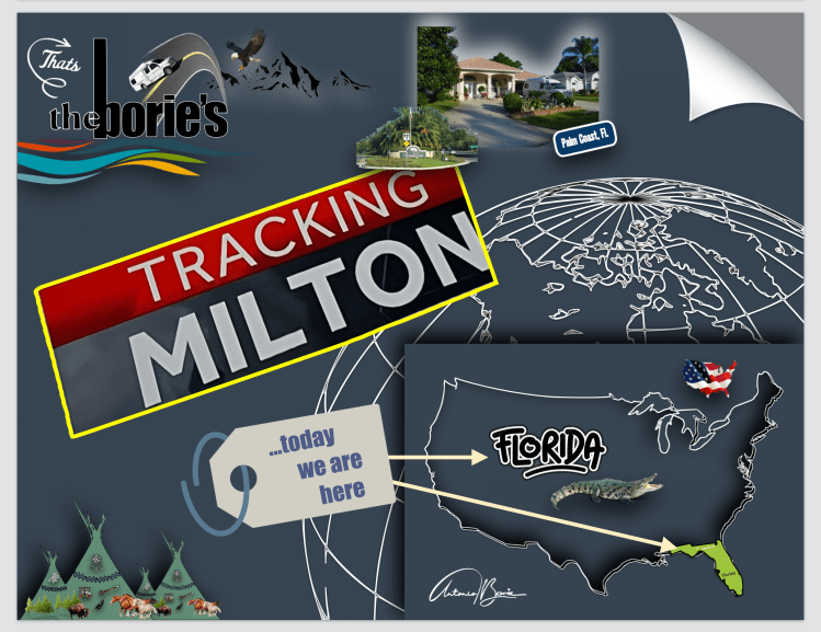
…o furacão Milton foi um furacão Atlântico extremamente poderoso e devastador que se tornou no segundo ciclone tropical mais intenso já registrado no Golfo do México, sendo também o segundo furacão de categoria 5 desta temporada de furacões no Atlântico de 2024!.
…Hurricane Milton was an extremely powerful and devastating Atlantic hurricane that became the second most intense tropical cyclone ever recorded in the Gulf of Mexico, and the second category 5 hurricane of this 2024 Atlantic hurricane season!.
…formou-se a partir de uma perturbação tropical de longa duração que se originou no oeste do Mar do Caribe!. Como tal, a sua intensificação gradual ia ocorrendo à medida que se movia lentamente para o leste, tornando-se num furacão de categoria 5 com ventos de 180 mph (285 km/h) e, no pico da sua intensidade era extremamente poderoso e devastador!.
…formed from a long-lasting tropical disturbance that originated in the western Caribbean Sea!. As such, its gradual intensification occurred as it slowly moved eastward, becoming a Category 5 hurricane with winds of 180 mph (285 km/h) and, at its peak intensity, it was extremely powerful and devastating!.
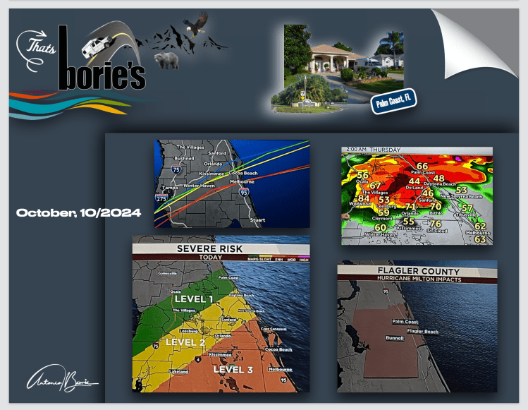
…no entanto, ao virar para nordeste em direção à Flórida, fez com que o furacão enfraquecesse, caindo para a categoria 3 antes de atingir a costa e, continuou enfraquecendo à medida que atravessava o estado em direção ao Oceano Atlântico, passando pela área onde vivemos, em 10 de Outubro, e mesmo antes de entrar no oceano Atlântico, tornou-se extratropical ao ficar incrustado numa zona frontal do oceano!.
…however, as it turned northeast toward Florida, it caused the hurricane to weaken, falling to Category 3 before making landfall, and continued to weaken as it crossed the state toward the Atlantic Ocean, passing through the area where (We live on October 10th, and even before entering the Atlantic Ocean, it became extratropical when it became embedded in a frontal area of the ocean)!.
…durante a sua passagem por terra, muitos residentes costeiros foram obrigados a evacuar, causando inundações e cortes na energia eléctrica, matando pelo menos 23 pessoas nos USA e três no México e as estimativas preliminares de danos são estimadas em pelo menos US$ 30 bilhões!.
…during its passage over land, many coastal residents were forced to evacuate, causing flooding and power outages, killing at least 23 people in the USA and three in Mexico and preliminary damage estimates are estimated at at least US$30 billion!.
…apesar de haver em prevenção, alguns milhares de homens e mulheres treinados e prontos para intervir em auxilio, tal como aproximadamente 2.500 camiões equipados com plataformas de reparação de emergência em catástrofes, estivemos três dias sem electricidade e internet, algumas árvores no quintal racharam ou tombaram, no telhado algumas telhas saltaram do lugar…, o que foi quase nada comparado com centenas de casas destruídas ou inundações constantes provocadas por chuvas torrenciais movidas por ventos ciclónicos, que outros sofreram!.
…despite there being a few thousand men and women trained and ready to intervene to help in prevention, as well as approximately 2,500 trucks equipped with emergency repair platforms in disasters, we were without electricity or internet for three days, some trees in the yard cracked or They fell, on the roof some tiles fell out of place…, which was almost nothing compared to hundreds of destroyed houses or constant flooding caused by torrential rains driven by cyclonic winds, which others suffered!.
…continuamos a viver!. Somos obrigados a isso, não temos outra alternativa, porque ao nascer entrámos neste calhau, perdido no Universo, a que todos chamam Planeta Terra!. No entanto, quando por aí caminhamos esbarramos frequentemente com muitos cenários com coisas do quotidiano e…, às vezes registamo-las!.
…we continue to live!. We are forced to do this, we have no other alternative, because at birth we entered this rock, lost in the Universe, which everyone calls Planet Earth!. However, when we walk around we often come across many scenes with everyday things and…, sometimes we register them!.
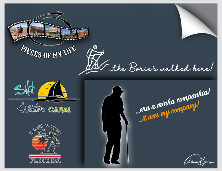
…por exemplo, esta semana ao caminhar na trilha que vai ao longo do canal de água salgada, o “Jenny”, pessoa amável e solitária que quase todos os dias por lá caminha, ia a falar sozinho, numa lamúria triste, quase de choro!. Ao dizer-lhe “bom dia”, ele aproveitou para falar, e em poucos minutos explicou-nos a razão daquela lamúria, que era o efeito da dor que sentia e queria libertar-se, porque a única saída que tinha era…, falar, contar, comentar e ter alguém para o ouvir!.
…for example, this week while walking on the trail that goes along the salt water canal, “Jenny”, a kind and lonely person who walks there almost every day, started talking to himself, in a sad whine, almost like crying!. When we said “good morning”, he took the opportunity to speak, and in a few minutes he explained to us the reason for his whining, which was the effect of the pain he felt and wanted to free himself, because the only way out was…, to speak. , tell, comment and have someone to listen to you!.
…e começou a contar-nos: “foi tudo muito rápido!. Começou com vómitos, falta de apetite e muito cansaço!. Começou por ir aos médicos, ao hospital, até que um exame revelou ter um cancro no fígado e…, se fosse só no fígado!. Também já tinha nos pulmões e sabe-se lá mais aonde!. Ficou internada uns dias, começando por me dizer muito baixinho “quero morrer, quero morrer”!. Passados quatro dias morreu agarrada à minha mão!. Agora sou viúvo!. A minha mulher faz-me muita falta, não para cuidar de mim, tomar conta da casa ou fazer a comida!. Nada disso!. Faz-me muito falta…, porque era a minha companhia”!.
…and began to tell us: “it all happened very quickly!. It started with vomiting, lack of appetite and a lot of tiredness! He started by going to the doctors, to the hospital, until an exam revealed that he had liver cancer and…, if it was only in the liver!. I also had it in my lungs and who knows where else!. She was hospitalized for a few days, starting by saying to me very quietly “I want to die, I want to die”!. After four days, she died clinging to my hand!. Now I’m a widower!. I miss my wife a lot, not to take care of me, take care of the house or cook the food!. None of that!. I miss it very much…, because it was my company”!.
…nós ouvimos em silêncio, porque durante a nossa estadia forçada na Guerra Colonial Portuguesa em África, aprendemos que o silêncio por vezes é uma porta aberta para eliminar a dor!. O amável “Jenny”, no final, agradeceu-nos vivamente por o ter-mos escutado e pediu-nos desculpa por nos ter incomodado!.
…we listen in silence, because during our forced stay in the Portuguese Colonial War in Africa, we learned that silence is sometimes an open door to eliminate pain!. The kind “Jenny”, at the end, thanked us warmly for listening to him and apologized for having disturbed us!.
Tony Borie, Século XXI. (Tony Borie, 21st Century).
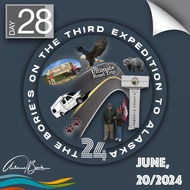
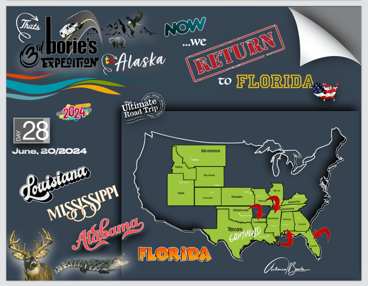
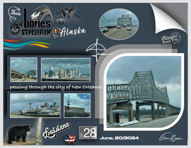
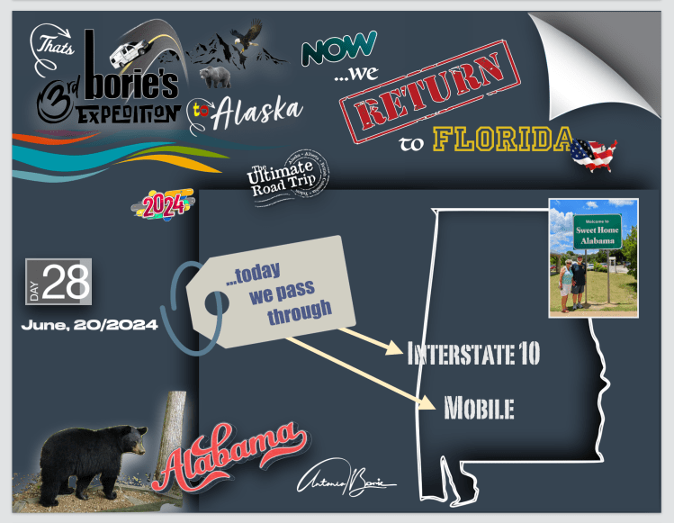
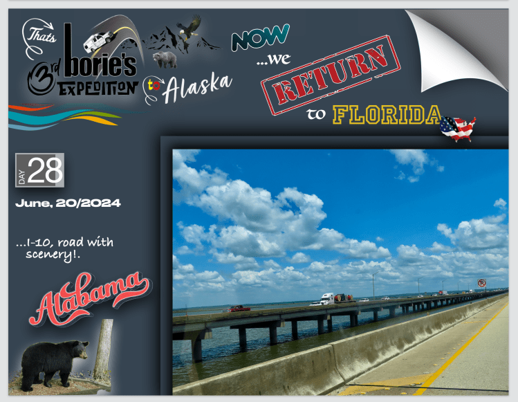
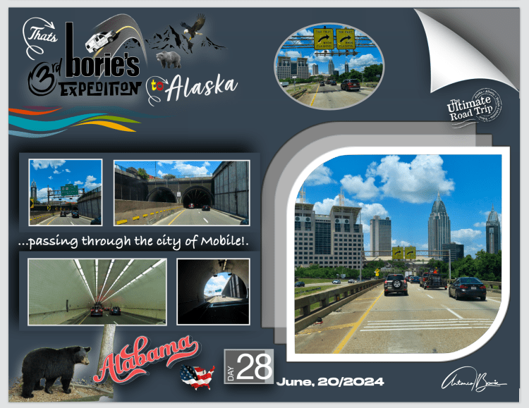
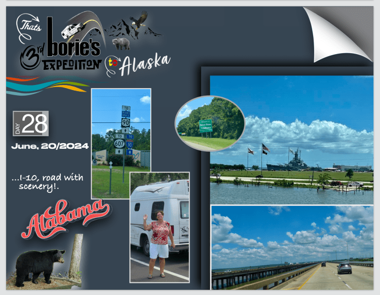
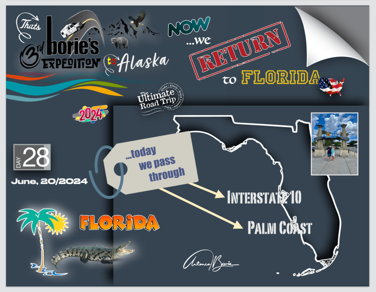
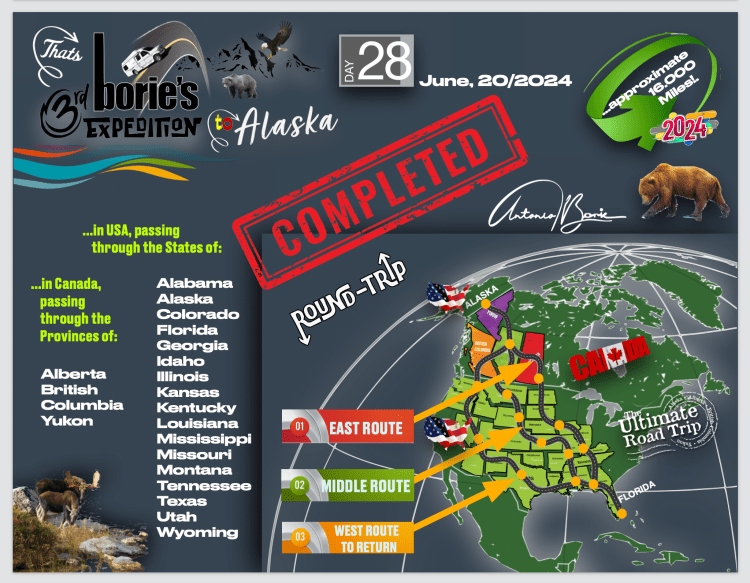
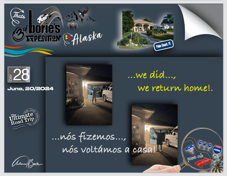
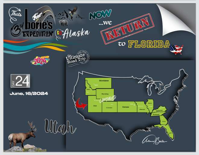
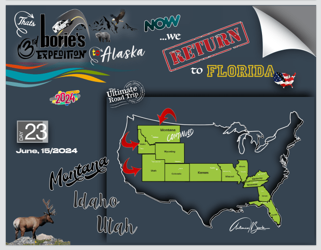
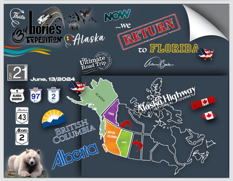
…no dia 28 da nossa “Terceira Expedição ao estado do Alaska” passando pelos estados de Louisiana, Mississippi e Alabama…, finalmente chegámos à Flórida, onde vivemos e regressámos de novo!. O tempo foi de quase céu azul com algumas nuvens brancas, excepto na região de New Orleans, na Louisiana, onde chovia!. Como tal, a história do dia…, não tem história!. Porquê?. Porque o que pretendíamos era viajar para leste, ou seja, chegar a casa!.
…on the 28th of our “Third Expedition to the state of Alaska” passing through the states of Louisiana, Mississippi and Alabama…, we finally arrived in Florida, where we live and returned again!. The weather was almost blue skies with some white clouds, except in the region of New Orleans, Louisiana, where it was raining!. As such, the story of the day…, there is no story!. Why?. Because what we wanted was to travel east, that is, to get home!.
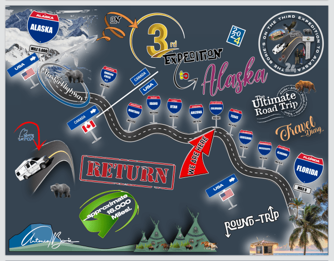
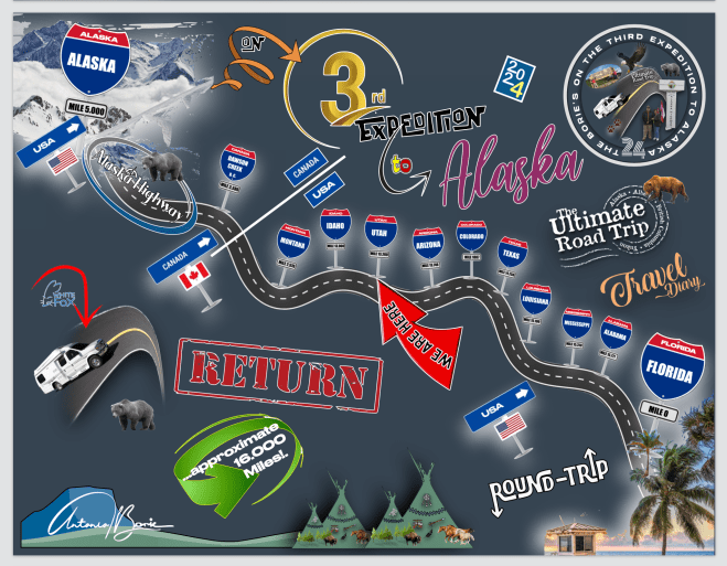
…e finalmente…, chegamos a casa!. Foram 28 dias e noites, 15.845 milhas e 4.554 fotos, atravessando muitos estados nos USA e algumas províncias no Canadá, passando por cidades, vilas, aldeias ou parques nacionais, com temperaturas de calor algumas vezes infernal, frio ou neve, chuva, lama, poeira ou pedra miúda, seguindo por milhas e milhas o “carro piloto” em reparações ou desvios de estradas destruídas por avalanches, ou até ventos fortes tal qual tornados, e…, também lindos dias de céu azul, através de grandes rios ou pequenos riachos com forte ou pequena corrente ou até lagos com água pura!.
…and finally…, we arrived home!. There were 28 days and nights, 15,845 miles and 4,554 photos, crossing many states in the USA and some provinces in Canada, passing through cities, towns, villages or national parks, with sometimes infernal heat, cold or snow, rain, mud, dust or small stones, following the “pilot car” for miles and miles in repairs or detours on roads destroyed by avalanches, or even strong winds like tornadoes, and…, also beautiful days with blue skies, through large rivers or small streams with strong or small current or even lakes with pure water!.
…muitas vezes fomos atraídos por aventuras ao ar livre, explorando lugares históricos ou simplesmente mergulhando numa atmosfera descontraída, como por exemplo, parando numa estrada num lugar quase deserto, vivendo aquilo que não é comum e que nos pode surpreender, porque estava chovendo e…, olhando o relógio da nossa “White Fox” (caravana), eram onze e meia da noite, no entanto, ainda era de dia, a chuva vinha do norte e estávamos no norte, como tal…, ela vinha do céu e caía direita sobre nós!.
…we were often attracted by outdoor adventures, exploring historical places or simply immersing ourselves in a relaxed atmosphere, for example, stopping on a road in an almost deserted place, experiencing something that is unusual and that might surprise us, because it was raining and… , looking at the clock in our “White Fox” (caravan), it was half past eleven at night, however, it was still daytime, the rain was coming from the north and we were in the north, as such…, it came from the sky and fell straight about us!.
…foi uma viagem panorâmica semelhante a uma viagem no tempo, aprendendo sempre, porque tivemos a oportunidade de poder explorar exposições e artefactos que nos ofereceram informações sobre um passado duma qualquer região, que às vezes abrigava tesouros históricos, proporcionando-nos uma apreciação mais profunda do seu significado cultural!.
…it was a panoramic journey similar to a journey through time, always learning, because we had the opportunity to explore exhibitions and artefacts that offered us information about the past of any region, which sometimes housed historical treasures, providing us with a deeper appreciation of its cultural significance!.
…ao longe víamos grandes ou pequenas montanhas cobertas de neve, outras cobertas com floresta, estradas com duas vias e rápidas, outras pequenas, com curvas e precipícios, com o piso em lama e água!. Parávamos aqui e ali, para admirar a natureza pura, com os animais selvagens ou águias de colarinho branco, no seu próprio território, onde nós sim…, éramos os intrusos que ocupávamos o seu espaço!.
…in the distance we saw large or small mountains covered in snow, others covered with forest, roads with two lanes and fast, others small, with curves and precipices, with mud and water on the floor!. We stopped here and there, to admire the pure nature, with wild animals or white-collared eagles, in their own territory, where we were…, we were the intruders who occupied their space!.
…vimos e fomos convivendo com pessoas de outras latitudes, mas com o mesmo sentido de aventura, muitas vezes debaixo de um sol radiante, outras, tal como acima já descrevemos, neve, chuva lama ou poeira e nuvens escuras e…, não sabendo onde era o nosso destino para esse dia, ou onde pernoitaríamos!.
…we saw and lived with people from other latitudes, but with the same sense of adventure, often under a radiant sun, other times, as we described above, snow, rain, mud or dust and dark clouds and…, not knowing where was our destination for that day, or where we would spend the night!.
…estivemos encostados ao Polo Norte, com algum sol por 24 horas, onde nunca era de noite!. Áreas desertas, onde viajávamos por centenas de milhas sozinhos, confiando na sorte e, na nossa “White Fox” (caravana)!. Tomando banho em lagos de água cristalina e quente, que brotava das profundezas do planeta Terra e, a chuva miudinha caindo nas nossas cabeças!.
…we were close to the North Pole, with some sun for 24 hours, where it was never night!. Deserted areas, where we traveled for hundreds of miles alone, trusting in luck and in our “White Fox” (caravan)!. Bathing in lakes of crystal clear, warm water, which flowed from the depths of planet Earth and the light rain falling on our heads!
…passando por algumas situações, onde uma lata de conserva de atum ou sardinha, era uma refeição apreciada, por dias, onde um café quente, era uma bebida desejada, mas não se encontrava, onde um simples naco de pão seco, se comia como o mais delicioso pitéu!. No entanto, também outros dias havia fartura, comendo comidas exóticas, como por exemplo carne de búfalo, pernas de caranguejo gigante, salmão ou halibute acabados de pescar!.
… going through some situations, where a can of canned tuna or sardines was a meal enjoyed for days, where a hot coffee was a desired drink, but was not found, where a simple hunk of dry bread was eaten as the most delicious snack! However, on other days there was plenty, eating exotic foods, such as buffalo meat, giant crab legs, freshly caught salmon or halibut!
…tivemos também situações engraçadas, como por exemplo, um certo dia que estava quase a chegar ao fim e não estávamos com disposição em cozinhar!. Entrámos num restaurante que nem parecia de luxo e…, depois de ler o “cardápio” e ver os preços, com muita educação simplesmente nos levantámos, saímos e…, sem o perceber, batemos a porta!. A equipe de serviço olhou para nós!. Que nos havia de importar…, fomos a um daqueles restaurantes de estrada, por sinal o “Tim Hortons”, muito popular no Canadá, e adoram servir pessoas depois do pôr do sol!.
…we also had funny situations, for example, a certain day that was almost coming to an end and we weren’t in the mood to cook!. We entered a restaurant that didn’t even look like a luxury restaurant and…, after reading the “menu” and seeing the prices, with great politeness we simply got up, left and…, without realizing it, we slammed the door!. The service team looked after us!. What should we care about…, we went to one of those roadside restaurants, by the way “Tim Hortons”, very popular in Canada, and they love serving people after sunset!.
…coisas assim acontecem a quem anda na estrada e adora ver cenários deslumbrantes, onde não existe vontade de sair deles, e…, dormindo sempre na nossa “White Fox” (caravana) e…, acordando ao som das suaves ondas do mar ou com vista para lagos, cujo cenário, só se vê em revistas de propaganda das agências de viajem!. Enfim, uma experiência única, na vida de qualquer pessoa e…, pensando sempre na célebre legenda “Alaska or Bust”!.
…things like this happen to those who are on the road and love seeing stunning scenery, where there is no desire to leave them, and…, always sleeping in our “White Fox” (caravan) and…, waking up to the sound of the soft sea waves or with view of lakes, whose scenery can only be seen in travel agency advertising magazines!. In short, a unique experience, in anyone’s life and…, always thinking about the famous caption “Alaska or Bust”!.
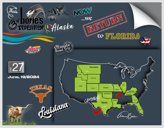
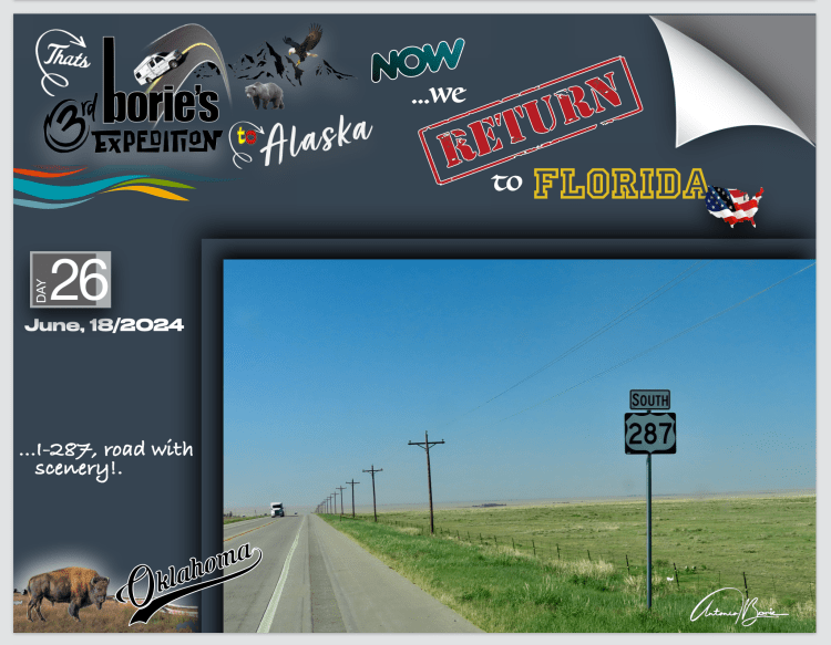
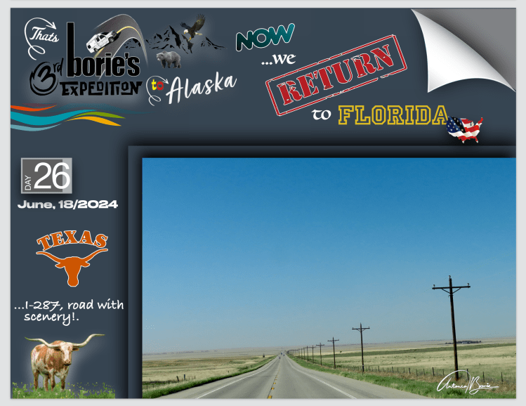
…pernoitámos no estado do Texas, onde quase tudo é grande!. São entre outras…,, as distâncias entre as localidades ou as tempestades de chuva e vento, principalmente quando nos aproximamos do sul, ou seja, do Golfo do México!. É uma viagem panorâmica semelhante a uma viagem no tempo, que serpenteia por pitorescas aldeias ou vilas repletas de prédios e casas históricas, onde na “Main Street”, (rua principal), está lá tudo, desde a farmácia, banco, quartel dos bombeiros ou da policia, estação de gasolina ou a loja de supermercado!.
…we spent the night in the state of Texas, where almost everything is big!. These are, among others…,, the distances between locations or rain and wind storms, especially when we approach the south, that is, the Gulf of Mexico!. It is a panoramic journey similar to a journey through time, which winds through picturesque villages or towns full of historic buildings and houses, where on the “Main Street”, everything is there, from the pharmacy, bank, fire station or from the police, gas station or the supermarket store!.
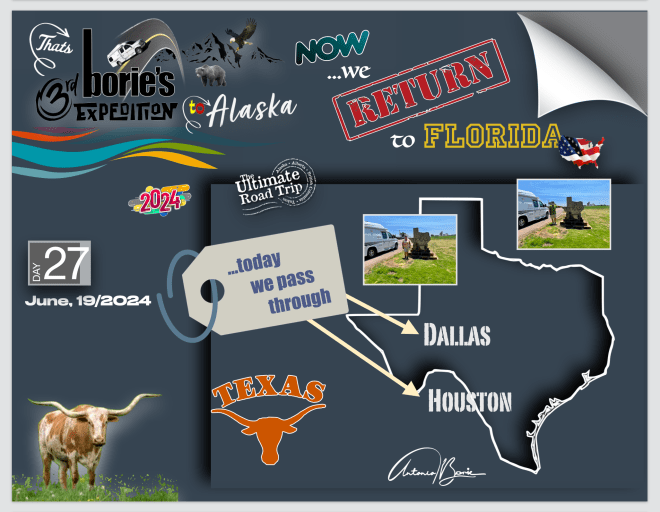
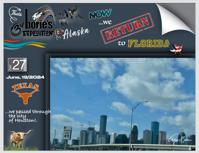
…até às grandes metrópoles, como por exemplo as cidades de Dallas ou Houston, onde se gastam horas e muita paciência para as atravessar, pois o tráfico é intenso, existem os camiões de longo curso, algumas luzes de control que se têm que respeitar e…, todos querem ser os primeiros a de lá sair, gerando aquela “barafunda”, quando os condutores começam por dizer: “que tráfico mais caótico”!. Enfim, tudo isto nos aconteceu mas…, sobrevivemos!.
…even to large metropolises, such as the cities of Dallas or Houston, where you spend hours and a lot of patience to cross them, as traffic is intense, there are long-distance trucks, some control lights that you have to respect and …, everyone wants to be the first to leave, creating that “hustle”, when the drivers start saying: “what a chaotic traffic”!. Anyway, all this happened to us but…, we survived!.
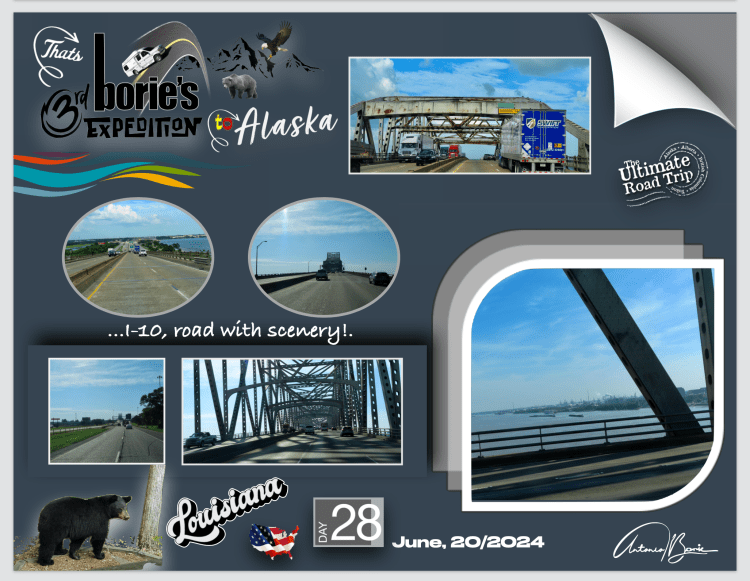
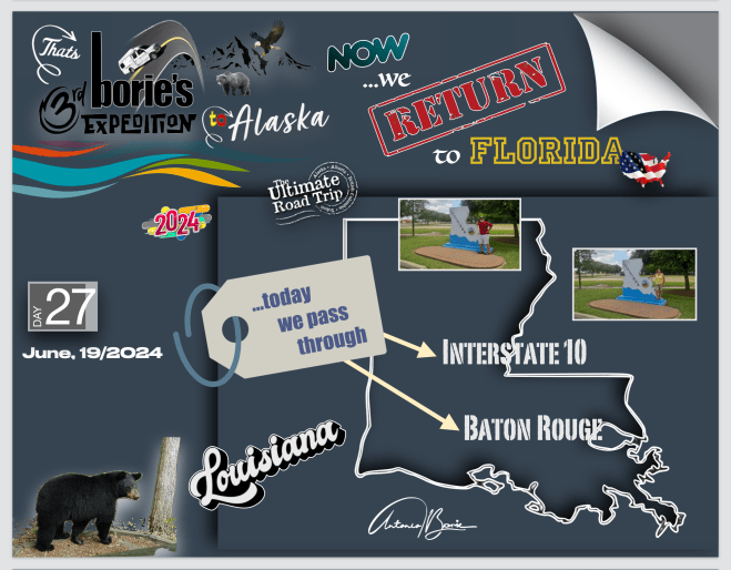
….e de uma maneira ou de outra chegámos à auto-estrada #10, que vem lá da Califórnia, segue quase junto à fronteira sul dos USA, e nos havia de levar à Flórida, estado onde presentemente vivemos!. Como tal, viajando nela no sentido leste…, chegámos ao estado de Louisiana!.
….and one way or another we arrived at highway #10, which comes from California, runs almost close to the southern border of the USA, and would take us to Florida, the state where we currently live!. As such, traveling in an easterly direction…, we arrived in the state of Louisiana!.
…que nos oferece um vislumbre do charme rústico do sul, caracterizado pelas terras alagadiças, onde as pontes são longas e constantes, pelas pessoas que sofrem frequentes inundações que lhe vão atrapalhando a vida e…, que sempre querem ser amáveis e prestáveis, tal como nos aconteceu quando chegámos a um parque de RV, onde pernoitámos, já perto da área de Baton Rouge!.
…which offers us a glimpse of the rustic charm of the south, characterized by marshy lands, where the bridges are long and constant, by people who suffer frequent floods that disrupt their lives and…, who always want to be kind and helpful, just like It happened to us when we arrived at an RV park, where we spent the night, close to the Baton Rouge area!.
…e por hoje…, é quase tudo, companheiros de jornada!.
…and for today…, that’s almost it, fellow travelers!
…um dos nossos lemas como viajantes é que…, as grandes cidades devem-se contornar, ou seja, passar ao largo ou então se verdadeiramente as queremos visitar, talvez estacionar fora dos seus limites e arranjar transporte que nos leve ao seu centro ou aos lugares, monumentos ou outros quaisquer pontos, que pretendemos na verdade ver, porque viajar para lá na nossa “White Fox” (caravana), é complicado, principalmente no estacionamento!.
…one of our mottos as travelers is that…, big cities should be bypassed, that is, bypassed or if we really want to visit them, perhaps park outside their limits and find transport to take us to their center or to the places, monuments or any other points that we actually want to see, because traveling there in our “White Fox” (caravan) is complicated, especially in parking!.
…como tal, seguindo numa estrada, às vezes deserta, podemos explorar a sua rica história, as paisagens deslumbrantes ou a beleza da vida selvagem, dos riachos ou das montanhas, sejam elas pequenas ou grandes e…, viajando pelo inesquecível coração do oeste/centro/leste americano, as expectativas são mais elevadas com curvas amplas e vistas deslumbrantes, e claro, com muita beleza de imprevisível!.
…as such, following a road, sometimes deserted, we can explore its rich history, the stunning landscapes or the beauty of the wildlife, the streams or the mountains, whether small or large and…, traveling through the unforgettable heart of the West/Central/Eastern America, expectations are higher with wide curves and stunning views, and of course, with lots of unpredictable beauty!.
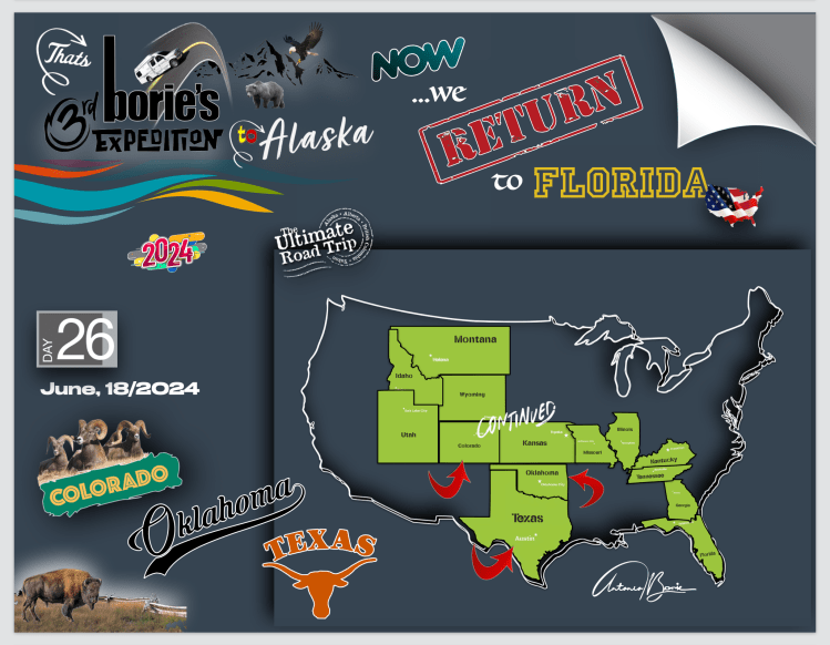
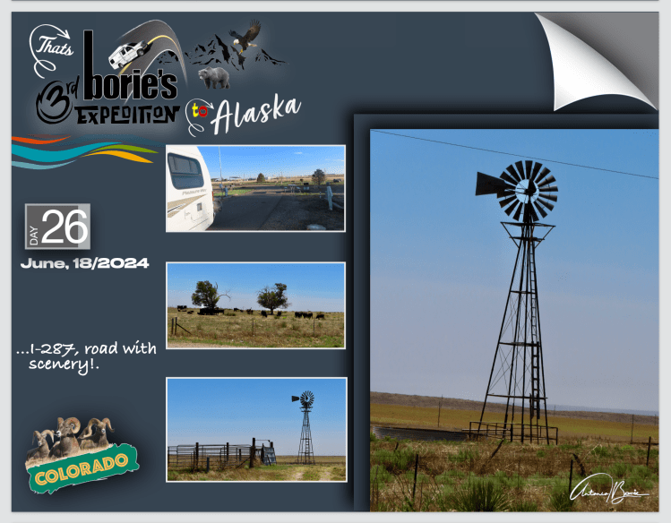
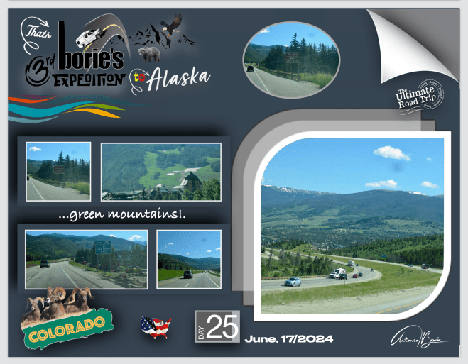
…como tal, foi mais ou menos o que hoje fizemos!. Estávamos no estado do Colorado, e…, viajando por estradas que atravessam transversalmente “pradarias” em direcção ao sul/leste ao mesmo tempo, passámos pelos estados de Oklahoma e Texas!.
…as such, that’s more or less what we did today! We were in the state of Colorado, and…, traveling along roads that cross “prairies” towards the south/east at the same time, we passed through the states of Oklahoma and Texas!.
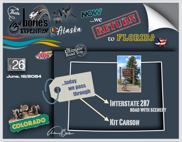
…ainda no estado do Colorado e viajando já em plena “pradaria aberta”, passámos pela pequena cidade de Kit Carson!. Afrouxámos, parando por algum tempo!. É uma cidade histórica que leva o nome de um dos mais notáveis habitantes das planícies de fronteira…, conhecido por capturar, explorar e lutar, “coisas” que representavam o verdadeiro espírito de fronteira, que estava e que ainda está um pouco vivo no “Velho Oeste”!.
…still in the state of Colorado and traveling in the middle of the “open prairie”, we passed through the small town of Kit Carson!. We loosened up, stopping for a while! It is a historic town named after one of the most notable inhabitants of the frontier plains…, known for capturing, exploring and fighting, “things” that represented the true frontier spirit, which was and still is somewhat alive. in the “Wild West”!.
…a cidade foi fundada no ano de 1838, e já foi o terminal oeste da Union Pacific Railroad, todavia, a sua localização tornou-a um centro comercial com vastas extensões de pastagens e à volta de quatro centenas de poços de petróleo e gás ainda activos, e não é surpresa que a agricultura, a pecuária e a produção de petróleo sejam as principais indústrias da área!. Hoje, a cidade está mais silenciosa do que no passado e os bares desapareceram e restam apenas alguns cafés e hotéis, mas andando por aqui, quase se pode ouvir esporas tilintando, os cavalos relinchando e os copos tilintando, tal como se vê em alguns filmes de Hollywood!.
…the city was founded in 1838, and was once the western terminus of the Union Pacific Railroad, however, its location made it a commercial center with vast expanses of pastureland and around four hundred oil and gas wells still assets, and it is no surprise that agriculture, livestock and oil production are the main industries in the area!. Today, the city is quieter than in the past and the bars have disappeared and only a few cafes and hotels remain, but walking around here, you can almost hear spurs clinking, horses neighing and glasses clinking, just like you see in some films. from Hollywood!
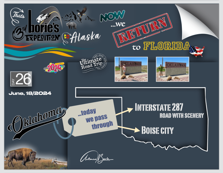
…continuando…,, o cenário das “pradarias” era constante e chegámos ao estado de Oklahoma!.
…continuing…,, the “prairie” scenery was constant and we arrived in the state of Oklahoma!.
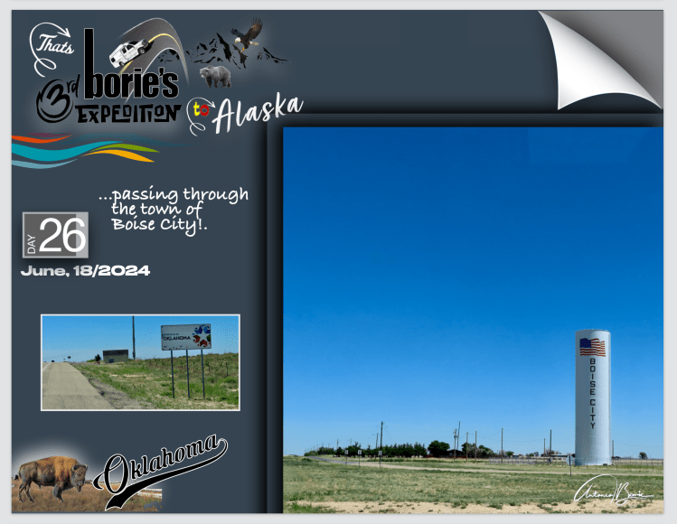
…onde pouco depois uma torre gigante nos anunciava a pequena cidade de Boise!. Tal como anteriormente, também afrouxámos e parámos porque existe lá uma conceituada estação de abastecimento de gasolina, onde se pode limpar o vidro da frente da nossa “White Fox” (caravana), usar as suas “facilidades” e com um excelente “conveniente store”, e que em viajem sempre usamos, onde o café é ótimo e tem uma equipe simpática e rápida!.
…where shortly afterwards a giant tower announced the small city of Boise!. As before, we also slowed down and stopped because there is a reputable gas filling station there, where you can clean the front window of our “White Fox” (caravan), use its “facilities” and with an excellent “convenient store”, and which we always use when traveling, where the coffee is great and the staff are friendly and fast!.
…a cidade tem uma história “engraçada”, que começou por volta do ano de 1908, onde três homens “espertalhões”, publicaram e distribuíram folhetos promovendo a cidade como elegante, arborizada com ruas pavimentadas, vários negócios, serviço ferroviário e um poço artesiano!. Venderam 3.000 lotes para compradores que descobriram ao lá chegar que…, nenhuma das informações do folheto era verdadeira!. Além de usarem publicidade falsa, os três homens “espertalhões”, não tinham titularidade dos lotes que venderam!. Claro, foram todos presos e julgados menos um que entretanto morreu de doença na época incurável!. No entanto, a cidade tomou forma e foi incorporada em 20 de julho de 1925!. Este exemplo, era o “Velho Oeste” que só se descobre…, viajando por lá, tal como nós!.
…the city has a “funny” history, which began around 1908, where three “smart” men published and distributed leaflets promoting the city as elegant, tree-lined with paved streets, several businesses, railway service and an artesian well !. They sold 3,000 lots to buyers who discovered when they got there that… none of the information in the brochure was true!. In addition to using false advertising, the three “smart” men did not have ownership of the lots they sold!. Of course, they were all arrested and tried except one who died of an incurable disease at the time!. However, the city took shape and was incorporated on July 20, 1925!. This example was the “Wild West” that can only be discovered… by traveling there, just like us!
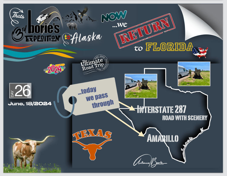
…continuando a nossa jornada rumo ao sul/leste, sempre com o mesmo cenário de “pradaria”, entrámos no estado do Texas!.
…continuing our journey towards the south/east, always with the same “prairie” scenery, we entered the state of Texas!.
…e mais uma vez, sempre que passamos pela cidade de Amarillo, paramos para comer num restaurante que cujo lema é “home of the free 72 onças steak”, (casa do bife de 72 onças grátis), que quer mais ou menos dizer que, se alguém conseguir comer um bife de 72 onças, não paga, é de graça!.
…and once again, whenever we pass through the city of Amarillo, we stop to eat at a restaurant whose motto is “home of the free 72 ounce steak”, which more or less means that, if someone can eat a 72 oz steak, they don’t pay, it’s free!.
…e durante a nossa presença no restaurante, houve dois candidatos a comer o enorme bife e, tudo foi acompanhado de um personagem parecido com um mestre de cerimónias, que faz um relato quase minucioso de todo este acontecimento, ou seja, do progresso do candidato e como vai comendo o enorme bife, e falando numa voz muito rápida, parecida com a voz de um relator típico do Texas, de um qualquer leilão de vacas ou cavalos, que nós, pessoas visitantes quase não compreendemos nada, mas que foi divertido!.
…and during our presence in the restaurant, there were two candidates eating the huge steak and everything was accompanied by a character similar to a master of ceremonies, who gave an almost detailed account of this entire event, that is, of the candidate’s progress and how he eats the huge steak, and speaks in a very fast voice, similar to the voice of a typical Texas rapporteur, at any cow or horse auction, which we, the visitors, hardly understand at all, but it was fun!.
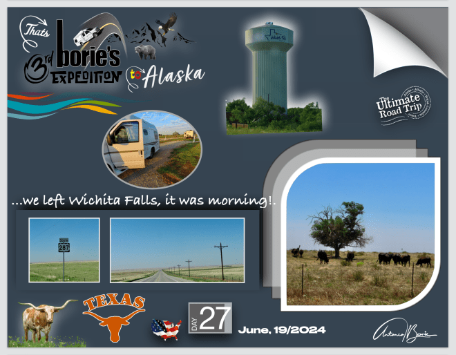
…continuando a nossa jornada, e o dia já ia longo quando parámos próximo da cidade de Wichita Falls, ainda no estado do Texas para pernoitar num parque de RV!.
…continuing our journey, and the day was already long when we stopped near the city of Wichita Falls, still in the state of Texas, to spend the night in an RV park!.
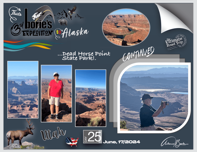
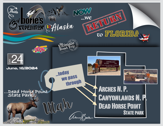
…pernoitámos aqui, no meio desta área do quase selvagem “Parque Estadual Dead Horse Point”, onde as preocupações de segurança incluem o isolamento relativo do parque!. Por exemplo: gás, alimentos e assistência médica está a mais de 30 milhas de distância, lá em baixo na cidade de Moab, sem mencionar o perigo de raios, chuva, ventos fortes ou as falésias não vedadas!.
…we stayed the night here, in the middle of this almost wild area “Dead Horse Point State Park”, where safety concerns include the relative isolation of the park!. For example: gas, food and medical care is over 30 miles away, down in the town of Moab, not to mention the danger from lightning, rain, high winds or the unsealed cliffs!
…mas todas estas pequenas grandes coisas…, fazem parte da nossa aventura e, se nos sentarmos em uma qualquer rocha, daquelas que por aqui existem, podemos ver o cenário de uma península de rochas no alto de falésias de arenito, conectadas ao planalto por uma estreita faixa de terra a que chamam garganta ou pescoço…, se assim o entenderem!.
…but all these little big things… are part of our adventure and, if we sit on any rock, one of those that exist around here, we can see the scenery of a peninsula of rocks on top of sandstone cliffs, connected to the plateau by a narrow strip of land that they call a throat or neck…, if you will!.
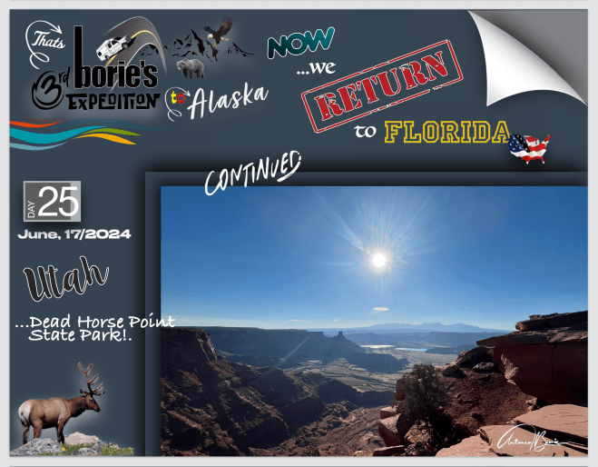
…wow, que maravilha!. Era manhã, e o sol aparecia de um lado diferente do de ontem que era da parte da tarde quando aqui chegámos!. Como tal, e devido à visão geral e dramática deste maravilhoso parque, torna-se um local muito popular para tirar fotografias!.
…wow, how wonderful! It was morning, and the sun appeared from a different side than yesterday, which was in the afternoon when we arrived here! As such, and due to the overall and dramatic view of this wonderful park, it becomes a very popular place to take photographs!.
…é um cenário que espera para ser descoberto, como por exemplo no local “Big Chief Overlook”, que está localizado num topo muito inclinado do parque, mas é um local óptimo, de onde se obtém incríveis vistas panorâmicas dos dois lados do parque!. Não nos surpreende que esta área foi usada na cena do Grand Canyon no final do filme de 1991, Thelma & Louise!.
…it’s a scenery waiting to be discovered, for example at the “Big Chief Overlook” site, which is located on a very steep top of the park, but it’s a great spot, from where you can get incredible panoramic views of both sides of the park!. It comes as no surprise that this area was used in the Grand Canyon scene at the end of the 1991 film Thelma & Louise!.
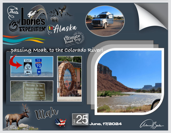
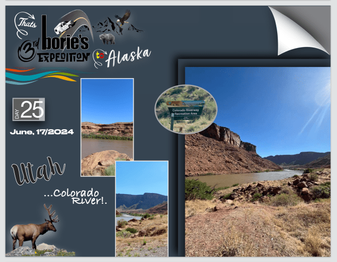
…era meia manhã quando começámos a descer a montanha em direção à cidade de Moab, para nos abastecer de gasolina e alguns alimentos e…, sempre que viajamos pelo oeste, é quase obrigatório usarmos a estrada #128, que é uma estrada estadual de aproximadamente 45 milhas, onde toda a extensão da estrada foi designada como Scenic Byway no Alto Colorado River, como parte do programa Utah Scenic Byways!. Esta estrada também faz parte da Estrada Pré-Histórica de Diamantes de Dinossauros, como uma Via Nacional Panorâmica!.
…it was mid-morning when we started to descend the mountain towards the city of Moab, to stock up on gasoline and some food and…, whenever we travel through the west, it is almost obligatory to use road #128, which is a state road approximately 45 miles where the entire length of the road has been designated as an Upper Colorado River Scenic Byway as part of the Utah Scenic Byways! program. This road is also part of the Prehistoric Dinosaur Diamond Road, as a National Scenic Byway!.
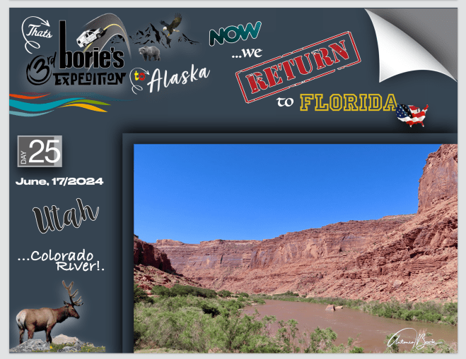
…hoje é quase usada como um passeio panorâmico e os residentes da região de Moab frequentemente se referem a esta estrada como “a estrada do rio”, porque o rio Colorado, segue a seu lado em quase toda a sua extensão, que começa ao norte de Moab, através de um desfiladeiro estreito e íngreme, descrito como espetacular pela National Geographic, cujas paredes de arenito são recomendadas pela sua beleza em guias de viagens!.
…today it is used almost as a scenic drive and residents of the Moab region often refer to this road as “the river road” because the Colorado River runs alongside it for almost its entire length, which begins north of Moab, through a narrow and steep gorge, described as spectacular by National Geographic, whose sandstone walls are recommended for their beauty in travel guides!.
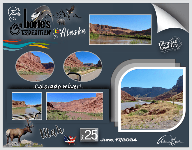
…aqui nesta área, começa o cenário das principais drenagens das Montanhas La Sal, já por diversas vezes referidas anteriormente, ampliando o lado leste do desfiladeiro do rio Colorado, num amplo vale de paredes de penhasco, chamado de “Richardson Anfiteatro”, que contém vários locais onde filmes e muitos comerciais já foram filmados!.
…here in this area, the scenario of the main drainages of the La Sal Mountains, already mentioned several times before, begins, expanding the east side of the Colorado River gorge, in a wide valley of cliff walls, called the “Richardson Amphitheatre”, which contains several locations where films and many commercials have been filmed!.
…como por exemplo, na área do Red Cliffs Ranch, foi o local preferido para filmes como Taza – Filho de Cochise, Rio Grande, Rio Concho, Wagon Master, Batalha no Apache Pass, Cheyenne Autumn ou Ten Who Dare, assim como muitos comerciais de televisão, existindo mesmo um pequeno museu com algumas relíquias usadas, por entre outros, o actor John Wayne, quando por aqui vivia temporadas, como protagonista dos seus diversos filmes!.
…for example, in the Red Cliffs Ranch area, it was the preferred location for films such as Taza – Son of Cochise, Rio Grande, Rio Concho, Wagon Master, Battle at Apache Pass, Cheyenne Autumn or Ten Who Dare, as well as many commercials television, there is even a small museum with some relics used, among others, by the actor John Wayne, when he lived here for seasons, as the protagonist of his various films!.
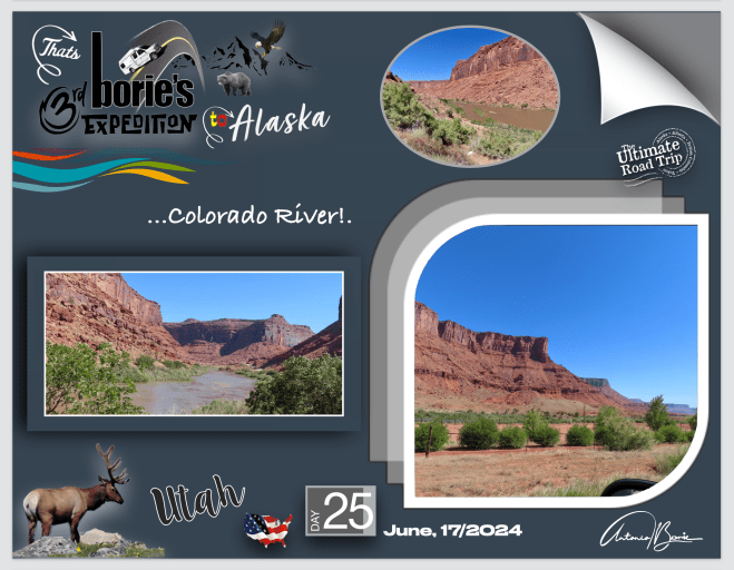
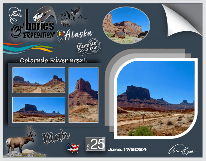
…no extremo leste do vale, o rio Colorado e esta maravilhosa estrada, formam a fronteira sul do Parque Nacional dos Arcos, mas não há acesso ao parque, no entanto existem trilhas ao longo da estrada e outras atrações populares que incluem Canyons e Arcos ou uma linda vista para as Torres Fisher, que são um conjunto de pináculos vermelhos escuros, que se tornam numa atração para os amantes de fotografias, tal como nós!.
…at the eastern end of the valley, the Colorado River and this wonderful road form the southern border of Arches National Park, but there is no access to the park, however there are trails along the road and other popular attractions that include Canyons and Arches or a beautiful view of the Fisher Towers, which are a set of dark red pinnacles, which become an attraction for photography lovers, like us!.
…depois deste lindo cenário do rio Colorado e das suas margens, e querendo continuar a seguir este rio, olhámos para trás pelo retrovisor, entrando na auto-estrada I-70, viajando no sentido leste!.
…after this beautiful scenery of the Colorado River and its banks, and wanting to continue following this river, we looked back in the rearview mirror, entering the I-70 highway, traveling east!.
…chegámos de novo ao estado do Colorado e…, viajando por esta auto-estrada, o cenário e constante!. Tem longas retas e curvas suaves com monumentos históricos, grandes zonas rochosas, pequenas montanhas e alguns túneis!.
…we arrived again in the state of Colorado and…, traveling along this highway, the scenery is constant!. It has long straights and smooth curves with historical monuments, large rocky areas, small mountains and some tunnels!.
…até que tem mesmo que passar por entre altas montanhas onde passa, o rio Colorado, o caminho de ferro e…, esta estrada que vai ao lado do rio, começa a desviar-se por cima do rio, ao lado do caminho de ferro, ao lado, por baixo ou por cima da outra via da estrada que vem do leste, entra num túnel e sai por cima do rio e…, aqui e ali ainda tem desvios para zonas descanso, porque também existem cheias ou acidentes!. Que maravilhosa “barafunda”!.
…until you have to pass through high mountains where it passes, the Colorado River, the railway and…, this road that runs alongside the river, begins to deviate above the river, alongside the railway , next to, below or above the other lane of the road that comes from the east, enters a tunnel and exits over the river and…, here and there there are still detours to rest areas, because there are also floods or accidents!. What a wonderful “mess”!
…tudo isto é na área quando serpenteia pelo Glenwood Canyon, onde se concluiu um dos projetos rodoviários mais extraordinários já construídos nos USA, que é uma rede de viadutos, pontes e túneis de aproximadamente 12,5 milhas de comprimento construída através de um desfiladeiro extraordinariamente estreito e ambientalmente sensível no oeste do Colorado, que marcou um marco na história do transporte desta nação!.
…all of this is in the area as it winds through Glenwood Canyon, where one of the most extraordinary highway projects ever built in the USA was completed, which is a network of viaducts, bridges and tunnels approximately 12.5 miles long built through an extraordinary canyon narrow and environmentally sensitive site in western Colorado that marked a milestone in this nation’s transportation history!.
…fomos ver a história desta maravilhosa “barafunda” e…, para a sua realização tiveram que construir duas estradas, uma quase em cima da outra, incluindo 40 pontes e viadutos que se estendiam por mais de 6 milhas entre seções da estrada!. A estrada tem 15 milhas de muros de contenção e um túnel de 4.000 pés de comprimento com furos para o tráfego em ambos os sentidos!. Os muros de contenção são fixados com tirantes ancorados e âncoras de solo, e a rodovia é pavimentada com lajes de pavimento pós-tensionadas moldadas no local, em balanço de 6 pés para além dos muros de contenção!.
…we went to see the history of this wonderful “mess” and…, to make it happen they had to build two roads, one almost on top of the other, including 40 bridges and viaducts that stretched for more than 6 miles between sections of the road!. The road has 15 miles of retaining walls and a 4,000 foot long tunnel with holes for traffic in both directions! The retaining walls are secured with anchored ties and ground anchors, and the highway is paved with cast-in-place post-tensioned pavement slabs, cantilevered 6 feet beyond the retaining walls!.
…só mais uma pequena observação, este projeto ganhou mais de 30 prémios, incluindo o prémio Outstanding Civil Engineering Achievement Award de 1993 da Sociedade Americana de Engenheiros Civis!. Achamos que foram bem entregues!.
…just one more small note, this project has won more than 30 awards, including the 1993 Outstanding Civil Engineering Achievement Award from the American Society of Civil Engineers!. We think they were delivered well!
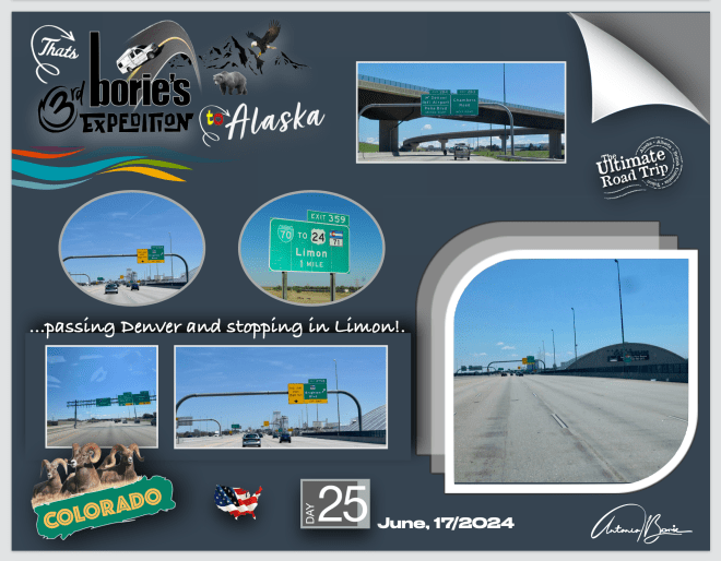
…já vamos longe na escrita!. Resumindo um pouco, continuámos viajando no sentido leste, atravessando mais uma vez a cidade de Denver, e pernoitando num parque de RV, na pequena cidade de Limon, ainda no estado do Colorado!.
…we’re already a long way in writing! To summarize a little, we continued traveling east, crossing the city of Denver once again, and spending the night in an RV park, in the small town of Limon, still in the state of Colorado!.
…da pequena cidade de Green River, onde pernoitámos num parque de RV, e que está em pleno desenvolvimento como no texto anterior já explicámos, e talvez seguindo a “Antiga Trilha Espanhola” porque ao longe avistávamos a cordilheira das “Montanhas Salgadas”, (alguns picos ainda com neve), até aos parques nacionais que tencionávamos visitar, foi um “pulo”, ou seja, foi rápido!.
…from the small town of Green River, where we spent the night in an RV park, and which is in full development as we explained in the previous text, and perhaps following the “Old Spanish Trail” because in the distance we could see the “Salty Mountains” mountain range, ( some peaks still with snow), to the national parks that we intended to visit, it was a “jump”, that is, it was quick!.
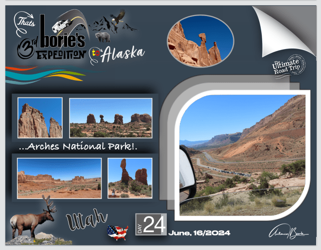
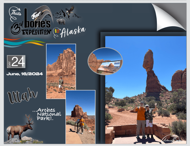
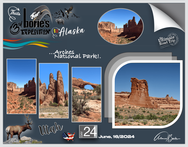
…e, iniciámos este dia dedicado aos parques nacionais situados a sudeste do estado do Utah…, depois das novas burocracias de entrada controlada, em que temos que nos inscrever antecipadamente via internet, para não haver congestionamento lá dentro e…, finalmente entrámos no “Arches Nacional Park”, adjacente ao Rio Colorado, onde existem mais de 2.000 arcos de arenito natural!.
…and, we started this day dedicated to the national parks located southeast of the state of Utah…, after the new controlled entry bureaucracies, in which we have to register in advance via the internet, to avoid congestion inside and…, we finally entered the “Arches National Park”, adjacent to the Colorado River, where there are more than 2,000 natural sandstone arches!.
…no Centro de Informação, situado na base das montanhas de arenito natural, recebemos toda a informação, podendo viajar na nossa “White Fox” (caravana), por todo o parque, parando aqui e ali, ou só nos pontos mais importantes, porque a estrada, embora estreita, tem alguma segurança, com subidas, precipícios, descidas algo assustadoras mas, o cenário compensa!.
…in the Information Center, located at the base of the natural sandstone mountains, we receive all the information, being able to travel in our “White Fox” (caravan), throughout the park, stopping here and there, or just at the most important points, because The road, although narrow, is somewhat safe, with climbs, cliffs and somewhat scary descents, but the scenery makes up for it!
…viajámos por numa extensão de mais de uma centena de milhas quadradas de alto deserto, localizado no Planalto do Colorado, com uma elevação de quase seis mil pés, que é na área da “Colina do Elefante”, sendo visitado por mais de um milhão de visitantes por ano!.
…we traveled through an expanse of over a hundred square miles of high desert, located on the Colorado Plateau, with an elevation of nearly six thousand feet, which is in the “Elephant Hill” area, being visited by over a million of visitors per year!.
…este parque é um paraíso, para quem como nós adora caminhar, pois são imensos os caminhos para percorrer e, dizem-nos que, provavelmente, esta região há cerca de 300 milhões de anos era mar, estava coberta de água salgada que, também provavelmente, foi evaporando, portanto hoje toda esta região está localizada, ou seja, “dorme sobre uma cama de sal evaporado subterrâneo”!.
…this park is a paradise for those like us who love walking, as there are countless paths to follow and, we are told that, probably, this region around 300 million years ago was sea, it was covered in salt water that It also probably evaporated, so today this entire region is located, in other words, “sleeping on a bed of evaporated underground salt”!
…que é a principal causa da formação dos seus arcos, torres, pedras equilibradas, barbatanas de arenito e monólitos erodidas nesta área!. Esta “cama de sal” tem milhares de metros de espessura em alguns lugares e foi depositado na “Bacia do Planalto do Colorado”, que é como chamam a esta área, há cerca de 300 milhões de anos, quando um qualquer mar, fluiu na região e, torno a dizer, provavelmente evaporou, como tentámos explicar no princípio!.
…which is the main cause of the formation of its arches, towers, balanced rocks, sandstone fins and eroded monoliths in this area!. This “salt bed” is thousands of meters thick in some places and was deposited in the “Colorado Plateau Basin”, which is what they call this area, about 300 million years ago, when some sea flowed into it. region and, I say again, it probably evaporated, as we tried to explain at the beginning!.
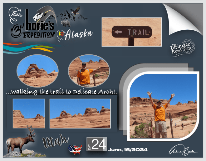
…Uff…, tanta história!. O dia estava de sol e céu azul, e nós, de uma maneira ou de outra, íamos progredindo e…, ainda tivemos força para caminhar a trilha que nos levou muito perto do mundialmente famoso “Arco Delicado”, e admirar um cenário de uma variedade de recursos e formações geológicas únicas, que contém a maior densidade de arcos naturais do mundo!. Valeu a pena!.
…Uff…, so much history!. The day was sunny and blue sky, and we, one way or another, were progressing and…, we still had the strength to walk the trail that took us very close to the world famous “Delicate Arch”, and admire a scenery of a variety of unique geological resources and formations, which contains the highest density of natural arches in the world!.
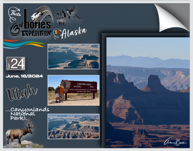
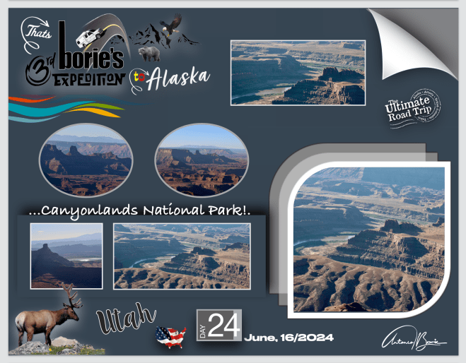
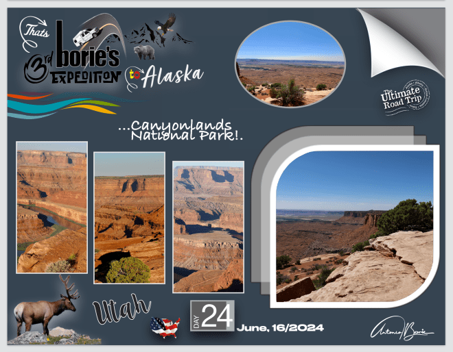
…saindo deste maravilhoso parque, um pouco ao norte entrámos na estrada #313, que subindo por algum tempo nos levou ao planalto onde se localiza a região norte do “Canyonlands Nacional Parque”, que muitos dizem que é ”o lugar mais estranho, maravilhoso e mágico do mundo e…, não há mais nada parecido em nenhum lugar”!.
…leaving this wonderful park, a little to the north we entered road #313, which, going up for some time, took us to the plateau where the northern region of the “Canyonlands Nacional Park” is located, which many say is “the strangest, most wonderful place and magical in the world and…, there is nothing like it anywhere else”!.
…será exagero?. Talvez!. No entanto, este é o maior parque nacional do estado de Utah, com imensas extensões de terra para explorar, localizado como no princípio já explicámos no sudeste de Utah, preservando uma paisagem colorida em numerosos desfiladeiros, mesas e buttes, pelo rio Colorado, pelo rio Green e pelos seus respectivos afluentes!.
…is it an exaggeration? Perhaps!. However, this is the largest national park in the state of Utah, with immense expanses of land to explore, located as we explained at the beginning in southeastern Utah, preserving a colorful landscape in numerous gorges, mesas and buttes, by the Colorado River, the Green River and its respective tributaries!.
…também nos oferece caminhadas ou observação de estrelas, porque os rios Colorado e Green, dividem o parque em quatro distritos, tais como, ilha no céu, agulhas, labirinto e os próprios rios, enquanto essas áreas compartilham uma atmosfera desértica primitiva, onde cada uma mantém o seu próprio carácter e oferece diferentes oportunidades de exploração!.
…also offers us hiking or stargazing, because the Colorado and Green rivers, divide the park into four districts, such as, island in the sky, needles, labyrinth and the rivers themselves, while these areas share a primitive desert atmosphere, where each one maintains its own character and offers different opportunities for exploration!.
…é um mundo de surpresas, com vales, montanhas, desfiladeiros, aberturas no solo feitas pelo Rio Colorado e seus afluentes, que por aqui deslizaram por milhões de anos, alguns animais pastando, grutas com desenhos feitos em rochas, pelos povos que por aqui habitaram, enfim muito daquilo que vemos nos filmes de “cowboys” antigos de Hollywood, com aqueles monumentos a sair do solo, que nos parecem feitos por alguém muito habilidoso, mas foi a natureza que os criou, e levaram milhões de anos até se formarem como hoje os vimos!.
…it is a world of surprises, with valleys, mountains, gorges, openings in the ground made by the Colorado River and its tributaries, which flowed here for millions of years, some animals grazing, caves with drawings made in rocks, by the people who here they inhabited, in short, much of what we see in old Hollywood “cowboy” movies, with those monuments coming out of the ground, which seem to us to have been made by someone very skilled, but it was nature that created them, and it took millions of years for them to form as we saw them today!
…depois, na mesma estrada mas já em direção ao norte, entrámos no “Parque Estadual Dead Horse Point”, queestá inserido no “Parque Nacional Canyonlands”, que já mencionámos, com imensas extensões de terra também para explorar, preservando uma paisagem colorida em numerosos desfiladeiros, mesas e buttes pelo rio Colorado, pelo rio Green e seus respectivos afluentes!.
…then, on the same road but heading north, we entered the “Dead Horse Point State Park”, which is part of the “Canyonlands National Park”, which we already mentioned, with immense expanses of land to explore, preserving a colorful landscape in numerous canyons, mesas and buttes along the Colorado River, the Green River and their respective tributaries!.
…é realmente uma parte especial do mundo!. É incrível ver o que a natureza por milhões de anos de atividade geológica, pode fazer num longo período de tempo, mostrando-nos a deposição de sedimentos nos oceanos, lagos de água doce, vento e dunas de areia, que criou as camadas rochosas do interior deste desfiladeiro!.
…it really is a special part of the world!. It is incredible to see what nature, millions of years of geological activity, can do over a long period of time, showing us the deposition of sediments in the oceans, freshwater lakes, wind and sand dunes, which created the rock layers of the Earth. inside this canyon!
…está localizado em uma altitude de 5.900 pés mas, mesmo neste ambiente hostil, com temperaturas extremas e falta de fonte de água, plantas e animais vivem por aqui!. As plantas crescem muito lentamente, por exemplo, uma simples árvore de 15 pés de altura, pode ter centenas de anos!.
…it is located at an altitude of 5,900 feet but, even in this hostile environment, with extreme temperatures and lack of water sources, plants and animals live here!. Plants grow very slowly, for example, a simple 15 foot tall tree can be hundreds of years old!
…existem diferentes histórias sobre como esta terra recebeu este incomum nome de “Parque Estadual Ponto do Cavalo Morto” e, parece-nos que a história que mais prevalece é que o nome veio do seu uso como um corral natural para mustangs, usado por vaqueiros no século XIX!. O planalto é cercado por falésias de 2.000 pés de altura, com apenas uma faixa estreita de terra de 27m de largura que liga a área ao planalto principal, sendo essa a razão pela qual era fácil para os “cowboys” cercar este estreito e impedir que os cavalos selvagens fugissem!. Todavia, vai lá saber-se porquê, uma vez, por alguma qualquer razão desconhecida, os cavalos foram deixados lá sem água, onde morreram de sede, à vista do rio Colorado, que deslizava a 2.000 pés abaixo!.
…there are different stories about how this land received its unusual name of “Dead Horse Point State Park”, and, it seems to us that the most prevalent story is that the name came from its use as a natural corral for mustangs, used by cowboys in the 19th century!. The plateau is surrounded by 2,000 foot high cliffs, with only a narrow strip of land 27m wide connecting the area to the main plateau, which is why it was easy for the “cowboys” to surround this strait and prevent the wild horses ran away!. However, we will find out why, once, for some unknown reason, the horses were left there without water, where they died of thirst, within sight of the Colorado River, which was flowing 2,000 feet below!.
…acampámos aqui, pernoitando neste parque, onde nos foi concedido o uso de água e outras facilidades!.
…we camped here, spending the night in this park, where we were granted the use of water and other facilities!.
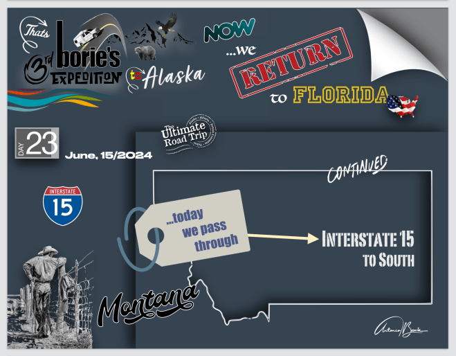
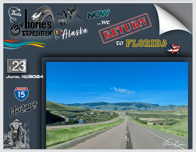
…continuando a viajar pela auto-estrada I-15 quase deserta, sempre em direcção ao sul, o cenário era…, aqui e ali, campos ondulados com grandes manadas de gado bovino pastando, pequenas montanhas e planícies, onde a cor verde era constante, e olhando o céu…, podíamos ver um azul maravilhoso!.
…continuing to travel along the almost deserted I-15 highway, always heading south, the scenery was…, here and there, rolling fields with large herds of cattle grazing, small mountains and plains, where the green color was constant, and looking at the sky…, we could see a wonderful blue!.
…entretanto passámos a fronteira para o estado de Idaho, onde já havia poucas montanhas, dando lugar a planícies de plantações de batatas e cereais!.
…in the meantime we crossed the border into the state ofIdaho, where there were few mountains, giving way to plains with potato and cereal plantations!.
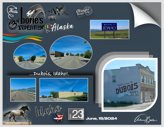
…e como necessitávamos de comprar gasolina, café e alguns géneros alimentícios, parámos na cidade de Dubois, que é uma pequena cidade, mas que deixa uma grande impressão aos visitantes tal com nós, porque nos pareceu acolhedora e situa-se fora das rotas habituais, onde se pode descobrir o fascínio das pequenas cidades do oeste, dando-nos oportunidade para uma pequena viagem panorâmica, ou seja, uma viagem no tempo, onde podemos experimentar um pouco da cultura americana do antigamente!.
…and as we needed to buy gasoline, coffee and some foodstuffs, we stopped in the city of Dubois, which is a small city, but which leaves a great impression on visitors like us, because it seemed welcoming and is located off the usual routes, where you can discover the fascination of the small cities of the West, giving us the opportunity for a small panoramic trip, that is, a journey through time, where we can experience a little of the American culture of the past!.
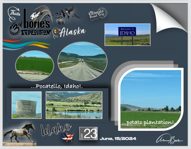
…e continuando a nossa jornada rumo ao sul, simplesmente afrouxámos ao passar pela cidade de Pocatello, porque as plantações de batata eram constantes serpenteando por pitorescas terras agrícolas, oferecendo um vislumbre do charme rústico, ou seja, uma verdadeira essência do charme rural, em contraste com as paisagens quase desérticas que tínhamos vindo a apreciar antes!.
…and continuing our journey south, we simply slacked off as we passed through the city of Pocatello, because the potato fields were constant meandering through picturesque farmland, offering a glimpse of rustic charm, in other words, a true essence of rural charm, in contrast with the almost desert landscapes that we had been enjoying before!.
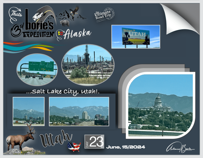
…entretanto passámos a fronteira para o estado do Utah!. Um tempo depois, o tráfico ficou quase congestionado, porque havia um grande encontro de estradas!. Era a área da grande cidade de Salt Lake City que continua a expandir-se para sul por milhas e milhas, com construção de novas moradias na encosta das montanhas que a circundam do lado leste, que já se pode ver quase coberta na sua totalidade!.
…in the meantime we crossed the border into the state of Utah!. A while later, traffic became almost congested, because there was a large junction of roads!. It was the area of the large city of Salt Lake City that continues to expand south for miles and miles, with new housing being built on the slopes of the mountains that surround it on the east side, which can now be seen almost covered in its entirety! .
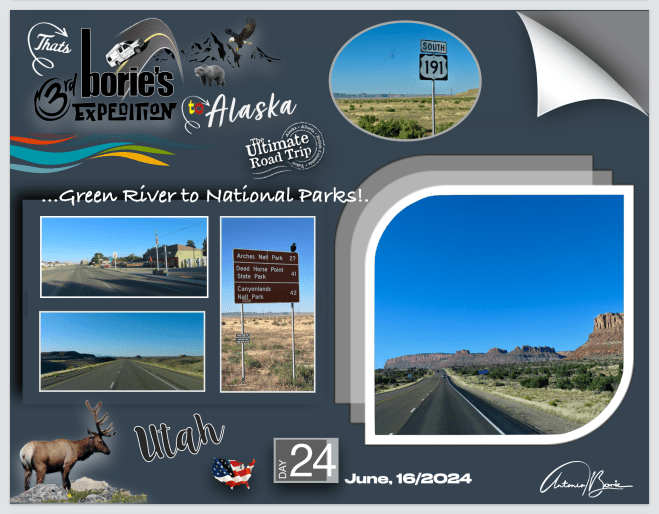
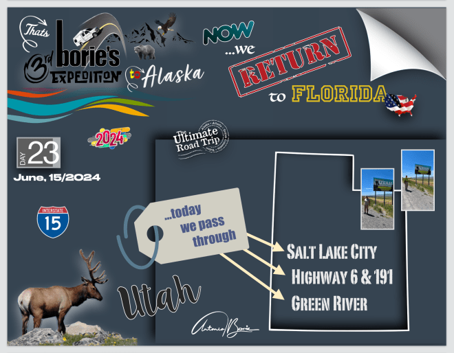
…mais a sul, e poupando algumas milhas no nosso percurso, saímos da auto-estrada I-15, entrando nas estradas cénicas e para o interior leste, #6 e #191, onde já se começaram a ver pequenas montanhas e outros monumentos naturais do sul do Utah…, sem qualquer vegetação!. Eram milhas e milhas de terra árida e deserta, localizadas fora dos roteiros mais conhecidos, onde cada milha passada, era uma oportunidade de se poder mergulhar num cenário do típico sul…, deste para nós, maravilhoso estado do Utah, e…, onde tencionávamos nos dias seguintes, visitar alguns dos seus parques naturais!.
…further south, and saving a few miles on our route, we left the I-15 highway, entering the scenic roads and towards the eastern interior, #6 and #191, where we started to see small mountains and other natural monuments from southern Utah…, without any vegetation!. There were miles and miles of arid and deserted land, located off the beaten track, where every mile passed was an opportunity to immerse yourself in a typical southern scenario…, given to us, the wonderful state of Utah, and…, where we intended In the following days, visit some of its natural parks!
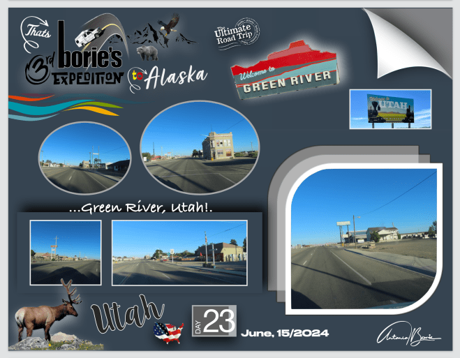
…já na auto-estrada I-70, rumo ao leste, parámos da pequena cidade de Green River, que já foi em tempos uma rota comercial da “Old Spanish Trail” que atravessava o rio Verde, na área da moderna e actual pequena cidade de Green River, que constantemente se está a modernizar, com hotéis, restaurantes e estações de gasolina gigantes, com supermercados que vendem tudo o que um viajante necessita, dando apoio às centenas de veículos comercias e não só, que transitam pela auto-estrada Interstate 70 nos dois sentidos!. Pernoitámos aqui, num parque de RV, próximo!.
…already on the I-70 highway, heading east, we stopped at the small town of Green River, which was once a commercial route of the “Old Spanish Trail” that crossed the Verde River, in the area of the modern and current small town of Green River, which is constantly being modernized, with hotels, restaurants and giant gas stations, with supermarkets that sell everything a traveler needs, supporting the hundreds of commercial and other vehicles that travel along the Interstate highway I-70 both ways!. We spent the night here, in a nearby RV park!
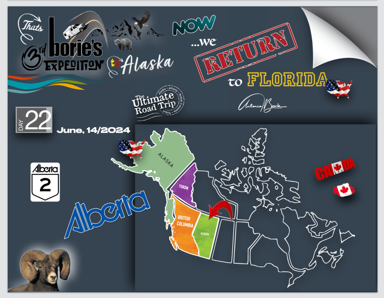
…hoje pela manhã o céu estava limpo e não havia muito tráfico quando viajámos nesta parte sul da província de Alberta, na nossa rota em direcção à fronteira com os USA!. O cenário era de grandes quintas cultivadas, e aqui e ali grandes armazéns de recolha de cereais junto do caminho de ferro, que quase seguia junto à estrada!.
…this morning the sky was clear and there wasn’t much traffic as we traveled in this southern part of the province of Alberta, on our route towards the border with the USA!. The scenery was of large cultivated farms, and here and there large grain collection warehouses next to the railway, which almost ran alongside the road!.
…até que chegámos à cidade de Lethbridge que recentemente se tornou a quarta cidade da província de Alberta, ultrapassando os 100.000 habitantes, talvez derivado às vizinhas Montanhas Rochosas do Canadá, que contribuem para os verões quentes e invernos amenos, desta bonita cidade que fica a sudeste de Calgary, e que é um centro comercial e financeiro no sul da província de Alberta, e com uma estrada rápida, que liga à fronteira com os USA!.
…until we arrived at the city of Lethbridge, which recently became the fourth city in the province of Alberta, exceeding 100,000 inhabitants, perhaps due to the neighboring Canadian Rockies, which contribute to the hot summers and mild winters of this beautiful city, which is located southeast of Calgary, which is a commercial and financial center in the south of the province of Alberta, and with a fast road that connects to the border with the USA!.
…continuávamos rumo ao sul e como a maioria dos campos bem cultivados em todo o mundo, estes que o cenário nos ia mostrando eram magnificamente verdes e…, depois de passar a cidade que leva o nome de Milk River, que é um rio que por lá passa que flui para sul, fazendo parte do sistema de drenagem do famoso rio Mississippi, cuja água é que alimenta as diversas quintas e pecuárias que cercam a cidade!.
…we continued heading south and like most well-cultivated fields around the world, what the scenery showed us were magnificently green and…, after passing the city named after Milk River, which is a river that There it flows south, forming part of the drainage system of the famous Mississippi River, whose water feeds the various farms and livestock that surround the city!.
…chegámos finalmente à fronteira com os USA!. Esperámos o momento de ser atendidos pelo oficial de serviço que nos perguntou aquelas perguntas frequentes tais como: “leva álcool, marijuana, armas de fogo, dinheiro em quantidade superior a uma certa quantia, animais, outras pessoas sem ser aquelas que mostrámos nos passaportes, mais isto e mais aquilo”!. E nós, olhámos o oficial nos olhos e…, dissemos: “senhor oficial, o que nós queremos é ir para casa”!. Ele mostrou um sorriso e disse: “Bem vindos a casa”!.
…we finally reached the border with the USA! We waited for the moment to be attended to by the officer on duty who asked us frequently asked questions such as: “do you carry alcohol, marijuana, firearms, money in excess of a certain amount, animals, other people other than those shown in your passports, more this and more that”!. And we looked the officer in the eye and… we said: “Mister Officer, what we want is to go home”!. He showed a smile and said: “Welcome home”!.
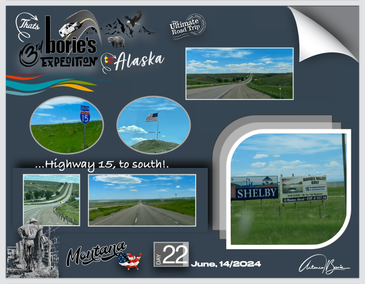
…e lá seguimos pela auto-estrada #15, em direcção ao sul, com longas, mesmo longas retas e curvas também longas e suaves, parando na cidade de Shelby, que para nós, é um lugar…, quase um entreposto comercial de fronteira, onde usámos as suas facilidades e nos abastecemos de alimentos e gasolina!.
…and there we followed highway #15, heading south, with long, really long straights and long, smooth curves, stopping in the city of Shelby, which for us is a place…, almost a border trading post, where we used its facilities and supplied ourselves with food and gasoline!.
…viajando e querendo fazer o maior número de milhas nesta quase deserta auto-estrada, cujo cenário era campos verdes e aqui e ali algum gado bobino pastando, parámos no “Missouri River Canyon”, cuja paisagem é magnífica e pode ser vista de um mirante de nível superior, com o rio lá no fundo e as falésias e as formações calcárias…, que ladeiam neste local o ainda pequeno Rio Missouri, que é um dos maiores e mais importantes rios dos USA!.
…travelling and wanting to do as many miles on this almost deserted highway, whose backdrop was green fields and here and there some cattle grazing, we stopped at the “Missouri River Canyon”, whose landscape is magnificent and can be seen from a viewpoint at a higher level, with the river at the bottom and the cliffs and limestone formations…, which flank the still small Missouri River in this place, which is one of the largest and most important rivers in the USA!.
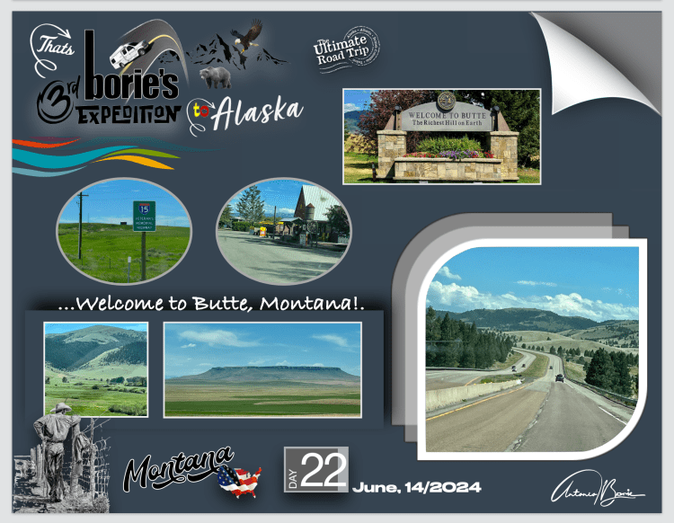
…e, continuando a viajar com a estrada quase deserta como acima já referimos, quase no local onde esta estrada se junta por alguma distância com a auto-estrada #90, parámos num parque de RV, próximo da cidade de Butte, ainda no estado de Montana, onde pernoitámos!.
…and, continuing to travel with the almost deserted road as we mentioned above, almost at the place where this road joins highway #90 for some distance, we stopped at an RV park, close to the city of Butte, still in the state from Montana, where we spent the night!.
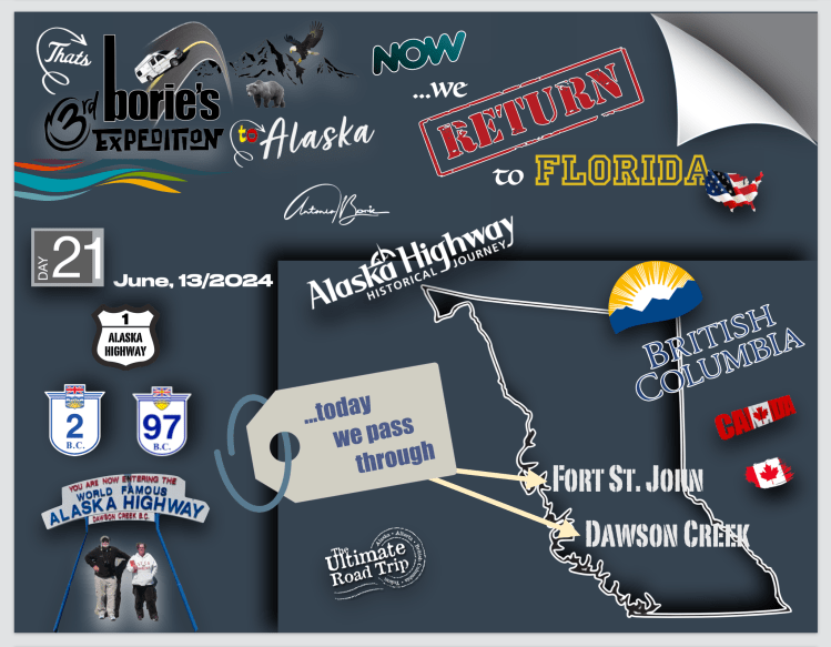
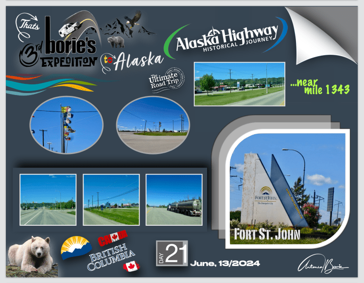
…o dia estava de céu aberto, já não havia chuva e estávamos perto da cidade de Forte Saint John, na província da Columbia Britânica, que é uma grande comunidade, com restaurantes, lojas comerciais, centro de visitas com internet e vária informação, estações de assistência mecânica e venda de gasolina, tal como lojas para viajantes, entre outras atracções!. Parámos para comprar café, biscoitos e gasolina!
…the day was clear, there was no more rain and we were close to the city of Fort Saint John, in the province of British Columbia, which is a large community, with restaurants, commercial stores, a visitor center with internet and various information, stations mechanical assistance and gasoline sales, as well as shops for travelers, among other attractions!. We stopped to buy coffee, cookies and gas!.
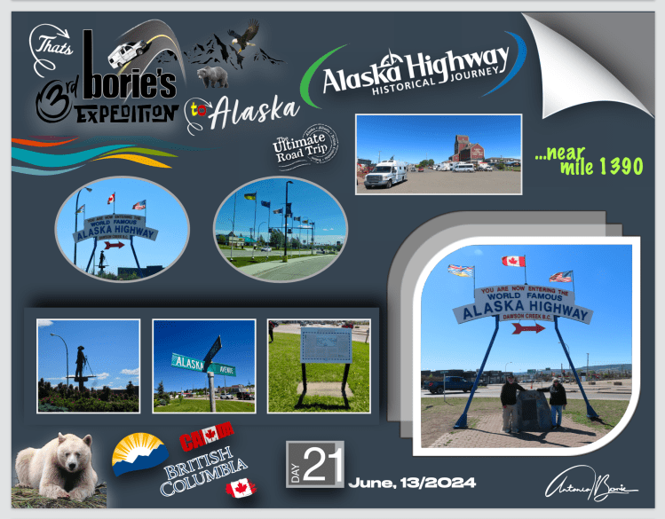
…viajando mais umas dezenas de milhas, chegámos onde umas semanas antes tínhamos partido, que era a cidade de Dawson Creek!. Em resumos anteriores já explicámos um pouco do que é a cidade, no entanto aqui existe um marco histórico assinalando o começo desta histórica estrada, onde dizem que é uma tradição de “boa sorte” tirar uma foto junto a este local!.
…travelling a few dozen more miles, we arrived where we had left a few weeks before, which was the city of Dawson Creek!. In previous summaries we have already explained a little about what the city is, however here there is a historical marker marking the beginning of this historic road, where they say it is a “good luck” tradition to take a photo next to this place!.
…parámos aqui e…, a nossa intenção era homenagear a nossa “White Fox” (caravana), por nos ter transportado mais uma vez não só através desta lendária estrada como também pelas estradas do Alaska, com chuva, neve, frio, buracos e às vezes até pequenas inundações, viajando milhares e milhares de milhas contínuas!.
…we stopped here and…, our intention was to pay homage to our “White Fox” (caravan), for once again transporting us not only through this legendary road but also along the roads of Alaska, with rain, snow, cold, potholes and sometimes even small floods, traveling thousands and thousands of continuous miles!.
…assim, foi eleita a “estrela do dia”, levando-a a uma oficina de mecânica especializada para manutenção e um completo diagnóstico, porque requer um certo cuidado com a sua manutenção!. As estradas com buracos, frequentes paragens forçadas e repentinas, tal como outros problemas como pedra miúda, poeira e lama, inundações repentinas ou curvas estreitas e inclinadas, sem mencionar um clima de neve, sol ou chuva puxada por forte vento, fazem com que os veículos percam alguma resistência e…, se não houver cuidado ficamos parados em qualquer lugar remoto…, e isso pode equivaler…, à morte de qualquer de nós!.
…thus, it was chosen as the “star of the day”, taking it to a specialized mechanics workshop for maintenance and a complete diagnosis, because it requires a certain amount of care with its maintenance!. Roads with potholes, frequent forced and sudden stops, as well as other problems such as small rocks, dust and mud, sudden floods or narrow and inclined curves, not to mention a climate of snow, sun or rain driven by a strong wind, cause the vehicles lose some resistance and…, if we are not careful we end up stuck in any remote place…, and this could be equivalent… to the death of any of us!.
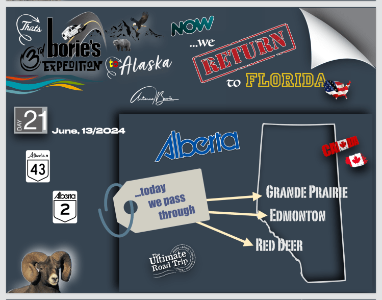
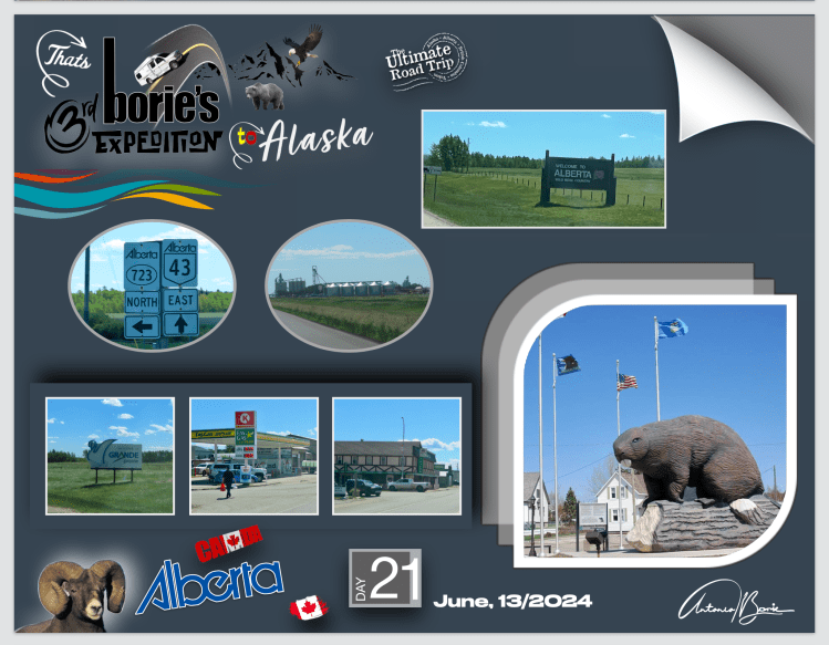
…ficou como nova…, porque até a lavaram!. Como tal, seguimos viajem, agora rumo ao sul, ou seja, à fronteira com os USA!. Entre outras povoações, passámos pela cidade de Grande Prairie, uma pequena “metrópole”, já na província de Alberta, que é uma das dez províncias do Canadá, que foi criada no ano de 1905, quando se separou dos “Territórios do Noroeste”, que eram parte das “Províncias das Pradarias” e das “Províncias Ocidentais!.
…it looked like new…, because they even washed it! As such, we continue our journey, now heading south, that is, to the border with the USA!. Among other towns, we passed through the city of Grande Prairie, a small “metropolis”, in the province of Alberta, which is one of the ten provinces of Canada, which was created in 1905, when it separated from the “Northwest Territories”, which were part of the “Prairie Provinces” and the “Western Provinces!.
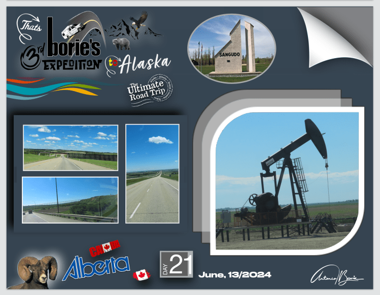
…sempre rumo ao sul e um pouco desviados para leste, chegámos à cidade de Edmonton, a capital política e industrial desta província, porque Alberta possui uma das economias mais fortes e influentes do Canadá, onde as suas quintas abastecem todo o Canadá!. Em outras palavras, é Alberta que dá de comer ao Canadá, porque também é uma grande produtora de petróleo e de gás natural, produzindo mais de 70% do petróleo e do gás natural do Canadá!.
…always heading south and a little diverted to the east, we arrived in the city of Edmonton, the political and industrial capital of this province, because Alberta has one of the strongest and most influential economies in Canada, where its farms supply the whole of Canada)!. In other words, it is Alberta that feeds Canada, because it is also a major producer of oil and natural gas, producing more than 70% of Canada’s oil and natural gas!
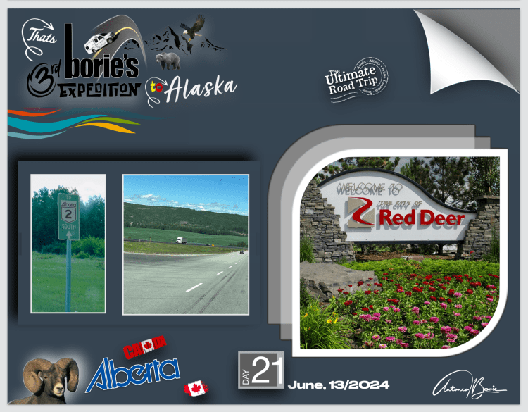
…e a nossa jornada continuava rumo à fronteira com os USA, percorrendo planícies, zonas desertas, vendo poços de petróleo trabalhando, manadas de gado bovino, quintas em funcionamento, máquinas agrícolas com o pessoal trabalhando e com um tráfico a ficar cada vez mais intenso…, até que chegámos à cidade de Red Deer, onde pernoitámos num parque de RV e…, dado o adiantado da hora, comemos fruta, pão ou biscoitos!.
…and our journey continued towards the border with the USA, crossing plains, desert areas, seeing oil wells working, herds of cattle, farms in operation, agricultural machines with people working and with traffic becoming increasingly intense …, until we arrived in the city of Red Deer, where we spent the night in an RV park and…, given the late hour, we ate fruit, bread or cookies!.