

…é uma excelente caminhada localizada na área da cidade de Daytona Beach, com um comprimento de aproximadamente 2,4 milhas de ida e volta e…, para lá chegar podemos seguir pela estrada US 92 para oeste por uma distância de 4.2 milhas até ao semáforo para Indian Lake Road, onde devemos entrar na faixa da esquerda e observar a sinalização do início da trilha no lado oposto da estrada, usando a próxima curva para entrar nas pistas no sentido leste da estrada US 92 para chegar ao início da trilha!.
…is an excellent hike located in the area of the city of Daytona Beach, with a length of approximately 2.4 miles round trip and…, to get there we can follow US 92 west for a distance of 4.2 miles to the traffic light to Indian Lake Road, where we should enter in the left lane and watch for trailhead signage on the opposite side of the road, using the next turn to enter the eastbound lanes of US 92 to reach the trailhead!.
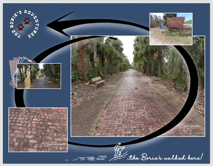
…esta excelente trilha, embora tenha permanecido lá por mais de um século, apenas escondida na floresta ao lado da sua substituta, que é a hoje estrada US 92, no seu início era a Estrada Pershing, que praticamente desapareceu da memória das pessoas e vai abrindo um túnel numa vasta floresta pantanosa, agora protegida como Tiger Bay State Forest, numa faixa de extensão de estrada de tijolos preservados desde o ano de 1917, oferecendo-nos uma visão do início das viagens de automóvel na Flórida!.
…this excellent trail, although it remained there for more than a century, just hidden in the forest next to its replacement, which is today US Highway 92, at its beginning was the Pershing Road, which has practically disappeared from people’s memory and will Tunneling through a vast swamp forest, now protected as Tiger Bay State Forest, on a stretch of brick road preserved since 1917, offering us a glimpse into the beginning of automobile travel in Florida!.
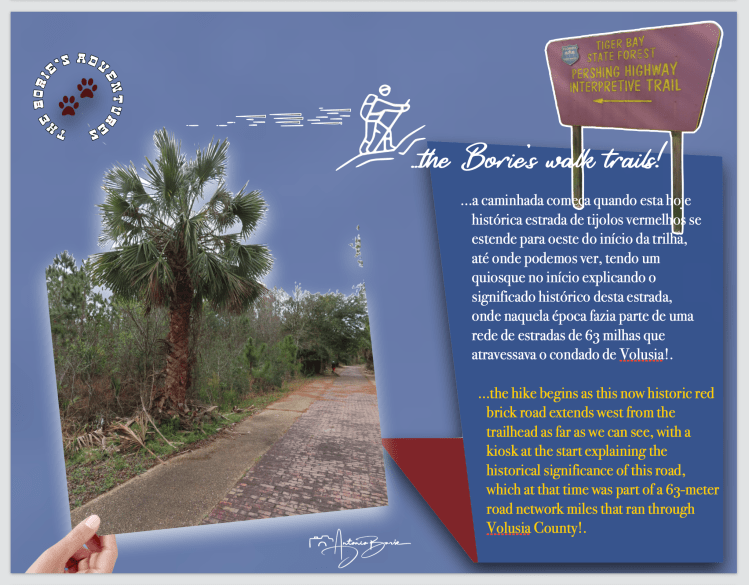
…a caminhada começa quando esta hoje histórica estrada de tijolos vermelhos se estende para oeste do início da trilha, até onde podemos ver, tendo um quiosque no início explicando o significado histórico desta estrada, onde naquela época fazia parte de uma rede de estradas de 63 milhas que atravessava o condado de Volusia!.
…the hike begins as this now historic red brick road extends west from the trailhead as far as we can see, with a kiosk at the start explaining the historical significance of this road, which at that time was part of a 63-meter road network miles that ran through Volusia County!.
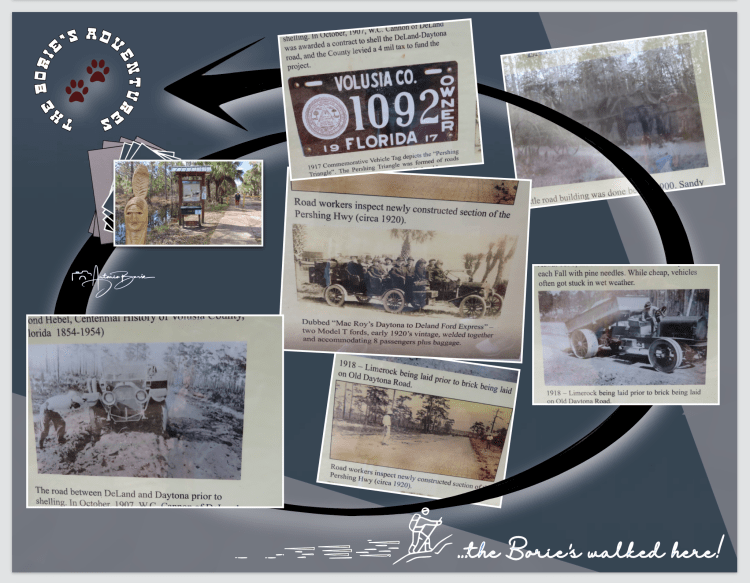
…a história diz-nos que o seu nome foi nomeado em homenagem a um general da Primeira Guerra Mundial com ligações com a área, e claro, a Estrada Pershing depressa atingiu a maioridade, pelo menos para carros na área do Modelo A!. Este segmento específico foi iniciado em 1917 para conectar as cidades de Daytona Beach com DeLand, havendo mesmo outra parte que ia de DeLand a Ormond Beach, conectando-se de volta a Daytona!. Como tal, juntas, elas eram conhecidas como Triângulo de Pershing, uma das primeiras estradas da Flórida, e foram lembradas quando a Tiger Bay State Forest construiu o início desta excelente trilha, que foi também quando esta jóia histórica que estava escondida, finalmente voltou aos holofotes!.
…history tells us that it was named after a World War I general with ties to the area, and of course, the Pershing Road soon came of age, at least for cars in the Model A area! This specific segment was started in 1917 to connect the cities of Daytona Beach with DeLand, there was even another part that went from DeLand to Ormond Beach, connecting back to Daytona!. As such, together they were known as the Pershing Triangle, one of Florida’s first roads, and were remembered when the Tiger Bay State Forest built the beginning of this excellent trail, which was also when this once-hidden historical gem finally returned to the spotlight!.
…naquela época, poucas pessoas possuíam carros!. A estrada tinha apenas a largura da superfície de tijolos, com quase dois metros e meio de largura!. Depois que o trânsito aumentou e os carros precisaram passar uns pelos outros, foi necessário alargar a estrada e assim, flancos de pedra Chattahoochee foram adicionados em ambos os lados!.
…at that time, few people owned cars! The road was only as wide as the brick surface, nearly eight feet wide! After traffic increased and cars needed to pass each other, it was necessary to widen the road and so Chattahoochee stone flanks were added on both sides!.
…depois, anos mais tarde quando a US 92 foi inaugurada no ano de 1947, esta estrada desapareceu da vista e da memória das pessoas, no entanto podemos ver com que facilidade a floresta a recuperou e…, só depois dos devastadores incêndios florestais de 1998 é que foi redescoberta!. Em 2011, tropas escoteiras e voluntários de Daytona limparam o mato para permitir que o serviço florestal a abrisse de novo, agora como uma trilha!.
…then, years later when US 92 was opened in 1947, this road disappeared from people’s sight and memory, however we can see how easily the forest recovered it and…, only after the devastating forest fires of 1998 is that it was rediscovered! In 2011, Boy Scout troops and Daytona volunteers cleared the brush to allow the Forest Service to open it again, now as a trail!.
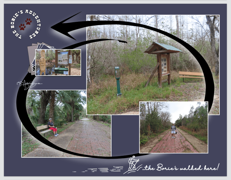
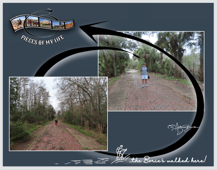
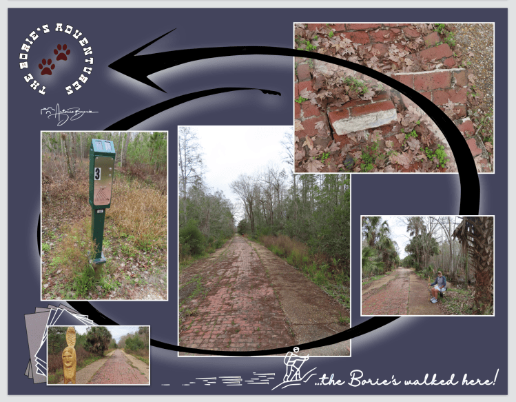
…voltando ao que vimos durante a nossa caminhada, o habitat circundante são florestas de pinheiros, existindo aqui e ali alguns bancos e um marcador de quilometragem que nos aparece após o primeiro quarto de milha e continuam por quarto de milha até o último banco!. A floresta faz a transição para uma planície húmida, com pinheiros e ciprestes e vegetação mista de pântano abaixo!.
…returning to what we saw during our walk, the surrounding habitat is pine forests, with here and there some benches and a mile marker that appears after the first quarter of a mile and continues for a quarter of a mile until the last bench!. The forest transitions to a moist plain, with pine and cypress trees and mixed swamp vegetation below!.
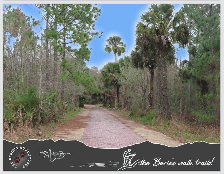
…depois de alguma distância percorrida, existem duas pequenas pontes que permitem que uns riachos escuros ladeados de ciprestes fluam sob a estrada!. Na trilha também existem algumas curvas lentas onde os salgueiros e algumas palmeiras rasteiras formam uma parede densa em frente aos ciprestes e pinheiros mais altos e quanto mais avançamos, mais selvagem a floresta parece, aglomerando-se de ambos os lados!.
…after some distance covered, there are two small bridges that allow dark streams lined with cypress trees to flow under the road!. On the trail there are also some slow curves where the willows and some low-lying palms form a dense wall in front of the taller cypresses and pines and the further we go, the wilder the forest seems, crowding on both sides!.

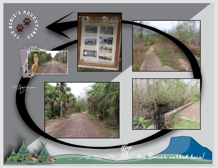
…a trilha termina oficialmente num quiosque e banco na marca de 1 milha!. Aqui, podemos ler todas as informações, pois elas falam mais detalhadamente sobre o sistema rodoviário do Pershing Triangle!. Os tijolos continuam passando pelo quiosque e a estrada desmorona no pântano que divide esta histórica estrada da US 92!.
…the trail officially ends at a kiosk and bench at the 1 mile mark!. Here, we can read all the information as it talks in more detail about the Pershing Triangle road system!. The bricks continue to pass the kiosk and the road collapses into the swamp that divides this historic road from US 92!.
…ufff…, dizem-nos também que já viram ursos ao longo desta excelente trilha!. Nós, felizmente não vimos nenhum!.
…ufff…, they also tell us that they have seen bears along this excellent trail! We luckily didn’t see any!
Tony Borie, Século XXI. (Tony Borie, 21st Century).
