

…o horizonte do centro de Seattle, bem como as Montanhas Olímpicas e Cascade, Mount Raineier, Mount Baker, Elliott Bay e as ilhas vizinhas, podem ser vistas do topo da Space Needle!.
…the downtown Seattle skyline, as well as the Olympic and Cascade Mountains, Mount Raineier, Mount Baker, Elliott Bay and surrounding islands can be viewed from the top of the Space Needle!.
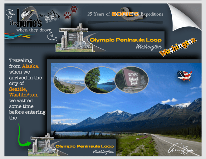
…guiando por um labirinto viaturas, que é muito típico nas grandes cidades, chegámos à área do Porto de Seattle, com muita sorte, encontrámos um espaço para a nossa “White Fox” (caravana) descansar!.
…driving through a labyrinth of vehicles, which is very typical in big cities, we arrived in the Seattle harbor area, with great luck, we found a space for our “White Fox” (caravan) to rest!.
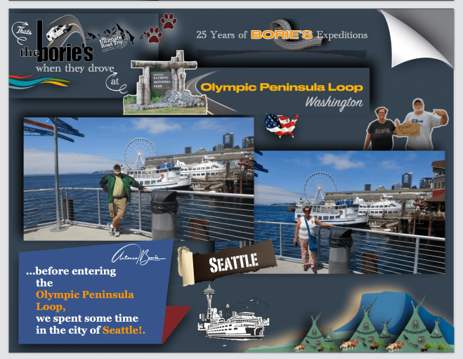
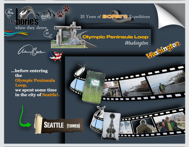
…quando tencionávamos abandonar a cidade de Seattle, surge sol e céu azul, num momento tirámos algumas fotos no que entendemos ser, o melhor local, na frente da Baía!.
…when you intend to leave the city of Seattle, sun rises and blue sky, in a moment we took some photos in what we understand to be, the best place, in front of the Bay!.
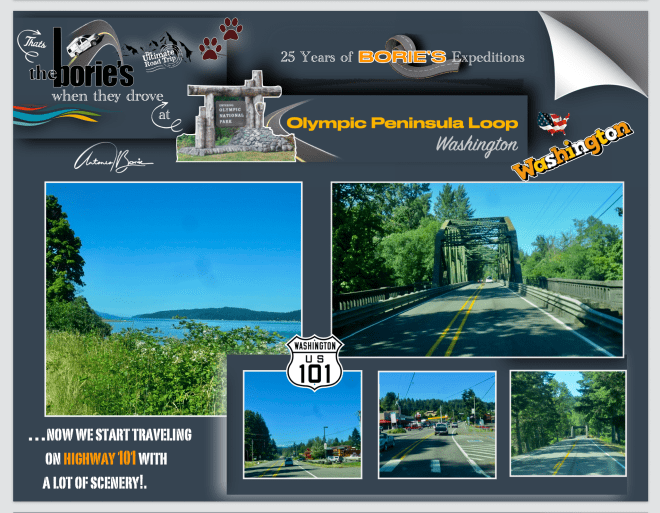
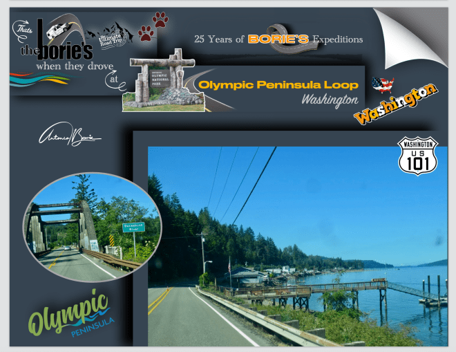
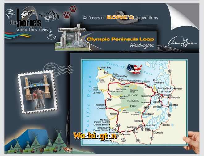
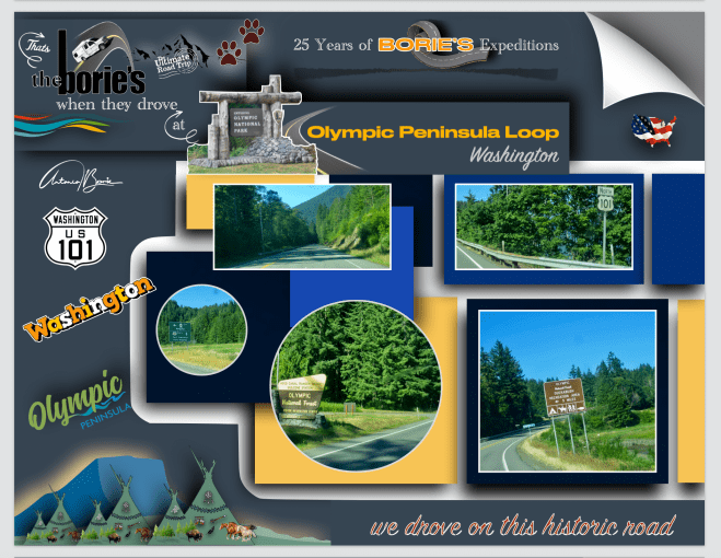
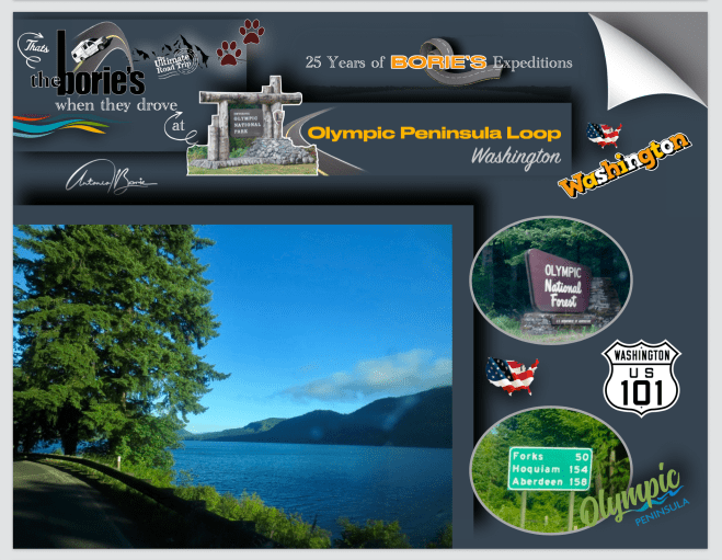
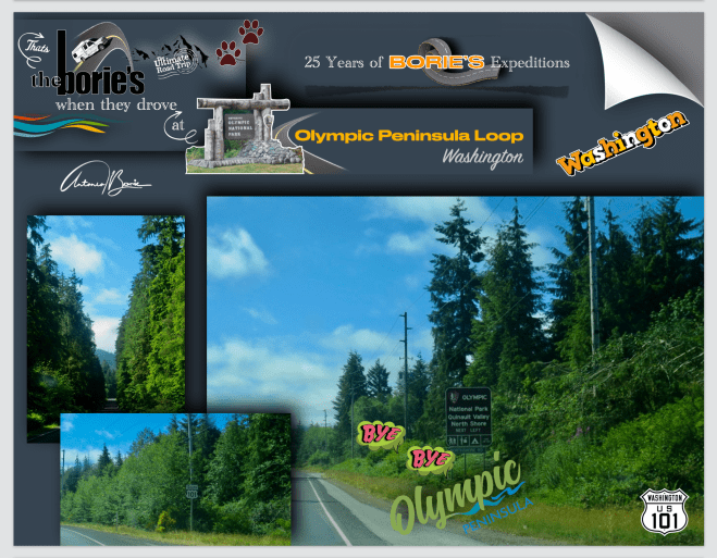
…quando entrámos no Highway 101, no sentido norte, a nossa intenção é percorrer a área das Montanhas Olímpicas, em toda a sua extensão, pois talvez amanhã, quando regressarmos pela costa do Oceano Pacífico, no sentido sul, nos disseram que o cenário é único!.
…when we entered Highway 101, heading north, our intention is to traverse the area of the Olympic Mountains, in all its extension, because perhaps tomorrow, when we return by the coast of the Pacific Ocean, heading south, we were told that scenery is unique!.
…a Floresta Nacional Olímpica é uma Floresta Nacional dos USA, localizada em Washington, com uma área de 628.115 acres (2.541,89 km2), quase envolve o Parque Nacional Olímpico e a Serra Olímpica!. A Floresta Nacional Olímpica contém partes dos condados de Clallam, Grays Harbor, Jefferson e Mason!. A paisagem da floresta nacional varia, desde a Floresta Tropical Olímpica temperada, até ao fiorde de água salgada do Canal da Capota, e estende-se até aos picos do Monte Washington!.
...the Olympic National Forest is a USA National Forest located in Washington, with an area of 628,115 acres (2,541.89 km2), it nearly surrounds Olympic National Park and the Olympic Mountain range!. Olympic National Forest contains parts of Clallam, Grays Harbor, jefferson and Mason counties!. The landscape of the national forest varies, from the temperate Olympic rain forest to the salt water fjord of Hood Canal to the peaks of Mt. Washington!.

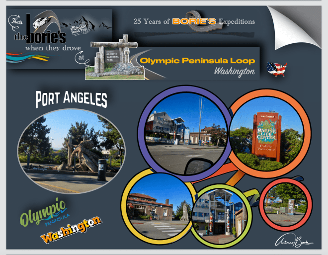
…paramos nesta pitoresca povoação, de Port Angeles, que há muitos anos se chamava “Puerto de Nuestra Señora de los Angeles”, que foi explorado pelo explorador espanhol Francisco de Eliza em 1791!. Em meados do século 19, após a colonização dos ingleses dos Estados Unidos, o nome foi encurtado e parcialmente anglicizado em sua forma atual de Port Angeles Harbour!.
…stop at this picturesque village, the city’s harbor was dubbed “Puerto de Nuestra Senora de los Ángeles” (Port of Our Lady of the Angels) by Spanish explorer Francisco de Eliza in 1791!. By the mid-19th century, after settlement by English speakers from the United States, the name was shotened and partially anglicized to its current form Port Angeles Harbor!.

…íamos entrando na floresta do parque Olímpico, com 8,5 milhas de comprimento, o Dungeness Spit é a maior área de areia do mundo e abriga o Refúgio Nacional da Vida Selvagem de Dungeness!. O refúgio é um santuário para mais de 250 espécies de aves, 41 espécies de mamíferos terrestres e oito espécies de mamíferos aquáticos!. As suas trilhas e áreas para piquenique oferecem vistas deslumbrantes das praias, do porto de Dungeness e do estreito de Juan de Fuca!.
…we were entering the forest of the Olympic park, 8.5 miles long, the Dungeness Spit is the largest sand area in the world and is home to the National Wildlife Refuge of Dungeness !. The refuge is a sanctuary for more than 250 species of birds, 41 species of land mammals and eight species of aquatic mammals !. Its trails and picnic areas offer stunning views of the beaches, the port of Dungeness and the Juan de Fuca Strait!.
…a Floresta Nacional Olímpica, é um a área onde a paisagem da floresta varia, pois vai desde uma zona temperada, passando pelos fiordes de água salgada do Canal da Capota, até aos picos do Monte Washington, como tal, aqui está sol, ali chove, acolá pode estar nevoeiro e mais além a temperatura é fresca, quente ou assim, assim!.
…the National Olympic Forest, is an area where the landscape of the forest varies, ranging from a temperate zone, passing through the salt water fjords of the Hood Canal, to the peaks of Mt. Washington, as such, here is sun, there it rains, there may be fog and beyond the temperature is cool, hot or so, like this!.
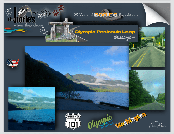
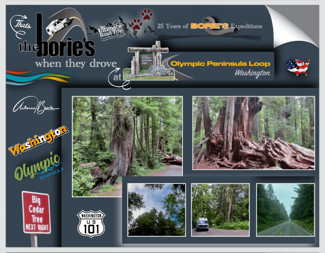
… como já devem de ter observado nas fotos, o clima mudou!. Entrámos na área no Parque Nacional Olímpico, localizado no estado de Washington, na Península Olímpica!. O parque tem quatro regiões básicas, o litoral do Pacífico, as áreas alpinas, a floresta tropical temperada do lado oeste e as florestas do lado leste mais seco!. Dentro do parque existem três ecossistemas distintos, que são florestas sub-alpinas e prados selvagens, florestas temperadas e a costa do Pacífico!. Esses três ecossistemas diferentes estão em condições precárias e têm um cenário excepcional!.
…as you may have noticed in the photos, the weather has changed!. We entered the Olympic national Park located in the state of Washington, on the Olympic Peninsula!. The park has four basic regions, the Pacific coastline, alpine areas, the west side temperate rainforest and the forests of the drier east side!. Within the park there are three distinct ecosystems which are sub-alpine forest and wildflower meadow, temperate forest, and the rugged Pacific Shore. These three different ecosystems are in pristine condition and have outstanding scenery!.
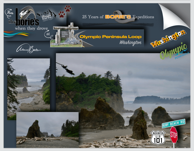
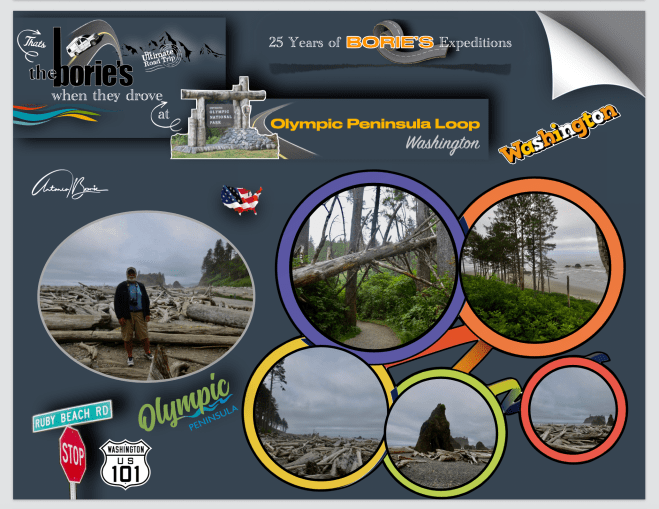
…para milhares de espécies marinhas, Ruby Beach é uma das áreas mais visitadas do Parque Nacional Olímpico, onde as suas águas costeiras são um porto seguro!. O ambiente marinho e as ilhas marítimas são protegidas por três refúgios nacionais de vida selvagem e pelo Santuário Marinho Nacional da Costa Olímpica!.
…for thousands of marine species, Ruby Beach is one of the most visited areas of the Olympic National Park, where its coastal waters are a safe haven !. The marine environment and maritime islands are protected by three national wildlife refuges and by the National Marine Sanctuary on the Olympic Coast!.

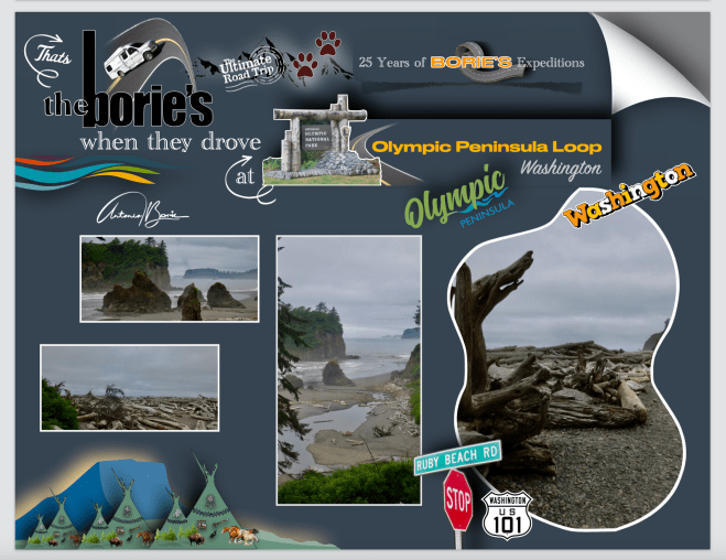
…como praticamente todas as praias da costa norte, Ruby Beach tem uma tremenda quantidade de madeira flutuante!. É notável pelo número de pilhas de madeira, que por ali estão. A praia é chamada por causa dos cristais de rubi na areia da praia!.
…like virtually all beaches on the northern coast, Ruby Beach has a tremendous amount of driftwood. It is notable for the number of sea stacks there. The Beach is so called because of the ruby-like crystals in the beach sand!.
…os refúgios administram as ilhas visíveis acima das águas da maré alta por 135 milhas ao longo da costa. Grandes colónias de ninhos de pássaros, como murres comuns e papagaios-do-mar, precisam desses postos avançados rochosos. Kalaloch e Ruby Beach estão localizadas na costa sudoeste da Península Olímpica e são acessíveis diretamente da estrada101, onde viajávamos rumo ao sul!.
…the refuges manage the islands visible above the waters of high tide for 135 miles along the coast. Large colonies of bird nests, such as common murres and puffins, need these rock outposts. Kalaloch and Ruby Beach are located on the southwest coast of the Olympic Peninsula and are accessible directly from Highway 101, where we were traveling south!.
…desça para a praia devagar, com atenção às pedras que lhe aparecem pelo caminho e, quando chegar à praia, tire o seu calçado, calque a areia, passe sobre os troncos de árvores perdidas pela praia, que já tiveram vida e agora servem para tornar esta praia única, levante a cabeça e olhe em seu redor, o cenário, com as ondas do mar do Pacifico, subindo para as rochas, que estão ali há milhões de anos, resistentes, nesse momento medite, pegue na sua camara fotográfica, e divirta-se!
…go down to the beach slowly, paying attention to the stones that appear along the way, and when you reach the beach, take off your shoes, sand the sand, pass over the tree trunks lost by the beach, which have already had life and now serve to make this beach unique, raise your head and look around, the scenery, with the waves of the Pacific Ocean, rising to the rocks, that have been there for millions of years, resistant, at that moment meditate, take your camera photograph, and enjoy!.
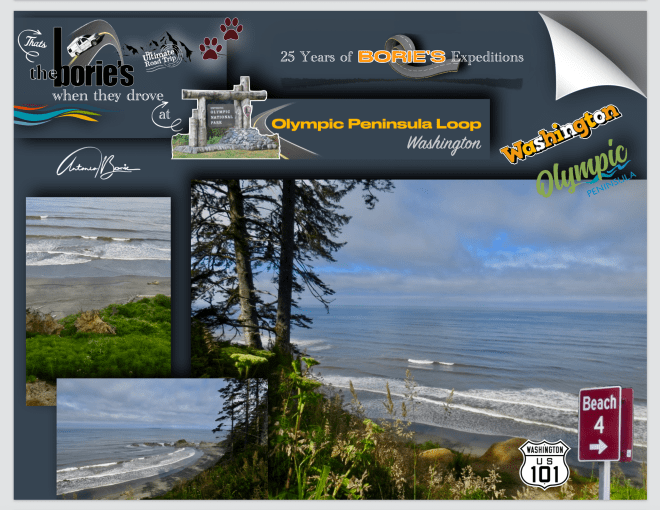

…vivemos no estado da Florida, praias lindas e desertas, com areia branca, não nos faltam, mas por aqui é diferente, esta costa de Washington, acidentada e isolada, é um diamante em bruto, ao longo do poderoso Oceano Pacífico!. Conhecido mais por ondas enormes, fortes tempestades que formam lagoas de marés, do que para bronzeamento, natação e usar fato de banho, as praias do Parque Nacional Olímpico não são esse típico destino de praia!. Mais de 73 milhas de litoral natural, que não é perturbado, designado como uma região selvagem, estão prontos para serem explorados por nós, que também adoramos sol, pois vivemos no estado da Florida, somos caminhantes de dia, de aventuras, que gostamos também de carregar uma mochila, mas aqui, as praias são um retorno a uma região selvagem, pura e, onde ainda se pode apreciar a natureza, tal como ela é!.
…we live in the state of Florida, beautiful beaches and deserted, with white sand, we do not lack, but here it is different, this rugged, isolated Washington Coast is a diamond in the rough along the mighty Pacific Ocean!. Known more for huge waves, serious storms and tide pools than for sun tanning, swimming, and little swimsuits, the beaches of Olympic National Park are not your typical beach destination!. Over 73 miles of undisturbed natural coastline, designated as wilderness, are ready to be explored for us, who also love the sun, because we live in the state of Florida, we are day hikers, for adventure, we also like to carry a backpack, but here, the beaches are a return to a pure, wilderness and where you can enjoy nature as it is!.
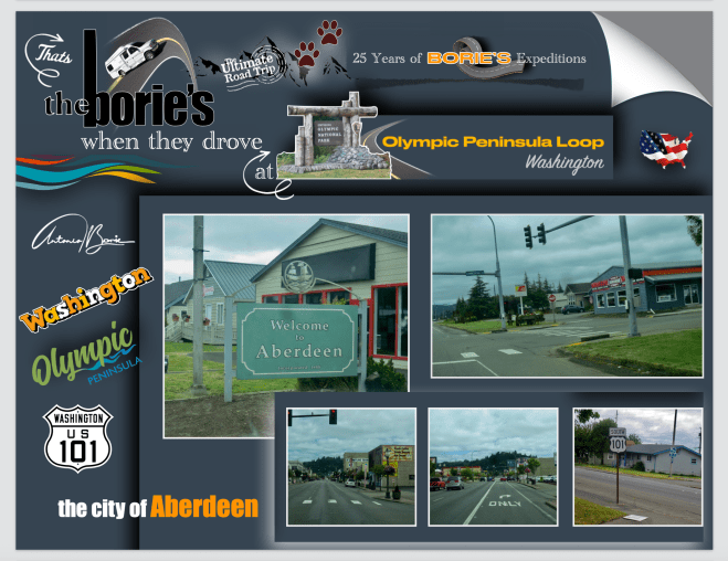
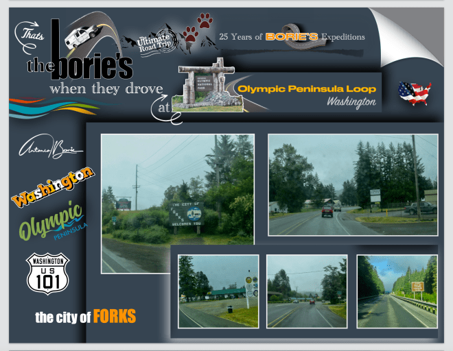
…quando, por volta do ano de 1884, Samuel Benn fundou o que é hoje a cidade de Aberdeen e, que se tornou na maior e mais conhecida cidade no porto de Grays, talvez nunca tivesse imaginado que nós, habitantes da Florida, por aqui passássemos, com alguma vontade de chegar ao sul leste dos USA!. Foi o que fizemos, passámos, compramos alguma gasolina, água e pão, e ao mesmo tempo que dissemos Bem Vindo, também dissemos Adeus!.
…when around the year 1884, Samuel Benn founded what is now the city of Aberdeen, and which became the largest and most well-known city in the port of Grays, perhaps he had never imagined that we, here we passed, with some desire to reach the south east of the USA!. That’s what we did, we passed, bought some gas, water and bread, and at the same time we said Welcome, we also said Goodbye!.
…passamos pelas ruas de Long Beach, mas não fomos ver a praia, pois o tempo era pouco para completar o programa de viajem que tínhamos para hoje!.
…we passed the streets of Long Beach, but we did not go to see the beach, because there was little time to complete the travel program we had for today!.

…a ponte de Astoria Megler, é uma estructura em ferro, formando arcos, através do Rio Columbia, entre Point Ellice, perto de Megler, em Washington, e Astoria, já no Oregon. É uma “estrela de cinema”, a própria ponte é proeminente no cinema, filmes como “Short Circuit”, “Kindergarten Cop”, Free Willy ” e “Free Willy 2” ou “The Goonies”, é ainda esta ponte que se vê, em a “Fada da Madison Bridge”, em “Irwin Allen”, ou no filme de desastre, feito em 1979 para a TV, “The Night the Bridge Fell Down”!.
…the Astoria Megler Bridge, is a steel cantilever through truss bridge, that spans the Columbia River between Point Ellice near Megler, Washington, and Astoria, Oregon!. Is a “movie star”, the bridge itself is featured prominently in the movies “Short Circuit”, “Kindergarten Cop”, Free Willy” and “Free Willy 2” and “The Goonies”. It stands in for the doomed fictional “Madison Bridge” in “Irwin Allen’s”, 1979 made-for-TV disaster movie “The Night the Bridge Fell Down”!.

…localizada a 14 miles (23 km) da foz do rio, a ponte é de 4,6 milhas (6,6 km) de comprimento e foi o último segmento completo da estrada 101, entre Olympia, Washington e Los Angeles, Califórnia. É a ponte com estructura em ferro contínua, mais longa da América do Norte e, ao atravessá-la, sobre o Rio Columbia, chegamos ao estado de Oregon!.
…located 14 miles (23 km) from the mouth of the river, the bridge is 4.1 miles (6.6 km) long and was the last completed segment of U. S. Route 101 between Olympia, Washington, and Los Angeles, California. It is the longest continuous truss bridge in North America, and as we crossed it over the Columbia River, we arrived in Oregon!.
Tony Borie.


