…passando já as oito dezenas de anos de idade na juventude da velhice e, depois de deixar o mercado de trabalho aos 65, sempre na companhia da nossa dedicada esposa Isaura, (que entre outras coisas sabe fotografar), temos realizado o máximo de viagens possíveis, dentro das nossas limitadas possibilidades financeiras, acampando, preparando a comida e dormindo na nossa pequena e antiga RV, que carinhosamente baptizámos como a louca “Raposa Branca”, da qual nos orgulhamos muito!.
…having already spent eight decades in the youth of old age and, after leaving the job market at 65, always in the company of our dedicated wife Isaura,(who, among other things, knows how to photograph), we have taken as many trips as possible, within our limited financial possibilities, camping, preparing food and sleeping in our small and old RV, which we affectionately named the crazy “White Fox”,of which we are very proud!.
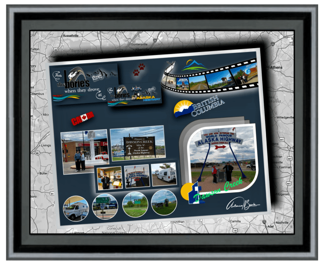

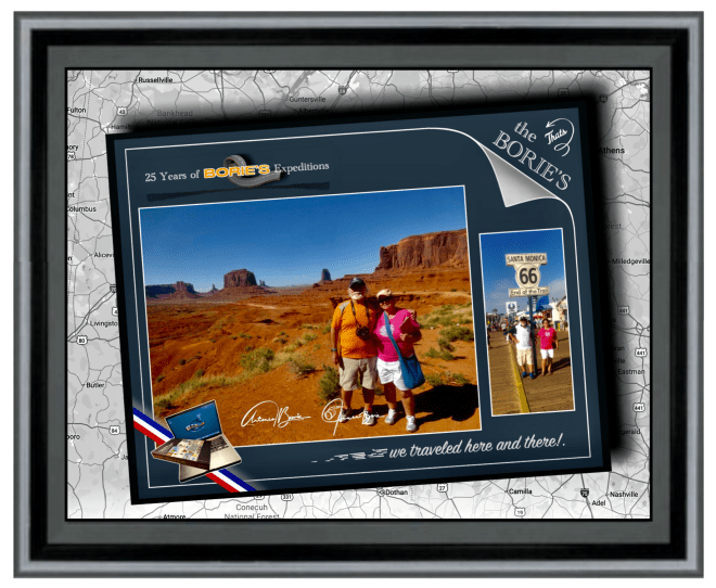
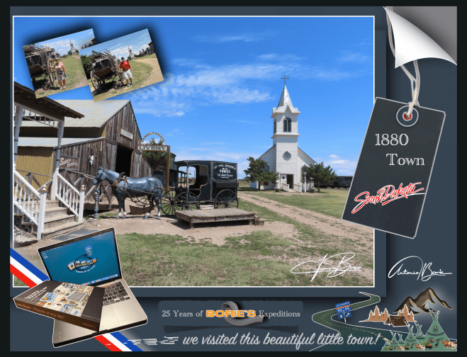
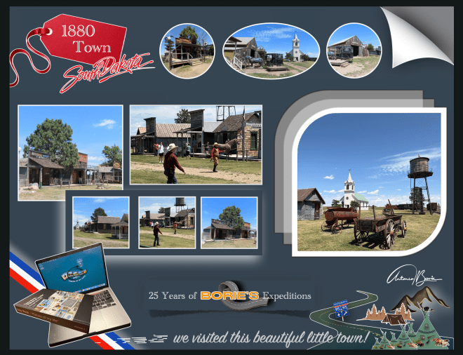
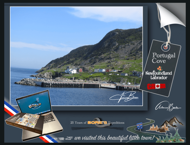
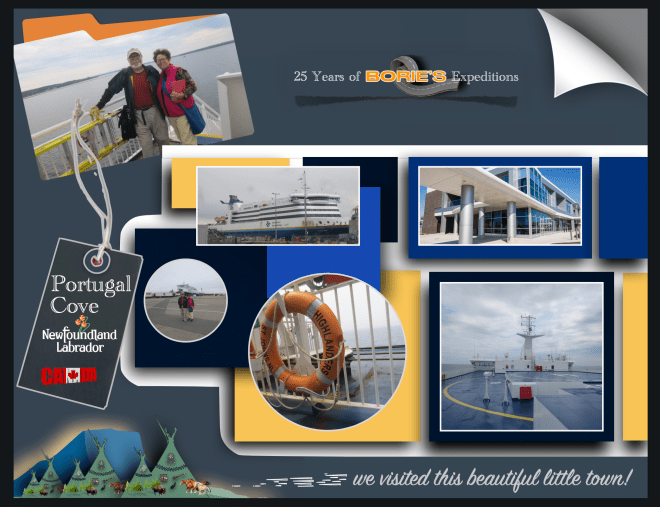
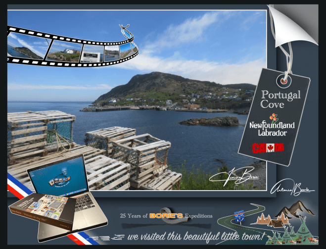
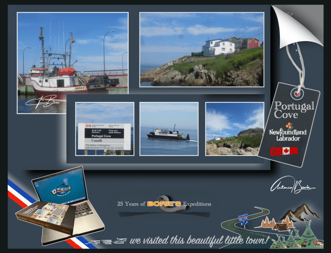
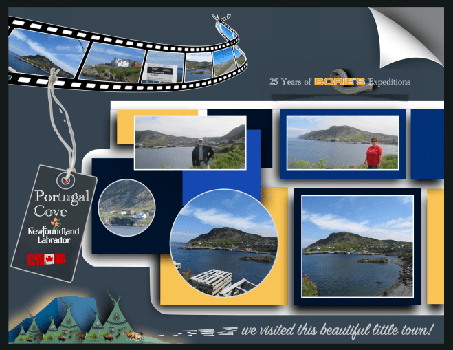
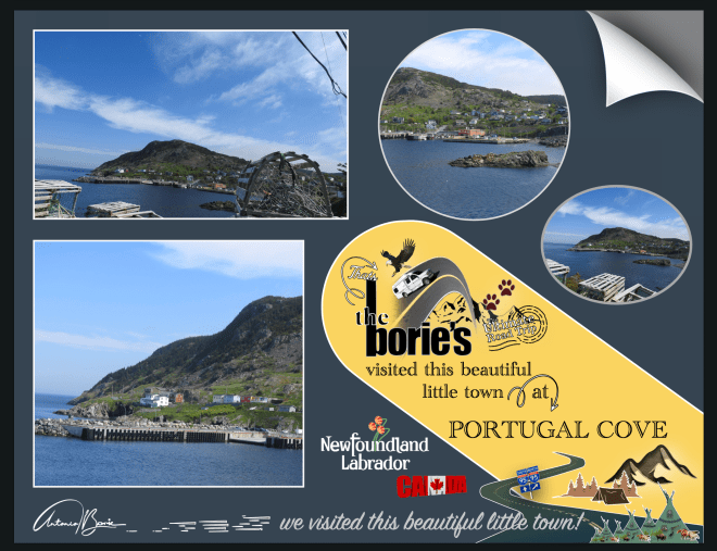
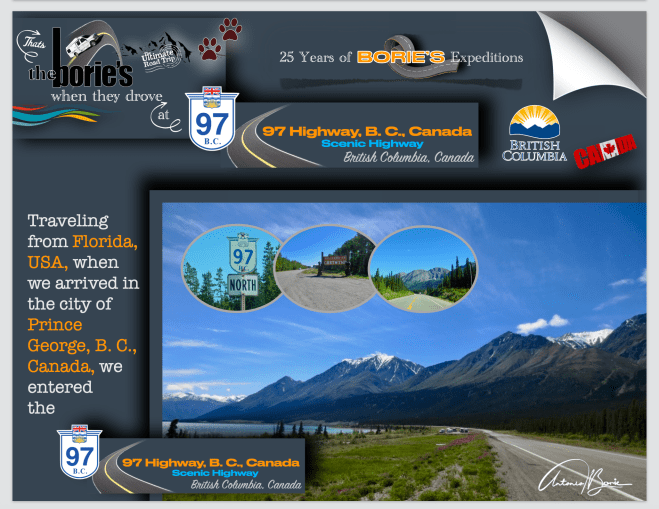
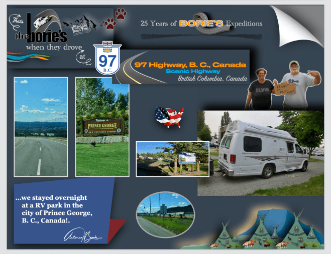
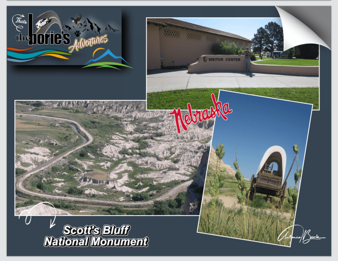
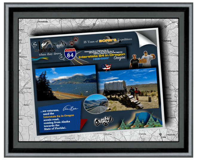
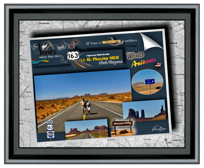
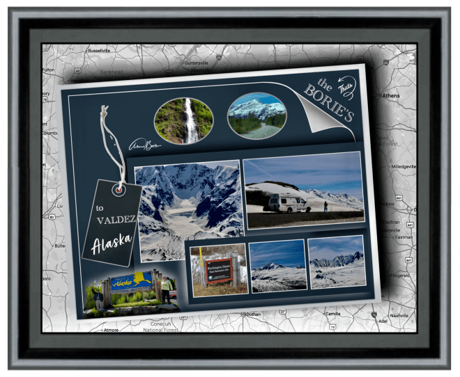
…entre outras viagens, já realizámos três expedições desde o estado da Flórida ao estado do Alaska, várias viagens completas pela Rota 66, percorrendo aproximadamente 80% das estradas mais perigosas, emocionantes e intimidantes dos EUA e Canadá, algumas com declives acentuados, ziguezagues intermináveis, mudanças climáticas repentinas e vistas que exigem toda a nossa atenção, visitando aproximadamente 90% dos parques nacionais dos EUA e do Canadá, incluindo uma expedição à Terra Nova e Labrador, no Canadá!.
…among other trips, we have already carried out three expeditions from the state of Florida to the state of Alaska, several complete trips along Route 66, covering approximately 80% of the most dangerous, exciting and intimidating roads in the USA and Canada, some with steep slopes, endless zigzags, sudden climate changes and views that demand our full attention, visiting approximately 90% of the national parks in the USA and Canada, including an expedition to Newfoundland and Labrador, Canada!.
…passando por cidades, vilas, aldeias ou parques nacionais, com temperaturas de calor algumas vezes infernal, frio ou neve, chuva, lama, poeira ou pedra miúda, seguindo por milhas e milhas o “carro piloto” em reparações ou desvios de estradas destruídas por avalanches, ou até ventos fortes tal qual tornados, e…, também lindos dias de céu azul, através de grandes rios ou pequenos riachos com forte ou pequena corrente ou até lagos com água pura!.
…passing through cities, towns, villages or national parks, with sometimes infernal heat, cold or snow, rain, mud, dust or small rocks, following for miles and miles the “pilot car”in repairs or detours on roads destroyed by avalanches, or even strong winds such as tornadoes, and…, also beautiful days with blue skies, through large rivers or small streams with strong or small currents or even lakes with pure water!.
…muitas vezes fomos atraídos por aventuras ao ar livre, explorando lugares históricos ou simplesmente mergulhando numa atmosfera descontraída, como por exemplo, parando numa estrada num lugar quase deserto, vivendo aquilo que não é comum e que nos pode surpreender, porque estava chovendo e…, olhando o relógio da nossa “Raposa Branca” (caravana), eram onze e meia da noite, no entanto, ainda era de dia, a chuva vinha do norte e estávamos no norte, como tal…, ela vinha do céu e caía direita sobre nós!.
…we were often attracted by outdoor adventures, exploring historical places or simply immersing ourselves in a relaxed atmosphere, for example, stopping on a road in an almost deserted place, experiencing something that is unusual and that might surprise us, because it was raining and… , looking at the clock in our “White Fox” (caravan), it was half past eleven at night, however, it was still daytime, the rain was coming from the north and we were in the north, as such…, it came from the sky and fell straight about us!.
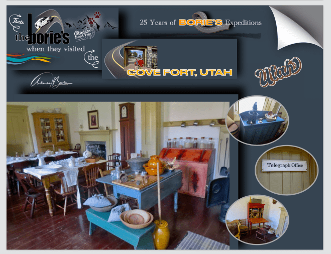
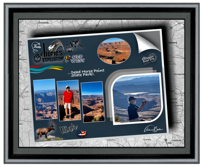
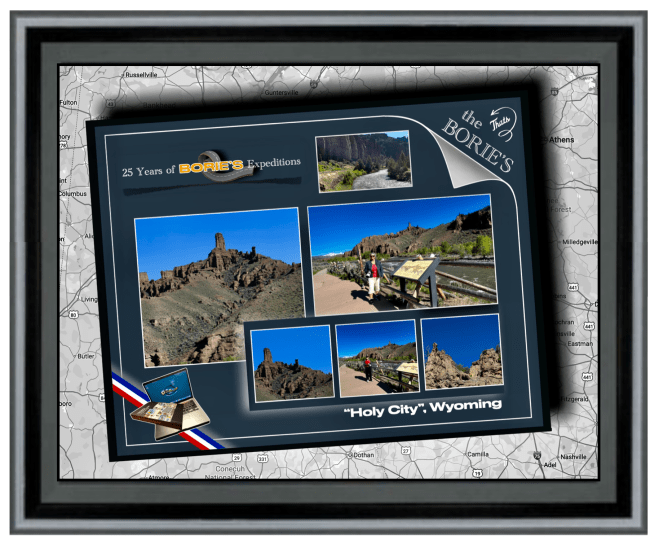
…tivemos a felicidade de apreciar cenários panorâmicos semelhante a uma viagem no tempo, aprendendo sempre, porque tivemos a oportunidade de poder explorar exposições e artefactos que nos ofereceram informações sobre um passado duma qualquer região, que às vezes abrigava tesouros históricos, proporcionando-nos uma apreciação mais profunda do seu significado cultural!.
…we had the happiness of enjoying panoramic scenes similar to a journey through time, always learning, because we had the opportunity to explore exhibitions and artefacts that offered us information about the past of any region, which sometimes housed historical treasures, providing us with a deeper appreciation of its cultural significance!.
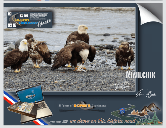
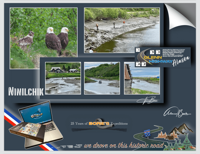
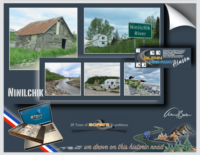
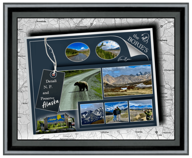
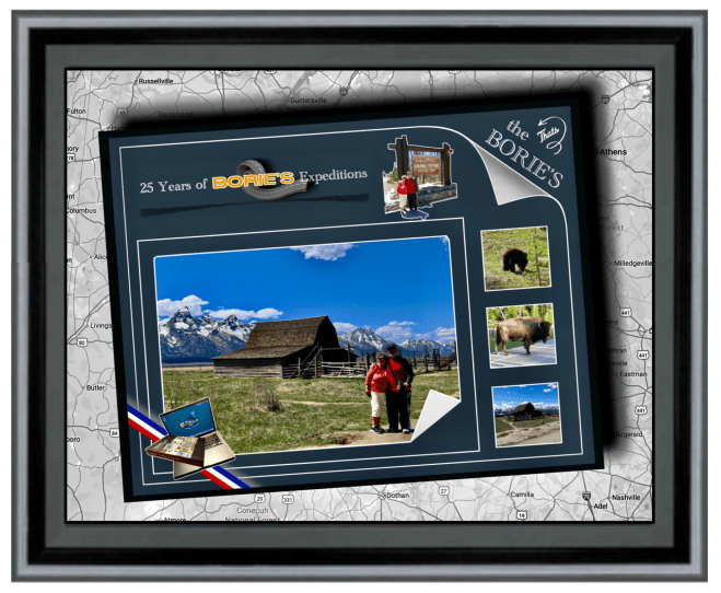
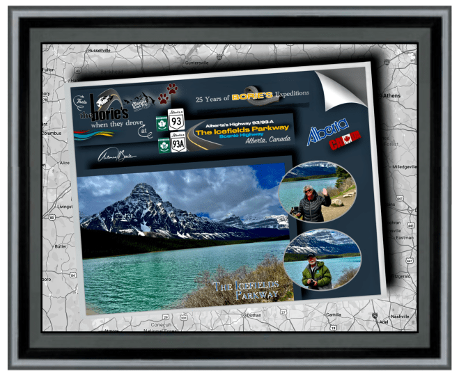
…ao longe víamos grandes ou pequenas montanhas cobertas de neve, outras cobertas com floresta, estradas com duas vias e rápidas, outras pequenas, com curvas e precipícios, com o piso em lama e água!. Parávamos aqui e ali, para admirar a natureza pura, com os animais selvagens ou águias de colarinho branco, no seu próprio território, onde nós sim…, éramos os intrusos que ocupávamos o seu espaço!.
…in the distance we saw large or small mountains covered in snow, others covered with forest, roads with two lanes and fast, others small, with curves and precipices, with mud and water on the floor!. We stopped here and there, to admire the pure nature, with wild animals or white-collared eagles, in their own territory, where we were…, we were the intruders who occupied their space!.

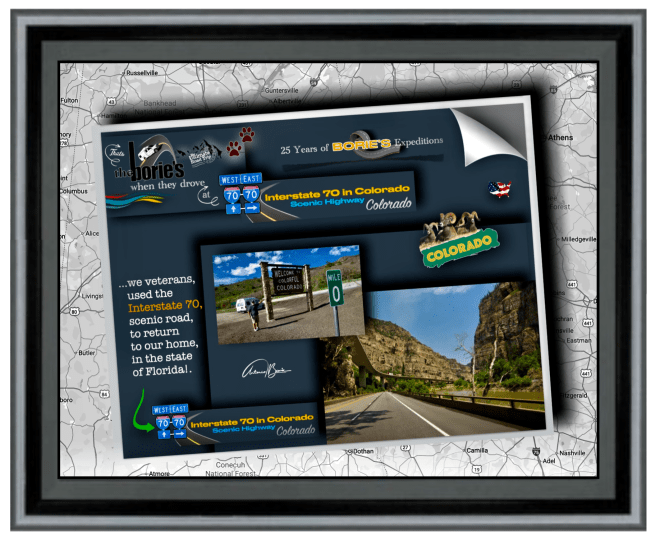
…vimos e fomos convivendo com pessoas de outras latitudes, mas com o mesmo sentido de aventura, muitas vezes debaixo de um sol radiante, outras, tal como acima já descrevemos, neve, chuva lama ou poeira e nuvens escuras e…, não sabendo onde era o nosso destino para esse dia, ou onde pernoitaríamos!.
…we saw and lived with people from other latitudes, but with the same sense of adventure, often under a radiant sun, other times, as we described above, snow, rain, mud or dust and dark clouds and…, not knowing where was our destination for that day, or where we would spend the night!.
…às vezes somos agraciados e aquecidos pela maravilhosa luz do sol que, depois de passar aproximadamente pelo paralelo 48º N, nos beneficia de 16 a 20 horas por dia e, nos pode levar na tal aventura como acima referimos, com alguma neve, chuva, pedras e poeira, lama, sol e algumas das paisagens mais bonitas do mundo, porque tanto nós como a nossa dedicada esposa Isaura, continuamos a querer ser bem-vindos a este mundo!.
…sometimes we are graced and warmed by the wonderful sunlight that, after passing approximately the 48º N parallel, benefits us from 16 to 20 hours a day and can take us on that adventure as mentioned above, with some snow, rain, stones and dust, mud, sun and some of the most beautiful landscapes in the world, because both we and our dedicated wife Isaura,continue to want to be welcomed into this world!.

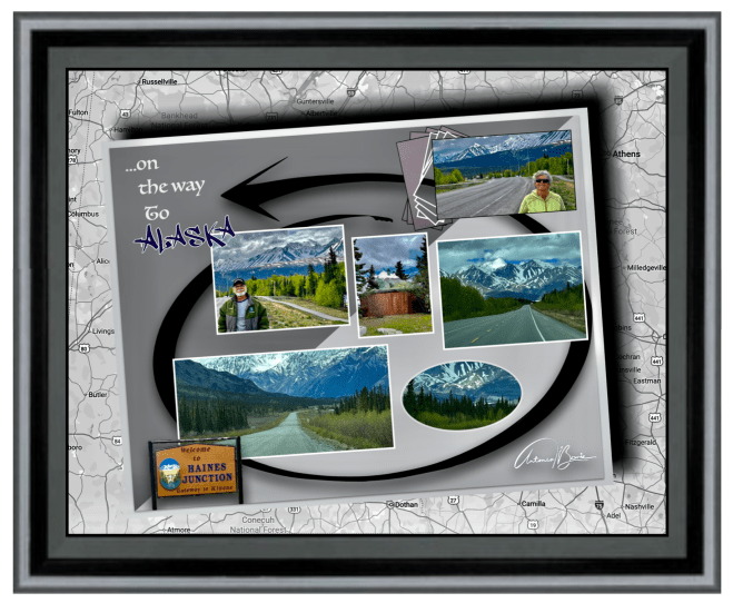
…estivemos e passámos a linha divisória do Polo Norte, com algum sol por 24 horas, onde nunca era de noite!. Áreas desertas, onde viajávamos por centenas de milhas sozinhos, confiando na sorte e, na nossa “Raposa Branca” (caravana)!. Tomando banho em lagos de água cristalina e quente, que brotava das profundezas do planeta Terra e, a chuva miudinha caindo nas nossas cabeças!.
…we were and passed the North Pole dividing line, with some sun for 24 hours, where it was never night!. Deserted areas, where we traveled for hundreds of miles alone, trusting in luck and in our “White Fox” (caravan)!. Bathing in lakes of crystal clear, warm water, which flowed from the depths of planet Earth and the light rain falling on our heads!.
…aqui e ali paramos, porque encontramos a aventura pendurada numa corda, ao lado duma montanha, dum rio selvagem, numa estrada deserta, mesmo dentro de uma tempestade, onde milhares ou milhões de pés (ou metros cúbicos), de chuva constante, ou a mesma quantidade de neve branca e gelada, nos causam algumas dificuldades mas, se na verdade queremos saber verdadeiramente quem somos, teremos que viajar até que ninguém saiba o nosso nome!.
…here and there we stop, because we find adventure hanging from a rope, on the side of a mountain, a wild river, on a desert road, even in a storm, where thousands or millions of feet (or cubic meters), of constant rain, or the same amount of white and cold snow, cause us some difficulties but,if we really want to truly know who we are, we will have to travel until no one knows our name!.
…e, não existe nada melhor do que o silêncio e o cenário de uma montanha coberta de neve, de um lago natural, cujo fundo é uma montanha ao contrário, onde os minerais que o compõem, dão tonalidades diferentes à sua água, consoante a luz natural do sol que nele se reflete, ou tomar banho num rio selvagem de água quente e cristalina, que brota das profundezas da terra, ou mesmo de um longo trecho de estrada deserta, que para nós viajantes do mundo, nos ensina mais, do que uma centena de anos de tranquilidade!.
…and, there is nothing better than the silence and the scenery of a snow-covered mountain, of a natural lake, whose bottom is a mountain in reverse, where the minerals that compose it, give different tones to your water, depending on the natural light of the sun reflected in it, or bathe in a wild river of warm, crystalline water, which flows from the depths of the earth, or even a long stretch of desert road, which for us world travelers, teaches us more , than a hundred years of tranquility!.

…tranquilidade, que temos ao apreciar um conjunto de cores violeta, azul, verde, amarelo, laranja ou vermelho, em qualquer lugar ou em qualquer pôr do sol!. Tranquilidade, ao caminhar sobre a cor da neve gelada de um qualquer glaciar!. Tranquilidade, ao cheirar as flores selvagem e coloridas, na beira de um qualquer riacho perdido na encosta de uma montanha!. Tranquilidade, ao apreciar um qualquer pássaro ou animal selvagem, rodeados das folhas verdes duma árvore que nasceu ao lado de um rio com água limpa e brilhante, que corre revoltoso entre pedras, em direção ao mar, como que querendo fugir da terra firme, onde os homens com a desculpa do “progresso e da riqueza fácil”, teimam em poluir e destruir constantemente!.
…tranquility, which we have when appreciating a set of violet, blue, green, yellow, orange or red colors, anywhere or at any sunset!. Tranquility, when walking on the color of the icy snow of any glacier! Tranquility, smelling the wild and colorful flowers, on the edge of some stream lost on the side of a mountain!. Tranquility, when appreciating any bird or wild animal, surrounded by the green leaves of a tree that was born next to a river with clean and bright water, which runs wildly between rocks, towards the sea, as if wanting to escape the dry land, where men, with the excuse of“progress and easy wealth”,insist on constantly polluting and destroying!.

…também passamos por algumas situações, onde uma lata de conserva de atum ou sardinha, era uma refeição apreciada, por dias, onde um café quente, era uma bebida desejada, mas não se encontrava, onde um simples naco de pão seco, se comia como o mais delicioso pitéu!. No entanto, também outros dias havia fartura, comendo comidas exóticas, como por exemplo carne de búfalo, pernas de caranguejo gigante, salmão ou halibute acabados de pescar!.
…also going through some situations, where a can of canned tuna or sardines was a meal enjoyed for days, where a hot coffee was a desired drink, but was not found, where a simple hunk of dry bread was eaten as the most delicious snack!. However, on other days there was plenty, eating exotic foods, such as buffalo meat, giant crab legs, freshly caught salmon or halibut!.
…e nesta já avançada idade, continuamos a pensar que para estar ainda mais vivos, temos que ter menos medo e, quando começamos a proceder assim, “perdemos algum medo, mas ganhamos uma vida inteira”, porque são estas pequenas coisas, estes pequenos pormenores, como a terra, o céu, os bosques e campos, lagos e rios, as montanha e o mar, que são os nossos excelentes professores e ensinam-nos mais do que podemos aprender dos livros!.
…and at this advanced age, we continue to think that to be even more alive, we have to be less afraid and, when we start to do this,“we lose some fear, but we gain a whole life”,because it is these little things, these small details, such as the earth, the sky, the forests and fields, lakes and rivers, the mountains and the sea, that are our excellent teachers and teach us more than we can learn from books!.
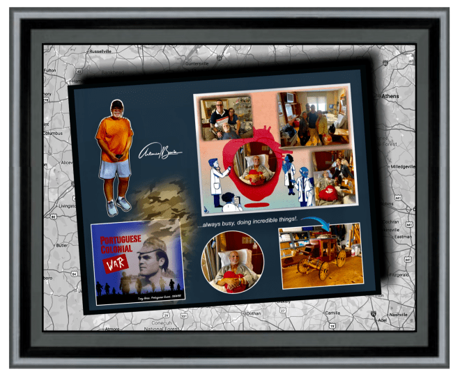
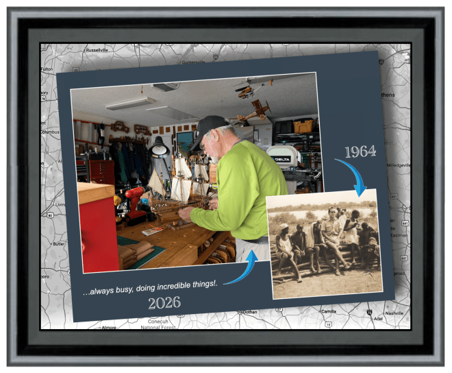
…tudo isto, apesar de entre outras anomalias, sermos sobreviventes por um período de dois dolorosos anos de uma maldita Guerra Colonial Portuguesa em África, da doença cancer e de uma melindrosa cirurgia ao coração e…, apesar de consumir diariamente medicina de manutenção, continuamos activos, sempre ocupados, fazendo coisas incríveis, onde entre outras, planejando futuras viagens, claro, como acima já explicámos, tudo sempre dentro das nossas modestas possibilidades financeiras!.
…all this, despite, among other anomalies, being survivors for a period of two painful years of a cursed Portuguese Colonial War in Africa, cancer and a painful heart surgery and…, despite consuming maintenance medicine daily, we remain active, always busy, doing incredible things, among others, planning future trips, of course, as we explained above, all always within our modest financial possibilities!.
…porquê?. Porque, a maioria das pessoas da nossa idade está sentada em sua poltrona assistindo ao Netflix e à TV, o que para nós era o pior castigo que nos poderiam dar, ou seja, colocarem-nos numa poltrona e nos forçar a assistir a filmes na Netflix, porque isso seria qualificado como um castigo cruel e incomum, e seria uma sentença de morte!.
…why?. Because, most people our age are sitting in their armchair watching Netflix and TV, which for us was the worst punishment they could give us, that is, putting us in an armchair and forcing us to watch movies on Netflix, because that would be qualified as a cruel and unusual punishment, and would be a death sentence!.
…sabemos, temos a perfeita noção de que vivemos com alguns recursos limitados, mas isso não significa que não possamos viver grandes aventuras!. Pessoas comuns como nós, podem viver aventuras extraordinárias com um orçamento relativamente pequeno, desde que não vivam “à grande e à francesa”, tal como a nossa saudosa avó materna nos dizia!.
…we know, we are perfectly aware that we live with some limited resources, but that doesn’t mean we can’t live great adventures!. Ordinary people like us can live extraordinary adventures with a relatively small budget, as long as they don’t live “big and French”, as our late maternal grandmother told us!.
…sabemos também, que o alto custo de vida impede a maioria das pessoas, mas felizmente também sabemos como viver na pobreza, e viver na pobreza funciona muito bem para nós!. Viver na pobreza significa que nunca ficaremos sem dinheiro a menos que vivamos até aos 100 anos!. E se vivermos até aos 100 anos, teremos muitas lembranças positivas de todas as nossas aventuras, porque viver o dia à dia à “rico”, para nós é “como roubar de Pedro para pagar a Paulo” e…, isso nunca faremos!
…we also know that the high cost of living holds most people back, but fortunately we also know how to live in poverty, and living in poverty works very well for us!. Living in poverty means we will never run out of money unless we live to be 100!. And if we live to be 100 years old, we will have many positive memories of all our adventures, because living day to day “rich”,for us is “like stealing from Pedro to pay Paulo” and…, we will never do that!..
…queridos leitores, neste momento da nossa vida, o nosso objetivo é morrer jovem o mais tarde possível e, quando nos sentamos ao volante da nossa “Raposa Branca”, sentimo-nos jovens novamente, imaginando-nos dirigindo pelas planícies do norte, vendo ao longe aquela cordilheira de montanhas ainda com alguma neve a reluzir no seu topo!.
…dear readers, at this moment in our lives, our goal is to die young as late as possible and, when we sit behind the wheel of our “White Fox”,we feel young again, imagining ourselves driving through the northern plains, seeing in the distance that mountain range with some snow still shining on its top!.
…será que estamos loucos tal como a nossa “Raposa Branca”, ou simplesmente…, apenas loucos?.
…are we crazy like our “White Fox”, or simply…,just crazy?.
Tony Borie.