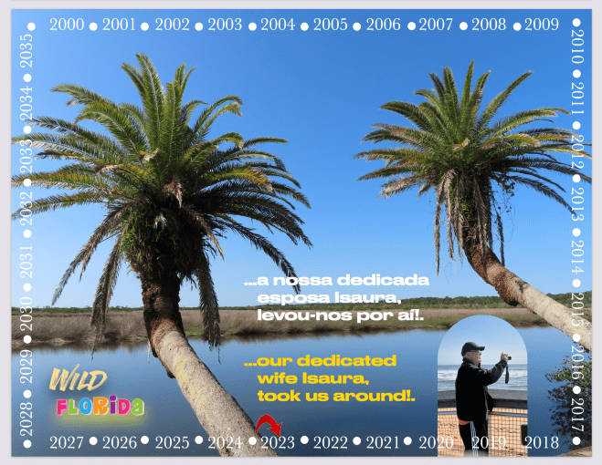
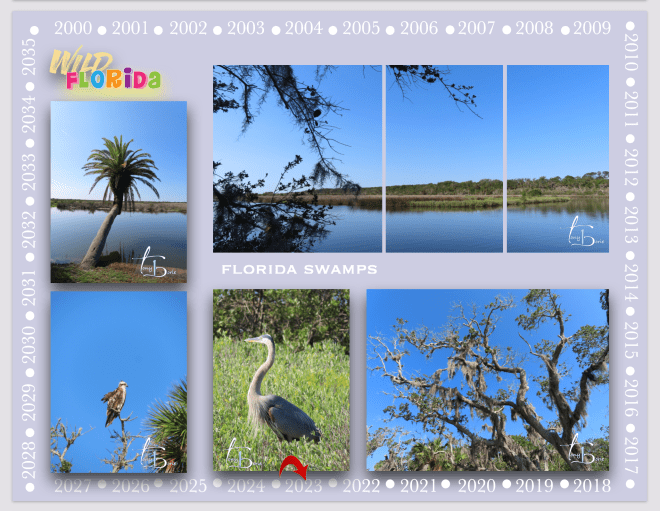
…devagar devagarinho vamos andando por aí!. A nossa dedicada esposa Isaura, a nosso pedido levou-nos a ver um dos lugares nossos preferidos que são os pântanos ao redor da área onde presentemente vivemos!. Porquê?. Porque um pântano pode ser um refúgio ou um pesadelo!.
…slowly slowly let’s walk around!. Our dedicated wife Isaura, at our request, took us to see one of our favorite places which are the swamps around the area where we currently live!. Why?. Because a swamp can be a refuge or a nightmare!.
…é lá que podem acontecer coisas misteriosas porque muitas vezes são lugares úmidos e sombrios de beleza selvagem onde poucos se atrevem a penetrar, tal como os sonhos estranhos que vamos tendo na nossa já um pouco longa recuperação, onde às vezes nos aparecem jacarés, ursos negros, gatos selvagens e quem sabe mais o quê, tal como um fantasma obcecado por aquela orquídea fantasma!.
…it is there that mysterious things can happen because they are often humid and dark places of wild beauty where few dare to penetrate, such as the strange dreams that we have in our already somewhat long recovery, where alligators, bears sometimes appear blacks, wild cats and who knows what else, such as a ghost obsessed with that ghost orchid!.
…claro…, sabemos perfeitamente que são os efeitos das dores normais e da medicina que diáriamente tomamos para nos atenuar o temporário sofrimento de recuperação pela devastação da melindrosa operação ao coração a que fomos sujeitos!.
…of course…, we know perfectly well that they are the effects of normal pain and the medicine that we take daily to alleviate the temporary suffering of recovery from the devastation of the touchy heart operation to which we were subjected!.
…mas…, os pântanos são onde a água encontra a terra, tornando-os assim nossos aliados na luta pela sobrevivência!.
…but…, the swamps are where the water meets the land, thus making them our allies in the struggle for survival!.
…mais uma vez obrigado do fundo do coração pelas mensagens que vamos recebendo de rápida recuperação!.
…once again thank you from the bottom of my heart for the messages we are receiving of speedy recovery!.
Tony Borie, Século XXI. (Tony Borie, 21st Century).
…lentamente, vamos sentindo melhoras todos os dias!. Esta semana, além das visitas periódicas de pessoal de enfermagem, a nossa dedicada esposa Isaura, levou-nos a três diferentes doutores e unidades hospitalares para fazer exames, com respostas de melhoras constantes e que tudo se vai resolvendo numa recuperação normal!.
…slowly, we feel improvements every day!. This week, in addition to the periodic visits by the nursing staff, our dedicated wife Isaura, took us to three different doctors and hospital units to undergo tests, with responses of constant improvement and that everything is being resolved in a normal recovery!.
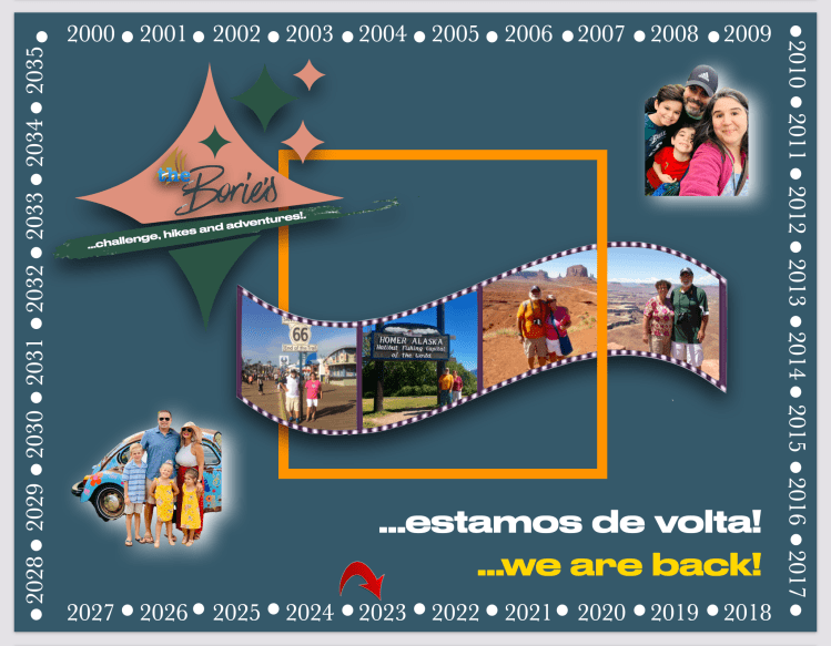
…assim…, existem esperanças de que em breve iremos andar por aí de novo!.
…so…, there are hopes that we will soon be walking around again!.
…obrigado do fundo do coração pelas mensagens de melhoras rápidas que vamos recebendo!.
…thank you from the bottom of my heart for the get well soon messages we are receiving!.
Tony Borie, Século XXI. (Tony Borie, 21st Century).
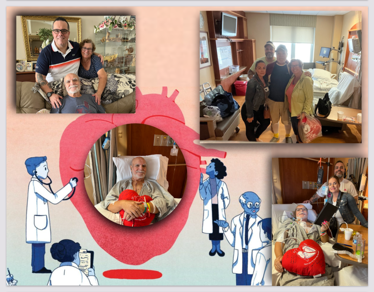
…estivémos 5 dias no Flagler Hospital da cidade de St. Agostinho, aqui na Florida!. A nossa dedicada esposa Isaura, a nossa filha Sandy e o nosso filho Tony, estiveram sempre connosco!.
…we spent 5 days at Flagler Hospital in the city of St. Augustine, here in Florida!. Our devoted wife Isaura, our daughter Sandy and our son Tony, were always with us!.
…recuperámos o suficiente para poder regressar a casa no dia 9 de Maio, encontramo-nos em recuperação com dores normais, recebendo períodicamente a visita de pessoal especializado que nos vai ajudando na já dita recuperação!.
…we recovered enough to be able to return home on the 9th of May, we are in recovery with normal pain, periodically receiving visits from specialized personnel who help us in the already said recovery!.
…as noites são longas e um pouco dolorosas e os dias mais fáceis de passar e como curiosidade…, vamos só descrever uma noite passada sobre o efeito de medicina!.
…a posição não é cómoda mas adormecemos…, o sonho vem à mente…, deambulamos por muitos lugares ao mesmo tempo…, é tudo branco, as paredes da casa, as letras do computador, as árvores, as pessoas, a água do mar e…, de vez em quando vai ficando tudo cinzento…, mas um cinzento muito bonito que vai desapadecendo e…, acordamos a chamar por alguém, perguntando onde estamos!.
…the nights are long and a little painful and the days are easier to pass and as a curiosity…, let’s just describe a night spent under the effect of medicine!.
…the position is not comfortable but we fall asleep…, the dream comes to mind…, we wander through many places at the same time…, everything is white, the walls of the house, the letters on the computer, the trees, the people, the sea water and…, from time to time everything turns gray…, but a very beautiful gray that disappears and…, we wake up calling for someone, asking where we are!.
…e as dores continuam!.
…and the pain continues!.
…obrigado pelas mensagens de melhoras rápidas que vamos recebendo!.
…thanks for the get well soon messages we are receiving!.
…ontem ou anteontem, talvez há uns dias, já não nos lembramos, “fomos à faca”!. Era assim que diziam no nosso tempo de criança, quando alguém tinha tido alguma intervenção cirurgica no seu corpo!.
…yesterday or the day before yesterday, maybe a few days ago, we no longer remember, “we went under the knife”!. That’s what they used to say in our childhood days, when someone had had some surgery done on their body!.
…estávamos a planejar uma viagem para o norte/oeste com a nossa dedicada esposa Isaura, quando tomámos conhecimento de que precisávamos de uma cirurgia ao coração!. De repente, a viagem, e quaisquer outras no futuro, eram as coisas mais distantes da nossa mente!.
…we were planning a trip to the north/west with our devoted wife Isaura, when we learned that we needed heart surgery!. Suddenly, the trip, and any others in the future, were the furthest things from our mind!.
…as causas eram que de tempos a tempos sentíamos uma dor do lado esquerdo do peito que se estendia ao comprimento do braço que nos causava um abatimento irregular em todo o corpo!. Fomos ver um especialista em doenças cardíacas!. Exames, ainda mais exames e…, o diagnóstico foi que havia quatro artérias no coração que estavam quase bloqueadas, mais uma válvula que não fechava ou abria regularmente e o resultado era…, se não houvesse uma cirurgia de coração aberto para reparar, havia fortes possibilidades de um ataque cardíaco!.
…the causes were that from time to time we felt a pain in the left side of the chest that extended to the length of the arm that caused an irregular slump in the whole body!. We went to see a heart disease specialist!. Tests, even more tests and…, the diagnosis was that there were four arteries in the heart that were almost blocked, plus a valve that did not close or open regularly and the result was…, if there was no open-heart surgery to repair it, there were strong possibilities of a heart attack!.
…embora já sobreviventes da maldita Guerra Colonial Portuguesa em África e da doença de câncer entre outras anomalias, considerávamo-nos uma pessoa saudável, caminhando quase todos os dias por algumas milhas de distância e tomando sempre a medicina diária de manutenção, no entanto, sabemos que chegam certos momentos da nossa vida que quando algo de estranho acontece, percebemos imediatamente que precisamos fazer uma mudança e…, felizmente a tempo, esse foi o ponto para nós!.
…although already survivors of the cursed Portuguese Colonial War in Africa and the disease of cancer among other anomalies, we considered ourselves a healthy person, walking almost every day for a few miles and always taking the daily maintenance medicine, however, we know there come certain times in our life that when something strange happens, we immediately realize that we need to make a change and…, luckily in time, that was the point for us!.
…e hoje pensamos!. “Operação de coração aberto…, isto assusta qualquer pessoa até à morte”!. Na verdade demorámos algum tempo a acordar e felizmente ainda por cá andamos, e agora…, a reabilitação, ou seja, uma combinação de cuidados compassivos, com as tais longas caminhadas, exercícios, nutrição e consumo adequado de água, tal como a regular medicina, temos a esperança que tudo se vai tornar mais fácil e, o tal planejamento da viajem pelo norte/oeste se vai tornar em realidade!.
…and today we think!. “Operation with an open heart…, this scares anyone to death”!. In fact, it took us some time to wake up and luckily we are still here, and now… rehabilitation, that is, a combination of compassionate care, with such long walks, exercise, nutrition and adequate water consumption, as well as regular medicine , we hope that everything will become easier and the planning of the trip through the north/west will come true!.
…e…, tudo já está quase passado graças à dedicação do doutor cirurgião Dereck Muehrcke e da sua equipa, tal como todo o pessal do Flagler Hospital na cidade de Santo Agostinhoe da nossa querida família, onde a dedicada esposa Isaurase desdobrou em sacrifícios para que a nossa reabilitação se vá realizando progressivamente, tal como a presença aqui na Florida do nosso filho Tonye da nossa filha Sandy,procurando sempre para que as coisas corressem o mais normal possívei, e também com o sacrifício do resto da família que, principalmente pelas razões das crianças continuarem a frequentar a escola, por lá ficaram no norte, telefonando diversas vezes ao dia!.
…and…, everything is almost over thanks to the dedication of the surgeon doctor Dereck Muehrcke and his team, as well as all the staff at the Flagler Hospital in the city of Saint Augustine and our dear family, where the dedicated wife Isaura made sacrifices for our rehabilitation to take place progressively, as well as the presence here in Florida of our son Tony and our daughter Sandy, always trying to make things run as normal as possible, and also with the sacrifice of the rest of the family who, (mainly for the reasons that the children continue to attend school, so they stayed in the north, calling several times a day)!.
…até breve e…, agradecemos do fundo do coração todos os votos de melhoras rápidas que temos recebido!.
…see you soon and…, we thank you from the bottom of our hearts for all the wishes for a speedy recovery that we have received!.
Tony Borie, Século XXI. (Tony Borie, 21st Century).
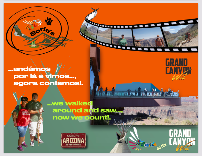
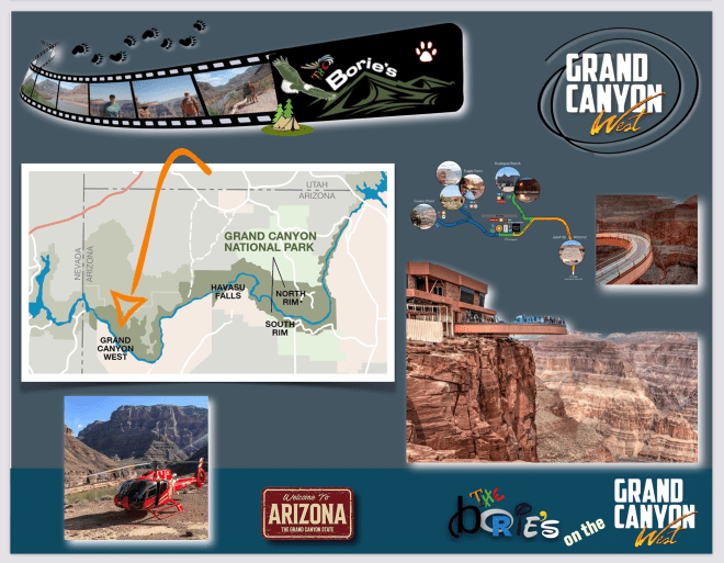
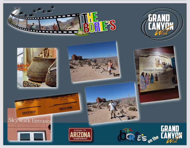
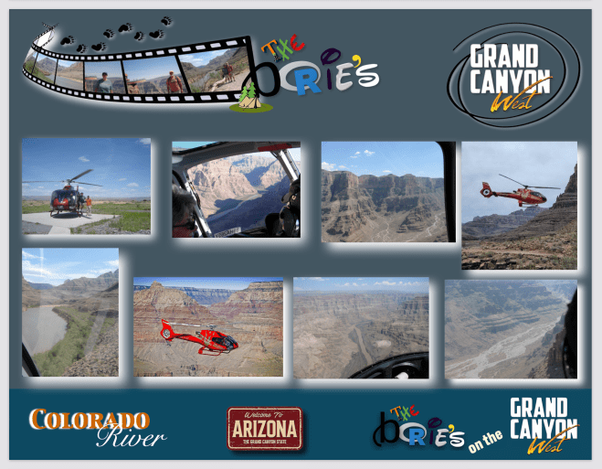
…depois de viajarmos aproximadamente 70 milhas pelo deserto do Arizona em direcção ao oeste, numa estrada de terra e cascalho, chegámos finalmente ao rancho Hualapai, onde nos instalámos pelo período de algum tempo porque para nós, amantes da natureza pura, é benéfico e espectacular o cenário desta área que procura abraçar tanto a cultura do local quanto a grandeza natural, porque situado na borda oeste deste maravilhoso Canyon histórico, o Grand Canyon West oferece-nos inúmeras experiências memoráveis, tal como vistas extravagantes, uma história muito rica, e claro, aventura ao ar livre!.
…after traveling approximately 70 miles through the Arizona desert towards the west, on a dirt and gravel road, we finally arrived at the Hualapai ranch, where we settled for a period of time because for us, lovers of pure nature, it is beneficial and spectacular the setting of this area that seeks to embrace both the local culture and the natural grandeur, because situated on the west rim of this wonderful historic Canyon, the Grand Canyon West offers us countless memorable experiences, such as extravagant views, a very rich history, and of course , outdoor adventure!.
….estávamos numa área que fazia parte do Parque Nacional do Grand Canyon, que é como se fosse uma “zona montanhosa”, mas ao contrário, cá em cima é plano, mesmo plano, depois são os “moldes” das montanhas, metidos nas aberturas da terra, desfiladeiros, que vão até às profundezas do rio Colorado!. Enfim, cerca de 2 bilhões de anos da história geológica da terra foram expostos pelo rio, à medida que este e os seus afluentes vão expondo camada após camada de sedimentos!.
….we were in an area that used to be part of the Grand Canyon National Park, which is like a “mountainous area”, but on the contrary, up here it is flat, even flat, then there are the “molds” of the mountains, placed in the earth openings, canyons, which go to the depths of the Colorado River!. Finally, about 2 billion years of the earth’s geological history were exposed by the river, as it and its tributaries expose layer after layer of sediment!.
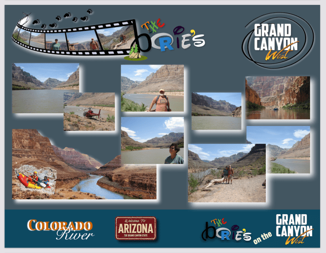
…e, estradas de terra, cascalho ou poeira, para nós é normal, porque adoramos o cenário do Rio Colorado, e sempre que viajamos para o oeste e nos é possível, vamos junto dele, porque nos oferece uma sensação inegável do pré-histórico ao estar entre as imponentes sentinelas de rocha e as águas agitadas do Grand Canyon West, que sem qualquer dúvida que é uma maravilha moldada pela lenta agitação do tempo que, até aos dias de hoje permanece sagrada, pelo menos para o povo da Nação Hualapai!.
…and, dirt, gravel or dust roads, for us it’s normal, because we love the scenery of the Colorado River, and whenever we travel west and we can, we go along it, because it gives us an undeniable prehistoric feeling standing among the towering rock sentinels and the churning waters of the Grand Canyon West, which is without a doubt a wonder shaped by the slow churning of time that, to this day, remains sacred, at least to the people of the Hualapai Nation!.
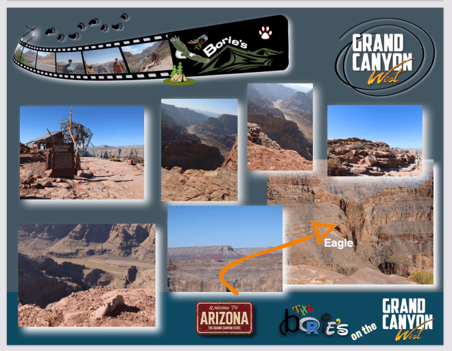
…o cenário da Nação Hualapai é evidente imediatamente após a chegada a Eagle Point, o lar da Skywalk em forma de ferradura e, despertou-nos a atenção um empregado do Rancho, que nos pareceu um nativo dos Hualapai, que barafustava pelo barulho dos helicópteros que sobrevoavam por ali, dizendo entre outras, que os pássaros e os insectos desapareceram e que à noite, aí sim, se torna um paraíso, pois os helicópteros param e todos os pássaros e insetos começam a cantar ao mesmo tempo!.
…the scenery of the Hualapai Nation is evident immediately upon arrival at Eagle Point, the home of the horseshoe-shaped Skywalk, and a ranch employee, who seemed to us a native of the Hualapai, caught our attention by the noise of the helicopters which flew over there, saying, among others, that the birds and insects disappeared and that at night, then, it becomes a paradise, as the helicopters stop and all the birds and insects begin to sing at the same time!.
…nós, habituados ao ambiente do resto do mundo, não nos tínhamos apercebido deste fenómeno mas, era verdade, à noite era uma sinfonia maciça de som, um levante incrível da vida que não sabíamos que existia!. Continuando a conversa com este nativo da Nação Hualapai, convidou-nos a passear na ponte do Skywalk, que é uma ponte de vidro em forma de ferradura de 10 pés de largura que se estende por 70 pés sobre a borda, até 4.000 pés acima do piso do Grand Canyon!.
…we, used to the environment of the rest of the world, had not noticed this phenomenon but, it was true, at night it was a massive symphony of sound, an incredible uprising of life that we did not know existed!. Continuing the conversation with this native of the Hualapai Nation, he invited us to take a walk on the Skywalk Bridge, which is a 10-foot-wide horseshoe-shaped glass bridge that spans 70 feet over the rim, up to 4,000 feet above the Grand Canyon floor!.
…foi o que fizémos!. No entanto, antes de nos aventurar na plataforma, tomámos conhecimento da história deste território, em fotos e desenhos que adornam as paredes deste complexo, com artefatos Hualapai envoltos em vidro, ouvindo a música tradicional e a narrativa que enchia a sala, com contos que narravam a força de um povo cuja perseverança é tão impressionante quanto aquele cenário de rochas e desfiladeiros a que eles chamam de lar!.
…that’s what we did!. However, before venturing into the platform, we learned about the history of this territory, in photos and drawings that adorn the walls of this complex, with Hualapai artifacts wrapped in glass, listening to traditional music and the narrative that filled the room, with tales that they narrated the strength of a people whose perseverance is as impressive as that scenery of rocks and canyons they call home!.
…entretanto ao nosso lado ouvimos uma voz que dizia, “vamos lá pessoal”!. E insistia, “vamos encontrar a águia”!. Essa personagem estava-se a referir a uma formação rochosa que lembra o perfil de uma águia e, criando alguma coragem entrámos finalmente na plataforma do Skywalk, com o chão aparentemente desaparecendo debaixo de nós, o estômago caiu um pouco mas, depois de algum tempo de embaraço na borda e um pouco de fé na magia, as nossas costas endireitaram-se e os nossos passos foram mais decididos, entrando e caminhando sobre esta ponte de vidro, e era verdade, olhando para as formações espectaculares e para uma rocha em forma de águia que se destacava um pouco a norte, que deu nome a este lugar, que é muito inerente à história de origem dos Hualapai!.
…however, next to us we heard a voice that said, “let’s go guys”!. And he insisted, “let’s find the eagle”!. This character was referring to a rock formation that resembles the profile of an eagle and, building up some courage we finally entered the Skywalk platform, with the ground apparently disappearing under us, the stomach dropped a little but after a while from embarrassment on the edge and a little faith in the magic, our backs straightened and our steps were more purposeful, entering and walking over this glass bridge, and it was true, looking at the spectacular formations and a rock shaped eagle that stood out a little to the north, which gave its name to this place, which is very inherent in the history of origin of the Hualapai!.
…na verdade até ficámos gratos por estar a olhar ao nosso redor, em vez de olhar para abaixo, para aquele desfiladeiro que nos parecia um precipício, enquanto outro helicóptero ocasionalmente voava sobre nós e, de volta ao terreno sólido, sem balanços, fizémos o nosso caminho através de uma aldeia nativa americana com moradias, abrigos e outras estruturas tradicionais, como modelos de arquitetura que estavam por ali muito antes de qualquer estranho andar por aqui!.
…in fact, we were even grateful that we were looking around us, instead of looking down at that canyon that looked like a precipice to us, while another helicopter occasionally flew over us and, back on solid ground, without rocking, we made our way through a Native American village with dwellings, shelters and other traditional structures, such as architectural models that were around long before any stranger walked here!.
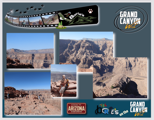
…fomos andando, apreciando a parte oeste do Grand Canyon, que é um cenário selvagem e implacável, onde a água é perigosamente escassa, repleto de desfiladeiros desconhecidos, cactos selvagens, pequenos caminhos perigosos mas, com vistas amplas e para nós maravilhosas!.
…we were walking, enjoying the west part of the Grand Canyon, which is a wild and unforgiving scenery, where water is dangerously scarce, full of unknown canyons, wild cacti, small dangerous paths but, with wide and wonderful views for us!.
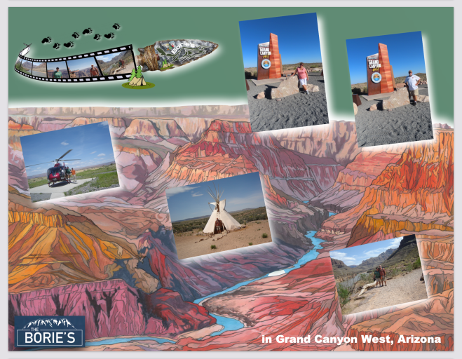
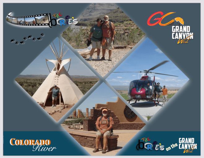
…por pura curiosidade, depois de recebermos alguma informação, também fomos para a linha, esperando a nossa vez de embarcar no helicóptero, que depois de sobrevoar uma área de aproximadamente 5 milhões de acres, que como já referimos anteriormente é o lar da tribo indígena Hualapai, onde em tempos caçavam e cultivavam uma grande faixa de planalto no norte do Arizona, bem como nas margens sul e oeste do Grand Canyon, nos levou a voar, descendo aproximadamente 3,500 pés até pousar nas margens do rio Colorado e, a ter contacto com a sua água!.
…out of sheer curiosity, after receiving some information, we also went to the line, waiting for our turn to board the helicopter, which, after flying over an area of approximately 5 million acres, which, as we mentioned earlier, is home to the Hualapai Indian tribe, who once hunted and farmed a large swath of plateaus in northern Arizona as well as the southern and western rims of the Grand Canyon, took us soaring, descending approximately 3,500 feet to land on the banks of the Colorado River, and then have contact with your water!.
…lá em baixo, na beira da água, um barco a motor levou-nos rio acima, em direcção ao parque nacional, tendo contacto com a água, num passeio, que nos pareceu uma caminhada para o céu, porque ao longo da água íamos sendo educados na geologia local, nos padrões climáticos sazonais ou na observação da vida selvagem do rio Colorado!.
…downstairs, at the edge of the water, a motor boat took us upriver, towards the national park, having contact with the water, in a walk, which seemed to us a walk to heaven, because along the we were educated in local geology, seasonal weather patterns or observing the wildlife of the Colorado River!.
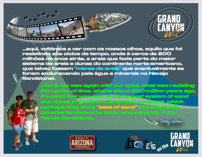
…aqui, voltámos a ver com os nossos olhos, aquilo que foi resistindo aos ciclos de tempo, onde à cerca de 200 milhões de anos atrás, a areia que fazia parte do maior sistema de areia e dunas do continente norte-americano, que talvez fossem “mares de areia” que eventualmente se foram endurecendo pela água e minerais no Navajo Sandstone, numa uniforme e incrível camada lisa de arenito, que se estendia do Arizona para Wyoming, e ainda hoje pode ter mais de dois mil pés de expessura em alguns lugares!.
…here, we saw again with our eyes, what was resisting the cycles of time, where, about 200 million years ago, the sand that was part of the largest sand and dune system on the North American continent, which perhaps they were “seas of sand” that were eventually hardened by water and minerals in the Navajo Sandstone, a uniform and amazingly smooth layer of sandstone, which stretched from Arizona to Wyoming, and still today may be over two thousand feet thick in some places!.
…e, depois de Arenito Navajo endurecido, outras camadas diferentes de sedimentares se foram empilhando, e claro, ao longo de alguns milhões de anos, a paciente água sob a forma de chuva, gelo, inundações e córregos, foi trabalhando, corroendo essas diferentes camadas de Arenito Navajo, onde a areia foi lentamente desaparecendo, surgindo um cenário a que hoje chamam o leito do rio Colorado!.
…and after the hardened Navajo Sandstone, other different sedimentary layers were piled up, and of course, over a few million years, the patient water in the form of rain, ice, floods and streams, was working, corroding (these different layers of Navajo Sandstone, where the sand was slowly disappearing, creating a scenario that is now called the bed of the Colorado River!.
…era já quase noite, quando regressamos ao Rancho, mas ainda a tempo de entre outras coisas, comer “cobras grelhadas”, dormir em cabanas, tal como os nossos antepassados dormiam há muitos anos, depois de andar a cavalo, ouvir canções de cowboys, dançar e beber cerveja à temperatura ambiental, em redor de uma enorme fogueira!.
…it was almost night when we returned to the Rancho, but there was still time to, among other things, eat “grilled snakes”, sleep in huts, as our ancestors slept many years ago, after riding horses, listening to songs (cowboys, dancing and drinking beer at room temperature, around a huge bonfire!.
…vindos do norte, alguns dias depois de atravessar o paralelo 48.º N, na intimidade de algumas estradas longas e desertas, num cenário por vezes perigoso, mas maravilhoso, ou seja, uma mistura de perigo e aventura da cabeça aos pés!. Exemplo disto foi que, em determinado momento, um urso castanho, ao atravessar a estrada, parou para “cagar”, não nos causando qualquer diferença, porque nós fazíamos o mesmo, pois por ali, não existiam “áreas de descanso”!. No fundo, no fundo, esta animalidade toda, de tão natural, acabava por ser pura e limpa, como a “cagada” do urso!.
…coming from the north, a few days after crossing the parallel 48º N, in the intimacy of some long and deserted roads, in a scenario sometimes dangerous, but wonderful, that is, a mixture of danger and adventure from head to toe!. An example of this was that, at a certain moment, a brown bear, when crossing the road, stopped to “shit”, not causing us any difference, because we did the same, because there were no “rest areas” there!. Deep down, deep down, this whole animal, so natural, turned out to be pure and clean, like the “shit” of the bear!.
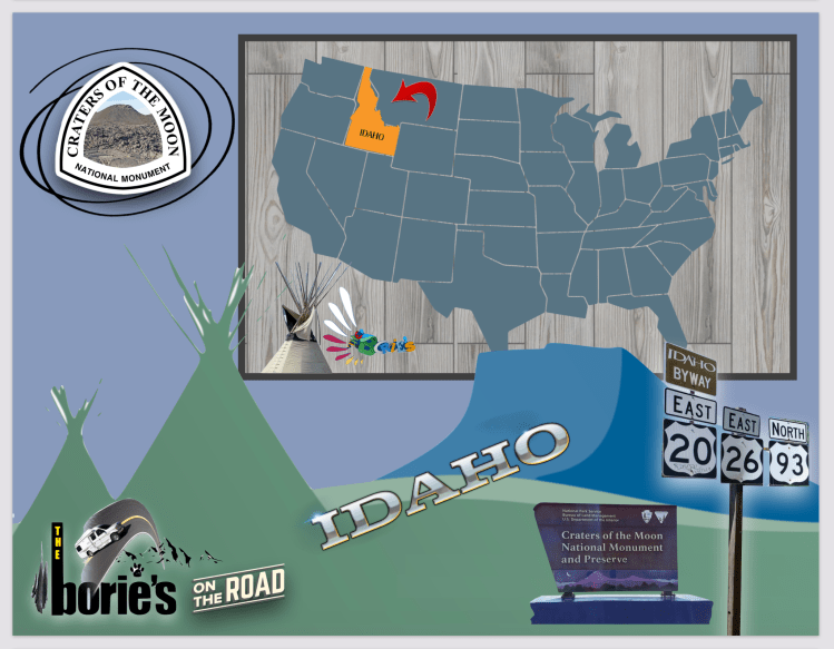
…estávamos agora no estado de Idaho, que há muitos anos atrás, fazia parte do “Oregon Country”, um território disputado entre os Estados Unidos e o Reino Unido, todavia, através de um tratado assinado no ano de 1846, os Estados Unidos assumiram posse da região, que inicialmente fazia parte do Território de Oregon, mas uns anos depois, tornou-se parte do Território de Washington!. O tempo passou e, uns anos mais tarde, este território de Idaho foi elevado à categoria de Estado, tornando-se o 43.º Estado americano a entrar na União!.
…we were now in the state of Idaho, which many years ago was part of the “Oregon Country”, a disputed territory between the United States and the United Kingdom, however, through a treaty signed in 1846, the United United took possession of the region, which initially was part of the Oregon Territory, but a few years later, it became part of the Washington Territory!. Time passed and, a few years later, this territory of Idaho was elevated to the category of State, becoming the 43rd American state to enter the Union!.
…a área para onde nos dirigia-mos, fazia parte da Trilha de Oregon, sendo mesmo um marco para os pioneiros, que viajávam nas décadas de 1850 e 1860 rumo ao oeste, em caravanas compostas de carros puxados por animais, que seguiam uma rota alternativa, usando as antigas trilhas indígenas que contornavam os fluxos de lava, que mais à frente iríamos encontrar!.
…the area we were headed to, was part of the Oregon Trail, and it was even a landmark for the pioneers, who were traveling west in the 1850s and 1860s, in caravans composed of cars pulled by animals, which followed an alternative route, using the old indigenous trails that skirted the lava flows, which we would find further ahead!.
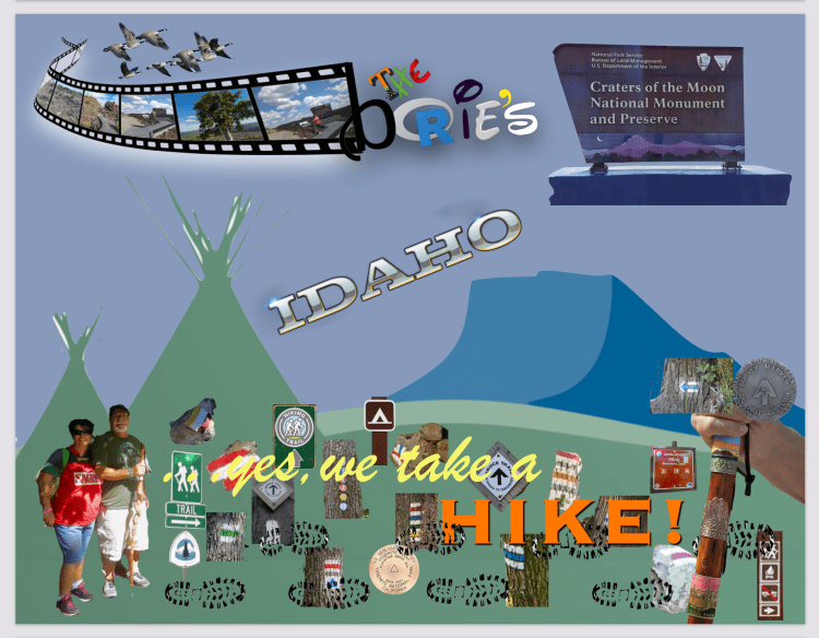
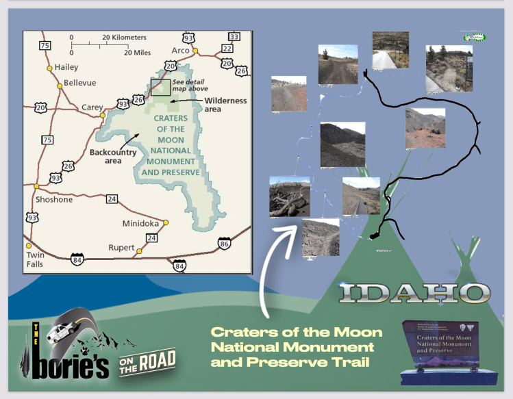
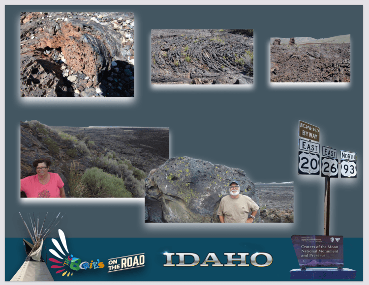
…era um deserto, a temperatura no Jeep marcava 114 graus, quando entrámos na área do Monumento e Reserva Nacional das Crateras da Lua, que é um monumento nacional dos EUA e reserva nacional na Planície do Rio Snake, no centro do território de Idaho!. Localiza-se a uma altitude média de 5.900 pés (1.800 m) acima do nível do mar e, as características desta área protegida são vulcânicas e representam uma das áreas de basalto de inundação mais bem preservadas no território continental dos Estados Unidos!.
…it was a desert, the temperature in the Jeep was 114 degrees, when we entered the area of the Monument and National Reserve of Craters of the Moon, which is a national monument of the USA and national reserve in the Snake River Plain, in the center of the territory of Idaho!. It is located at an average altitude of 5,900 feet (1,800 m) above sea level, and the characteristics of this protected area are volcanic and represent one of the best preserved flood basalt areas in the continental United States!.
…o Monumento e a Reserva abrangem três grandes campos de lava e cerca de 400 milhas quadradas (1.000 km2) de pastagens de estepe de artemísia para cobrir uma área total de 1.117 milhas quadradas (2.893 km2)!. O Monumento sozinho cobre 343.000 acres (139.000 ha) e, todos os três campos de lava ficam ao longo da Grande Fenda de Idaho, com alguns dos melhores exemplos de fissuras abertas do mundo, incluindo as mais profundas conhecidas na Terra, a 240 metros de profundidade!.
…the Monument and Reserve encompass three large lava fields and about 400 square miles (1,000 km2) of sagebrush steppe pastures to cover a total area of 1,117 square miles (2,893 km2)!. The Monument alone covers 343,000 acres (139,000 ha), and all three lava fields lie along the Great Rift of Idaho, with some of the best examples of open cracks in the world, including the deepest known on Earth, 240 meters away depth!.
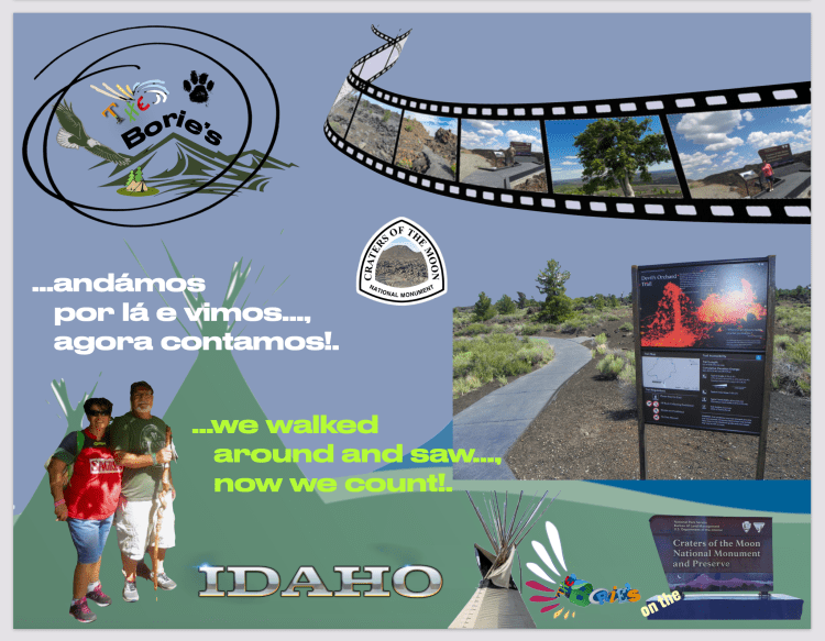
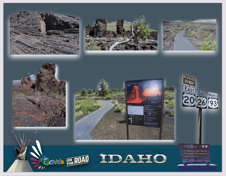
…alguém dizia a nosso lado que, depois de ver uma rocha de lava, você viu todas elas, pois todas são parecidas, no entanto, nós fizemos uma longa caminhada, mesmo com a temperatura que no momento se fazia sentir, vendo excelentes exemplos de quase todas as variedades de lava basáltica, bem como moldes de árvores (cavidades deixadas por árvores incineradas por lava), tubos de lava (um tipo de caverna) e muitas outras características vulcânicas!.
…someone said to us that, after seeing a lava rock, you saw them all, because they are all similar, however, we did a long walk, even with the temperature that was felt at the time, seeing excellent examples of almost all varieties of basaltic lava, as well as tree molds (cavities left by trees incinerated by lava), lava tubes (a type of cave) and many other volcanic features!.
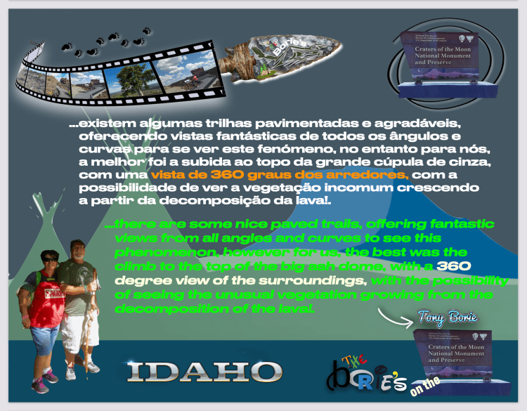
…existem algumas trilhas pavimentadas e agradáveis, oferecendo vistas fantásticas de todos os ângulos e curvas para se ver este fenómeno, no entanto para nós, a melhor foi a subida ao topo da grande cúpula de cinza, com uma vista de 360 graus dos arredores, com a possibilidade de ver a vegetação incomum crescendo a partir da decomposição da lava!.
…there are some nice paved trails, offering fantastic views from all angles and curves to see this phenomenon, however for us, the best was the climb to the top of the big ash dome, with a 360 degree view of the surroundings, with the possibility of seeing the unusual vegetation growing from the decomposition of the lava!.
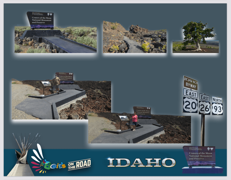
…podemos presenciar crateras de vulcões adormecidos, que formavam vales e pequenas montanhas, onde só existia pedra negra, agreste, com a formação de pequenas ondas, que em alguns lugares, estavam a detiriorar-se, porque estavam ali, a sofrer a erosão, recebendo calor, frio ou chuva, por milhares de anos!.
…we can witness craters of sleeping volcanoes, which formed valleys and small mountains, where there was only black stone, rough, with the formation of small waves, which in some places were deteriorating, because they were there, suffering the erosion, receiving heat, cold or rain, for thousands of years!.
…visitamos o Centro de Visitantes e assistimos a um filme, com informação sobre o que estávamos vendo, ficando a saber que, as erupções vulcânicas mais recentes terminaram há cerca de 2.100 anos e, provavelmente foram testemunhadas pelo povo Shoshone, que eram os paleo-indianos, que visitaram a área cerca de 12.000 anos atrás!.
…we visited the Visitors Center and watched a movie, with information about what we were seeing, finding out that the most recent volcanic eruptions ended about 2,100 years ago and were probably witnessed by the Shoshone people, who were the paleo-indians, who visited the area about 12,000 years ago!.
…no entanto, não deixaram muitas evidências arqueológicas, todavia, acredita-se que criaram trilhas através das crateras do campo de lava durante as suas migrações de verão do rio Snake, para as pradarias existentes a oeste do campo de lava, não existindo evidência de habitação permanente por qualquer grupo nativo americano, onde se presume que faziam caça e colecta, perseguindo alces, ursos, bisões, pumas e ovelhas selvagens, ou seja, animais grandes que não mais ocupam esta área!.
…however, they did not leave much archaeological evidence, however, it is believed that they created trails through the craters of the lava field during their summer migrations from the Snake River, to the prairies existing west of the lava field. evidence of permanent housing by any Native American group, where hunting and gathering is presumed, chasing moose, bears, bison, cougars and wild sheep, that is, large animals that no longer occupy this area!.
Tony Borie, Sécuo XXI. (Tony Borie, 21st Century).
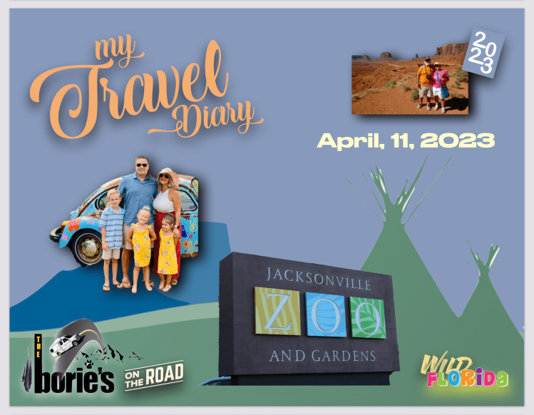
…na área onde presentemente vivemos, os últimos dias foram de chuva, vento e algum frio!. Como tal e com a visita de parte da família que vive no norte, a maneira de passar o tempo que normalmente é na praia, assim…, tem sido à volta de casa!. As crianças, falam em inúmeros lugares onde queriam visitar na Florida e…, num dia da semana em que o tempo parecia melhor pediram quase cantando…, poderíamos ir ao zoológico?.
…in the area where we currently live, the last few days have been rain, wind and some cold!. As such, and with the visit of part of the family that lives in the north, the way to spend time that is usually on the beach, like this…, has been around the house!. The children talk about the countless places they wanted to visit in Florida and…, on a day of the week when the weather seemed better, they asked almost singing…, could we go to the zoo?.
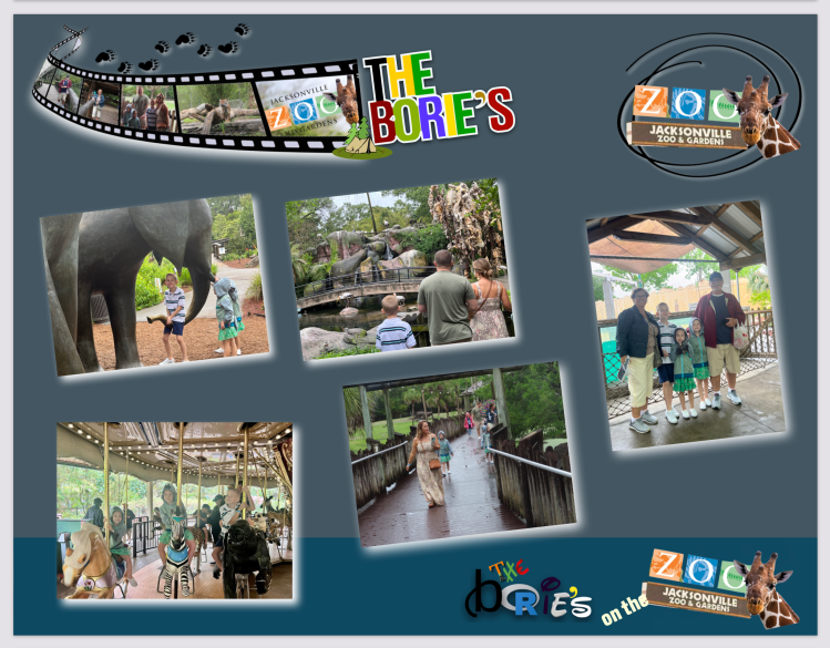
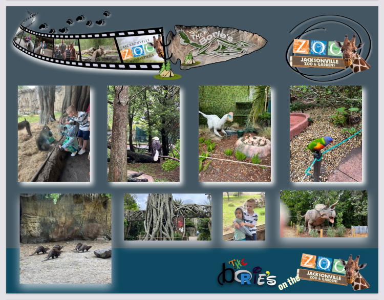
…depois, em pouco mais que uma hora de carro, estávamos no portão da frente do “Zoo e Jardins” nos arredores da cidade de Jacksonville, fazendo parte dos mais de um milhão de visitantes que aqui vêm anualmente!. Entretanto, os pais compraram os ingressos no computador, sobretudo para evitar as filas, onde um amável funcionário do zoológico nos ajudou a identificar os ingressos antes de entrar e, nós os adultos, levámos roupa e jaquetas para no caso de chuva, no entanto as crianças ao passar pela loja de recordações imediatamente pediram aquelas jaquetas imitando alguns animais do Zoo!.
…then, in just over an hour by car, we were at the front gate of the “Zoo and Gardens” on the outskirts of the city of Jacksonville, part of the more than one million visitors who come here annually!. However, the parents bought the tickets on the computer, mainly to avoid the queues, where a kind zoo employee helped us to identify the tickets before entering and, we adults, we took clothes and jackets in case of rain, however the children when passing by the souvenir shop immediately asked for those jackets imitating some animals from the Zoo!.
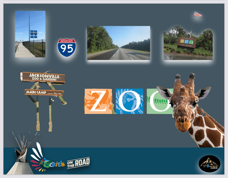
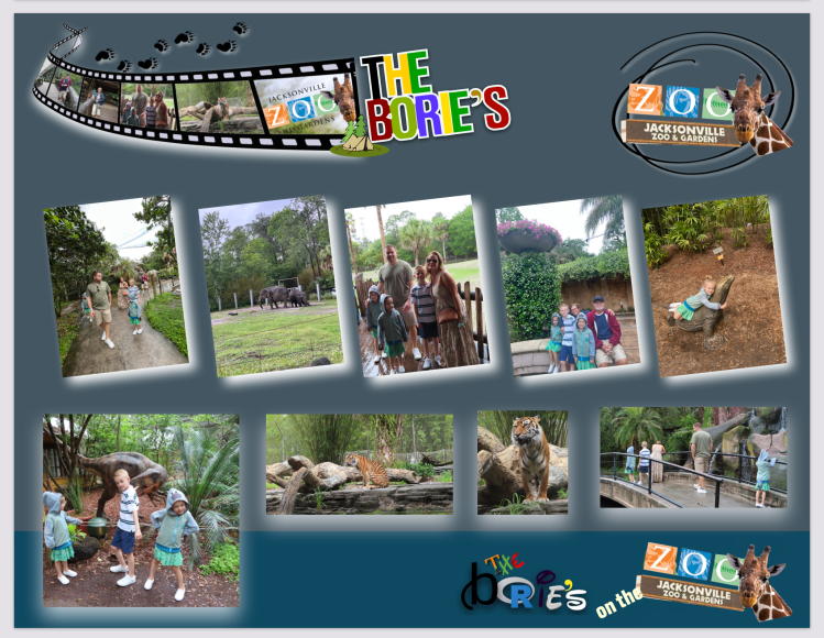
…já estávamos dentro do Zoo que fica localizado na foz do rio Trout, perto de onde deságua o rio St. Johns!. Começámos por caminhar, caminhar, parando aqui e ali!. Em primeiro lugar, fomos dar uma olhada nos elefantes que enfiavam a tromba nas grades para roubar erva, folhas e alguns vegetais!. Por ali havia outros vários animais, incluindo leopardos, onças, hipopótamos, alligatores, porcos-espinhos ou até cobras!.
…we were already inside the Zoo which is located at the mouth of the Trout River, close to where the St. Johns!. We started walking, walking, stopping here and there!. First, we went to take a look at the elephants that stuck their trunks through the bars to steal grass, leaves and some vegetables!. There were other various animals there, including leopards, jaguars, hippos, alligators, porcupines or even snakes!.
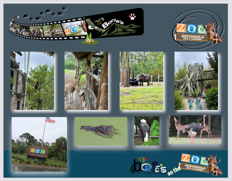
…caminhando por carreiros de cimento ou passadiços em madeira que nos levavam às exposições dos animais com segurança, onde alguns estavam atrás de uma cerca ou de uma parede de vidro, como por exemplo as áreas designadas por Planícies da África Oriental, destacando os animais da savana africana, com diversas espécies de macacos e outros animais e…, a Florida Selvagem, que apresenta os animais nativos do estado!. Às vezes, alguns animais estavam onde não se conseguiam ver, mas tudo bem se não se conseguia ver todos os animais do zoológico, pois eram tantos!.
…walking along cement paths or wooden walkways that took us safely to the animal exhibits, where some were behind a fence or a glass wall, such as the areas designated as East African Plains, highlighting the animals of the African savannah, with several species of monkeys and other animals and…, Wild Florida, which presents the native animals of the state!. Sometimes, some animals were where you couldn’t see them, but it’s okay if you couldn’t see all the animals in the zoo, because there were so many!.
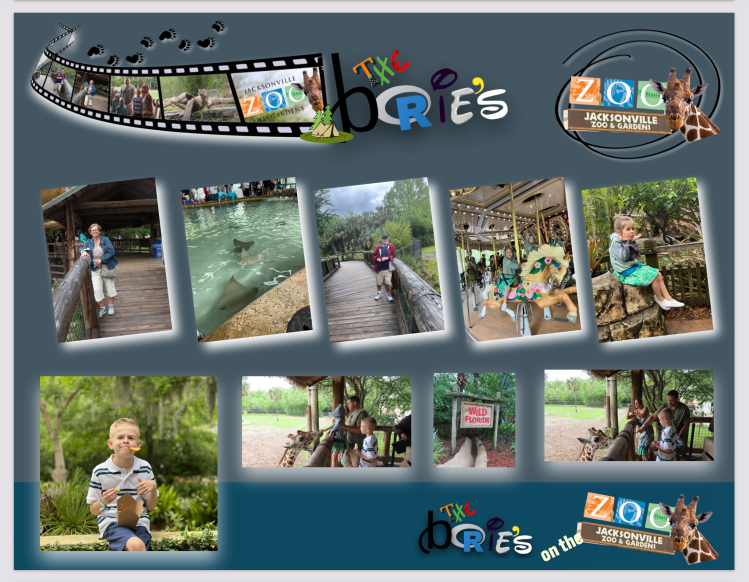
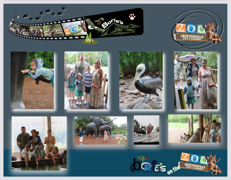
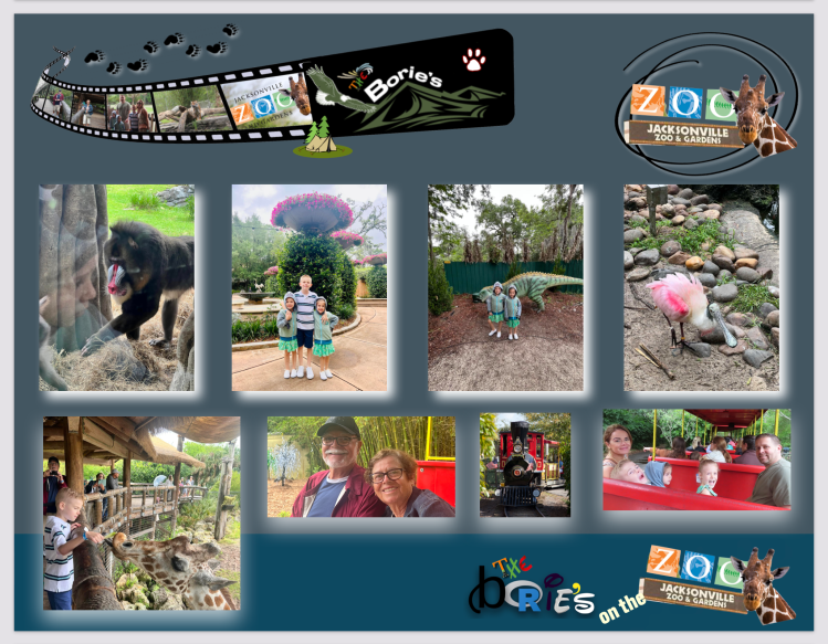
…entretanto, chegámos junto das girafas que eram fantásticas, comendo directamente das mãos das crianças uma simples folha de alface, que a assistente que estava ali para gentilmente oferecer às já mencionadas crianças!. Uma das nossas crianças até disse em voz alta: “no meu aniversário quero uma girafa igual a esta”!.
…in the meantime, we got close to the giraffes who were fantastic, eating directly from the children’s hands a simple lettuce leaf, which the assistant who was there to kindly offer the aforementioned children!. One of our children even said out loud: “For my birthday I want a giraffe just like this”!.
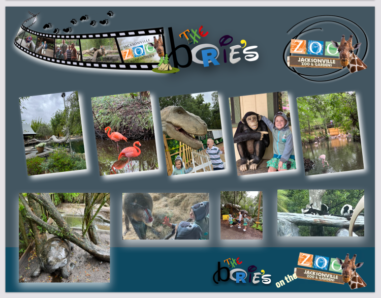
…continuando, chegámos à área dos macacos que faziam todo o tipo de acrobacias fazendo as crianças rirem-se, divertirem-se e…, através do vidro de segurança, rosnavam parecendo até que iam atacar!. Entretanto entrámos na área do safari dos tigres, onde dentro de um recinto bastante longo que incluía trilhas, pequenos lagos, árvores e rochas, onde havia cinco tigres, parecendo que nos compreendiam e que se colocavam em diferentes posições para melhor se poderem fotografar, parando, olhando-nos, abrindo a boca, esticando as pernas ou deitando-se ao comprido!.
…continuing on, we reached the area where the monkeys performed all kinds of acrobatics, making the children laugh, have fun and…, through the safety glass, they growled, looking as if they were going to attack!. Meanwhile we entered the tiger safari area, where within a fairly long enclosure that included trails, small lakes, trees and rocks, there were five tigers, seeming to understand us and that they were putting themselves in different positions to better be able to photograph themselves, stopping , looking at us, opening its mouth, stretching its legs or lying down lengthwise!.
…continuando, entrámos na área dos pássaros, que era uma autêntica floresta tropical!. Havia por ali entre outras aves, pavões, que gostam de ficar sózinhos, incluindo um pavão branco, outro num tom azul que havia espalhado as suas belas penas e parecia que estava dançando, gansos de diferentes cores e tamanhos, flamingos, cisnes, piriquitos ou patos pequeninos que nadavam atrás da mãe pata!. As águias estavam numa área à parte cercada por uma rede metálica!.
…continuing, we entered the bird area, which was an authentic tropical forest!. There were other birds around, peacocks, which like to be alone, including a white peacock, another in a blue tone that had spread its beautiful feathers and looked like it was dancing, geese of different colors and sizes, flamingos, swans, parakeets or tiny ducks that swam after the mother duck!. The eagles were in a separate area surrounded by a metallic net!.
…local este onde também se abriga uma grande colónia de reprodução de cegonhas selvagens, que embora não estejam ameaçadas de extinção, esta ave continua um achado raro no continente norte-americano, e neste caso, fixou residência permanente aqui, numa árvore quase gigante e com bastante ramagem!.
…this place is also home to a large breeding colony of wild storks, which although not endangered, this bird remains a rare find on the North American continent, and in this case, it took up permanent residence here, in an almost giant tree and with plenty of branches!.
…próximo também havia a casa dos répteis que mostra a variedade de répteis e anfíbios nativos da Florida, com várias espécies de cobras e cascavéis que estão entre as suas principais atrações!.
…next there was also the house of reptiles that shows the variety of reptiles and amphibians native to Florida, with several species of snakes and rattlesnakes that are among its main attractions!.
…a pedido das crianças, passámos algum tempo belo Asian Bamboo Garden que apresenta plantações e elementos extraídos de toda a Ásia e não pretende representar um país ou cultura específicos!. A sua entrada é pelo Trout River Plaza através de um tradicional portão circular da lua!. Um grande lago de lótus e uma piscina de carpas incorporam recursos de rocha e água destinados a evocar os princípios chineses!. O jardim também possui uma Ponte da Lua, refletindo a forma da lua na água da piscina de lótus, e um bosque de bambu contendo uma escultura de bronze de um panda gigante!.
…at the request of the children, we spent some time in the beautiful Asian Bamboo Garden, which features plantings and elements drawn from across Asia and is not intended to represent a specific country or culture!. Its entrance is through Trout River Plaza through a traditional circular moon gate!. A large lotus pond and koi pool incorporate rock and water features intended to evoke Chinese principles!. The garden also features a Moon Bridge, reflecting the shape of the moon in the water of the lotus pool, and a bamboo grove containing a bronze sculpture of a giant panda!.
…é um fenómeno mas é verdade!. Se precisar-mos de um lugar tranquilo para fazer uma pausa, podemos sentar-nos num banco próximo ao curral das cabras!. As cabras são divertidas de assistir, principalmente as bebés, porque podem pular e brincar umas com as outras. Podemos até acariciá-las gentilmente nas costas e comprando a sua comida preferida, segurando-a com a mão espalmada e aberta, as cabras usarão os seus lábios macios para pegar essa comida!.
…is a phenomenon but true!. If we need a quiet place to take a break, we can sit on a bench near the goat corral!. Goats are fun to watch, especially the baby ones, because they can jump and play with each other. We can even stroke them gently on the back and when buying their favorite food, holding it with an open and flat hand, the goats will use their soft lips to take that food!.
…dentro do zoológico havia muitas mais coisas para ver!. Podíamos olhar no mapa ou nas placas de informação que nos ajudavam a encontrar o caminho, como por exemplo onde se localizava o “carroucel”, encontrar uma casa de banho, uma casa de venda comida e bebida ou a estação mais próxima do pequeno combóio que por ali circulava apitando frquentemente!.
…inside the zoo there were many more things to see!. We could look on the map or on the information boards that helped us find the way, such as where the “carroucel” was located, finding a bathroom, a food and drink shop or the nearest station for the small train that there it circulated whistling frequently!.
…quando chegou a hora de sair, caminhámos calmamente até ao portão de saída, pensando que um dia destes iremos voltar ao zoológico, nem que seja só para aprender mais sobre os diferentes animais e aves que vimos neste magnífico lugar!.
…when it was time to leave, we walked calmly to the exit gate, thinking that one of these days we would return to the zoo, if only to learn more about the different animals and birds we saw in this magnificent place!.
Tony Borie, Século XXI. (Tony Borie, 21st Century).
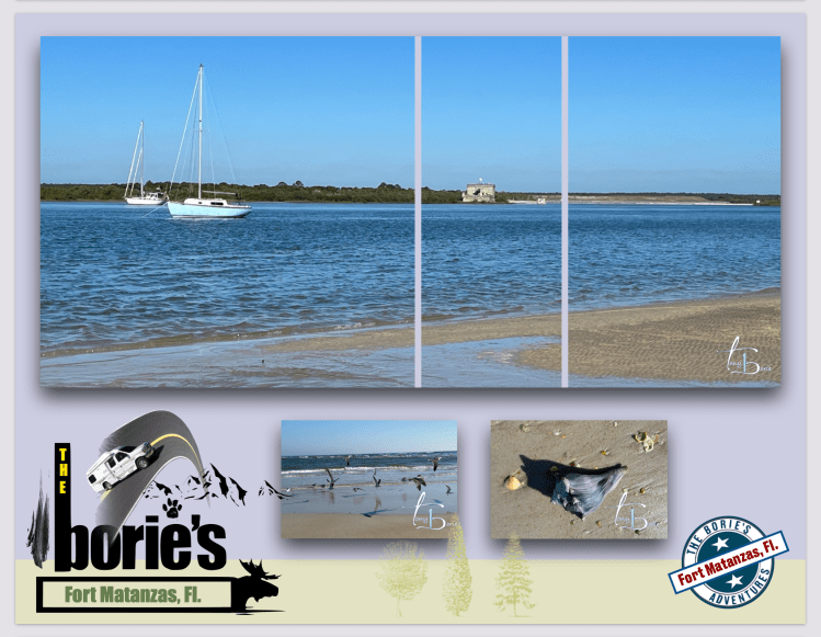
…a nossa dedicada esposa Isaura tirou estas fotos da área a que carInhosamente chamamos a nossa “Trilha da água, que é composto por um pequeno circuito de água salgada do oceano Atlântico, onde por vezes alguns golfinhos tendem em aparecer e onde nós caminhando, passamos sob a ponte da foz do rio Matanzas, entrando pela baía, onde usufruímos de uma vista previlegiada do Monumento Nacional do Forte de Matanzas!.
…our dedicated wife Isaura took these photos of the area that we affectionately call our “Water trail, which is made up of a small circuit of salt water from the Atlantic Ocean, where sometimes some dolphins tend to appear and where we walk, pass under the bridge at the mouth of the Matanzas River, entering the bay, where we enjoy a privileged view of the National Monument of the Fort of Matanzas!.
…cujo nome para muitas pessoas não é lá muito bonito!. E…, porquê Matanzas?. Matanzas, é uma área onde desagua o Rio Matanzas, cuja entrada não é estabilizada por molhes, portanto, está sempre sujeita a mudanças, como exemplo, existem mapas históricos feitos por militares espanhóis no século XVIII, que nos mostram que a enseada hoje se deslocou muitas centenas de metros para sul, do que era a sua localização durante a época do Império Espanhol!.
…whose name for many people is not very beautiful!. And…, why Matanzas?. Matanzas, is an area where the Matanzas River flows, whose entrance is not stabilized by jetties, therefore, it is always subject to changes, as an example, there are historical maps made by the Spanish military in the 18th century, which show us that the cove has moved many hundreds of meters to the south, from what was its location during the time of the Spanish Empire!.
…e, onde a sua história nos diz que exploradores franceses fundaram Forte Caroline, no que é hoje a cidade de Jacksonville, por volta do ano de 1564, como refúgio para os colonos “Huguenotes”!. Como tal, em resposta a essa invasão francesa sobre aquilo que a Espanha considerava como seu território, um tal Pedro Menéndez de Avilés, fundou a cidade de Santo Agostinho no ano seguinte!.
…and, where its history tells us that French explorers founded Fort Caroline, in what is now the city of Jacksonville, around the year 1564, as a refuge for “Huguenot” settlers!. As such, in response to this invasion French over what Spain considered its territory, a certain Pedro Menéndez de Avilés, founded the city of Saint Augustine the following year!.
…e, sentindo-se preparado para combate, Menéndez de Avilés, rápidamente atacou Forte Caroline, viajando por terra!. Ao mesmo tempo, os franceses pensando o mesmo, navegaram, pretendendo atacar Santo Agostinho por mar!. Os espanhóis dominaram o pouco defendido Forte Caroline, poupando apenas as mulheres e crianças, enquanto os franceses, fustigados por uma enorme tempestade, naufragaram os seus navios na costa de Santo Agostinho!.
…and, feeling prepared for combat, Menéndez de Avilés, quickly attacked Fort Caroline, traveling by land!. At the same time, the French thinking the same, sailed, intending to attack Saint Augustine by sea!. The Spanish dominated the poorly defended Fort Caroline, sparing only the women and children, while the French, buffeted by a huge storm, wrecked their ships off the coast of Saint Augustine!.
…assim, quando os espanhóis encontraram os sobreviventes que iam dando à praia, executaram-nos, atravessando-os com uma espada junto das dunas!. A localização dessas dunas, tornaram-se conhecidas como “Matanzas”, que no idioma espanhol quer dizer mais ou menos “abates”!. Como tal, esta área ficou para sempre chamada de Matanzas!.
…so, when the Spaniards found the survivors who were washed up on the beach, they executed them, crossing them with a sword near the dunes!. The location of these dunes became known as “Matanzas”, which in the Spanish language means more or less “slaughter”!. As such, this area was forever called Matanzas!.
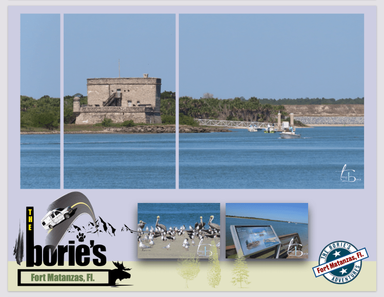
…depois, houve mais lutas com corsários que navegavam por aqui, principalmente britânicos, que sempre tentaram bloquear esta importante entrada que era o ascesso mais meridional que os espanhóis usavam para as suas viagens de barco entre Santo Agostinho e Havana, Cuba!. Contudo durou pouco tempo, pois alguns anos depois, os espanhóis, usando como mão de obra, condenados, escravos e tropas de Cuba, erigeram uma torre de pedra coquina de 15 metros quadrados, por 9,1 metros de altura, agora chamada Forte Matanzas, na actual Ilha de Rattlesnake, ficando assim com uma posição de comando, sobre a enseada de Matanzas, salvaguardando esta entrada estratégica!.
…then, there were more fights with privateers who sailed here, mainly British, who always tried to block this important entrance, which was the southernmost access that the Spaniards used for their boat trips between Saint Augustine and Havana, Cuba!. However, it was short-lived, as a few years later, the Spaniards, using convicts, slaves and troops from Cuba as labor, erected a coquina stone tower measuring 15 square meters, 9.1 meters high, now called Fort Matanzas, on the current Rattlesnake Island, thus having a command position over the Matanzas cove, safeguarding this strategic entrance!.
…hoje, é um lugar histórico onde adoramos caminhar num areal que se estende por uma distância até se perder de vista, onde a colónia de aves selvagens é imensa, voando e aterrando junto a nós e, às vezes quando se juntam, tal como faziam os espanhóis, defendem o seu território!.
…today, it is a historic place where we love to walk on a beach that stretches for a distance as far as the eye can see, where the colony of wild birds is immense, flying and landing next to us and, sometimes when they get together, just as they did the Spaniards defend their territory!.
Tony Borie, Século XXI. (Tony Borie, 21st Century).
…vamos sorrir!. Porque rir, quando se tem vontade e quanto mais alto melhor, é um bom exercício!. É quase como correr por dentro!. Engraçado, não nos lembramos onde já vimos esta frase escrita, devemos de andar distraídos, deve ser a idade, pois também não nos lembramos de estar distraídos!.
…lets smile!. Because laughing, when you feel like it and the louder the better, is good exercise! It’s almost like running inside!. Funny, we do not remember where we have already seen this sentence written, we must be distracted, it must be age, as we also do not remember being distracted!.
…era no estado do Arizona, íamos rumo ao norte na estrada rápida número 17!. Atravessávamos zonas desertas, com uma povoação aqui e ali normalmente um pouco retirado da estrada, dando a entender que eram comunidades de casas “rasteiras”, que se confundiam com a pouca vegetação que por ali havia!. Uma curiosidade, era que quase sempre estava uma “pick- up” ou duas já antigas na frente ou no lado dessas casas!.
…it was in the state of Arizona, we were heading north on fast road number 17!. We crossed desert areas, with a village here and there usually a little removed from the road, implying that they were communities of “low-level” houses, which blended in with the little vegetation there was!. A curiosity was that there was almost always an old “pick-up” or two in front or on the side of these houses!.
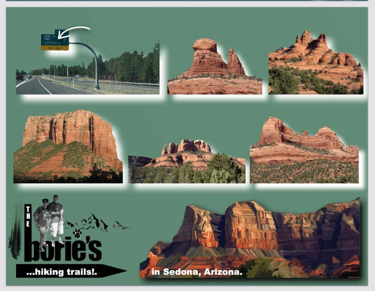
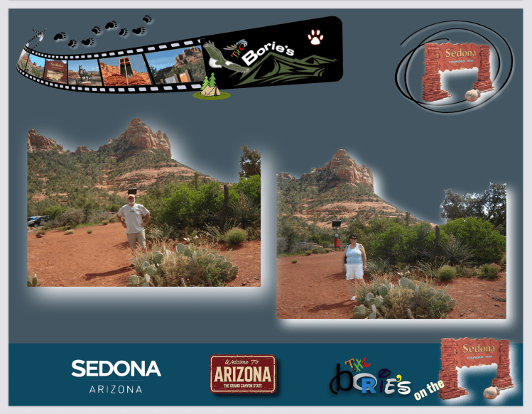
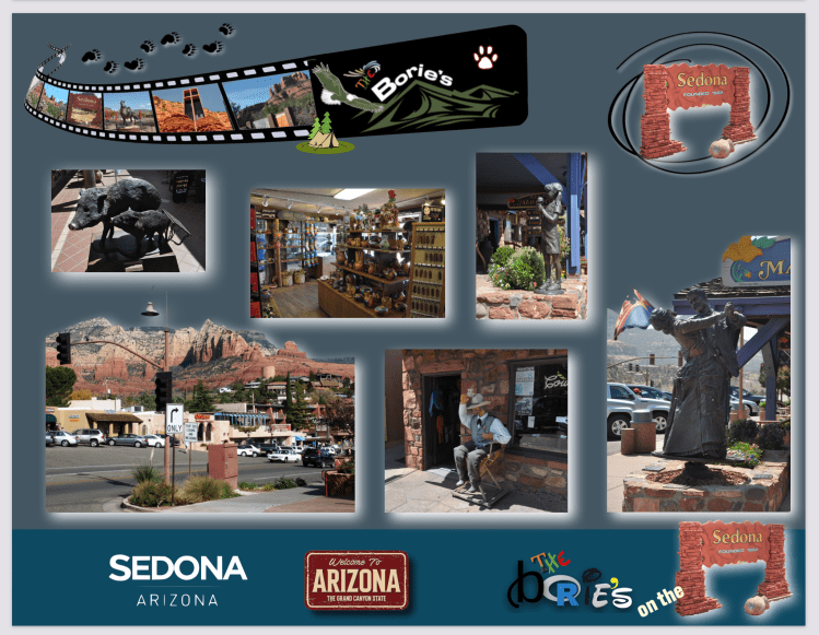
…voltando à estrada e cntinuando a nossa rota rumo ao norte, estava a cidade de Sedona!. Aqui sim, parámos!. Está situada na parte alta do Deserto de Sonora, deve de ser a cidade onde há vestígios de presença humana, mais antiga nos USA, pois dizem que 11.500 até 9.000 anos AC, já por aqui andavam pessoas, que habitavam a região a que hoje chamam “Verde Valley” e está rodeada de pequenas montanhas de arenito vermelho, com lugares estratégicos, onde se pode admirar a natureza, principalmente ao pôr do sol!.
..returning to the road and continuing our route towards the north, there was the city of Sedona!. Here yes, we stopped!. It is located in the upper part of the Sonoran Desert, it must be the city where there are traces of human presence, the oldest in the USA, as they say that from 11,500 to 9,000 years BC, people were already walking around here, who inhabited the region that today they call “Verde Valley” and is surrounded by small red sandstone mountains, with strategic places where you can admire nature, especially at sunset!.
…é uma cidade com muito turismo, para onde se deslocam muitas pessoas, algumas até aqui fixam residência, pois a sua altitude, 4500 pés, (1372 metros), e o seu clima suave, tanto no inverno como no verão, fazem desta cidade um bom lugar para viver!.
…it is a city with a lot of tourism, where many people travel, some even settle here, because its altitude, 4500 feet, (1372 meters), and its mild climate, both in winter and in summer, make this city a good place to live!.
…alguém nos disse, que é uma cidade “Hollywood”, pois já se rodaram aqui mais de 60 produções, que com o tempo se tornaram famosas, e também por aqui caminharam e viveram “Estrelas de Hollywood”, como por exemplo, Errol Flynn, John Wayne, Joan Crawford, James Steward, Robert Michum ou Elvis Presley, chamam-lhe mesmo, “Arizona’s Little Hollywood”!.
…someone told us that it is a “Hollywood” city, as more than 60 productions have already been filmed here, which over time became famous, and “Hollywood Stars” have walked and lived here, such as for example, Errol Flynn, John Wayne, Joan Crawford, James Steward, Robert Michum or Elvis Presley, they even call it, “Arizona’s Little Hollywood”!.
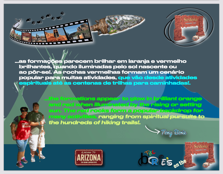
…as atracções principais de Sedona é a sua variedade de formações de arenito vermelho que parecem brilhar em laranja e vermelho brilhantes, quando iluminadas pelo sol nascente ou até ao pôr do sol!.
…the main attractions of Sedona are its variety of red sandstone formations that seem to glow bright orange and red when illuminated by the rising sun or even at sunset!.
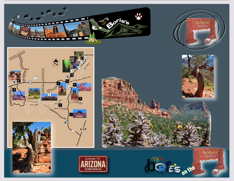
…nós, simples visitantes, explorámos alguns lugares que nos informaram serem mais populares e conhecidos, no entanto ficámos com a sensação de que não importa se é pela primeira vez ou pela centésima vez que por aqui caminhamos, pois existem tantos lugares incríveis para ver e coisas para fazer em Sedona que podemos mesmo perguntar por onde é que devemos começar!.
…we, simple visitors, explored some places that we were told were more popular and known, however we were left with the feeling that it doesn’t matter if it’s the first time or the hundredth time that we walk through here, because there are so many amazing places to see and things to do in Sedona that we might even wonder where should we start!.
…por exemplo, existem mais de quatro centenas de trilhas por entre montanhas e áreas consideradas sagradas para os nativos Navajo e Hopi por gerações!. Dentro da pequena cidade também existem museus, lojas de lembranças, cafés ou restaurantes, tal como esplanadas com motivos decorativos da região mais alta do Deserto de Sonora!.
…for example, there are more than four hundred trails through mountains and areas considered sacred to Navajo and Hopi natives for generations)!. Within the small town there are also museums, souvenir shops, cafes or restaurants, as well as terraces with decorative motifs from the highest region of the Sonoran Desert!.
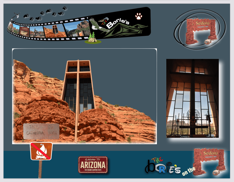
…ou a popular Capela da Santa Cruz, uma capela católica romana construída de 1954 a 1956 nas colinas de rocha vermelha de Sedona, dentro da Floresta Nacional de Coconino, onde quando os visitantes sobem uma rampa longa e curva do estacionamento até a capela podem apreciar entre outras, a beleza e as característica de uma cruz de ferro de 90 pés (27,4 m) de altura na parede sudoeste, que serve a propósitos estéticos e estruturais, que cria uma impressão de grandeza e força e que fica na base de um penhasco de 1.500 pés (457,2 m) e é cercado por enormes pedaços de arenito!.
…or the popular Chapel of the Holy Cross, a Roman Catholic chapel built from 1954 to 1956 in the red rock hills of Sedona, within the Coconino National Forest, where visitors walk up a long, curving ramp from the parking lot to the chapel. among others, the beauty and features of a 90-foot (27.4 m) high iron cross on the southwest wall, which serves both aesthetic and structural purposes, which creates an impression of grandeur and strength and which stands at the base of (a cliff of 1,500 feet (457.2 m) and is surrounded by huge pieces of sandstone!.
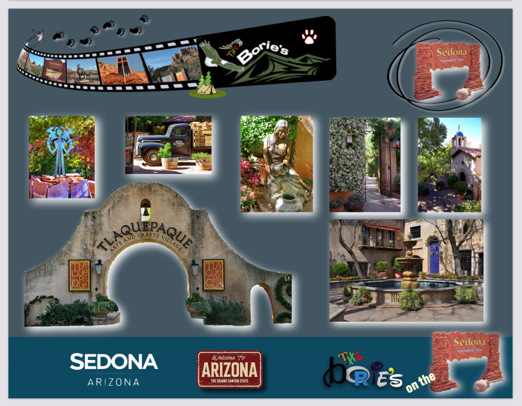
…ainda antes de continuar a nossa jornada rumo ao norte, visitámos também a “Tlaquepaque Arts & Shopping Village”, que é um agradável lugar e que segue o modelo de Guadalajara, oferecendo-nos uma experiência única onde existem pátios íntimos e um lindo terraço, com a pitoresca capela de estilo antigo, parecendo-nos um local perfeito para convívio e…, se sentir alguma paz!.
…even before continuing our journey north, we also visited the “Tlaquepaque Arts & Shopping Village”, which is a pleasant place that follows the model of Guadalajara, offering us a unique experience where there are intimate patios and a beautiful terrace , with the picturesque old-style chapel, looking like a perfect place for socializing and…, if you feel some peace!.
…gostávamos de ter pernoitado por aqui, mas os preços de qualquer bem comum que qualquer cidadão necessita para sobreviver, não estavam de acordo com as nossas possibilidades financeiras, portanto, a solução foi retomar o rumo do norte ao encontro da cidade a que chamam de Flagstaff, cuja economia ainda hoje sobrevive entre outras coisas, à custa da madeira que fornece para as traves do caminho de ferro, onde perguntamos a uma simpática senhora qual a comida original desta área. Logo nos respondeu que os seus pais comiam carne de búfalo!
…we would have liked to have spent the night here, but the prices of any common good that any citizen needs to survive, were not in line with our financial possibilities, so the solution was to return to the north towards the city they call Flagstaff, whose economy still survives today, among other things, at the expense of the wood it supplies for the railroad beams, where we asked a nice lady what the original food of this area is. Soon she replied that her parents ate buffalo meat!.
Tony Borie, Século XXI. (Tony Borie, 21st Century).
…nós, aventureiros, cidadãos do mundo, vamos percorrendo um percurso sem qualquer destino, até onde a idade e alguma saúde, nos autorize a desfrutar do previlégio que é, poder usufuir da luz do sol, da água da chuva, do frio da neve, do calor da praia, da amizade das pessoas, ou de continuarmos a poder acompanhar o crescimento da família, sentindo o seu amor, traduzido em algum carinho!.
…we, adventurers, citizens of the world, let us go on a course without any destination, as far as age and some health, allow us to enjoy the privilege that is, to be able to enjoy the light of the sun, rainwater, cold snow, the warmth of the beach, the friendship of people, or to continue to be able to keep up with the growth of the family, feeling their love, translated into some affection!.
…porquê, não sabemos!. Mas sempre tivémos uma certa atracção pelo estado de Dakota do Sul, talvez as suas planícies onde ainda pastam alguns rebanhos de búfalos, as montanhas Black Hills, na parte oeste, onde sobressaiem rochas gigantes de granito, algumas cobertas de árvores centenárias, que nos mostram um cenário de beleza, onde a floresta continua intacta e em paz, depois de lutas por anos e anos entre os índios americanos e os colonizadores, que iam avançando para oeste, desejando aquele território, ou talvez a sua história de cidades pioneiras, como por exemplo Deadwood!.
…why, we do not know!. But we’ve always had a certain attraction for the state of South Dakota, perhaps its plains where some herds of buffalo still graze, the Black Hills in the west, where giant granite rocks stand out, some covered with centuries-old trees, which show us a landscape of beauty, where the forest remains intact and in peace, after struggles for years and years between the American Indians and the settlers, who were advancing towards the west, wishing that territory, or perhaps its history of pioneer cities, example Deadwood!.
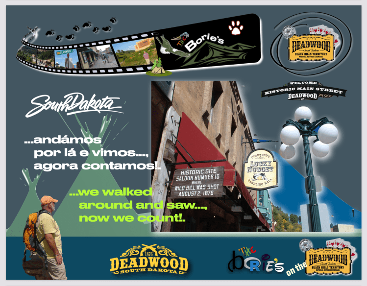
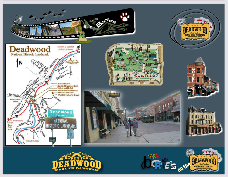
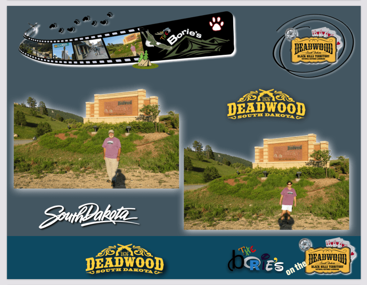
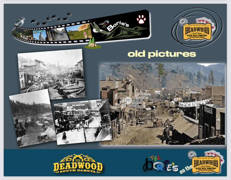
…e…, já era ao anoitecer, a estrada desenhava algumas curvas, descidas e subidas, quando nos surge a cidade de Deadwood, no estado de Dakota do Sul, situada nas colinas das montanhas deBlack Hills, com uma história de centenas de anos que, por volta do ano de 1870 se formou com um assentamento ilegal, assim como ilegal foi parte da sua vivência, onde cresceram os salões de jogo, vieram as prostitutas, o álcool corria nas gargantas, sendo tudo pago com pepitas de ouro, não havia lei, ou se havia não se respeitava, matáva-se por uma pá, uma bacia de limpar a terra do ouro, ou por um burro da carga, enfim…, era a lei do mais rápido!.
…and…, it was already dusk, the road drew some curves, descents and ascents, when the city of Deadwood, in the state of South Dakota, situated in the hills of the Black Hills mountains, with a history of hundreds of years , around the year 1870 formed with an illegal settlement, just as illegal was part of their experience, where gambling halls grew, prostitutes came, alcohol ran in the throats, all being paid with gold nuggets, there was law, or if it had not respected itself, it was killed by a shovel, a basin to clean the land of gold, or by a donkey of the load, finally, was the law of the fastest!
…num território concedido aos Índios Americanos no Tratado de Laramie no ano de 1868, território este, que já pertencia ao povo Lakota, verdadeiros habitantes desta área por séculos, garantia-lhes a posse das montanhas e colinas de Black Hills, todavia as disputas sobre aquelas colinas continuaram e, tinham que continuar, pois havia lá ouro, tendo as disputas atingido a Suprema Corte dos USA, por diversas ocasiões!.
…in a land granted to the American Indians in the Treaty of Laramie in 1868, this territory, which already belonged to the Lakota people, true inhabitants of this area for centuries, guaranteed them the possession of the mountains and hills of the Black Hills, yet the disputes over those hills continued, and they had to continue, for there was gold there, and the disputes reached the Supreme Court of the USA, on several occasions!.
…verdadeiramente, o que é hoje a cidade de Deadwood começou, quando o coronel George Armstrong Custer, liderou uma expedição a essas montanhas, anunciando a descoberta de ouro, no “French Creek”, que era um ribeiro que por lá passava, perto do que é hoje a cidade de Custer, no mesmo estado!. O anúncio do coronel Custer, desencadeou a corrida ao ouro na área de Black Hills, dando origem ao que hoje chamam a cidade de Deadwood, onde a sua população, rápidamente, de apenas de umas dezenas, passou para 5.000 pessoas!.
…truly, what is today the city of Deadwood began, when Colonel George Armstrong Custer led an expedition to these mountains, announcing the discovery of gold, in the French Creek, which was a brook that passed through there, near what is now the city of Custer, in the same state!. Colonel Custer’s announcement unleashed the gold rush in the Black Hills area, giving rise to what they now call the city of Deadwood, where its population, quickly, from only a few dozen, passed to 5,000 people!.
…depois, foi a azáfama normal em povoações que se formaram com a corrida ao ouro, longe da pouca civilização que naquele tempo havia, onde tudo era permitido, o ouro abundava, não se respeitava nada a não ser a ganância e a oportunidade de ser mais poderoso que o vizinho, lutavam e matavam, por um pequeno espaço num qualquer ribeiro, o álcool, a pólvora, as armas, o jogo, os salões com senhoras cresciam e, tudo era pago com ouro!.
…later, it was the usual bustle in settlements that formed with the gold rush, away from the little civilization that was in those days where everything was allowed, gold abounded, nothing was respected except greed and opportunity to be more powerful than the neighbor, they fought and killed, for a little space in any brook, alcohol, gunpowder, guns, gambling, salons with ladies growing, and everything was paid for with gold!.
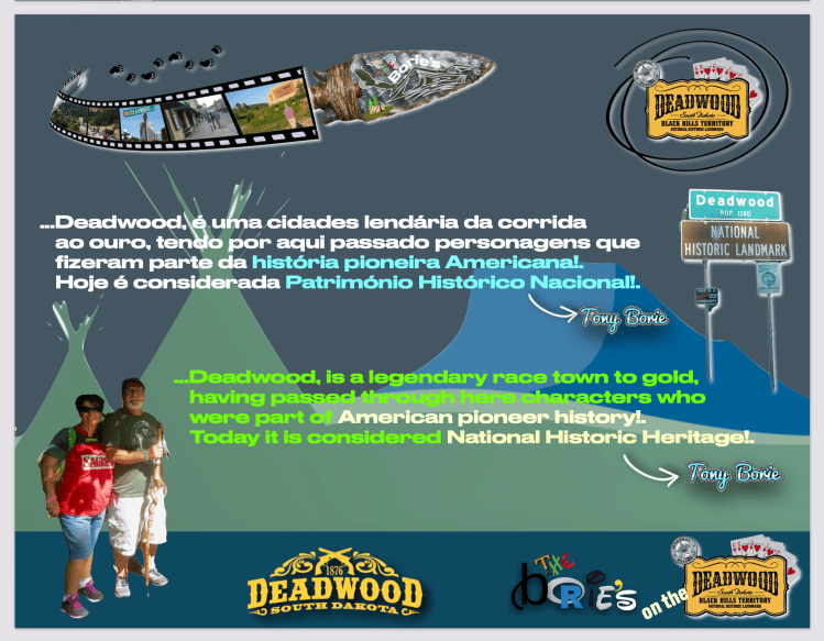
...Deadwood, é uma das cidades lendárias da corrida ao ouro, tendo por aqui passado personagens que fizeram parte da história pioneira Americana, como por exemplo, Seth Bullock, um homem da lei, Wyatt Earp, lendário pistoleiro, mais tarde Sherife Marshal dos U.S., jogador professional e guarda de bordel ou George Hearst, magnata do ouro em São Francisco e Senador dos U.S.A., pela Califórnia!.
…Deadwood, is one of the legendary cities of the gold rush, having here passed characters that are part of the pioneering American history, for example, Seth Bullock, a man of law, Wyatt Earp, legendary gunslinger, later Sherif Marshal of the US, professional player and brothel guard or George Hearst, gold tycoon in San Francisco and US Senator, California!.
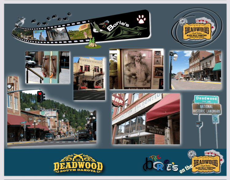
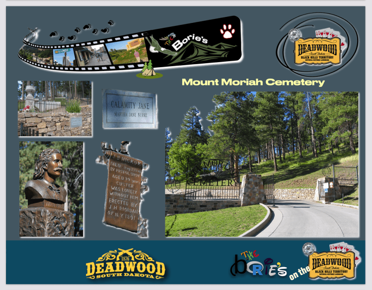
…no entanto, as personagens que ao longo dos tempos se tornaram ainda mais lendárias e que por aqui passaram, fazendo parte da história da cidade de Deadwood, foram James Butler Hickok, (“Wild Bill” Hickok), e Martha Jane Cannary, (Calamity Jane), que por aqui ficaram para sempre, sepultadas no cemitério das colinas da cidade, tendo direito a estátuas e, os seus habitantes se orgulham ao contar a sua história!.
…but the characters that have become even more legendary over the years have been James Butler Hickok (“Wild Bill” Hickok), and Martha Jane Cannary (Calamity Jane), who have stayed here forever, buried in the cemetery of the city’s hills, having rights to statues, and its inhabitants are proud to tell their story!.
…o James Butler Hickok, mais conhecido como “Wild Bill” Hickok, era um herói folclórico do velho oeste americano, conhecido pelo seu trabalho através do território de fronteira, como guia e tradutor, mestre de caravanas, soldado, espião, batedor, sherife, pistoleiro, jogador, showman e actor!. A sua notoriedade, ganha no seu próprio tempo, é reforçada por muitas histórias estranhas, muitas vezes fabricadas pelo que ele contava sobre a sua própria vida!. Alguns relatos contemporâneos das suas façanhas, são conhecidos como sendo fictícios, todavia eles constituem a base de grande parte da sua reputação de fama!.
…James Butler Hickok, better known as “Wild Bill” Hickok, was a folk hero of the Old American West, known for his work across the border territory, as a guide and translator, a master of caravans, a soldier, a spy, a batter , sheriff, gunslinger, player, showman and actor!. His notoriety, gained in his own time, is reinforced by many strange stories, often fabricated by what he told about his own life!. Some contemporary accounts of his exploits are known to be fictitious, yet they form the basis of much of his reputation for fame!
…apesar de usar uma grande faca, duas grandes pistolas, de dizer que tinha lutado sózinho contra ursos, morto muitos “peles-vermelhas”, ganho dezenas de “duelos”, de ser forte e audaz, conhecer todo o território, um certo dia, no célebre “Salon N.º 10”, desta cidade de Deadwood, um garoto, que se lembrava da sua cara, por ter morto o seu pai, que o tinha desafiado para um duelo, disferiu-lhe dois tiros pelas costas, assim de repente, à queima-roupa, por trás, acabando com toda a sua audácia e rapidez!.
…despite using a large knife, two large pistols, to say that I had fought alone against bears, killed many “redskins”, won dozens of “duels”, being strong and daring, knowing the whole territory, one day in the celebrated “Salon No. 10” of this city of Deadwood, a boy who remembered his face for having killed his father, who had challenged him to a duel, gave him two shots, so suddenly, at close range, behind, ending with all his audacity and speed!.
…por sua vez, a Martha Jane Cannary, mais conhecida como “Calamity Jane”, também conhecida pelo seu trabalho através do território de fronteira, como guia, tradutora e batedora professional, acompanhando caravanas, tornando-se mais conhecida, quando se apaixonou pelo “Wild Bill” Hickok, junto ao qual lutou contra os índios!. Usava roupas masculinas, demonstrava compaixão pelos outros, especialmente pelos doentes e necessitados, contrastando um pouco com os seus jeitos temerários, que ajudaram a torná-la numa figura notável de fronteira, sabendo-se que não tinha educação formal e era uma alcoólica itinerante!. Como já dissémos, ficaram os dois para sempre na cidade de Deadwood, sepultados no cemitério das colinas que circundam esta cidade, fazendo parte do seu folclore!.
…in turn, Martha Jane Cannary, better known as “Calamity Jane”, also known for her work across the border territory, as a guide, translator and professional scout, accompanying caravans, becoming better known when fell in love with the “Wild Bill” Hickok, next to which fought against the Indians!. He wore men’s clothes, showed compassion for others, especially the sick and the needy, contrasting somewhat with his reckless ways, which helped make her a remarkable frontier figure, knowing that she had no formal education and was a traveling alcoholic!. As we have already said, they were forever in the city of Deadwood, buried in the cemetery of the hills that surround this city, being part of their folklore!.
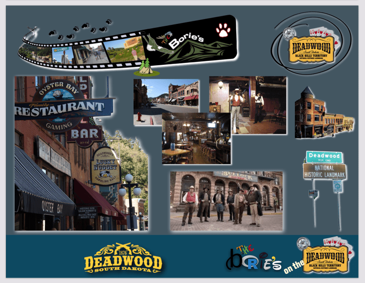
…a cidade de Deadwood em Dakota do Sul, por algumas vezes foi estrela de Hollywood e várias séries de TV se filmaram nesta cidade ou sua área!. Filmes como “Calamity Jane”, com a célebere atriz Doris Day,“Dances With Wolves”, com o actor Kevin Costner, entre muitos outros, foram rodados por aqui e as suas ruas e a estrutura da cidade mantêm-se!. Hoje é considerada Património Histórico Nacional!.
…the city of Deadwood in South Dakota, for some times it was a Hollywood star and several TV series were filmed in this city or its area!. Films such as “Calamity Jane”, with the famous actress Doris Day,“Dances With Wolves”, with actor Kevin Costner, among many others, were shot here and its streets and city structure remain!. Today it is considered National Historic Heritage!.
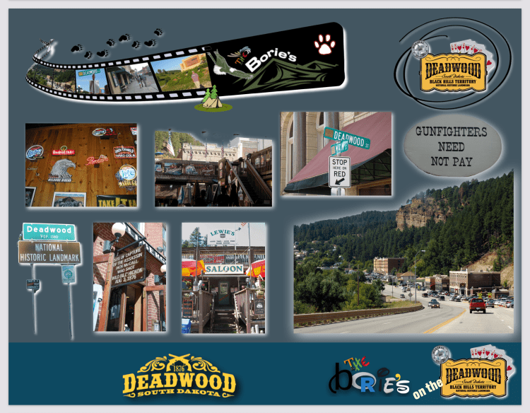
…nos bares e restaurantes, existem áreas de casino com máquinas de jogo, a bebida continua a correr, algumas senhoras continuam pela portas dos bares, há música e festas em tudo o que é esquina, sendo visitada por centenas, talvez milhares de pessoas!.
…in the bars and restaurants, there are casino areas with gaming machines, the drink continues to flow, some ladies continue through the doors of the bars, there is music and parties in every corner, being visited by hundreds, maybe thousands of people! .