

The Borie’s went to the north to see the family, and.. (Part 1)
Palm Coast, Florida!


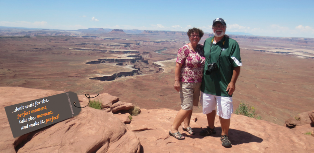
…uma, duas, às vezes três, em cada, dos últimos treze anos, nós viajamos para norte, com o propósito de ver a família!. É saudável, a família vai aumentando, os netos vão crescendo, cada vez vemos neles coisas diferentes, alguns já frequentam a escola, falam e têm costumes, de uma maneira moderna, usam roupa moderna, e nós, hoje reconhecemos, que quando mais jovens, passámos ao lado do crescimento dos nossos filhos!. Sim, os tempos eram outros, para sobreviver, havia que trabalhar muitas horas, em horários diferentes, num trabalho, onde era necessário dispender muito esforço físico, sobre toda a classe de intempérie, como tal, o tempo livre do trabalho, se era que o havia, era para descansar!. Claro, todos estes argumentos, não são uma desculpa, para a falta de tempo, que devíamos dispensar aos nossos filhos! Sorry!. (one, two, sometimes three, in each of the last thirteen years, we travel north, for the purpose of seeing the family!. It is healthy, the family is increasing, the grandchildren are growing, we see different things in them, some already attend school, speak and have customs, in a modern way, wear modern clothes, and we now recognize that when younger, we have gone along with the growth of our children!. Yes, there were other times, in order to survive, we had to work many hours, at different times, in a job, where it was necessary to spend a great deal of physical effort on the whole class of inclemency, such as free time off work, there was, it was to rest!. Of course, all these arguments are not an excuse, for the lack of time, that we should give to our children! Sorry)!.
Highway 95, Florida! (to north)


…entrando no Highway 95, em direção ao norte, viajamos por algumas dezenas de milhas até à fronteira com o estado da Georgia, mas temos que nos lembrar que cerca de dois terços da Flórida, ocupa uma península entre o Golfo do México e o Oceano Atlântico, e tem o litoral contínuo, mais longo nos EUA, que são aproximadamente 1.350 milhas (2.170 km), sem incluir a contribuição das muitas ilhas barreiras. É o único estado que faz fronteira tanto com o Golfo do México, quanto com o Oceano Atlântico, e é o ponto mais baixo de qualquer Estado dos U. S.. Também recordamos que este estado onde hoje vivemos, o primeiro contato europeu foi feito em 1513, pelo explorador espanhol Juan Ponce de Leon que o chamou de “La Florida” (terra de flores) ao navegar por aqui na época da Páscoa e, foi um desafio para as potências coloniais européias, antes de ser um Estado dos Estados Unidos, em 1845!. (entering Highway 95, heading north, we traveled a few tens of miles to the border with Georgia, but we have to remember that, about two-thirds of Florida occupies a peninsula between the Gulf of Mexico and the Atlantic Ocean, and has the longest coastline in the contiguous USA, approximately 1,350 miles (2,170 km), not including the contribution of the many barrier islands. It is the only state that borders both the Gulf of Mexico and the Atlantic Ocean, and has the lowest high point of any U. S. State. We also recall that this state where we now live, since the first European contact was made in 1513, by Spanish explorer Juan Ponce de Leon who named it “La Florida”, (land of flowers) upon landing there in the Easter season, and was a challenge for the European colonial powers, before it gained statehood in the United States, in 1845)!.
Highway 95, Georgia! (to north)


…em direção ao norte, viajando pela estrada 95, passamos o estado da Georgia encostados ao Oceano Atlântico, onde o terreno é plano, não como na parte mais ao norte, onde estão as montanhas Blue Ridge, parte do sistema das Montanhas dos Apalaches. O Piemonte, estende-se através da parte central do estado, desde o sopé do Blue Ridge até à linha de queda, onde os rios caem em cascata até à planície costeira de parte da região. O ponto mais alto da Geórgia é Brasstown Calvo, a 4,784 pés (1,458 m) acima do nível do mar, o mais baixo é o Oceano Atlântico e, dos estados inteiramente a leste do rio Mississippi, a Geórgia é a maior área terrestre!. (heading north, traveling along Highway 95, we passed the state of Georgia leaning against the Atlantic Ocean, where the terrain is flat, not as in the northernmost part is in the Blue Ridge mountains, part of the Appalachian Mountains system. The Piedmont extends through the central part of the state from the foothills of the Blue Ridge to the Fall Line, where the rivers cascade down in elevation to the coastal plain of the state’s soutern part. Georgia’s highest point is Brasstown Bald at 4,784 feet (1,458 m) above sea level, the lowest is the Atlantic Ocean, and of the states entirely east of the Mississippi River, Georgia is the largest in land area)!.
Highway 95, South Carolina! (to north)

 …atravessando o estado de South Carolina, com a distância de mais ou menos 190 milhas de litoral, nesta área, onde circula a estrada 95, se sair-mos fora da estrada e viajar pelas povoações, podemos ver belos jardins, locais históricos e plantações do sul, culturas coloniais e européias e, o seu desenvolvimento económico crescente!. O nome de Carolina do Sul, foi dado em homenagem ao Rei Charles I da Inglaterra, que primeiro formou a Colónia Inglesa, com Carolus, sendo em latino “Charles”!. (crossing the state of South Carolina, with the distance of about 190 miles of coastline, in this area, where Highway 95 runs, if we leave off the road and travel through the villages, we can see beautiful lust gardens, historic sites and Southern Plantations, Colonial and European cultures, and its growing economic development!. South Carolina named in honor of King Charles I of England, who first formed the English colony, with Carolus being Latin “Charles”!.
Highway 95, South Carolina! (buy gas)


…aqui, em South Carolina, a gasolina sempre foi mais barata do que em outros estados, por tal sempre paramos para comprá-la!. (here in South Carolina, gasoline has always been cheaper than in other states, so we always stop to buy it)!.
Highway 95, South Carolina! (to north)


Highway 95, South Carolina! (South of the Border)


…passamos e, desta vez não paramos, chamam-lhe “South of the Border”, é uma atração no Highway 95, em Dilon, ao sul de Rowland. É assim chamado porque é apenas ao sul da fronteira entre Carolina do Norte e Carolina do Sul, e tem como tema, um estilo Mexicano. A área de descanso, contém restaurantes, postos de gasolina, um motel e uma paragem de camiões, bem como um pequeno parque de diversões, sem passeios de operação, mais um campo de mini-golfe, lojas, e lojas de fogos de artifício. A sua mascote é “Pedro”, uma caricatura de um bandido mexicano!. Dizem também que por volta de 1950, alguém fundou ao sul da fronteira, o “South of the Border Depot”, que era uma carroça de cerveja, no local adjacente ao Condado de Robeson, que era, ao mesmo tempo, um dos muitos condados “secos”, (que não vendiam álcool) da Carolina do Norte, e o negócio estava constantemente expandido com bugigangas mexicanas e inúmeros itens importados do México!. (we pass and, this time we do not stop, they call it “South of the Border”, is an attraction on Interstate 95, in Dilon, just south of Rowland. It is so named because it is just south of the border between North Carolina and South Carolina, and is themed in Mexican style. The rest area contains restaurants, gas stations, and a motel, and truck stop as well as a small dilapidated amusement park with no operating rides, but a mini golf course still in commission, shopping and fireworks stores. Its mascote is Pedro, a caricature of a Mexican bandido!.They also say that around 1950, someone founded the South of the Border Depot, a beer stand, at the location adjacent to Robeson County which was, at one time, one of many dry North Carolina counties, and the business was steadily expanded with Mexican trinkets and numerous kitsch items imported from Mexico!).
Highway 95, North Carolina! (to north)


…o estado de Carolina do Norte é, pelo menos pela área onde passamos, quando viajamos na estrada 95, no sentido norte, uma extensão do que vemos na Carolina do Sul, no entanto Carolina do Norte, é composta por três regiões geográficas principais, que são, região da planície litoral do Atlântico, ocupando a parte leste do estado, a região central de Piemonte e a região da Montanha no oeste, que faz parte das Montanhas Apalaches. Por onde passamos, a planície costeira consiste em áreas mais especificamente definidas, conhecidas como Outer Banks, uma série de ilhas de barreira, estreitas e arenosas, separadas do continente por canais ou entradas de mar. Uma curiosidade, que em especial nós, aventureiros viajantes, apreciamos saber, é que tantos navios foram perdidos do Cabo Hatteras, onde a área é conhecida como “Cemitério do Atlântico”, mais de 1.000 navios afundaram-se nessas águas, desde que os registros começaram em 1526. O mais famoso deles é o “Revinge da Rainha Anne” “, (flagship do pirata Blackbeard), que encalhou em Beaufort Inlet em 1718!. (the state of North Carolina is, at least by the area we passed, when we traveled on Highway 95, northbound, an extension of what we see in South Carolina, however North Carolina consists of three main geographic regions; Atlantic coastal plain region, occupying the eastern portion of the state, the central Piedmont region, and the Mountain region in the west, which is part Appalachian Mountains. Where we pass, the coastal plain consists of more specifically-defined areas known as the Outer Banks, a string of sandy, narrow barrier islands separated from the mainland by sounds or inlets. a curiosity, which we adventurous travelers especially appreciate, is that, so many ships have been lost off Cape Hatteras, that the area is know as the “Graveyard of the Atlantic”, more than 1,000 ships have sunk in these waters since records began in 1526. The most famous of these is the “Queen Anne’s Revenge”, (flagship of the pirate Blackbeard), which went aground in Beaufort Inlet in 1718!.
Highway 95, Virginia! (Welcome to Virginia)
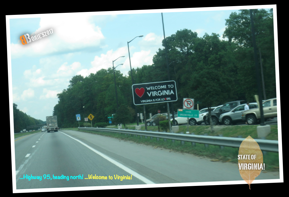
…nós gostamos do estado de Virginia, já por aqui andámos por diversas vezes quando jovens e, viviamos no estado de Nova Jersey!. Além de ser apelidado de “Domínio Velho”, devido ao seu estado, como a primeira possessão colonial Inglesa estabelecida na América do Norte, é “Mãe dos Presidentes”, porque oito presidentes dos EUA nasceram lá, mais do que qualquer outro estado, e mais, o que para nós é importante, quando entramos no estado, o sinal que nos aparece, dizendo, “Welcome to Virginia” (Bem Vindo a Virginia), diz também que o “V” de Virginia é “Virginia is for lovers”, ou seja “Virginia é para amor”!. (we like the state of Virginia, we’ve been here several times when we were young, and we lived in the state of New Jersey! Besides is nicknamed the “Old Dominion”, due to its status as the first English colonial possession established in mainland North America, and “Mother of Presidents” because eight U.S. presidents were born there, more than any other state, and more, which is important to us, as we enter the state, the sign that appears to us, saying, “Welcome to Virginia,” also says Virginia’s “V” is “Virginia is for lovers,” or be “Virginia is for love”!.
Highway 95, Virginia! (buy gas)


…tal como em South Carolina, aqui, aproveitamos a oportunidade, obrigado!. (just like in South Carolina, here, we take the opportunity, thank you)!.
Highway 95, Virginia! (to north)


Highway 295, Virginia! (Varina-Enon Bridge)


…no estado de Virginia, quase sempre nos desviamos para a estrada 295, que é um circulo à volta da cidade de Richmond, não só porque gostamos do cenário, como fugimos ao tráfico da grande cidade que é Richmond, e também porque passamos na Varina-Enon Bridge, que é uma ponte, que transporta a Interstate 295 através do rio James, perto do fosso holandês, entre o Condado de Henrico, perto de Richmond e Chesterfield County, perto de Hopewell, e tem seis pistas, com passagem de emergência, na berma direita e esquerda, com 150 pés (46 m) de espaço livre para navegação vertical e, 630 pés (192 m) de espaço livre para navegação horizontal, esta ponte abrange o canal de transporte, que leva ao Porto de Richmond!. (in the state of Virginia, we almost always turn off on Route 295, which is a circle around the city of Richmond, not only because we like the scenery, but also because of the traffic in the great city of Richmond, and also because we passed at Varina-Enon Bridge, is a cable-stayed bridge which carries Interstate 295 across the James River near Dutch gap between Henrico County near Richmond and Chesterfield County near Hopewell, and has six lanes with full right and left shoulders, with 150 feet (46 m) of vertical navigational clearance and 630 feet (192 m) of horizontal navigational clearance, the bridge spans the shipping channel that leads to the Port of Richmond)!.
Highway 95, Virginia! (National Museum of the Marine Corps)


…o nosso filho, (Antonio Sérgio), o Tony, foi militar, prestando serviço no Corpo dos Marines dos USA, por tal, já visitámos o Museu Nacional do Corpo de Marines por algumas vezes e, sempre que por aqui passamos, olhamos e, prestamos homenagem a estes heróis!. (our son, (Antonio Sérgio), the Tony, was a military man, serving in the US Marine Corps, so we have visited the Marine Corps National Museum for a few times and, whenever we go by here, we look and pay homage to these heroes)!.
Highway 95, Virginia! (to north)


Highway 95, Maryland! (Welcome to Maryland)

…passávamos na área de Washington DC, parecia que ia chover, entrámos no estado de Maryland, que é uma das Treze Colónias originais, Maryland é considerado o local de nascimento da liberdade religiosa na América, quando foi formado por George Calvert no início do século 17, como um refúgio pretendido para católicos perseguidos da Inglaterra. Maryland foi o sétimo estado para ractificar a Constituição dos Estados Unidos e, desempenhou um papel fundamental na fundação de Washington, DC, que foi estabelecido em terras doadas pelo estado!. (we were in the Washington DC area, it looked like it was going to rain, we went into the state of Maryland, which is one of the original Thirteen Colonies, Maryland is considered to be the birthplace of religious freedom in America, when it was formed by George Calvert in the early 17th century as an intended refuge for persecuted Catholics from England. Maryland was the seventh state to ratify the United States Constitution, and played a pivotal role in the founding of Washington, D.C., which was established on land donated by the state)!.
Highway 95, Maryland! (Baltimore)


…havia algumas névoas escuras, a chuva devia andar por aí, olhando para o nosso lado esquerdo, para quem como nós, vem do sul, podemos ver o porto de mar de Baltimore, que foi fundado em 1729, e é o segundo maior porto marítimo do Atlântico Médio, e o porto interno da cidade, já foi o segundo porto de entrada principal para imigrantes, que chegavam aos Estados Unidos e, um importante centro de produção!. (there were some dark mists, the rain must go around, looking at our left side, for those of us coming from the south, we can see the Baltimore sea port, which was founded in 1729, is the second-largest seaport in the Mid-Atlantic, and the city’s Inner harbor was once the second leading port of entry for immigrantes to the United States and a major manufacturing center)!.
Highway 95, Maryland! (Fort McHenry Tunnel)


…existem viajantes, que têm receio de atravessar túneis, não é o nosso caso, pois até achamos que os túneis são muito úteis, poupam tempo aos viajantes!. Aqui, passamos sob o túnel Fort McHenry, é um túnel bidirecional que transporta o tráfego na Interstate 95, sob o porto de Baltimore. O ponto mais baixo no Sistema Interestadual sob a água, o túnel tem o nome de Fort McHenry, que é um forte que existe nas proximidades!. (here are travelers, who are afraid to go through tunnels, it is not our case, because we even think the tunnels are very useful, they save time for the travelers! Here, we pass under the Fort McHenry Tunnel, is a four-tube, bi-directional tunnel that carries traffic on Interstate 95 underneath the Baltimore Harbor. The lowest point in the Interstate System under water, the tunnel is named for nearby Fort McHenry!.
Highway 95, Maryland! (rest area)

…já era de noite, parámos nesta área de descanso, para comer algo e, descansar! (it was already night, we stopped in this area of rest, to eat something and, to rest)!.
Tony Borie, October 2017.
